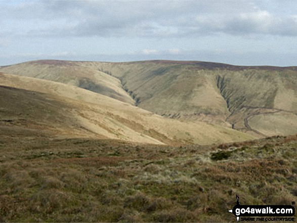
A Google Peak Bagging Map of The Border Hills area of Scottish Region 27: The Scottish Borders a fully detailed list
The Border Hills area of Scottish Region 27: The Scottish Borders region is the area enclosed by an imaginary line connecting:
- Scotsdike to Hawick via the A7 through Langholm and Teviothead to the North West
- Hawick to Coldstream via the River Teviot, Denholm, Ancrum, Kelso and the River Tweed to the North
- Coldstream to Scotsdike via the border between England & Scotland via Carter Bar, Deadwater and Kershopefoot to the South East
If you include all the Munros, the Corbetts, the Grahams, the Donalds, the Murdos, the Marilyns, the Bridgets (Hills), and all the Mountains, Tops, Peaks and Hills with a Trig Point on them there are 23 tops to climb, bag & conquer and the highest point is Cauldcleuch Head at 619m (2,032ft).
To see these Mountains, Peaks, Tops and Hills displayed in different ways - see the options in the left-hand column and towards the bottom of this page.
LOG ON and RELOAD this page to show which Mountains, Peaks, Tops and Hills you have already climbed, bagged & conquered [. . . more details]
See this list in: Alphabetical Order‡
| Height Order
To reverse the order select the link again.
Mountain, Peak, Top or Hill:
Bagged
1. Wether Law (Teviothead)
509m (1,671ft)
See the location of Wether Law (Teviothead) and walks up it on a google Map Wether Law (Teviothead) is on interactive maps:
A downloadable go4awalk.com PDF Peak Bagging Map featuring Wether Law (Teviothead) will be available soon. |
2. Tudhope Hill
599m (1,966ft)
See the location of Tudhope Hill and walks up it on a google Map Tudhope Hill is on interactive maps:
A downloadable go4awalk.com PDF Peak Bagging Map featuring Tudhope Hill will be available soon. |
3. The Curr
564m (1,851ft)
The Curr is on interactive maps:
|
4. Skelfhill Pen
532m (1,746ft)
See the location of Skelfhill Pen and walks up it on a google Map Skelfhill Pen is on interactive maps:
A downloadable go4awalk.com PDF Peak Bagging Map featuring Skelfhill Pen will be available soon. |
5. Rubers Law
424m (1,392ft)
Rubers Law is on interactive maps:
A downloadable go4awalk.com PDF Peak Bagging Map featuring Rubers Law will be available soon. |
6. Roan Fell (South Top)
560m (1,837ft)
Send it in and we'll publish it here.
Roan Fell (South Top) is on interactive maps:
|
7. Roan Fell
568m (1,864ft)
See the location of Roan Fell and walks up it on a google Map Roan Fell is on interactive maps:
A downloadable go4awalk.com PDF Peak Bagging Map featuring Roan Fell will be available soon. |
8. Pike Fell
499m (1,638ft)
See the location of Pike Fell and walks up it on a google Map Pike Fell is on interactive maps:
A downloadable go4awalk.com PDF Peak Bagging Map featuring Pike Fell will be available soon. |
9. Linton Hill
282m (926ft)
Linton Hill is on interactive maps:
A downloadable go4awalk.com PDF Peak Bagging Map featuring Linton Hill will be available soon. |
10. Larriston Fell
512m (1,680ft)
Larriston Fell is on interactive maps:
A downloadable go4awalk.com PDF Peak Bagging Map featuring Larriston Fell will be available soon. |
11. Lamb Hill
511m (1,677ft)
Lamb Hill is on interactive maps:
|
12. King's Seat
532m (1,746ft)
King's Seat is on interactive maps:
|
13. Hownam Law
449m (1,474ft)
See the location of Hownam Law and walks up it on a google Map Hownam Law is on interactive maps:
A downloadable go4awalk.com PDF Peak Bagging Map featuring Hownam Law will be available soon. |
14. Greatmoor Hill (Starcleuch Edge)
599m (1,966ft)
Send it in and we'll publish it here.
Greatmoor Hill (Starcleuch Edge) is on interactive maps:
A downloadable go4awalk.com PDF Peak Bagging Map featuring Greatmoor Hill (Starcleuch Edge) will be available soon. |
15. Fanna Hill
515m (1,690ft)
Fanna Hill is on interactive maps:
A downloadable go4awalk.com PDF Peak Bagging Map featuring Fanna Hill will be available soon. |
16. Ellson Fell
537m (1,762ft)
See the location of Ellson Fell and walks up it on a google Map Ellson Fell is on interactive maps:
A downloadable go4awalk.com PDF Peak Bagging Map featuring Ellson Fell will be available soon. |
17. Dod Hill (Teviothead)
495m (1,625ft)
See the location of Dod Hill (Teviothead) and walks up it on a google Map Dod Hill (Teviothead) is on interactive maps:
A downloadable go4awalk.com PDF Peak Bagging Map featuring Dod Hill (Teviothead) will be available soon. |
18. Din Fell
530m (1,739ft)
Din Fell is on interactive maps:
|
19. Cauldcleuch Head
619m (2,032ft)
Cauldcleuch Head is on interactive maps:
A downloadable go4awalk.com PDF Peak Bagging Map featuring Cauldcleuch Head will be available soon. |
20. Carlin Tooth
551m (1,808ft)
Carlin Tooth is on interactive maps:
|
21. Carby Hill (Caerba Hill)
268m (880ft)
Send it in and we'll publish it here.
See the location of Carby Hill (Caerba Hill) and walks up it on a google Map Carby Hill (Caerba Hill) is on interactive maps:
A downloadable go4awalk.com PDF Peak Bagging Map featuring Carby Hill (Caerba Hill) will be available soon. |
22. Blackwood Hill (Arnton Fell)
447m (1,467ft)
Send it in and we'll publish it here.
Blackwood Hill (Arnton Fell) is on interactive maps:
A downloadable go4awalk.com PDF Peak Bagging Map featuring Blackwood Hill (Arnton Fell) will be available soon. |
23. Belling Hill
354m (1,162ft)
Belling Hill is on interactive maps:
A downloadable go4awalk.com PDF Peak Bagging Map featuring Belling Hill will be available soon. |
View these 23 Mountains, Peaks, Tops and Hills:
- On an Interactive Google Map with a list of tops below it.
(makes it easier to locate a particular top) - On a Detailed List in:
Alphabetical Order | Height Order - On one page with 'yet-to-be-bagged' listed 1st
& then 'already-bagged' tops listed 2nd in:
Alphabetical Order | Height Order - On one page with 'already-bagged' tops listed 1st
& then 'yet-to-be-bagged' tops listed 2nd in:
Alphabetical Order | Height Order
Is there a Mountain, Peak, Top or Hill missing from the above google map or list?
Let us know an we will add it to our database.

