The Llyn Peninsula - a fully detailed list of all the Peaks, Tops and Hills
The Isle of Anglesey and The Llyn (Lleyn) Peninsula, Anglesey & Gwynedd is the area that includes the Isle of Anglesey and the area west of the Snowdonia National Park boundary which includes the Llyn (Lleyn) Peninsula.
If you include all the Deweys, the Marilyns, the Bridgets (Hills) and all the Mountains, Tops, Peaks and Hills with a Trig Point on them there are 20 tops to climb, bag & conquer and the highest point is Yr Eifl at 564m (1,851ft).
To see these Mountains, Peaks, Tops and Hills displayed in different ways - see the options in the left-hand column and towards the bottom of this page.
![]() Your Personal Bagging Record for The Isle of Anglesey and The Llyn (Lleyn) Peninsula
Your Personal Bagging Record for The Isle of Anglesey and The Llyn (Lleyn) Peninsula
LOG ON and RELOAD this page to show which Mountains, Peaks, Tops and Hills you have already climbed, bagged & conquered [. . . more details]
See this list in: Alphabetical Order
| Height Order‡
To reverse the order select the link again.
Mountain, Peak, Top or Hill:
Bagged

![]()
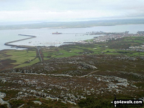
1. Yr Eifl
564m (1,851ft)
Yr Eifl is on interactive maps:
A downloadable go4awalk.com PDF Peak Bagging Map featuring Yr Eifl will be available soon. |

![]()
2. Gyrn Ddu (Llyn Peninsula)
522m (1,713ft)
Send it in and we'll publish it here.
Gyrn Ddu (Llyn Peninsula) is on interactive maps:
A downloadable go4awalk.com PDF Peak Bagging Map featuring Gyrn Ddu (Llyn Peninsula) will be available soon. |

![]()
3. Bwlch Mawr
509m (1,670ft)
Bwlch Mawr is on interactive maps:
A downloadable go4awalk.com PDF Peak Bagging Map featuring Bwlch Mawr will be available soon. |

![]()
4. Carn Fadryn
371m (1,217ft)
Carn Fadryn is on interactive maps:
A downloadable go4awalk.com PDF Peak Bagging Map featuring Carn Fadryn will be available soon. |

![]()
5. Mynydd Carnguwch
358m (1,174ft)
Mynydd Carnguwch is on interactive maps:
A downloadable go4awalk.com PDF Peak Bagging Map featuring Mynydd Carnguwch will be available soon. |
![]()
6. Mynydd Rhiw
304m (997ft)
Mynydd Rhiw is on interactive maps:
A downloadable go4awalk.com PDF Peak Bagging Map featuring Mynydd Rhiw will be available soon. |

![]()
7. Garn Boduan
279m (915ft)
Garn Boduan is on interactive maps:
A downloadable go4awalk.com PDF Peak Bagging Map featuring Garn Boduan will be available soon. |
![]()
8. Moel-y-gest
263m (863ft)
Moel-y-gest is on interactive maps:
A downloadable go4awalk.com PDF Peak Bagging Map featuring Moel-y-gest will be available soon. |

![]()
9. Mynydd Cennin
262m (859ft)
Mynydd Cennin is on interactive maps:
A downloadable go4awalk.com PDF Peak Bagging Map featuring Mynydd Cennin will be available soon. |
![]()
10. Carreglefain
261m (856ft)
Carreglefain is on interactive maps:
A downloadable go4awalk.com PDF Peak Bagging Map featuring Carreglefain will be available soon. |
![]()
11. Carneddol
235m (771ft)
Carneddol is on interactive maps:
A downloadable go4awalk.com PDF Peak Bagging Map featuring Carneddol will be available soon. |
![]()
12. Foel (Llyn Peninsula)
223m (731ft)
Send it in and we'll publish it here.
Foel (Llyn Peninsula) is on interactive maps:
A downloadable go4awalk.com PDF Peak Bagging Map featuring Foel (Llyn Peninsula) will be available soon. |
![]()
13. Holyhead Mountain
220m (722ft)
Holyhead Mountain is on interactive maps:
A downloadable go4awalk.com PDF Peak Bagging Map featuring Holyhead Mountain will be available soon. |
![]()
14. Mynydd Anelog
192m (630ft)
Mynydd Anelog is on interactive maps:
A downloadable go4awalk.com PDF Peak Bagging Map featuring Mynydd Anelog will be available soon. |
![]()
15. Mynydd Bodafon (Yr Arwydd)
178m (584ft)
Send it in and we'll publish it here.
Mynydd Bodafon (Yr Arwydd) is on interactive maps:
A downloadable go4awalk.com PDF Peak Bagging Map featuring Mynydd Bodafon (Yr Arwydd) will be available soon. |
![]()
16. Mynydd Eilian
177m (580ft)
Mynydd Eilian is on interactive maps:
A downloadable go4awalk.com PDF Peak Bagging Map featuring Mynydd Eilian will be available soon. |
![]()
17. Mynydd y Garn
170m (557ft)
Mynydd y Garn is on interactive maps:
A downloadable go4awalk.com PDF Peak Bagging Map featuring Mynydd y Garn will be available soon. |
![]()
18. Mynydd Enlli (Bardsey Island)
167m (548ft)
Send it in and we'll publish it here.
Mynydd Enlli (Bardsey Island) is on interactive maps:
A downloadable go4awalk.com PDF Peak Bagging Map featuring Mynydd Enlli (Bardsey Island) will be available soon. |
![]()
19. Bwrdd Arthur
164m (538ft)
Bwrdd Arthur is on interactive maps:
A downloadable go4awalk.com PDF Peak Bagging Map featuring Bwrdd Arthur will be available soon. |
![]()
20. Mynydd Cilan
117m (383ft)
Mynydd Cilan is on interactive maps:
|
View these 20 Mountains, Peaks, Tops and Hills:
- On an Interactive Google Map with a list of tops below it.
(makes it easier to locate a particular top) - On a Detailed List in:
Alphabetical Order | Height Order - On one page with 'yet-to-be-bagged' listed 1st
& then 'already-bagged' tops listed 2nd in:
Alphabetical Order | Height Order - On one page with 'already-bagged' tops listed 1st
& then 'yet-to-be-bagged' tops listed 2nd in:
Alphabetical Order | Height Order
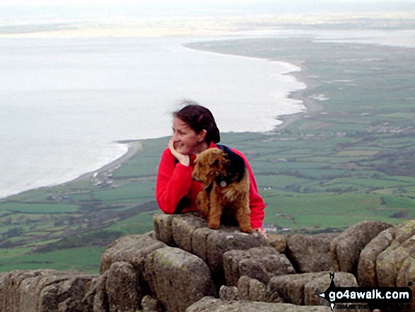
 Yr Eifl in The Isle of Anglesey and The Llyn (Lleyn) Peninsula
Photo: Mike Griffiths
Is there a Mountain, Peak, Top or Hill missing from the above google map or list?
Let us know an we will add it to our database.
To contribute to go4awalk.com or to contact us about anything at all - see Talk To Us.
For help see Help.
go4awalk.com and go4awalk.co.uk are registered trademarks of TMDH Limited.
Copyright © 2000-2026 TMDH Limited. All rights reserved.
Copyright Terms & Conditions Privacy Statement
A - Z Walks Home Log On/Accounts Photo Gallery Walk Ideas and Collections Fell Facts Hill Skills Walking Questions and Answers Your Stories News Competitions Product Reviews/Gear Tests Walking Gear Guides Peaks and Mountains Peak Bagging Find New Walking Friends Camping GPS Waypoints for Walking Contents Walk Search Talk To Us go4awalk.com Help Free Example Walks Newsletter


