Scotland - a fully detailed list of all the Mountains, Peaks, Tops and Hills (Page 6 of 8)
If you count only the Grahams there are 219 tops to climb, bag & conquer and the highest point is Sgurr a' Chaorainn at 761m (2,498ft).
To see these Mountains, Peaks, Tops and Hills displayed in different ways - see the options in the left-hand column and towards the bottom of this page.
LOG ON and RELOAD this page to show which Mountains, Peaks, Tops and Hills you have already climbed, bagged & conquered [. . . more details]
Page 6 of 8 Go to page:
1 2 3 4 5 6 7 8 |
See this list in: Alphabetical Order
| Height Order‡
To reverse the order select the link again.
Mountain, Peak, Top or Hill:
Bagged
151. Beinn Gaire
666m (2,186ft)
Graham (151st)
Marilyn (577th in Scotland, 662nd in GB)
We hope to have walks that climb & bag Beinn Gaire very soon
See the location of Beinn Gaire and walks up it on a google MapBeinn Gaire is on interactive maps:
OS Explorer (Orange Covers): 390
OS Landranger (Pink Covers): 40
A downloadable go4awalk.com PDF Peak Bagging Map featuring Beinn Gaire will be available soon. |
152. Uamh Bheag
665m (2,184ft)
Graham (152nd)
Donald (55th)
Marilyn (578th in Scotland, 663rd in GB)
OS Trig Point
We hope to have walks that climb & bag Uamh Bheag very soon
See the location of Uamh Bheag and walks up it on a google MapUamh Bheag is on interactive maps:
OS Explorer (Orange Covers): OL47
OS Landranger (Pink Covers): 57
A downloadable go4awalk.com PDF Peak Bagging Map featuring Uamh Bheag will be available soon. |
153. Beinn Mheadhoin (Glen Orrin)
665m (2,183ft)
Graham (154th)
Marilyn (579th in Scotland, 664th in GB)
We hope to have walks that climb & bag Beinn Mheadhoin (Glen Orrin) very soon
See the location of Beinn Mheadhoin (Glen Orrin) and walks up it on a google MapBeinn Mheadhoin (Glen Orrin) is on interactive maps:
OS Explorer (Orange Covers): 430
OS Landranger (Pink Covers): 25
A downloadable go4awalk.com PDF Peak Bagging Map featuring Beinn Mheadhoin (Glen Orrin) will be available soon. |
154. Meall Tairbh
665m (2,183ft)
Graham (153rd)
Marilyn (580th in Scotland, 665th in GB)
We hope to have walks that climb & bag Meall Tairbh very soon
See the location of Meall Tairbh and walks up it on a google MapMeall Tairbh is on interactive maps:
OS Explorer (Orange Covers): 377
OS Landranger (Pink Covers): 50
A downloadable go4awalk.com PDF Peak Bagging Map featuring Meall Tairbh will be available soon. |
155. Beinn Ruadh
664m (2,179ft)
Graham (155th)
Marilyn (581st in Scotland, 666th in GB)
OS Trig Point
We hope to have walks that climb & bag Beinn Ruadh very soon
See the location of Beinn Ruadh and walks up it on a google MapBeinn Ruadh is on interactive maps:
OS Explorer (Orange Covers): OL37
OS Landranger (Pink Covers): 56
A downloadable go4awalk.com PDF Peak Bagging Map featuring Beinn Ruadh will be available soon. |
156. Aodann Chleireig
663m (2,176ft)
Graham (157th)
Marilyn (582nd in Scotland, 668th in GB)
We hope to have walks that climb & bag Aodann Chleireig very soon
See the location of Aodann Chleireig and walks up it on a google MapAodann Chleireig is on interactive maps:
OS Explorer (Orange Covers): 398 and
399
OS Landranger (Pink Covers): 40
A downloadable go4awalk.com PDF Peak Bagging Map featuring Aodann Chleireig will be available soon. |
157. Croit Bheinn
663m (2,176ft)
Graham (158th)
Marilyn (583rd in Scotland, 669th in GB)
We hope to have walks that climb & bag Croit Bheinn very soon
See the location of Croit Bheinn and walks up it on a google MapCroit Bheinn is on interactive maps:
OS Explorer (Orange Covers): 391
OS Landranger (Pink Covers): 40
A downloadable go4awalk.com PDF Peak Bagging Map featuring Croit Bheinn will be available soon. |
158. Sgorr a' Choise
663m (2,176ft)
Graham (156th)
Marilyn (584th in Scotland, 671st in GB)
We hope to have walks that climb & bag Sgorr a' Choise very soon
See the location of Sgorr a' Choise and walks up it on a google MapSgorr a' Choise is on interactive maps:
OS Explorer (Orange Covers): 384
OS Landranger (Pink Covers): 41
A downloadable go4awalk.com PDF Peak Bagging Map featuring Sgorr a' Choise will be available soon. |
159. Oireabhal
662m (2,173ft)
Graham (159th)
Marilyn (585th in Scotland, 672nd in GB)
We hope to have walks that climb & bag Oireabhal very soon
See the location of Oireabhal and walks up it on a google MapOireabhal is on interactive maps:
OS Explorer (Orange Covers): 456
OS Landranger (Pink Covers): 13 and
14
A downloadable go4awalk.com PDF Peak Bagging Map featuring Oireabhal will be available soon. |
160. Windlestraw Law
659m (2,163ft)
Graham (160th)
Donald (60th)
Marilyn (586th in Scotland, 676th in GB)
OS Trig Point
We hope to have walks that climb & bag Windlestraw Law very soon
See the location of Windlestraw Law and walks up it on a google MapWindlestraw Law is on interactive maps:
OS Explorer (Orange Covers): 337
OS Landranger (Pink Covers): 73
A downloadable go4awalk.com PDF Peak Bagging Map featuring Windlestraw Law will be available soon. |
161. Carn Glas-choire
659m (2,162ft)
Graham (161st)
Marilyn (587th in Scotland, 677th in GB)
OS Trig Point
We hope to have walks that climb & bag Carn Glas-choire very soon
See the location of Carn Glas-choire and walks up it on a google MapCarn Glas-choire is on interactive maps:
OS Explorer (Orange Covers): OL60
OS Landranger (Pink Covers): 35 and
36
A downloadable go4awalk.com PDF Peak Bagging Map featuring Carn Glas-choire will be available soon. |
162. Creag Dhubh (Spean Bridge)
658m (2,160ft)
Graham (163rd)
Marilyn (588th in Scotland, 678th in GB)
OS Trig Point
We hope to have walks that climb & bag Creag Dhubh (Spean Bridge) very soon
See the location of Creag Dhubh (Spean Bridge) and walks up it on a google MapCreag Dhubh (Spean Bridge) is on interactive maps:
OS Explorer (Orange Covers): 392 and
400
OS Landranger (Pink Covers): 34 and
41
A downloadable go4awalk.com PDF Peak Bagging Map featuring Creag Dhubh (Spean Bridge) will be available soon. |
163. Creag Mhor (Loch Voil)
658m (2,160ft)
Graham (164th)
Marilyn (589th in Scotland, 679th in GB)
We hope to have walks that climb & bag Creag Mhor (Loch Voil) very soon
See the location of Creag Mhor (Loch Voil) and walks up it on a google MapCreag Mhor (Loch Voil) is on interactive maps:
OS Explorer (Orange Covers): OL46
OS Landranger (Pink Covers): 57
A downloadable go4awalk.com PDF Peak Bagging Map featuring Creag Mhor (Loch Voil) will be available soon. |
164. Creag Ruadh (Glen Truim)
658m (2,160ft)
Graham (162nd)
Marilyn (590th in Scotland, 680th in GB)
We hope to have walks that climb & bag Creag Ruadh (Glen Truim) very soon
See the location of Creag Ruadh (Glen Truim) and walks up it on a google MapCreag Ruadh (Glen Truim) is on interactive maps:
OS Explorer (Orange Covers): OL51 and
OL56
OS Landranger (Pink Covers): 42
A downloadable go4awalk.com PDF Peak Bagging Map featuring Creag Ruadh (Glen Truim) will be available soon. |
165. Meall nan Eagan
658m (2,160ft)
Graham (165th)
Marilyn (591st in Scotland, 681st in GB)
We hope to have walks that climb & bag Meall nan Eagan very soon
See the location of Meall nan Eagan and walks up it on a google MapMeall nan Eagan is on interactive maps:
OS Explorer (Orange Covers): OL50
OS Landranger (Pink Covers): 42
A downloadable go4awalk.com PDF Peak Bagging Map featuring Meall nan Eagan will be available soon. |
166. Mid Hill (Beinn Dubh)
657m (2,156ft)
Graham (167th)
Marilyn (592nd in Scotland, 682nd in GB)
We hope to have walks that climb & bag Mid Hill (Beinn Dubh) very soon
See the location of Mid Hill (Beinn Dubh) and walks up it on a google MapMid Hill (Beinn Dubh) is on interactive maps:
OS Explorer (Orange Covers): OL39
OS Landranger (Pink Covers): 56
A downloadable go4awalk.com PDF Peak Bagging Map featuring Mid Hill (Beinn Dubh) will be available soon. |
167. Millfore
657m (2,156ft)
Graham (166th)
Donald (62nd)
Marilyn (593rd in Scotland, 683rd in GB)
OS Trig Point
We hope to have walks that climb & bag Millfore very soon
See the location of Millfore and walks up it on a google MapMillfore is on interactive maps:
OS Explorer (Orange Covers): 319
OS Landranger (Pink Covers): 77
A downloadable go4awalk.com PDF Peak Bagging Map featuring Millfore will be available soon. |
168. Meall Blair
656m (2,153ft)
Graham (168th)
Marilyn (594th in Scotland, 685th in GB)
OS Trig Point
We hope to have walks that climb & bag Meall Blair very soon
See the location of Meall Blair and walks up it on a google MapMeall Blair is on interactive maps:
OS Explorer (Orange Covers): 399
OS Landranger (Pink Covers): 33
A downloadable go4awalk.com PDF Peak Bagging Map featuring Meall Blair will be available soon. |
169. Meall Odhar (Glen Lochy)
656m (2,152ft)
Graham (169th)
Marilyn (595th in Scotland, 686th in GB)
We hope to have walks that climb & bag Meall Odhar (Glen Lochy) very soon
See the location of Meall Odhar (Glen Lochy) and walks up it on a google MapMeall Odhar (Glen Lochy) is on interactive maps:
OS Explorer (Orange Covers): OL39 and
377
OS Landranger (Pink Covers): 50
A downloadable go4awalk.com PDF Peak Bagging Map featuring Meall Odhar (Glen Lochy) will be available soon. |
170. Beinn na Cille
652m (2,140ft)
Graham (170th)
Marilyn (596th in Scotland, 688th in GB)
We hope to have walks that climb & bag Beinn na Cille very soon
See the location of Beinn na Cille and walks up it on a google MapBeinn na Cille is on interactive maps:
OS Explorer (Orange Covers): 376 and
383
OS Landranger (Pink Covers): 49
A downloadable go4awalk.com PDF Peak Bagging Map featuring Beinn na Cille will be available soon. |
171. Fiarach
652m (2,139ft)
Graham (171st)
Marilyn (597th in Scotland, 689th in GB)
We hope to have walks that climb & bag Fiarach very soon
See the location of Fiarach and walks up it on a google MapFiarach is on interactive maps:
OS Explorer (Orange Covers): OL39 and
377
OS Landranger (Pink Covers): 50
A downloadable go4awalk.com PDF Peak Bagging Map featuring Fiarach will be available soon. |
172. Blackhope Scar
651m (2,137ft)
Graham (173rd)
Donald (64th)
Marilyn (598th in Scotland, 690th in GB)
OS Trig Point
We hope to have walks that climb & bag Blackhope Scar very soon
See the location of Blackhope Scar and walks up it on a google MapBlackhope Scar is on interactive maps:
OS Explorer (Orange Covers): 337
OS Landranger (Pink Covers): 73
A downloadable go4awalk.com PDF Peak Bagging Map featuring Blackhope Scar will be available soon. |
173. Glas-bheinn Mhor
651m (2,137ft)
Graham (172nd)
Marilyn (599th in Scotland, 691st in GB)
OS Trig Point
We hope to have walks that climb & bag Glas-bheinn Mhor very soon
See the location of Glas-bheinn Mhor and walks up it on a google MapGlas-bheinn Mhor is on interactive maps:
OS Explorer (Orange Covers): 416
OS Landranger (Pink Covers): 26
A downloadable go4awalk.com PDF Peak Bagging Map featuring Glas-bheinn Mhor will be available soon. |
174. Beinn Donachain
650m (2,133ft)
Graham (174th)
Marilyn (600th in Scotland, 692nd in GB)
We hope to have walks that climb & bag Beinn Donachain very soon
See the location of Beinn Donachain and walks up it on a google MapBeinn Donachain is on interactive maps:
OS Explorer (Orange Covers): 377
OS Landranger (Pink Covers): 50
A downloadable go4awalk.com PDF Peak Bagging Map featuring Beinn Donachain will be available soon. |
175. Sgorr Mhic Eacharna
650m (2,133ft)
Graham (175th)
Marilyn (601st in Scotland, 693rd in GB)
We hope to have walks that climb & bag Sgorr Mhic Eacharna very soon
See the location of Sgorr Mhic Eacharna and walks up it on a google MapSgorr Mhic Eacharna is on interactive maps:
OS Explorer (Orange Covers): 391
OS Landranger (Pink Covers): 40
A downloadable go4awalk.com PDF Peak Bagging Map featuring Sgorr Mhic Eacharna will be available soon. |
176. Carn Salachaidh
647m (2,123ft)
Graham (176th)
Marilyn (602nd in Scotland, 694th in GB)
OS Trig Point
We hope to have walks that climb & bag Carn Salachaidh very soon
See the location of Carn Salachaidh and walks up it on a google MapCarn Salachaidh is on interactive maps:
OS Explorer (Orange Covers): 437
OS Landranger (Pink Covers): 20
A downloadable go4awalk.com PDF Peak Bagging Map featuring Carn Salachaidh will be available soon. |
177. Beinn na Cloiche
646m (2,120ft)
Graham (177th)
Marilyn (603rd in Scotland, 695th in GB)
We hope to have walks that climb & bag Beinn na Cloiche very soon
See the location of Beinn na Cloiche and walks up it on a google MapBeinn na Cloiche is on interactive maps:
OS Explorer (Orange Covers): 392 and
384
OS Landranger (Pink Covers): 41
A downloadable go4awalk.com PDF Peak Bagging Map featuring Beinn na Cloiche will be available soon. |
178. Craignaw
645m (2,117ft)
Graham (178th)
Donald (67th)
Marilyn (604th in Scotland, 696th in GB)
We hope to have walks that climb & bag Craignaw very soon
See the location of Craignaw and walks up it on a google MapCraignaw is on interactive maps:
OS Explorer (Orange Covers): 318
OS Landranger (Pink Covers): 77
A downloadable go4awalk.com PDF Peak Bagging Map featuring Craignaw will be available soon. |
179. Sgiath a' Chaise
645m (2,117ft)
Graham (179th)
Marilyn (605th in Scotland, 697th in GB)
We hope to have walks that climb & bag Sgiath a' Chaise very soon
See the location of Sgiath a' Chaise and walks up it on a google MapSgiath a' Chaise is on interactive maps:
OS Explorer (Orange Covers): OL46
OS Landranger (Pink Covers): 57
A downloadable go4awalk.com PDF Peak Bagging Map featuring Sgiath a' Chaise will be available soon. |
180. Biod an Fhithich
644m (2,113ft)
Graham (180th)
Marilyn (606th in Scotland, 698th in GB)
In 1993 Biod an Fhithich was demoted as a Graham but reinstated in 2013.
We hope to have walks that climb & bag Biod an Fhithich very soon
See the location of Biod an Fhithich and walks up it on a google MapBiod an Fhithich is on interactive maps:
OS Explorer (Orange Covers): 413 and
414
OS Landranger (Pink Covers): 33
A downloadable go4awalk.com PDF Peak Bagging Map featuring Biod an Fhithich will be available soon. |
Page 6 of 8 Go to page:
1 2 3 4 5 6 7 8 |
View these 219 Mountains, Peaks, Tops and Hills:
Is there a Mountain, Peak, Top or Hill missing from the above google map or list?
Let us know an we will add it to our database.
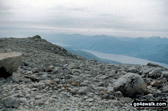
 The summit of Ben Nevis in Glen Shiel to Glenfinnan and Loch EilScotland


