   |
Vital Statistics:
| Length: | 18¾mls (30km) |
| Ascent: | 7,309ft (2,408m) |
| Time: | 14¾hrs |
| Grade: |  |

Route outline for walk c120:
Bowness Knott Car Park Ennerdale - Low Gillerthwaite Field Centre - High Gillerthwaite Yourth Hostel - Red Pike (Buttermere) - High Stile - High Crag (Buttermere) - Seat (Buttermere) - Scarth Gap - Hay Stacks (Haystacks) - Innominate Tarn - Blackbeck Tarn - Black Beck - Green Crag (Buttermere) - Great Round How - Brandreth - Gillercomb Head - Green Gable - Windy Gap - Great Gable - Westmorland Cairn - Beck Head - Beckhead Tarn - Kirk Fell (East Top) - Kirk Fell - Black Sail Pass - Looking Stead (Pillar) - High Level Route - Robinson's Cairn - Pillar - Wind Gap - Black Crag (Pillar) - High Beck - Low Beck - Ennerdale.
Peaks, Summits and Tops reached on this walk:
 10 English Mountains |
 9 Wainwrights |
 11 English Nuttalls |
 3 English Deweys |
 0 Wainwright Outlying Fells |
 4 Marilyns |
 0 Bridgets |
Peak Bagging Statistics for this walk:
The highest point of this walk is Great Gable at 899m (2951ft). Great Gable is classified as an English Mountain (Hewitt) (9th highest in England, 25th highest in England & Wales) and a Wainwright (No. 7).
Great Gable is also known as an English Nuttall (11th highest in England, 28th highest in England & Wales) and an English Marilyn (4th highest in England, 238th highest in the UK).
Completing this walk will also take you to the top of Pillar at 892m (2928ft). Pillar is classified as an English Mountain (Hewitt) (11th highest in England, 29th highest in England & Wales) and a Wainwright (No. 8).
Pillar is also known as an English Nuttall (13th highest in England, 33rd highest in England & Wales) and an English Marilyn (6th highest in England, 249th highest in the UK).
The summit of Pillar is marked by an Ordnance Survey Trig Point.
You will also reach the summit of Black Crag (Pillar) at 828m (2717ft). Black Crag (Pillar) is classified as an English Mountain (Hewitt) (31st highest in England, 60th highest in England & Wales)
Black Crag (Pillar) is also known as an English Nuttall (37th highest in England, 69th highest in England & Wales).
Along the way you will also bag:
- High Stile at 807m (2646ft). High Stile is classified as an English Mountain (Hewitt) (38th England, 71st highest in England & Wales), a Wainwright (No. 29), an English Nuttall (45th highest in England, 86th highest in England & Wales) and an English Marilyn (13th England, 378th highest in the UK).
- Kirk Fell at 802m (2631ft). Kirk Fell is classified as an English Mountain (Hewitt) (42nd England, 77th highest in England & Wales), a Wainwright (No. 33), an English Nuttall (49th highest in England, 92nd highest in England & Wales) and an English Marilyn (15th England, 391st highest in the UK).
- Green Gable at 801m (2629ft). Green Gable is classified as an English Mountain (Hewitt) (43rd highest in England, 78th highest in England & Wales), a Wainwright (No. 34) and an English Nuttall (50th highest in England, 93rd highest in England & Wales).
- Kirk Fell (East Top) at 787m (2583ft). Kirk Fell (East Top) is classified as an English Mountain (Hewitt) (50th England, 89th Eng & Wal) and an English Nuttall (59th highest in England, 108th highest in England & Wales).
- Red Pike (Buttermere) at 755m (2478ft). Red Pike (Buttermere) is classified as an English Mountain (Hewitt) (67th highest in England, 116th highest in England & Wales), a Wainwright (No. 62) and an English Nuttall (83rd highest in England, 142nd highest in England & Wales).
- High Crag (Buttermere) at 744m (2442ft). High Crag (Buttermere) is classified as an English Mountain (Hewitt) (72nd highest in England, 126th highest in England & Wales), a Wainwright (No. 65) and an English Nuttall (89th highest in England, 154th highest in England & Wales).
- Brandreth at 715m (2346ft). Brandreth is classified as an English Mountain (Hewitt) (89th highest in England, 152nd highest in England & Wales), a Wainwright (No. 81) and an English Nuttall (112th highest in England, 191st highest in England & Wales).
- Looking Stead (Pillar) at 627m (2058ft). Looking Stead (Pillar) is known as an English Nuttall (220th highest in England, 383rd highest in England & Wales).
- Hay Stacks (Haystacks) at 597m (1959ft). Hay Stacks (Haystacks) is classified as a Wainwright (No. 131) and an English Dewey (13th highest in England, 29th highest in England & Wales)
- Seat (Buttermere) at 561m (1841ft). Seat (Buttermere) is classified as an English Dewey (53rd highest in England, 122nd highest in England & Wales).
- Green Crag (Buttermere) at 528m (1732ft). Green Crag (Buttermere) is classified as an English Dewey (117th highest in England, 274th highest in England & Wales).
You can find this walk and other nearby walks on these unique free-to-access Interactive Walk Planning Maps:
1:25,000 scale OS Explorer Map (orange/yellow covers):
1:50,000 scale OS Landranger Map (pink/magenta covers):
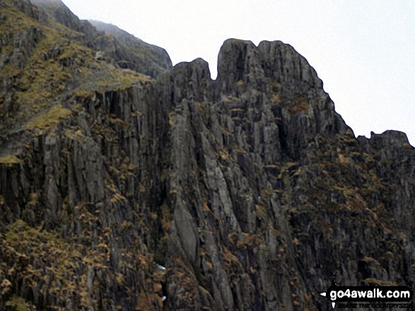
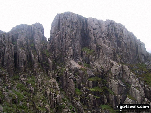
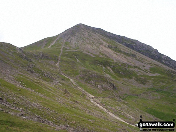
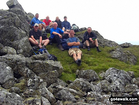
Some Photos and Pictures from Walk c120 The Ennerdale Horseshoe
In no particular order . . .


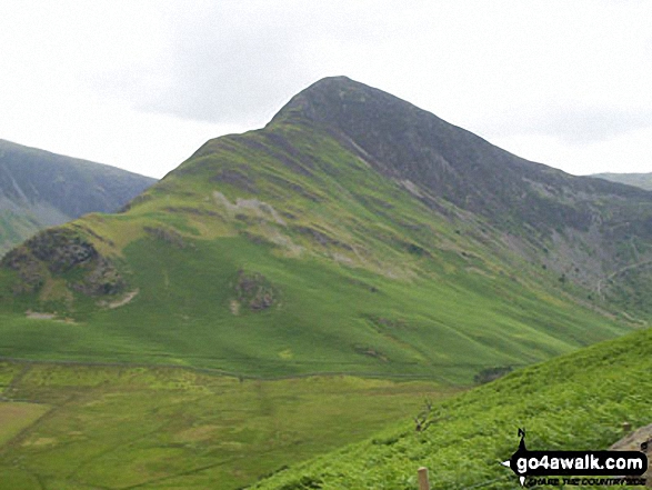
High Crag (left), Crummock Water and Grasmoor (right) from the summit of Hay Stacks (Haystacks)
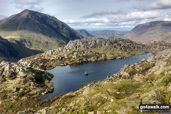
Seat (Buttermere) & High Crag (Buttermere) (left) and Grasmoor (right) from the small pool on Hay Stacks (Haystacks)

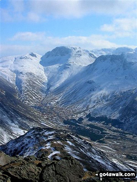
Green Gable left), Great Gable (centre) and Kirk Fell (right) with the Scafell Massif beyond (centre) from High Crag (Buttermere)

Mellbreak, Crummock Water and Grasmoor from the summit of Red Pike (Buttermere)
. . . load all 229 walk photos from Walk c120 The Ennerdale Horseshoe
Send us your photographs and pictures from your walks and hikes
We would love to see your photographs and pictures from walk c120 The Ennerdale Horseshoe. Send them in to us as email attachments (configured for any computer) along with your name and where the picture was taken to:
and we shall do our best to publish them.
(Guide Resolution = 300dpi. At least = 660 pixels (wide) x 440 pixels (high).)

You can also submit photos from walk c120 The Ennerdale Horseshoe via our Facebook Page.
NB. Please indicate where each photo was taken.


