Four easy to follow pub walks from The Queens Arms, Taddington, The Peak District, Derbyshire, England
To reach The Queens Arms, Taddington, in-car SatNav users should select the Latitude/Longitude (Lat Lon) screen and enter:
Lat = N53.23607 and Lon = W 1.78244
Not familiar with this pub?
Four easy to follow pub walks from The Queens Arms, Taddington, The Peak District, Derbyshire, England
Scroll down the list of walks below & click on each walk title (in blue) to locate it on the map above.

   |
Vital Statistics:
| Length: | 7.5 miles (12 km) |
| Ascent: | 880ft (268m) |
| Time: | 3.75hrs |
| Grade: |  |
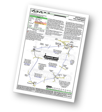
Route Summary:
Taddington - Humphrey Gate - Slough Top - Chelmorton - The Midshires Way - Pomeroy - Flagg - Taddington.


|
Vital Statistics:
| Length: | 9.75 miles (15.5 km) |
| Ascent: | 1,342ft (409m) |
| Time: | 5 hrs |
| Grade: |  |
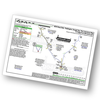
Route Summary:
Monyash - High Low - Wheal Lane - Deep Dale - White Lodge (A6) - Taddington Field - Lodley View Farm - Taddington - Sough Top - The Limestone Way - Flagg - Monyash

|
Vital Statistics:
| Length: | 8.5 miles (13.5 km) |
| Ascent: | 1,812ft (555m) |
| Time: | 5 hrs |
| Grade: | |

Route Summary:
Wye Dale - Blackwell Junction - The Monsal Trail - Chee Dale - Miller's Dale Station - Miller's Dale - Priestcliffe - Taddington - Sough Top - Chelmorton - The Midshires Way - Burrs Farm - Marl Dale - Topley Pike Quarry - Wye Dale

|
Vital Statistics:
| Length: | 15.25 miles (24.5 km) |
| Ascent: | 1,759ft (536m) |
| Time: | 7.25hrs |
| Grade: |  |

Route Summary:
Wye Dale - The River Wye - Blackwell Junction - The Monsal Trail - Chee Dale - Miller's Dale Station - Miller's Dale - Litton Mill - Water-cum-Jolly Dale - Cressbrook - Monsal Dale - White Lodge - Deep Dale - Taddington - Sough Top - Chelmorton - Burrs Farm - Marl Dale - Wye Dale