15 easy-to-follow walk, route maps of all grades on OS Explorer Map OL45 The Cotswolds
Fifteen easy-to-follow walk, route maps of all grades on OS Explorer Map OL45 The Cotswolds in Walk Grade OrderTap/mouse over a coloured circle (1-3 easy walks, 4-6 moderate walks, 7-9 hard walks) and click to select.
You can use these checkboxes to show only the grades of walk you are interested in:-
Fifteen easy-to-follow walk, route maps of all grades on OS Explorer Map OL45 The Cotswolds in Walk Grade Order
Scroll down the list of walks below & click on each walk title (in blue) to locate it on the map above.
See this list of walks, routes & maps in:
Grade Order | Length Order | Time Order | Walk Number or Start Location Order
NB. To reverse (toggle) this order, click Grade Order again

   |
Vital Statistics:
| Length: | 10.25 miles (16.5 km) |
| Ascent: | 463ft (141m) |
| Time: | 4.25hrs |
| Grade: |  |

Route Summary:
Moreton-in-Marsh - The Mornarch's Way - Upper Fields Farm - Longborough - Donnington - Broadwell - Quinmoor Far - River Evenlode - Evenlode - Codicote Farm - Moreton-in-Marsh


|
Vital Statistics:
| Length: | 9 miles (14.5 km) |
| Ascent: | 801ft (244m) |
| Time: | 4.25hrs |
| Grade: |  |

Route Summary:
Adlestrop - The Macmillan Way - Chastleton - Chastleton House - Chastleton Barrow Iron Age Fort - Cornwell - Daylesford - The Macmillan Way - Lower Oddington - Adlestrop Park - Adlestrop

|
Vital Statistics:
| Length: | 9 miles (14.5 km) |
| Ascent: | 754ft (230m) |
| Time: | 4 hrs |
| Grade: | |

Route Summary:
Chedworth - Woodlands Farm - Postcombe - Withington Woods - Withington - River Coln - Woodbridge - Cassey Compton - Turpin's Green - Hutnage - Chedworth Roman Villa - The Monarch's Way - The Macmillan Way - Yanworth Mill - Chedworth Woods - Chedworth

|
Vital Statistics:
| Length: | 3.75 miles (6 km) |
| Ascent: | 394ft (120m) |
| Time: | 1.75hrs |
| Grade: |  |
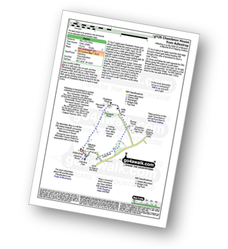
Route Summary:
Adlestrop - The Macmillan Way - Chastleton - Chastleton House - Chastleton Barrow Iron Age Fort - Long Drive - Adlestrop

|
Vital Statistics:
| Length: | 5.75 miles (9 km) |
| Ascent: | 571ft (174m) |
| Time: | 2.75hrs |
| Grade: | |

Route Summary:
Chedworth Roman Villa - The Macmillan Way - River Coln - Yanworth Common - Yanworth Wood - Streetfold - Yanworth - Dean Grove - Sheep Wash - Oxpens Farm - The Monarch's Way - Stowell Grove - Budford's Grove - Yanworth Mill - River Coln - Chedworth Woods - Chedworth Roman Villa

|
Vital Statistics:
| Length: | 6 miles (9.5 km) |
| Ascent: | 508ft (155m) |
| Time: | 2½ hrs |
| Grade: | |

Route Summary:
Stow-on-the-Wold - The Monarch's Way - Broadwell - Donnington - Battle of Stow Memorial - The Gloucestershire Way - Upper Swell - Stow-on-the-Wold

|
Vital Statistics:
| Length: | 6.75 miles (11 km) |
| Ascent: | 312ft (95m) |
| Time: | 3 hrs |
| Grade: | |

Route Summary:
Bourton-on-the-Water - Little Rissington - Great Rissington - New Bridge - River Windrush - Bourton-on-the-Water

|
Vital Statistics:
| Length: | 6.25 miles (10 km) |
| Ascent: | 670ft (204m) |
| Time: | 3 hrs |
| Grade: | |
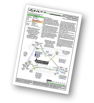
Route Summary:
Adlestrop - The Macmillan Way - Chastleton - Chastleton House - Chastleton Barrow Iron Age Fort - Cornwell - Adlestrop

|
Vital Statistics:
| Length: | 8.5 miles (13.5 km) |
| Ascent: | 951ft (290m) |
| Time: | 4 hrs |
| Grade: | |

Route Summary:
Winchcombe - River Isbourne - The Cotswold Way - Salter's Lane - Hailes Abbey - North Farmcote - Lynes Barn - Campden Lane (Track) - Deadmanbury Gate - Wardens' Way - Salt Way - The Warren - Parks Farm - Sudeley Lodge - Sudeley Castle - Winchcombe

|
Vital Statistics:
| Length: | 10.75 miles (17 km) |
| Ascent: | 689ft (210m) |
| Time: | 4.75hrs |
| Grade: | |
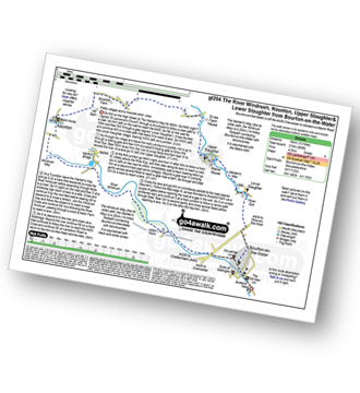
Route Summary:
Bourton-on-the-Water - The Warden's Way - River Eye - Lower Slaughter - Upper Slaughter - Brockhill Farm - Naunton - The Windrush Way - River Windrush - Aston Farm - Bourton-on-the-Water

|
Vital Statistics:
| Length: | 8.25 miles (13 km) |
| Ascent: | 696ft (212m) |
| Time: | 3.75hrs |
| Grade: | |


|
Vital Statistics:
| Length: | 6.5 miles (10.5 km) |
| Ascent: | 272ft (83m) |
| Time: | 2.75hrs |
| Grade: | |

Route Summary:
Shipton Under Wychwood - Milton Under Wychwood - Grange Farm - Home Farm - Foxholes Nature Reserve - The Oxfordshire Way - Bruern Abbey - Shipton Under Wychwood

|
Vital Statistics:
| Length: | 5.5 miles (9 km) |
| Ascent: | 400ft (122m) |
| Time: | 2½ hrs |
| Grade: | |
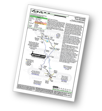
Route Summary:
Churchill - Sarsden Halt. Kingham Hill Farm - Cornwell - Swailsford Bridge - Churchill

|
Vital Statistics:
| Length: | 7 miles (11 km) |
| Ascent: | 420ft (128m) |
| Time: | 3 hrs |
| Grade: | |


|
Vital Statistics:
| Length: | 6.25 miles (10 km) |
| Ascent: | 558ft (170m) |
| Time: | 2.75hrs |
| Grade: | |
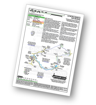
Route Summary:
Burford - Fulbrook - Widley Copse - Dean Bottom - Widford Church - River Windrush - Burford
See this list of walks, routes & maps in:
Grade Order | Length Order | Time Order | Walk Number or Start Location Order
NB. To reverse (toggle) this order, click Grade Order again