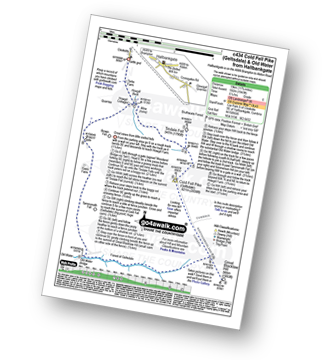
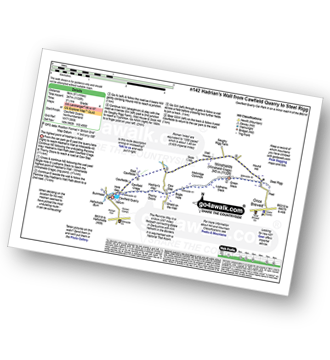
6 easy to follow walk route maps of all grades on OS Explorer Map OL43 Hadrian’s Wall
Six easy-to-follow hand-crafted printable walk route maps that are wholly on or partly on OS Explorer Map OL43 Hadrian’s Wall to suit all levels of fitness and ability.
Tap/mouse over a coloured circle (1-3 easy walks, 4-6 moderate walks, 7-9 hard walks) and click to select.
You can use these checkboxes to show only the grades of walk you are interested in:-
Six easy-to-follow walk route maps of all grades on OS Explorer Map OL43 Hadrian’s Wall in Walk Grade Order
Scroll down the list of walks below & click on each walk title (in blue) to locate it on the map above.
See this list of walks, routes & maps in:
Grade Order |
Length Order |
Time Order |
Walk Number or Start Location Order
NB. To reverse (toggle) this order, click Grade Order again
Route Summary:
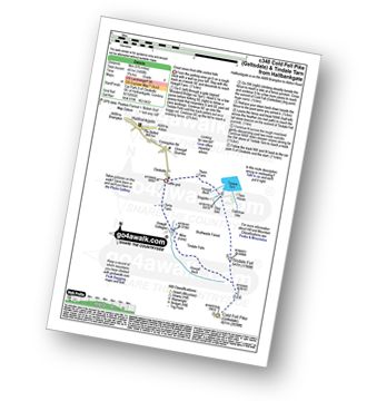
Clesketts - Tortie Farm - Howgill Cottages - Tindale Fells - Howgill Beck - Cold Fell Pike (Geltsdale) - Tindale Fell - Tindale Tarn - Thron Farm - Clesketts
Route Summary:
Clesketts - Tortie Farm - Howgill Cottages - Tindale Fells - Howgill Beck - Tindale Fell - Cold Fell Pike (Geltsdale) - Great Blacklaw Hill - Old Water - Old Water Bridge - Gairs Farm - Howgill Cottages - Clesketts
Route Summary:
Housteads Visitor Centre - Chapel Hill - Housesteads - Vercovicium Fort - The Hadrian's Wall Path - Housesteads Crags - Cuddy's Crag - The Pennine Way - Hotbank Crags - Hotbank - Crag Lough - Highshield Crags - Steel Rigg - Peel Crags - Peel - Once Brewed - Brackies Burn - Smith's Shield - Causeway House - Vindolanda Roman Fort - Chesterholm - Barcombe - East Crindledykes Farm - Green Brae - Little Shield - Deafley Rigg - Housteads Visitor Centre
Route Summary:
Haltwhistle - Wydon Farm - Wydon Eals Farm - River South Tyne - Featherstone Castle - Lambley Viaduct Nature Trail - Thorneyhole Wood - Featherstone Rowfoot - Park Village - Broomhouse Farm - Haltwhistle
Route Summary:
Cawfield Quarry Car Park - Hadrian's Wall - The Pennine Way - The Hadrian's Wall Path - Cawfield Crags - Thorny Doors - Caw Gap - Bogle Hole - Lodhams Slack - Winshields (Winshield Crags) - Green Slack - Steel Rigg - Hound Hill - Melkridge Common - East Cawfields - Cawfields - Cawfield Quarry Car Park
Route Summary:
Allenheads - Dirt Pots - The Weardale Way - Killhope Law - Shivery Hill - Carshield Moor - Scum Hill - Hartley Moor - Nan Davison's Cleugh - Philipson's Fold - Knockshield Moor - Black Way (Track) - Swinhope Shield - High Knock Shield - Knock Shield - Knockburn Farm - River East Allen - Low Sipton Shield - Sipton Terrace - Teedham Green - Corn Mill - Low Huntwell - Dirt Pots - Allenheads
See this list of walks, routes & maps in:
Grade Order |
Length Order |
Time Order |
Walk Number or Start Location Order
NB. To reverse (toggle) this order, click Grade Order again
To contribute to go4awalk.com or to contact us about anything at all - see Talk To Us. For help see Help.
go4awalk.com and go4awalk.co.uk are registered trademarks of TMDH Limited.
Copyright © 2000-2024 TMDH Limited. All rights reserved.
Copyright | Terms & Conditions | Privacy Statement
A - Z
Walks
Home
Log On/Accounts
Photo Gallery
Walk Ideas and Collections
Fell Facts
Places to Stay
Hill Skills
Walking Questions and Answers
Your Stories
News
Competitions
Product Reviews/Gear Tests
Walking Gear Guides
Peaks and Mountains
Peak Bagging
Find New Walking Friends
Camping
GPS Waypoints for Walking
Walk Search
Talk to us
go4awalk.com Help
Free example walks
Newsletter