7 easy-to-follow walk, route maps of all grades on OS Explorer Map OL9 Exmoor
Seven easy-to-follow walk, route maps of all grades on OS Explorer Map OL9 Exmoor in Walk Grade OrderTap/mouse over a coloured circle (1-3 easy walks, 4-6 moderate walks, 7-9 hard walks) and click to select.
You can use these checkboxes to show only the grades of walk you are interested in:-
Seven easy-to-follow walk, route maps of all grades on OS Explorer Map OL9 Exmoor in Walk Grade Order
Scroll down the list of walks below & click on each walk title (in blue) to locate it on the map above.
See this list of walks, routes & maps in:
Grade Order | Length Order | Time Order | Walk Number or Start Location Order
NB. To reverse (toggle) this order, click Grade Order again

   |
Vital Statistics:
| Length: | 5 miles (8 km) |
| Ascent: | 1,708ft (521m) |
| Time: | 3.75hrs |
| Grade: |  |

Route Summary:
Lynmouth - The East Lyn River - Wester Wood - Horner's Neck Wood - Watersmeet - Watersmeet House - Trilly - Countisbury - Butter Hill - The Sought West Coast Path - Lower Blackhead - Sillery Sands - Black Rocks - Point Perilous - Lynmouth


|
Vital Statistics:
| Length: | 5.5 miles (8.5 km) |
| Ascent: | 1,493ft (455m) |
| Time: | 3½ hrs |
| Grade: | |

Route Summary:
Lynton - The Danes Or Valley Of Rocks - Six Acre Wood - The South West Coast Path - Lee Bay - Lee Abbey - Castle Rock - Rugged Jack - Wringcliff Bay - Ruddy Ball - Lynmouth - Lynton

|
Vital Statistics:
| Length: | 5.75 miles (9 km) |
| Ascent: | 1,083ft (330m) |
| Time: | 3.25hrs |
| Grade: | |
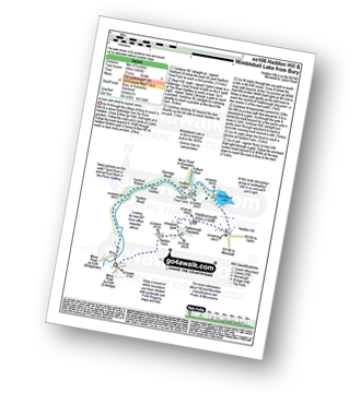
Route Summary:
Bury - River Haddeo - Hartford Bottom - Hartford Lodge - Pulham River - Upton Dam - Wimbleball Lake - Haddon Hill - Hadborough (Haddon Hill) - Hadborough Plantation - Haddon Farm - Bury

|
Vital Statistics:
| Length: | 6 miles (9.5 km) |
| Ascent: | 1,408ft (429m) |
| Time: | 3½ hrs |
| Grade: | |

Route Summary:
Bossington - Allerford - Selworthy - Selworthy Beacon - The South West Coast Path - Hurlstone Combe - Hurlstone Point - Porlock Bay - Bossington

|
Vital Statistics:
| Length: | 6.75 miles (11 km) |
| Ascent: | 1,254ft (382m) |
| Time: | 3.75hrs |
| Grade: | |
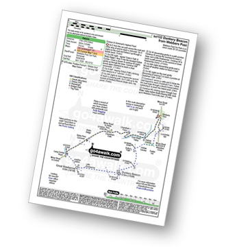
Route Summary:
Webbers Post - Dicky's Path - Hollow Combe - Dunkery Beacon - Little Rowbarrow - Great Rowbarrow - Lang Combe Head - Cloutsham Gate - Cloutsham Farm - East Water Valley - Webbers Post

|
Vital Statistics:
| Length: | 8.75 miles (14 km) |
| Ascent: | 1,634ft (498m) |
| Time: | 4.75hrs |
| Grade: |  |

Route Summary:
Withypool - The Two Moors Way - Withypool Hill - Westwater Farm - Parsonage Down - River Barle - Tarr Steps - Knaplock Wood - Withypool

|
Vital Statistics:
| Length: | 9.5 miles (15 km) |
| Ascent: | 2,038ft (621m) |
| Time: | 5½ hrs |
| Grade: |  |

Route Summary:
Luccombe - Luccombe Plantation - Webbers Post - Dicky's Path - Hollow Combe - Dunkery Beacon - Little Rowbarrow - Great Rowbarrow - Lang Combe Head - Cloutsham Gate - Stoke Pero Church - Prickslade - Cloutsham Farm - East Water Valley - Webbers Post - Horner Plantataion - Luccombe
See this list of walks, routes & maps in:
Grade Order | Length Order | Time Order | Walk Number or Start Location Order
NB. To reverse (toggle) this order, click Grade Order again