Walks Routes Maps from Burnhope Reservoir in The North Pennines, County Durham in Walk Grade Order
Route maps for Walks that start, or go through, Burnhope Reservoir in The North Pennines, County Durham, England in Walk Grade Order
Details of refreshments, pubs & parking are included on each Burnhope Reservoir walk description.

   |
Vital Statistics:
| Length: | 7.5 miles (12 km) |
| Ascent: | 1,287ft (392m) |
| Time: | 4 hrs |
| Grade: |  |
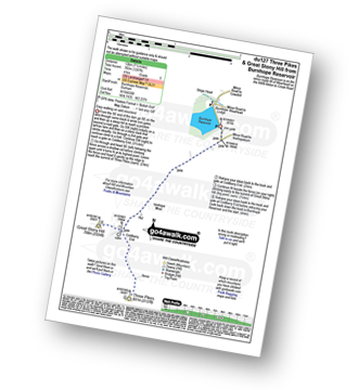
Route Summary:
Burnhope Reservoir - Ireshope Moor - Coldberry End - Three Pikes - Coldberry End - Great Stony Hill - Coldberry End - Ireshope Moor - Burnhope Reservoir


|
Vital Statistics:
| Length: | 11.5 miles (18.5 km) |
| Ascent: | 1,631ft (497m) |
| Time: | 5.75hrs |
| Grade: |  |

Route Summary:
Burnhope Reservoir - Ireshope Moor - Coldberry End - Great Stony Hill - Scaud Hill - Redgleam (Harwood Common) - Burnhope Seat - Dead Stones - White Edge (Burnhope Reservoir) - Lamb's Head - Highwatch Currick - The Malakoff - Bents Head - Stripe End - Burnhope Reservoir

|
Vital Statistics:
| Length: | 14 miles (22.5 km) |
| Ascent: | 1,904ft (580m) |
| Time: | 7 hrs |
| Grade: |  |

Route Summary:
Burnhope Reservoir - Ireshope Moor - Coldberry End - Three Pikes - Coldberry End - Great Stony Hill - Scaud Hill - Redgleam (Harwood Common) - Burnhope Seat - Dead Stones - White Edge (Burnhope Reservoir) - Lamb's Head - Highwatch Currick - The Malakoff - Bents Head - Stripe End - Burnhope Reservoir
See more easy-to-follow circular walks in The North Pennines
See more easy-to-follow circular walks in County Durham