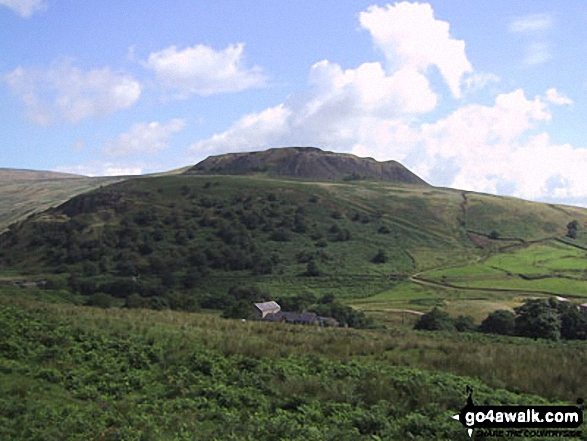
Hey Edge from Crowden
The Dark Peak Area,
The Peak District National Park,
Derbyshire, England
See views like this by using any of these 8 easy-to-follow circular walk route maps:

   |
Vital Statistics:
| Length: | 5.25 miles (8.5 km) |
| Ascent: | 823ft (251m) |
| Time: | 2.75hrs |
| Grade: |  |
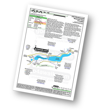
Route Summary:
Crowden - The Pennine Way - Torside Reservoir - Rhodeswood Reservoir - The Longdendale Trail - The Pennine Way - Torside Reservoir - Crowden


|
Vital Statistics:
| Length: | 7.25 miles (11.5 km) |
| Ascent: | 1,515ft (562m) |
| Time: | 4.25hrs |
| Grade: |  |

Route Summary:
Crowden - The Pennine Way - Torside Reservoir - Rhodeswood Reservoir - Higher Deepclough - Devil's Elbow - Ogden Clough - Nell's Pike - Bramah Edge - Peaknaze Moor - The Pennine Way - Torside Reservoir - Crowden

|
Vital Statistics:
| Length: | 6.25 miles (10 km) |
| Ascent: | 1,610ft (491m) |
| Time: | 4 hrs |
| Grade: | |
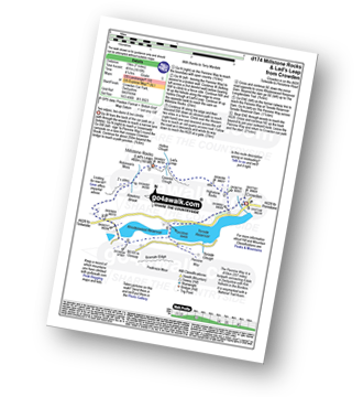
Route Summary:
Crowden - The Pennine Way - Highstone Rocks - Lad's Leap - Millstone Rocks (Lad's Leap) - Rhodeswood Reservoir - The Longdendale Trail - The Pennine Way - Torside Reservoir - Crowden

|
Vital Statistics:
| Length: | 9 miles (14.5 km) |
| Ascent: | 1,746ft (532m) |
| Time: | 5 hrs |
| Grade: | |
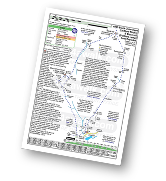
Route Summary:
Crowden - Crowden Brook - The Pennine Way - Highstone Rocks - Span Gutter - Rakes Rocks - Oakenclough Brook - Laddow Moss - Black Chew Head (Laddow Rocks) - Near Broadslate - Sliddens - Dun Hill - Black Hill (Soldier's Lump) - Tooleyshaw Moss - Tooleyshaw Moor - White Low - Westend Moss - Hey Moss - Hey Edge - Crowden

|
Vital Statistics:
| Length: | 8.25 miles (13 km) |
| Ascent: | 1,860ft (567m) |
| Time: | 4.75hrs |
| Grade: | |

Route Summary:
Edale - The Pennine Way - Upper Booth - Jacob's Ladder (Edale) - Edale Head - Kinder Scout - Edale Moor - Kinder Plateau - Kinder Low (Kinder Scout) - Noe Stool (Edale Head) - Pym Chair (Edale Head) - Crowden Tower (Kinder Scout) - Crowden Brook - Grindslow Knoll (Kinder Scout) - Grindsbrook Clough - Grinds Brook - The Vale of Edale - Edale

|
Vital Statistics:
| Length: | 8.5 miles (13.5 km) |
| Ascent: | 2,289ft (698m) |
| Time: | 5½ hrs |
| Grade: |  |
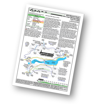
Route Summary:
Crowden - The Pennine Way - Highstone Rocks - Lad's Leap - Millstone Rocks (Lad's Leap) - Rhodeswood Reservoir - Higher Deepclough - Devil's Elbow - Ogden Clough - Nell's Pike - Bramah Edge - Peaknaze Moor - The Pennine Way - Torside Reservoir - Crowden

|
Vital Statistics:
| Length: | 10.25 miles (16.5 km) |
| Ascent: | 1,870ft (570m) |
| Time: | 5.75hrs |
| Grade: | |

Route Summary:
Edale - The Pennine Way - Upper Booth - Jacob's Ladder (Edale) - Kinder Low (Kinder Scout) - Red Brook - Kinder Downfall - Kinder Scout - Edale Moor - Kinder Plateau - Crowden Head (Kinder Scout) - Grindslow Knoll (Kinder Scout) - Grindsbrook Clough - Grinds Brook - The Vale of Edale - Edale

|
Vital Statistics:
| Length: | 10.5 miles (17 km) |
| Ascent: | 1,975ft (602m) |
| Time: | 5.75hrs |
| Grade: | |

Route Summary:
Woodhead Tunnel - Middle Black Clough - Bleaklow Stones (Bleaklow Hill) - Bleaklow Head (Bleaklow Hill) - The Wain Stones (or Kissing Stones) - The Pennine Way - Clough Edge - The Longdendale Trail - Crowden - Woodhead Reservoir - Woodhead Tunnel
Send us your photographs and pictures of walks and hikes in the British countryside
If you would like to see your digital photographs as part of this collection, please send them as email attachments (configured for any computer) along with your name to:
and we shall do our best to publish them.
(Guide Resolution = 300dpi. At least = 587 pixels (wide) x 440 pixels (high).)

You can also submit photos via our Facebook Page.
NB. Please indicate where each photo was taken.
NB. To see photographs and pictures from a particular walk choose your walk from Walks or use our Walk Search facility.
To see photographs and pictures on, of or from a particular Mountain, Peak, Top or Hill select from Peaks & Mountains' or enter the Mountain, Peak, Top or Hill Name into our 'Photo Search facility.