River Ashop
The Dark Peak Area,
The Peak District National Park,
Derbyshire, England
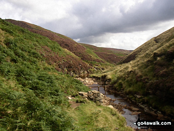
See views like this by using any of these 12 easy-to-follow circular walk route maps:

   |
Vital Statistics:
| Length: | 3.5 miles (5.5 km) |
| Ascent: | 705ft (215m) |
| Time: | 2 hrs |
| Grade: |  |
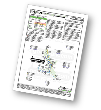
Route Summary:
Birchin Clough - (A57 Snake Pass) - Lady Clough - River Ashop - Saukin Ridge - Black Ashop Moor - Snake Plantations - Lady Clough Moor - Lady Clough - Lady Clough Bridge - Birchin Clough - (A57 Snake Pass).


|
Vital Statistics:
| Length: | 9 miles (14.5 km) |
| Ascent: | 1,689ft (515m) |
| Time: | 5 hrs |
| Grade: |  |

Route Summary:
Birchin Clough - A57 Snake Pass - Lady Clough - River Ashop - Rough Bank - Fair Brook - Kinder Scout - Edale Moor - Kinder Plateau - Kinder Downfall - The Pennine Way - The Edge (Kinder Scout) - Ashop Head - Mill Hill (Ashop Head) - Black Ashop Moor - Within Clough - Red Clough - Upper Gate Clough - Ashop Clough - Birchin Clough

|
Vital Statistics:
| Length: | 8.75 miles (14 km) |
| Ascent: | 1,328ft (405m) |
| Time: | 4½ hrs |
| Grade: | |

Route Summary:
Birchin Clough - Snake Path - Ashop Clough - Upper Gate Clough - Red Clough - Within Clough - Ashop Head - The Pennine Way - Mill Hill (Ashop Head) - Featherbed Top (Featherbed Moss) - A57 Snake Pass - Old Woman - Doctors Gate - Lady Clough - Birchin Clough

|
Vital Statistics:
| Length: | 10 miles (16 km) |
| Ascent: | 1,568ft (478m) |
| Time: | 5.25hrs |
| Grade: |  |

Route Summary:
Ashopton Bridge - Ladybower Reservoir - Ashopton - Whinstone Lee Tor - Hurkling Stones - Wheel Stones - White Tor (Derwent Edge) - Salt Cellar (Boulder) - Derwent Edge - Dove Stone (Boulder) - Dovestones Tor - Cakes of Bread - Bradfield Gate Head - Back Tor (Derwent Edge) - Lost Lad - Bamford House - Little Howden Moor - Derwent Reservoir - Derwent Valley - Ladybower Reservoir - Ashopton Bridge..

|
Vital Statistics:
| Length: | 9.75 miles (15.5 km) |
| Ascent: | 1,841ft (561m) |
| Time: | 5½ hrs |
| Grade: | |

Route Summary:
Birchin Clough - (A57 Snake Pass) - Lady Clough - River Ashop - Rough Bank - Fair Brook - Fairbrook Naze (Kinder Scout) - The Kinder Plateau - Edale Moor - The Edge (Kinder Scout) - The Pennine Way - Ashop Head - Mill Hill - Black Ashop Moor - Within Clough - Red Clough - Upper Gate Clough - Ashop Clough - Birchin Clough - (A57 Snake Pass).

|
Vital Statistics:
| Length: | 8.75 miles (14 km) |
| Ascent: | 2,192ft (688m) |
| Time: | 5½ hrs |
| Grade: | |

Route Summary:
Bowden Bridge - Hayfield - Booth Sheepwash - White Brow - Kinder Reservoir - Nab Brow - William Clough - Ashop Head - Mill Hill (Ashop Head) - The Pennine Way - Kinder Scout - The Edge (Kinder Scout) - Kinder Downfall - Red Brook - Cluther Rocks - Kinder Low (Kinder Scout) - Edale Cross - Kinderlow End - Oaken Clough - Tunstead House Farm - Bowden Bridge - Hayfield

|
Vital Statistics:
| Length: | 8.25 miles (13 km) |
| Ascent: | 2,060ft (628m) |
| Time: | 5 hrs |
| Grade: | |

Route Summary:
Birchin Clough - A57 Snake Pass - Lady Clough - River Ashop - Rough Bank - Fair Brook - Gate Side Clough - Wood Moor - Dunge Clough - The Wicken - Blackden Brook - Blackden Moor - Kinder Scout - Edale Moor - Kinder Plateau - Seal Edge - Seal Stones (Kinder Scout) - Fair Brook - Birchin Wood - Birchin Clough

|
Vital Statistics:
| Length: | 10 miles (16 km) |
| Ascent: | 2,368ft (722m) |
| Time: | 6 hrs |
| Grade: | |

Route Summary:
Ladybower Reservoir - Fairholmes Car Park - Lockerbrook Farm - Lockerbrook Heights - Rowlee Pasture - Alport Castles - River Alport - Alport Dale - Alport Farm - Hayridge Farm - Upper Ashop - Blackley Clough - Hagg Farm - Hagg Side - Fairholmes Car Park - Ladybower Reservoir

|
Vital Statistics:
| Length: | 9.5 miles (15 km) |
| Ascent: | 2,074ft (632m) |
| Time: | 5½ hrs |
| Grade: | |

Route Summary:
Hayfield - Sett Valley Trail - Birch Vale - The River Sett - The Pennine Bridleway - Lantern Pike - Matley Moor - Burnt Hill - Mill Hill (Ashop Head) - The Pennine Way - William Clough - Kinder Reservoir - Snake Path - Middle Moor - Hayfield

|
Vital Statistics:
| Length: | 13.75 miles (22 km) |
| Ascent: | 2,061ft (628m) |
| Time: | 7 hrs |
| Grade: |  |

Route Summary:
Ladybower Reservoir - Fairholmes Car Park - Ashopton - Whinstone Lee Tor - Hurkling Stones - Wheel Stones - White Tor (Derwent Edge) - Salt Cellar (Boulder) - Derwent Edge - Dove Stone (Boulder) - Dovestones Tor - Cakes of Bread - Bradfield Gate Head - Back Tor (Derwent Edge) - Lost Lad - Sheepfold Clough - Abbey Brook - Howden Dean - Abbey Tip Plantation - Derwent Reservoir - Fairholmes Car Park - Ladybower Reservoir

|
Vital Statistics:
| Length: | 12.25 miles (19.5 km) |
| Ascent: | 2,189ft (667m) |
| Time: | 6.75hrs |
| Grade: | |

Route Summary:
Birchin Clough - (A57 Snake Pass) - Lady Clough - River Ashop - Rough Bank - Fair Brook - Seal Edge - Seal Stones (Kinder Scout) - Fairbrook Naze (Kinder Scout) - The Kinder Plateau - Edale Moor - The Edge (Kinder Scout) - The Pennine Way - Ashop Head - Mill Hill (Ashop Head) - Featherbed Top (Featherbed Moss) - A57 Snake Pass - Old Woman - Doctors Gate - Lady Clough - Birchin Clough - (A57 Snake Pass).

|
Vital Statistics:
| Length: | 19.75 miles (31.5 km) |
| Ascent: | 2,757ft (840m) |
| Time: | 9.75hrs |
| Grade: |  |

Route Summary:
Ladybower Reservoir - Fairholmes Car Park - Ashopton - Whinstone Lee Tor - Hurkling Stones - Wheel Stones - White Tor (Derwent Edge) - Salt Cellar (Boulder) - Derwent Edge - Dove Stone (Boulder) - Dovestones Tor - Cakes of Bread - Bradfield Gate Head - Back Tor (Derwent Edge) - Abbey Brook - High Peak - Howden Moors - Featherbed Moss (Howden Edge) - High Stones (Howden Moor) - Margery Hill - Outer Edge - Crow Stones - Crow Stones Edge - Airspeed Consul TF-RPM Plane Wreckage - Broadhead Clough - Cranberry Bed - Bull Clough - Cranberry Clough - Slippery Stones - Packhorse Bridge (River Derwent) - Howden Reservoir - Cold Side (Howden Reservoir) - Derwent Reservoir - Fairholmes Car Park - Ladybower Reservoir
Send us your photographs and pictures of walks and hikes in the British countryside
If you would like to see your digital photographs as part of this collection, please send them as email attachments (configured for any computer) along with your name to:
and we shall do our best to publish them.
(Guide Resolution = 300dpi. At least = 587 pixels (wide) x 440 pixels (high).)

You can also submit photos via our Facebook Page.
NB. Please indicate where each photo was taken.
NB. To see photographs and pictures from a particular walk choose your walk from Walks or use our Walk Search facility.
To see photographs and pictures on, of or from a particular Mountain, Peak, Top or Hill select from Peaks & Mountains' or enter the Mountain, Peak, Top or Hill Name into our 'Photo Search facility.