Cyclist (and bike) on The Calf trig point
The Howgill Fells,
The Yorkshire Dales National Park,
Cumbria, England

See views like this by using any of these 6 easy-to-follow circular walk route maps:

   |
Vital Statistics:
| Length: | 6 miles (9.5 km) |
| Ascent: | 1,946ft (593m) |
| Time: | 4½ hrs |
| Grade: |  |

Route Summary:
The Cross Keys - River Rawthey - Cautley Holme Beck - Cautley Spout - Cautley Crag - Great Dummacks - Little Dummacks - Calders - Bram Rigg Top - The Calf - Bowderdale Beck - Bowderdale Head - Cautley Holme Beck - The Cross Keys


|
Vital Statistics:
| Length: | 6.5 miles (10.5 km) |
| Ascent: | 2,612ft (796m) |
| Time: | 5 hrs |
| Grade: |  |

Route Summary:
The Cross Keys - River Rawthey - Cautley Holme Beck - Cautley Spout - Cautley Crag - Great Dummacks - Little Dummacks - Calders - Bram Rigg Top - The Calf - Bowderdale Beck - Bowderdale Head - Yarlside - Ben End - The Cross Keys

|
Vital Statistics:
| Length: | 9.5 miles (15 km) |
| Ascent: | 3,114ft (949m) |
| Time: | 6½ hrs |
| Grade: |  |

Route Summary:
Sedbergh - Settlebeck Gill - Winder Hill - Arant Haw - Calders - Bram Rigg Top - The Calf - White Fell Head - Long Rigg Beck - Ivy Crag - Eller Mire - Crosdale Beck - Nursery Wood - Lockbank Farm - Sedbergh

|
Vital Statistics:
| Length: | 8 miles (12.5 km) |
| Ascent: | 3,485ft (1,062m) |
| Time: | 6½ hrs |
| Grade: | |

Route Summary:
The Cross Keys - River Rawthey - Ben End - Yarlside - Kensgriff - Randygill Top - Bowderdale Beck - The Calf - Bram Rigg Top - Calders - Great Dummacks - Cautley Crag - Croonthard Brow - Cautley Holme Beck - River Rawthey - The Cross Keys

|
Vital Statistics:
| Length: | 11 miles (17.5 km) |
| Ascent: | 4,430ft (1,350m) |
| Time: | 8½ hrs |
| Grade: |  |

Route Summary:
Carlingill Bridge - The Howgills - Carlingill Beck - Carlin Gill - Screes of Black Force - Carlingill Spout - Blakethwaite Bottom - Docker Knott - Great Blea Gill - Simon's Seat (Howgills) - Langdale Beck (Howgills) - Hazelgill Knott - Bowderdale Beck - Bowderdale Head - Cautley Spout - Cautley Crag - Great Dummacks - Little Dummacks - Calders - Bram Rigg Top - The Calf - White Fell Head - Bush Howe - Windscarth Wyke - Breaks Head - Fell Head (Howgills) - Fell Head Scar - Linghaw - Knowles - Back Balk - Gibbet Hill - Carlingill Bridge - The Howgill Fells.

|
Vital Statistics:
| Length: | 11.5 miles (18.5 km) |
| Ascent: | 4,411ft (1,344m) |
| Time: | 8.75hrs |
| Grade: | |
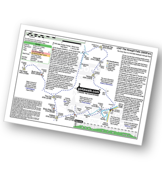
Route Summary:
The Cross Keys - River Rawthey - Ben End - Yarlside - Kensgriff - Randygill Top - Bowderdale Beck - The Calf - Bush Howe - Fell Head (Howgills) - The Calf - Bram Rigg Top - Calders - Cautley Crag - Croonthard Brow - Cautley Holme Beck - River Rawthey - The Cross Keys
Send us your photographs and pictures of walks and hikes in the British countryside
If you would like to see your digital photographs as part of this collection, please send them as email attachments (configured for any computer) along with your name to:
and we shall do our best to publish them.
(Guide Resolution = 300dpi. At least = 587 pixels (wide) x 440 pixels (high).)

You can also submit photos via our Facebook Page.
NB. Please indicate where each photo was taken.
NB. To see photographs and pictures from a particular walk choose your walk from Walks or use our Walk Search facility.
To see photographs and pictures on, of or from a particular Mountain, Peak, Top or Hill select from Peaks & Mountains' or enter the Mountain, Peak, Top or Hill Name into our 'Photo Search facility.





