![]()
Harrison Stickle
736m (2415ft)
The Central Fells, The Lake District, Cumbria, England
Tap/mouse over a coloured circle (1-3 easy walks, 4-6 moderate walks, 7-9 hard walks) and click to select.

Not familiar with this top?
   |
|---|
Vital Statistics:
| Length: | 4.5ml (7.5km) |
|---|---|
| Ascent: | 2,645ft (806m) |
| Time: | 4½ hrs |
| Grade: |  (Moderate) (Moderate) |

Route Summary:
Great Langdale - The New Dungeon Ghyll - Great Langdale - Stickle Ghyll - Stickle Tarn - Jack's Rake - The Langdale Pikes - Pavey Ark - Thunacar Knott - Harrison Stickle - Pike of Stickle (Pike O' Stickle) - Loft Crag - Mark Gate - The New Dungeon Ghyll - Great Langdale
|
|---|
Vital Statistics:
| Length: | 7.25ml (11.5km) |
|---|---|
| Ascent: | 3,046ft (928m) |
| Time: | 5.75hrs |
| Grade: |  (Moderate) (Moderate) |

Route Summary:
Great Langdale - The New Dungeon Ghyll - Stickle Ghyll - Whitegill Crag - Blea Rigg - Sergeant Man - High Raise (Langdale) - The Langdale Pikes - Thunacar Knott - Pavey Ark - Harrison Stickle - Pike of Stickle (Pike O' Stickle) - Loft Crag - Mark Gate - The New Dungeon Ghyll - Great Langdale
|
|---|
Vital Statistics:
| Length: | 8.25ml (13km) |
|---|---|
| Ascent: | 2,924ft (891m) |
| Time: | 6 hrs |
| Grade: | (Moderate) |

Route Summary:
Great Langdale - The New Dungeon Ghyll - Stickle Ghyll - Stickle Tarn - North Rake - The Langdale Pikes - Pavey Ark - Thunacar Knott - Harrison Stickle - Loft Crag - Pike of Stickle (Pike O' Stickle) - Martcrag Moor - Stake Pass - The Cumbria Way - Stake Gill - Mickleden - Mickleden Beck - The New Dungeon Ghyll - Great Langdale
|
|---|
Vital Statistics:
| Length: | 10mls (16km) |
|---|---|
| Ascent: | 3,580ft (1,091m) |
| Time: | 7.25hrs |
| Grade: |  (Hard) (Hard) |

Route Summary:
Great Langdale - The New Dungeon Ghyll - Stickle Ghyll - Stickle Tarn - North Rake - The Langdale Pikes - Pavey Ark - Thunacar Knott - Harrison Stickle - Loft Crag - Pike of Stickle (Pike o' Stickle) - Martcrag Moor - Stake Pass - Black Crags (Langdale) - Little Gill Head - Rossett Pike - Rossett Gill - The Cumbria Way - Mickleden - Mickleden Beck - The New Dungeon Ghyll - Great Langdale
|
|---|
Vital Statistics:
| Length: | 12ml (19km) |
|---|---|
| Ascent: | 3,502ft (1,067m) |
| Time: | 7.75hrs |
| Grade: |  (Hard) (Hard) |

Route Summary:
Stonethwaite - Wainwright's Coast to Coast Walk - Stonethwaite Beck - Galleny Force - The Cumbria Way - Langstrath Beck - Stake Pass - Pike of Stickle (Pike O' Stickle) - Harrison Stickle - Thunacar Knott - High Raise (Langdale) - Low White Stones - Greenup Edge - Ullscarf - Low Saddle (Coldbarrow Fell) - Willygrass Gill - Dock Tarn.
|
|---|
Vital Statistics:
| Length: | 13.75ml (22km) |
|---|---|
| Ascent: | 3,991ft (1,216m) |
| Time: | 9 hrs |
| Grade: | (Hard) |

Route Summary:
Grasmere - Allan Bank - Wray Gill - Silver How - Lang How - Sinescar Pike - Little Castle How - Great Castle How - Blea Rigg - Sergeant Man - Thunacar Knott - Pavey Ark - Harrison Stickle - Loft Crag - Pike of Stickle (Pike O' Stickle) - High Raise (Langdale) - Codale Head - Tarn Crag (Easedale) - Far Easedale Gill - Sourmilk Falls - Far Easedale Beck - Goody Bridge - Grasmere
See Harrison Stickle and the surrounding tops on our free-to-access 'Google Style' Peak Bagging Maps:
The Central Fells of The Lake District National Park
Less data - quicker to download
The Whole of The Lake District National Park
More data - might take a little longer to download
See Harrison Stickle and the surrounding tops on our downloadable Peak Bagging Maps in PDF format:

NB: Whether you print off a copy or download it to your phone, these PDF Peak Baggers' Maps might prove incredibly useful when your are up there on the tops and you cannot get a phone signal.
*This version is marked with the walk routes you need to follow to Walk all 214 Wainwrights in just 59 walks.
You can find Harrison Stickle & all the walks that climb it on these unique free-to-access Interactive Walk Planning Maps:
1:25,000 scale OS Explorer Map (orange/yellow covers):
1:50,000 scale OS Landranger Maps (pink/magenta covers):
 Fellow go4awalkers who have already walked, climbed, summited & bagged Harrison Stickle
Nick Tippins walked up Harrison Stickle on September 23rd, 2025 [from/via/route] c281: The Langdale Pikes via North Rake from Great Langdale [with] Fran
Iain Jones climbed it on July 20th, 2013 [from/via/route] The Langdale Horseshoe - 29 July 2025 - walked from Great Langdale via Whitegill Crag
Christine Shepherd bagged it during August, 2005 [from/via/route] Great Langdale [with] On my own [weather] After a misty start the day was bright & sunny. - I also climbed the Langdale Pikes from Borrowdale using walk c329 on 7.6.08 & repeated this walk when I led a group on28.6.08. My latest visit was after an exciting ascent of Jack's Rake on 12.5.12 using walk c225.Climbed from Stickle Ghyll with a group from Head4theHills on 15/01/23 Climbed again solo on 3/7/25
Pete George hiked Harrison Stickle on March 29th, 2025 [from/via/route] New Dungeon Ghyll [with] Roco [weather] Pleasant but overcast & windy
James Hughes summited on November 12th, 2024 [from/via/route] c281 The Langdale Pikes via North Rake from Great Langdale [weather] Amazingly clear day. Warm winter sun.
To add (or remove) your name and experiences on this page - Log On and edit your Personal Mountain Bagging Record
. . . [see more walk reports]
More Photographs & Pictures of views from, on or of Harrison Stickle

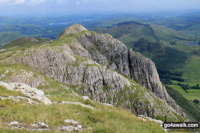
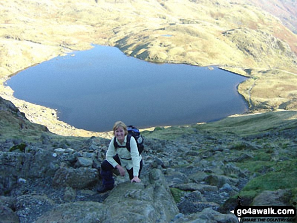
Harrison Stickle (right) and Pike of Blisco (Pike o' Blisco) in the distance from north of Stickle Tarn, The Langdale Pikes, Great Langdale

Great Langdale, Lingmoor Fell and Lake Windermere from the summit of Harrison Stickle
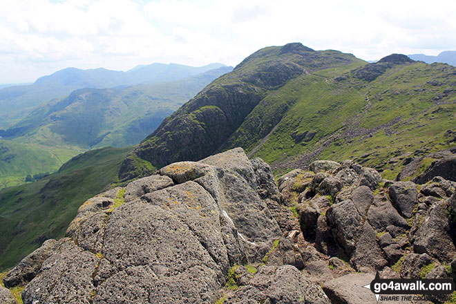
Bowfell Buttress (left), Great Langdale and The Langdale Pikes (with Harrison Stickle prominent) from the col between Bow Fell (Bowfell) and Bow Fell (Bowfell) (North Top)

Crinkle Crags (South Top), Crinkle Crags (Long Top), Crinkle Crags (Gunson Knott), Shelter Crags, Shelter Crags, (North Top), The Band , Bow Fell (Bowfell) and Bow Fell (Bowfell) (North Top), Esk Pike, Rossett Pike and The Langdale Pikes including Pike of Stickle (Pike o' Stickle) (left) Loft Crag and Harrison Stickle from Stool End, Great Langdale
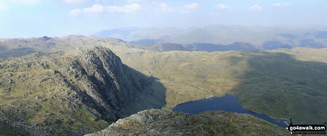
*Pavey Ark and Stickle Tarn with the Blea Ridge beyond from Harrison Stickle Summit (Langdale Pikes)

The Langdale Pikes including Pike of Stickle (Pike o' Stickle) (left) Loft Crag and Harrison Stickle from Stool End, Great Langdale
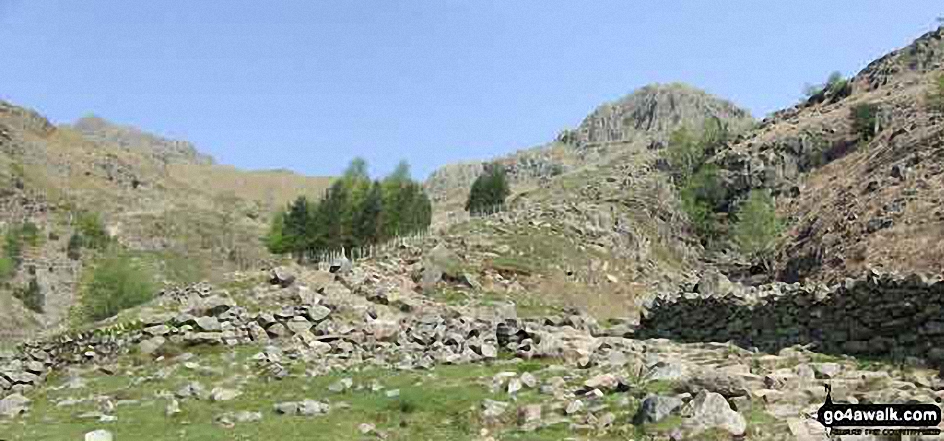
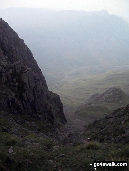
*Starting up Stickle Ghyll from Great Langdale with Harrison Stickle (The Langdale Pikes) (far left)
. . . see all 56 walk photographs & pictures of views from, on or of Harrison Stickle
Send us your photographs and pictures on, of, or from Harrison Stickle
If you would like to add your walk photographs and pictures to this page, please send them as email attachments (configured for any computer) along with your name to:
and we shall do our best to publish them.
(Guide Resolution = 300dpi. At least = 660pixels (wide) x 440 pixels (high).)

You can also submit photos via our Facebook Page.
NB. Please indicate where each photo was taken and whether you wish us to credit your photos with a Username or your First Name/Last Name.