![]()
Great Borne
616m (2021ft)
The Western Fells, The Lake District, Cumbria, England
Tap/mouse over a coloured circle (1-3 easy walks, 4-6 moderate walks, 7-9 hard walks) and click to select.
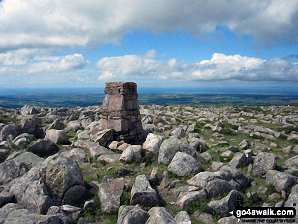
The summit of Great Borne is marked by an Ordnance Survey Trig Point.
Not familiar with this top?
   |
|---|
Vital Statistics:
| Length: | 9.75ml (15.5km) |
|---|---|
| Ascent: | 2,734ft (833m) |
| Time: | 6.25hrs |
| Grade: |  (Moderate) (Moderate) |

Route Summary:
Buttermere - Buttermere Dubbs - Scale Bridge - Scale Force - Scale Beck - Blea Crag - Lingcomb Edge - Ling Comb - Little Dodd (Ennerdale) - Starling Dodd - Great Borne - Floutern Tarn - Black Beck (Mosedale) - Scale Force - Scale Beck (Crummock Water) - Crummock Water - Buttermere
|
|---|
Vital Statistics:
| Length: | 9.75ml (15.5km) |
|---|---|
| Ascent: | 3,157ft (962m) |
| Time: | 6½ hrs |
| Grade: |  (Hard) (Hard) |

Route Summary:
Buttermere - Sourmilk Gill - Bleaberry Tarn - Dodd (Buttermere) - The Saddle - Red Pike (Buttermere) - Ling Comb - Little Dodd (Ennerdale) - Starling Dodd - Great Borne - Floutern Tarn - Black Beck (Mosedale) - Blea Crag - Scale Force - Scale Beck (Crummock Water) - Crummock Water - Buttermere Dubs - Buttermere
|
|---|
Vital Statistics:
| Length: | 16ml (25.5km) |
|---|---|
| Ascent: | 6,285ft (1,915m) |
| Time: | 12.25hrs |
| Grade: |  (Very Hard) (Very Hard) |
Route Summary:
Buttermere - Scale Force - Scale Beck - Blea Crag - Great Borne - Starling Dodd - Little Dodd (Ennerdale) - Ling Comb - Lingcomb Edge - Red Pike (Buttermere) - Dodd (Buttermere) - Red Pike (Buttermere) - High Stile - High Crag (Buttermere) - Gamlin End - Seat (Buttermere) - Scarth Gap - Hay Stacks (Haystacks) - Innominate Tarn - Blackbeck Tarn - Black Beck - Green Crag (Buttermere) - Warnscale Beck - Dubs Hut - Dubs Quarry - Fleetwith Pike - Honister Crag (Black Star) - Fleetwith Pike - Fleetwith Edge - Gatesgarth - Buttermere
See Great Borne and the surrounding tops on our free-to-access 'Google Style' Peak Bagging Maps:
The Western Fells of The Lake District National Park
Less data - quicker to download
The Whole of The Lake District National Park
More data - might take a little longer to download
See Great Borne and the surrounding tops on our downloadable Peak Bagging Maps in PDF format:

NB: Whether you print off a copy or download it to your phone, these PDF Peak Baggers' Maps might prove incredibly useful when your are up there on the tops and you cannot get a phone signal.
*This version is marked with the walk routes you need to follow to Walk all 214 Wainwrights in just 59 walks.
You can find Great Borne & all the walks that climb it on these unique free-to-access Interactive Walk Planning Maps:
1:25,000 scale OS Explorer Map (orange/yellow covers):
1:50,000 scale OS Landranger Map (pink/magenta covers):
 Fellow go4awalkers who have already walked, climbed, summited & bagged Great Borne
Paul Roddam walked up Great Borne on July 19th, 2025 [with] Barb, Bri [weather] Muggy
Ian Ashton climbed it on January 19th, 2025 [with] Ella
Tim Winn bagged it on September 25th, 2024 [from/via/route] Bowness Car Park, Ennnerdale [with] Steve, Dave, John, Mike and Darrell [weather] Dry.
Richard Fulcher hiked Great Borne on April 2nd, 2024 [from/via/route] We parked in Bowness Knot car park next to Ennerdale Water (£8 😱). We then set off back up the road until the stile leading to the path by Rake Beck. We hiked up this path until just below Herdus & then scrambled up the slippery steep rock to the top & across to Great Borne. From Great Borne we went down & up to Starling Dodd & then continued towards Red Pike veering off to the right to join the path leading down to the road at the bottom. We then strolled back wearily to the car! [with] Jen [weather] Cold on the tops with a breeze, but still & quite pleasant down at the lake side. Low cloud to start with clearing later.
Sarah Moore summited on April 9th, 2023 [from/via/route] My own invention! Wanting not to drive from YHA Ennerdale & to make the most of the High Stile ridge [with] On my own [weather] Not so sunny - good... very windy at times - tough (lots of people coming off the tops / turning back, but glad I didn't) - Loved this - an 8 hour walk really started to test me lengthwise & absolutely adored the lack of people on what I thought would be a crazy busy Easter Sunday. One to remember...
To add (or remove) your name and experiences on this page - Log On and edit your Personal Mountain Bagging Record
. . . [see more walk reports]
More Photographs & Pictures of views from, on or of Great Borne

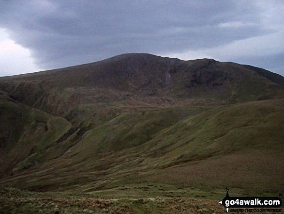
Cairn on the ridge between Sliver Cove Beck and Deep Gill with Ennerdale Water, Great Borne and Starling Dodd beyond
Climbing the ridge between Sliver Cove Beck and Deep Gill with Ennerdale Water, Great Borne and Starling Dodd beyond


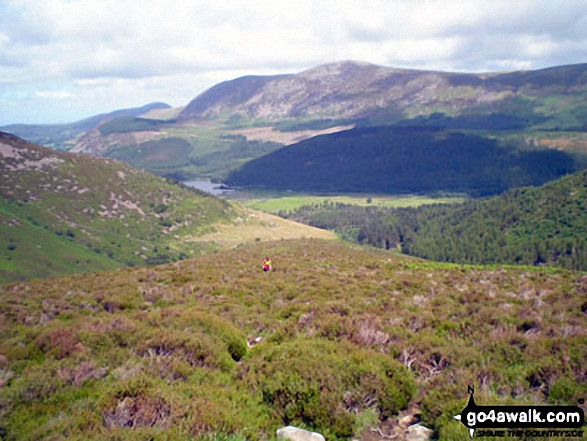
Ennerdale Water from halfway up Rake Beck on the lower SW slopes of Great Borne

*Ennerdale Water (left), Starling Dodd and Great Borne, Loweswater (right of centre), Mellbreak and Crummock Water (right) from Red Pike (Buttermere)

Steeple and Long Crag with Crag Fell (sunlit in the distance), Ennerdale Water and Great Borne from Pillar

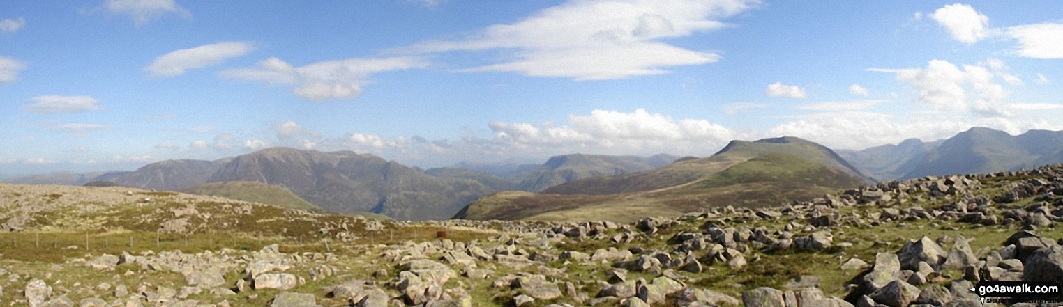
*Grasmoor (left of centre) and Red Pike (Buttermere) (right of centre) from Great Borne
. . . see all 20 walk photographs & pictures of views from, on or of Great Borne
Send us your photographs and pictures on, of, or from Great Borne
If you would like to add your walk photographs and pictures to this page, please send them as email attachments (configured for any computer) along with your name to:
and we shall do our best to publish them.
(Guide Resolution = 300dpi. At least = 660pixels (wide) x 440 pixels (high).)

You can also submit photos via our Facebook Page.
NB. Please indicate where each photo was taken and whether you wish us to credit your photos with a Username or your First Name/Last Name.