![]()
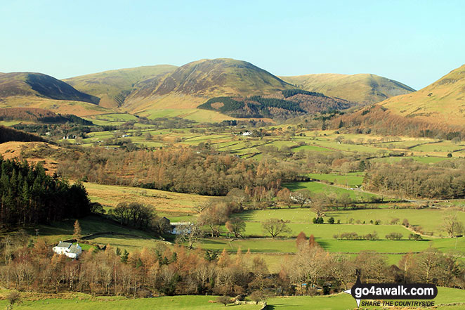
Gavel Fell
526m (1726ft)
The Western Fells, The Lake District, Cumbria, England
Tap/mouse over a coloured circle (1-3 easy walks, 4-6 moderate walks, 7-9 hard walks) and click to select.

Not familiar with this top?
   |
|---|
Vital Statistics:
| Length: | 6.5mls (10.5km) |
|---|---|
| Ascent: | 2,025ft (617m) |
| Time: | 4½ hrs |
| Grade: |  (Moderate) (Moderate) |

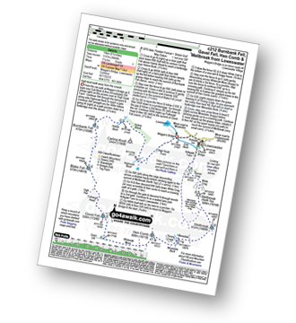
Route Summary:
Maggie's Bridge (Loweswater) - Loweswater - High Nook Farm - Highnook Beck - Holme Wood - Burnbank Fell - Sharp Knott - Blake Fell - Fothergill Head - Gavel Fell - Black Crag (Gavel Fell) - Highnook Beck - Maggie's Bridge (Loweswater)
|
|---|
Vital Statistics:
| Length: | 8.5mls (13.5km) |
|---|---|
| Ascent: | 2,540ft (774m) |
| Time: | 6 hrs |
| Grade: |  (Moderate) (Moderate) |

Route Summary:
Maggie's Bridge (Loweswater) - Loweswater - High Nook Farm - Highnook Beck - Holme Wood - Holme Beck - Burnbank Fell - Sharp Knott - Blake Fell - Fothergill Head - Gavel Fell - Grain Gill - Whiteoak Moss - Hen Comb - Little Dodd (Loweswater Fell) - Mosedale (Loweswater) - Mosedale Beck (Loweswater) - Loweswater Village - Maggie's Bridge (Loweswater)
|
|---|
Vital Statistics:
| Length: | 9.5ml (15km) |
|---|---|
| Ascent: | 3,666ft (1,117m) |
| Time: | 7.25hrs |
| Grade: |  (Hard) (Hard) |
Route Summary:
Maggie's Bridge (Loweswater) - Loweswater - High Nook Farm - Highnook Beck - Holme Wood - Holme Beck - Burnbank Fell - Sharp Knott - Blake Fell - Fothergill Head - Gavel Fell - Grain Gill - Whiteoak Moss - Hen Comb - Thrang Crags - Mosedale (Loweswater) - Mosedale Beck (Loweswater) - Mellbreak - Mellbreak (North Top) - White Crag - Loweswater Village - Maggie's Bridge (Loweswater)
See Gavel Fell and the surrounding tops on our free-to-access 'Google Style' Peak Bagging Maps:
The Western Fells of The Lake District National Park
Less data - quicker to download
The Whole of The Lake District National Park
More data - might take a little longer to download
See Gavel Fell and the surrounding tops on our downloadable Peak Bagging Maps in PDF format:

NB: Whether you print off a copy or download it to your phone, these PDF Peak Baggers' Maps might prove incredibly useful when your are up there on the tops and you cannot get a phone signal.
*This version is marked with the walk routes you need to follow to Walk all 214 Wainwrights in just 59 walks.
You can find Gavel Fell & all the walks that climb it on these unique free-to-access Interactive Walk Planning Maps:
1:25,000 scale OS Explorer Map (orange/yellow covers):
1:50,000 scale OS Landranger Map (pink/magenta covers):
 Fellow go4awalkers who have already walked, climbed, summited & bagged Gavel Fell
Paul Roddam walked up Gavel Fell on September 27th, 2025 [with] Barb [weather] cloudy but dry
Ian Ashton climbed it on February 15th, 2025 [with] Ella
Tim Winn bagged it on October 25th, 2024 [from/via/route] Maggie's Bridge [with] Barry, Paul and Roger [weather] Dry.
Geoff Hand hiked Gavel Fell on September 17th, 2024 [from/via/route] Walk C212 Burnbank fell, Blake fell, Gavel fell, Hen Comb & Mellbreak from Loweswater. What a lovely area, although quite wet. Route finding early on was difficult but once on Burnbank it was quite straight forward. Weather was superb, blue sky all day. Loweswater is lovely. [with] Tess, my Jack Russell [weather] Lovely blue sky all day & warm! - Finding the way up Burnbank was difficult as there didn't appear to be any paths, but after that it was plain sailing. Great climb down Mell break!
Caroline Winter summited on August 16th, 2024 [from/via/route] Fell dyke CP, Cogra Moss reservoir, Blake fell, Burnbank Fell, back track to Gavel Fell & return same route [with] Solo [weather] Warm, breezy in tops, excellent views over fells & Scottish Borders - Stunning scenery-track follows fence line to Gavel fell.
To add (or remove) your name and experiences on this page - Log On and edit your Personal Mountain Bagging Record
. . . [see more walk reports]
More Photographs & Pictures of views from, on or of Gavel Fell
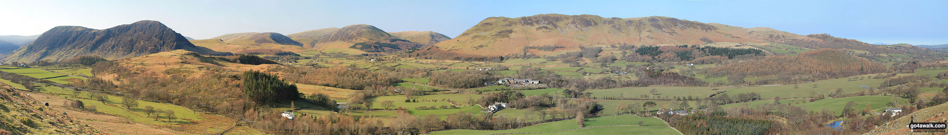
Mellbreak, Mellbreak (North Top), Gavel Fell, Blake Fell, Carling Knott, Burnbank Fell and Loweswater Fell featuring Darling Fell, Low Fell and Fellbarrow from Lanthwaite Green


Gavel Fell (left), Blake Fell, Carling Knott and Burnbank Fell from Lanthwaite Green

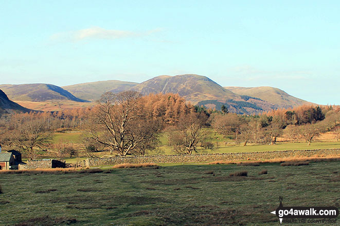
Hen Comb (left), Gavel Fell, Carling Knott and Burnbank Fell (right) from Scale Hill, Loweswater
Gavel Fell, Blake Fell, Carling Knott, Burnbank Fell from Lanthwaite Green
Send us your photographs and pictures on, of, or from Gavel Fell
If you would like to add your walk photographs and pictures to this page, please send them as email attachments (configured for any computer) along with your name to:
and we shall do our best to publish them.
(Guide Resolution = 300dpi. At least = 660pixels (wide) x 440 pixels (high).)

You can also submit photos via our Facebook Page.
NB. Please indicate where each photo was taken and whether you wish us to credit your photos with a Username or your First Name/Last Name.