Brandreth
715m (2346ft)
The Western Fells, The Lake District, Cumbria, England
Tap/mouse over a coloured circle (1-3 easy walks, 4-6 moderate walks, 7-9 hard walks) and click to select.
Not familiar with this top?
See Brandreth and the surrounding tops on our free-to-access 'Google Style' Peak Bagging Maps:
The Western Fells of The Lake District National Park
Less data - quicker to download
The Whole of The Lake District National Park
More data - might take a little longer to download
See Brandreth and the surrounding tops on our downloadable Peak Bagging Maps in PDF format:
NB: Whether you print off a copy or download it to your phone, these PDF Peak Baggers' Maps might prove incredibly useful when your are up there on the tops and you cannot get a phone signal.
*This version is marked with the walk routes you need to follow to Walk all 214 Wainwrights in just 59 walks.
You can find Brandreth & all the walks that climb it on these unique free-to-access Interactive Walk Planning Maps:
1:25,000 scale OS Explorer Map (orange/yellow covers):
1:50,000 scale OS Landranger Maps (pink/magenta covers):
 Fellow go4awalkers who have already walked, climbed, summited & bagged Brandreth
James Hughes walked up Brandreth on August 10th, 2025 [from/via/route] c417 Base Brown, Great Gable & Kirk Fell from Honister [weather] Warmish, sometimes overcast, sometimes sunny. - Stomp up to Grey Knotts from Honister - didn't feel too bad as started at decent height. Easy yomp over to Brandreth before hitting the path to descend to Base Brown. Good views then steepish ascent back to Green Gable. Good vista of Great Gable & Moses Trod below. Hard trek up Great Gable on rocky terrain. Topped & then overshot after the memorial to return to path down to Kirk Fell. Took one of the false boulder paths cited by Wainwright which ended in scree Sunday. The error of my ways became more apparent looking back as the scree looks quite severe. Had actually ascended Great Gable before from Kirk Fell col which was easier, although easy to understand how it would be hard in the mist. Another there & back on Kirk Fell - big flat top. Return via Moses Trod back to tramway track. Pint of Wainwright Amber Ale at Borrowdale Hotel. Average.
Paul Roddam climbed it on July 19th, 2025 [with] Barb, Bri [weather] Muggy
Andrew Gayne bagged it on May 15th, 2025 [from/via/route] From Honister Pass, Tin Slate Mine [with] Becky Gayne [weather] Really sunny & hot day. - Overnight stay at Ravenstone Manor near Bassenthwaite having walked Howtown to Glenridding the previous day, went up Grey Knotts then Brandreth before going up Green Gable & finally Grey Gable. Steepish scramble up & down Grey Gable. Visited Westmorland Cairn for amazing views
Geoff Hand hiked Brandreth on April 9th, 2025 [from/via/route] Climbed up from Honister slate mine to close this one out. Missed it last year when going for Gt Gable & Kirk fell [with] Solo [weather] Lovely sunny day - Done & dusted
Tim Winn summited on October 27th, 2024 [from/via/route] Honister Slate Mine [with] Barry, Paul and Roger [weather] Dry.
To add (or remove) your name and experiences on this page - Log On and edit your Personal Mountain Bagging Record
. . . [see more walk reports]
More Photographs & Pictures of views from, on or of Brandreth

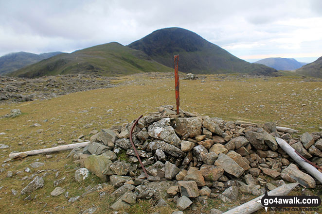
Brandreth summit cairn with Gillercomb Head leading up to Green Gable with Great Gable looking majestic in the background

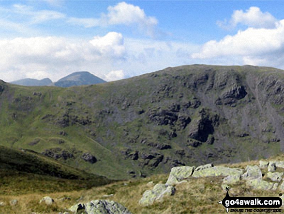
Great view of Brandreth, Green Gable, Great Gable (the rounded dome), Kirk Fell, Pillar (the highest point), Black Crag and Steeple from Lingcomb Edge just below the summit of Red Pike (Buttermere)
. . . see all 14 walk photographs & pictures of views from, on or of Brandreth
Send us your photographs and pictures on, of, or from Brandreth
If you would like to add your walk photographs and pictures to this page, please send them as email attachments (configured for any computer) along with your name to:
and we shall do our best to publish them.
(Guide Resolution = 300dpi. At least = 660pixels (wide) x 440 pixels (high).)
You can also submit photos via our Facebook Page.
NB. Please indicate where each photo was taken and whether you wish us to credit your photos with a Username or your First Name/Last Name.

 (Moderate)
 (Moderate)
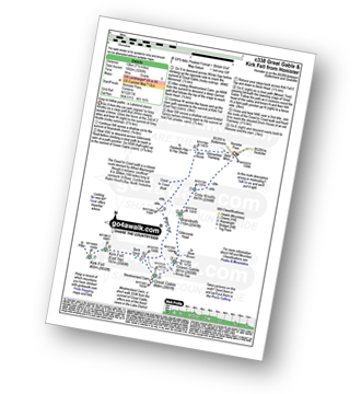
 (Hard)

 (Hard)
 (Very Hard)
