![]()
Moel Penamnen
628m (2061ft)
The Moelwyns, Snowdonia, Gwynedd, Wales
The summit of Moel Penamnen is marked by an Ordnance Survey Trig Point.

Not familiar with this top?
   |
|---|
Vital Statistics:
| Length: | 9.5mls (15km) |
|---|---|
| Ascent: | 2,914ft (888m) |
| Time: | 6½ hrs |
| Grade: |  (Hard) (Hard) |

Route Summary:
Blaenau Ffestiniog - Trefeini - Maen-offeren Quarry - Moel Bowydd - Moel Penamnen - Foel-fras (Moel Penamnen) - Cwt-y-bugail Quarry - Manod Mawr (North Top) - Graig-ddu Slate Quarry - Manod Mawr - Nant Dwr-oer - Manod Bach - Nant Dwr-oer - Blaenau Ffestiniog
See Moel Penamnen and the surrounding tops on our free-to-access 'Google Style' Peak Bagging Maps:
The Moelwyns area of Snowdonia National Park
Less data - quicker to download
The Whole of Snowdonia National Park
More data - might take a little longer to download
See Moel Penamnen and the surrounding tops on our downloadable Peak Bagging Map in PDF format:

NB: Whether you print off a copy or download it to your phone, this PDF Peak Baggers' Map might prove incredibly useful when your are up there on the tops and you cannot get a phone signal.
You can find Moel Penamnen & all the walks that climb it on these unique free-to-access Interactive Walk Planning Maps:
1:25,000 scale OS Explorer Map (orange/yellow covers):
1:50,000 scale OS Landranger Map (pink/magenta covers):
 Fellow go4awalkers who have already walked, climbed, summited & bagged Moel Penamnen
Daniel Moran walked up Moel Penamnen on November 25th, 2024 [from/via/route] Festiniog [with] Frankie chel [weather] decent views made up for the bog - Franke enjoyed his new coat, Circular route with chel & frankie, tough walk in parts especially up moel penamnen, extremely boggy
Christina Lander climbed it on May 25th, 2024 [from/via/route] Dolwyddelan - Y Ro Wen - Foel Fras - Moel Penamnen - Pen y Benar - Sarn Helen - Dolwyddelan [with] Dick [weather] Sunny day/light cloud
Donovan Suddell bagged it on August 27th, 2023 [from/via/route] Blaenau Ffestiniog [with] Solo [weather] overcast. Summit was clear
Melfyn Parry hiked Moel Penamnen on August 22nd, 2022 [from/via/route] Started walk from car park in Blaenau Ffestiniog, headed up through quarry workings to Maen Offeren, at drum house veer left up grassy path to fence. Crossed & headed along spot heights to follow faint path to ridge, turned left & headed to summit of Moel Penamnen. Retraced steps along ridge & continued to summit of Foel Fras. Descent from here following fence to corner of forest before crossing style & continuing along fence to eventually reach summit of Manod Mawr North Top, this path is very boggy & ascent to summit is steep. Descended left from summit to gain main quarry road & turned right. Path passes to right of quarry buildings, follow track & then veer left to gain summit of Manod Mawr. Retraced steps back to track & then turned left following old inclines back to the A470 & then back to car park [with] DS [weather] Started well, drizzle around 10:30, then stopped & then around 11:30 persistent rain stayed with us all day. - From Foel Fras to summit of Manod Mawr North Top is very boggy countryside, can't imagine this would be navigable once the real wet weather sets in over autumn/winter. Probably a walk best completed on a frozen winters' day when the ground would be hard or after a period of dry weather. Definitely gaiter country.
Mark Davidson summited on July 12th, 2011 [from/via/route] Walk gw170 Moel Penamnen & Manod Mawr from Blaenau Ffestiniog [with] Alone [weather] Nice & sunny - The route instructions print out for this walk were excellent!
Bleddyn Rhys conquered it on May 26th, 2018 [from/via/route] Parcio yn Llechwedd - fynnu o'r Crimea llwybr cyhoeddus i'r llynoedd. Cors anferth rhwng Penamnen a Manod Mawr - byddwch yn ofalus! Ar hyd yr hen drac ir chwaral i fynd adra, heibio'r zip lines. [with] ar ben fy hyn! [weather] Cymysglud - poeth a clos ond daeth y glaw. 3air cawod, ar olaf yn drom ac yn hir! Tranau ong nghwmpas. - 15 Km - 4 awr Tir yn gally bod yn anodd.
Robert Taylor-Marriott scaled it on August 7th, 2014 [from/via/route] Route 61: Moelwyns Moel Penamnen. Manod Mawr North Top. Manod Mawr (MPMM). [with] Vince Wetton and Robert Taylor-Marriott. [weather] Sunny, cloudy, warm.
Vince Wetton walked up Moel Penamnen on August 7th, 2014 [from/via/route] Gw170 [with] RTM [weather] Bright & Sunny
Gerald Murphy climbed it on June 2nd, 2012 [from/via/route] Dolwyddelan bus stop, past the church, following a path after the railway bridge to the South & into a valley. This leads eventually, having crossed some man made forest tracks, to a steep path up to a ladder stile at the edge of the forest. turning to the right & keeping fairly close to the forest fence I crossed a second stile & climbed Y Foel Fras (586m), descended & climbed Moel Penamnen (620m). I then descended to the Llynau Farlwydd (one is kept empty now as a sacrificial flood plain to protect the Llechwedd slate quarry). This took me, via the edge of the lake up to the County Boundary fence which i followed to Moel Farlwydd (577m). I then took the quarry road back to the Llechwedd quarry & returned to Blaenau Ffestiniog. [with] alone [weather] Sunny, light wind, warm - Two big points. On leaving the ladder stile at the edge of the forest, take great care heading for the next stile. On the day in question the ground was soft following a dry spell but, the next time I walked this way after walking via Y Ro Wen, I returned via the outer edge of the forest to the same stile but, crossing the soft ground to the next stile I suddenly dropped into a bog above my knees & had real problems getting myself out by using my trekking pole as a way of spreading my upper body weight acvross the slightly firmer ground behind me and, with great difficulty, extracting one leg from the bog before I could lift the other leg. Point two is that the public are not allowed to use the quarry road back to the quarry - which I didn't realise until I got back to the quarry and, climbing over the final gate, saw the No Trespassers sign!
Paul Booth and Trevor Williams have both walked, climbed & bagged Moel Penamnen.
To add (or remove) your name and experiences on this page - Log On and edit your Personal Mountain Bagging Record
More Photographs & Pictures of views from, on or of Moel Penamnen


360 degree view from Moel Penamnen summit featuring (from left to right): The Moelwyns - Moelwyn Bach, Craigysgafn & Moelwyn Mawr, Allt-fawr, Moel Druman & Ysgafell Wen, Moel Farlwyd (foreground above/left of blue lake), Yr Aran (pointed peak above Moel Farlwyd), Mount Snowdon (Yr Wyddfa) & Y Lliwedd, The Glyderau - Glyder Fach, Glyder Fawr & Tryfan, Carnedd Moel Siabod, Y Ro Wen, Foel-fras (Moelwyns), Manod Mawr (above two light blue lakes) and The Arenigs - Arenig Fawr & Arenig Fach.

Mount Snowdon (Yr Wyddfa) & Y Lliwedd (left) and The Glyderau - Glyder Fach, Glyder Fawr & Tryfan (right) from Moel Penamnen

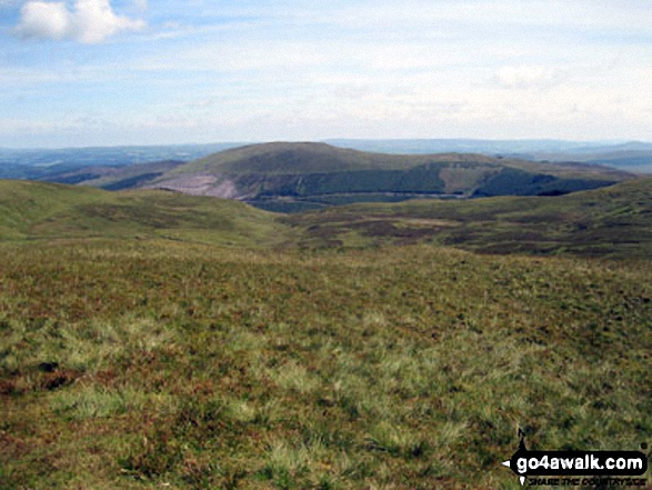
Sheep safely grazing on Allt-fawr (Moelwyns) with Moel Penamnen and Manod Mawr across the valley in the distance


Moel Penamnen summit with Mount Snowdon (Yr Wyddfa) (left) and The Glyderau (Glyder Fach & Glyder Fawr) on the horizon

The Carneddau & Carnedd Moel Siabod (on horizon), Moel Penamnen (left) and Llyn Newydd & Llyn Bowydd (mid distance ) from Manod Mawr (North Top)

Mount Snowdon (Yr Wyddfa) & Y Lliwedd (left) and The Glyderau - Glyder Fach, Glyder Fawr & Tryfan (centre) and Carnedd Moel Siabod (right) with Moel Penamnen and Llyn Newydd & Llyn Bowydd (mid distance right) from the summit of Manod Mawr (North Top)
. . . see all 13 walk photographs & pictures of views from, on or of Moel Penamnen
Send us your photographs and pictures on, of, or from Moel Penamnen
If you would like to add your walk photographs and pictures to this page, please send them as email attachments (configured for any computer) along with your name to:
and we shall do our best to publish them.
(Guide Resolution = 300dpi. At least = 660pixels (wide) x 440 pixels (high).)

You can also submit photos via our Facebook Page.
NB. Please indicate where each photo was taken and whether you wish us to credit your photos with a Username or your First Name/Last Name.