UK Postcode CW8 - The 30 nearest easy-to-follow, circular walk route maps to you
The thirty nearest easy-to-follow, circular walk route maps to you in UK Postcode CW8 in Walk Grade Order
The UK cities, towns and villages in Cheshire, England that have CW8 in their UK Postcode include:
• Acton Bridge • Anderton • Barnton • Crowton • Cuddington • Delamere • Hartford • Little Leigh • Sandiway • Weaverham • Whitegate •
Not familiar with the area around CW8?
See these 30 nearest walks to UK Postcode CW8 on a google map
   |
Vital Statistics:
| Length: | 5.25 miles (8.5 km) |
| Ascent: | 417ft (127m) |
| Time: | 2½ hrs |
| Grade: |  |
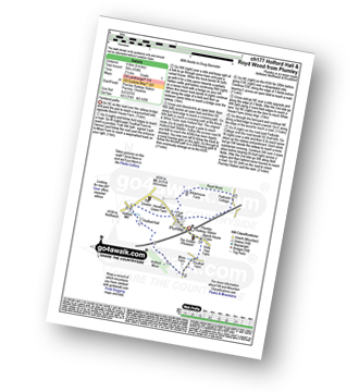
Route Summary:
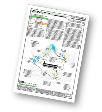
Whitegate - New Pool - Petty Pool - Pettypool Wood - Newchurch Common - Whitegate Way (Dismantled Railway) - Whitegate Station - Martonsands - Foxwist Green - Whitegate
|
Vital Statistics:
| Length: | 5 miles (8 km) |
| Ascent: | 338ft (103m) |
| Time: | 2.25hrs |
| Grade: | |

Route Summary:
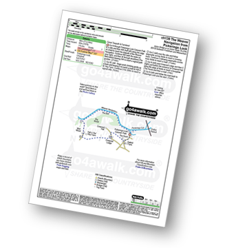
Little Leigh - Friar's Rough - Trent and Mersey Canal - Bardleymeadow Wood - Daleford House - Saltersford Tunnel - Barnton - Stone Heyes Farm - Desley Heath Farm - Claterwick Farm - Little Leigh
|
Vital Statistics:
| Length: | 3.75 miles (6 km) |
| Ascent: | 253ft (77m) |
| Time: | 2 hrs |
| Grade: |  |

Route Summary:
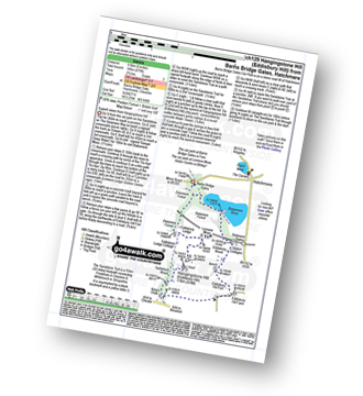
Marbury Country Park - Forge Brook - Big Wood - Trent and Mersey Canal - The Cheshire Ring Walk - Anderton - Anderton Boat Lift - Kennel Wood - The North Cheshire Way - Marbury Country Park.
|
Vital Statistics:
| Length: | 7.25 miles (11.5 km) |
| Ascent: | 384ft (117m) |
| Time: | 3 hrs |
| Grade: |  |

Route Summary:
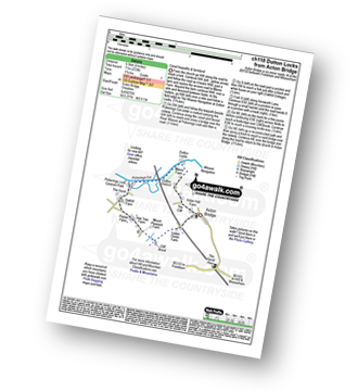
Acton Bridge - Manor Farm - Dutton Locks - River Weaver - Pickerings Cut - Dutton Viaduct - Pickerings Lock - The Weaver Navigation - The Belt - Hall O' The' Hey Farm - Crewood Lodge - Oakhill Farm - Cliff Brook - Lower Green Farm - Acton Bridge
|
Vital Statistics:
| Length: | 4 miles (6.5 km) |
| Ascent: | 233ft (71m) |
| Time: | 1.75hrs |
| Grade: | |
Route Summary:
Acton Bridge - Manor Farm - Dutton Locks - River Weaver - Pickerings Cut - Dutton Viaduct - Pickerings Lock - Oakhill Farm - Cliff Brook - Lower Green Farm - Acton Bridge
|
Vital Statistics:
| Length: | 3.75 miles (6 km) |
| Ascent: | 197ft (60m) |
| Time: | 1.75hrs |
| Grade: | |
Route Summary:
Pickerings Lock - The Weaver Navigation - The Belt - Hall O' The' Hey Farm - Crewood Lodge - The Hurst - Oakwell Farm - Pickerings Lock
|
Vital Statistics:
| Length: | 5 miles (8 km) |
| Ascent: | 226ft (69m) |
| Time: | 2.25hrs |
| Grade: | |

Route Summary:
Pickmere - Wathall Farm - Moss End - Hilltop Farm - The North Cheshire Way - Great Budworth - Pick Mere - Pickmere
|
Vital Statistics:
| Length: | 6 miles (9.5 km) |
| Ascent: | 479ft (146m) |
| Time: | 2.75hrs |
| Grade: | |
Route Summary:
Hatchmere - Barns Bridge Gate - Delamere Forest - The Sandstone Way - The Delamere Way - Blakemere Moss - Linmere Visitor Centre - Eddisbury Hill - Eddisbury Hill Fort - Eddisbury Hill Farm - Hangingstone Hill (Eddisbury Hill) - Nettleford Wood - The Sandstone Way - Eddisbury Lodge Cottage - Eddisbury Lodge - Delamere Forest - Barns Bridge Gate - Hatchmere
|
Vital Statistics:
| Length: | 5.5 miles (8.5 km) |
| Ascent: | 158ft (48m) |
| Time: | 2.25hrs |
| Grade: | |

Route Summary:
Arley - Arley Hall - Arley Brook - Hollies Farm - Antrobus - Budworth Heath - Great Budworth - Stockley Farm - Arley
|
Vital Statistics:
| Length: | 6 miles (9.5 km) |
| Ascent: | 164ft (50m) |
| Time: | 2½ hrs |
| Grade: | |
|
Vital Statistics:
| Length: | 3.75 miles (6 km) |
| Ascent: | 118ft (36m) |
| Time: | 1½ hrs |
| Grade: | |

|
Vital Statistics:
| Length: | 6.25 miles (10 km) |
| Ascent: | 1,254ft (382m) |
| Time: | 3½ hrs |
| Grade: |  |

Route Summary:
Frodsham - Beacon Hill (Frodsham) - Frodsham Golf Course - Dunsdale Wood - Tong Dean - Helsby Hill Fort - Helsby Hill - The Longster Trail - Harmers Wood - The Sandstone Trail - Snidley Moor and Woodhouse Hill - Snidley Moor Wood - Beacon Hill (Frodsham) - Frodsham
|
Vital Statistics:
| Length: | 6 miles (9.5 km) |
| Ascent: | 295ft (90m) |
| Time: | 2½ hrs |
| Grade: | |
Route Summary:
Tarpoley - The Sandstone Trail - Ferney Lees - Wharton's Bridge - The Shorpshire Union Canal - Wharton's Lock - A49 - Tiverton - Tarpoley
|
Vital Statistics:
| Length: | 11.25 miles (18 km) |
| Ascent: | 883ft (269m) |
| Time: | 5 hrs |
| Grade: |  |
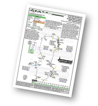
Route Summary:
Tarpoley - The Sandstone Trail - Ferney Lees - Wharton's Bridge - The Shorpshire Union Canal - Wharton's Lock - Beeston Castle - Beeston - Peckforton Woods - Higher Burwardsley - Waste Hill - Peckforton Hills - Peckforton Castle Lodge - Willis's Wood - Beeston - A49 - Tiverton - Tarpoley
|
Vital Statistics:
| Length: | 6.25 miles (10 km) |
| Ascent: | 400ft (122m) |
| Time: | 2.75hrs |
| Grade: | |

Route Summary:
Higher Walton - The Bridgewater Canal - Hillfoot Farm - The Mersey Valley Way - Bellfield Farm - Dennow Cottage - Dennow Farm - Hatton - Blue Coat Farm - Row's Wood - Moore - The Bridgewater Canal - Walton Hall - Higher Walton
Not familiar with the area around CW8?
See these 30 nearest walks to UK Postcode CW8 on a google map
|
Vital Statistics:
| Length: | 8.25 miles (13 km) |
| Ascent: | 295ft (90m) |
| Time: | 3½ hrs |
| Grade: | |
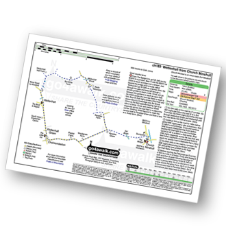
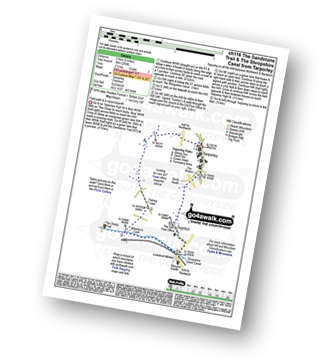
Route Summary:
Church Minshull - Sunnyside - Eel Brook - Paradise Green - Paradise Wood - Wettenhall Green - Wettenhall - Stockerlane - Bankside Farm - Brookside Wood - Wettenhall Brook - Darnall Radio Telescope - Paradise Farm - Paradise Green - Eel Brook - Sunnyside - Church Minshull
|
Vital Statistics:
| Length: | 6.75 miles (11 km) |
| Ascent: | 370ft (110m) |
| Time: | 3 hrs |
| Grade: | |
Route Summary:
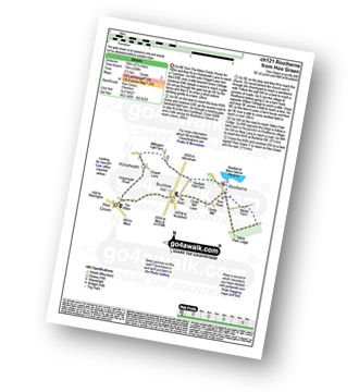
Hoo Green - Hulseheath - Gorse Barn - Millington Brook - Agden Brook - Denfield Hall Farm - Rostherne Brook - Rostherne - Rostherene Mere Nature Reserve - Marsh Farm - Rostherne - Cicely Mill - Bucklow Hill - Hulseheath - Hoo Green
|
Vital Statistics:
| Length: | 3.5 miles (5.5 km) |
| Ascent: | 286ft (87m) |
| Time: | 1.75hrs |
| Grade: | |

Route Summary:
Tiverton - The Shropshire Union Canal - Wharton's Lock - The Sandstone Trail - Beeston Castle - Beeston - Beeston Hall Farm - Tiverton
|
Vital Statistics:
| Length: | 4.5 miles (7 km) |
| Ascent: | 190ft (58m) |
| Time: | 1.75hrs |
| Grade: | |
Route Summary:
Thelwall - Manchester Ship Canal - Thelwall Viaduct - Statham - The Bridgewater Canal - The Cheshire Ring Canal Walk - Thelwall
|
Vital Statistics:
| Length: | 3.75 miles (6 km) |
| Ascent: | 204ft (62m) |
| Time: | 2 hrs |
| Grade: | |

Route Summary:
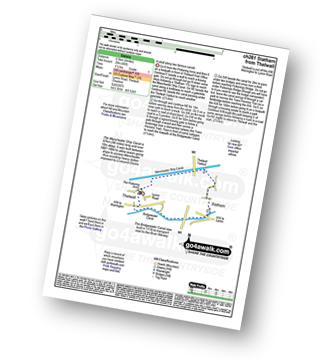
The Trans Pennine Trail (Lymm) - Lymm - The Bridgewater Canal - The Cheshire Ring Canal Walk - Lymm Village - The Dingle - Lymm Dam - The Bongs - Crosfield Bridge - Lymm Dam - The Dingle - Lymm Cross - The Bridgewater Canal - The Cheshire Ring Canal Walk - Slitten Gorge - The Trans Pennine Trail - Lymm.
|
Vital Statistics:
| Length: | 11 miles (17.5 km) |
| Ascent: | 269ft (82m) |
| Time: | 4½ hrs |
| Grade: | |

Route Summary:
The Trans Pennine Trail (Lymm) - Lymm - Carr Green - Oldfield Brow - Altrincham - The Bridgewater Canal - The Cheshire Ring Canal Walk - Dunham Town - Dunham Massey - Little Bollington - The Bridgewater Canal - The Cheshire Ring Canal Walk - Agden Bridge - Oughtrington - Lymm Village - Slitten Gorge - The Trans Pennine Trail - Lymm.
|
Vital Statistics:
| Length: | 5.25 miles (8.5 km) |
| Ascent: | 246ft (75m) |
| Time: | 2.25hrs |
| Grade: | |

Route Summary:
The Trans Pennine Trail (Lymm) - Lymm - The Bridgewater Canal - The Cheshire Ring Canal Walk - Lymm Village - The Dingle - Lymm Dam - The Bongs - Crosfield Bridge - Oughtrington - The Bridgewater Canal - The Cheshire Ring Canal Walk - Rushgreen - Slitten Gorge - The Trans Pennine Trail - Lymm.
|
Vital Statistics:
| Length: | 9.5 miles (15 km) |
| Ascent: | 358ft (109m) |
| Time: | 3.75hrs |
| Grade: | |
Route Summary:
Over Peover - Peover Hall - Great Wood - Peover Eye - Woodend Farm - Blackden Heath - Redlion Brook - Goostrey - The Bongs - Swanwick Hall Farm - Booth Bed Lane - Boots Green - Meadowbank Farm - Long Lane - Peover Hall - Peover Hall Church - Peover Village Hall - Over Peover
|
Vital Statistics:
| Length: | 4.75 miles (7.5 km) |
| Ascent: | 515ft (157m) |
| Time: | 2.25hrs |
| Grade: | |

Route Summary:
Beeston - Beeston Castle - The Sandstone Trail - Peckforton Woods - Higher Burwardsley - Waste Hill - Peckforton Hills - Peckforton Castle Lodge - Willis's Wood - Beeston
|
Vital Statistics:
| Length: | 6 miles (9.5 km) |
| Ascent: | 236ft (72m) |
| Time: | 2½ hrs |
| Grade: | |

Route Summary:
Dunham Town - The Bridgewater Canal - The Cheshire Ring Canal Walk - Agden Bridge - Agden Brook Farm - Arthill Farm - Reddy Lane Cottage - Little Bollington - Dunham Massey Park - Dunham Park - Dunham Town
|
Vital Statistics:
| Length: | 9.5 miles (15 km) |
| Ascent: | 1,831ft (558m) |
| Time: | 5.25hrs |
| Grade: |  |
Route Summary:
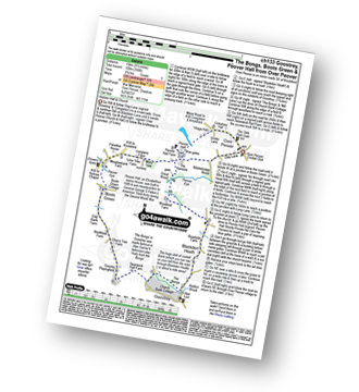
Higher Burwardsley - The Sandstone Trail - Bulkeley Hill - Raw Head (Rawhead) - Chiflik Farm - Gallantry Bank - Bickerton - Bickerton Hill - Maiden Castle (Bickerton Hill) - Brown Knowl - Fullers Moor - Harthill - Burwardsley - Higher Burwardsley
|
Vital Statistics:
| Length: | 5.5 miles (8.5 km) |
| Ascent: | 1,050ft (320m) |
| Time: | 3 hrs |
| Grade: | |
Route Summary:
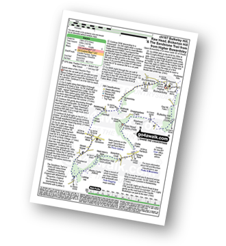
Higher Burwardsley - The Sandstone Trail - Bulkeley Hill - Raw Head (Rawhead) - Bodnook Wood - Burwardsley Hill - Burwardsley - Higher Burwardsley
|
Vital Statistics:
| Length: | 8.5 miles (13.5 km) |
| Ascent: | 453ft (138m) |
| Time: | 3½ hrs |
| Grade: | |

Route Summary:
Hale (near Altrincham) - The River Bollin - The Bollin Valley Way - Coppice Farm - Ryecroft Farm - Birkin Farm - Birtles Farm - New Mills - Breach House Farm - Higherhouse Farm - The River Bollin - Ross Mill - Hale.
|
Vital Statistics:
| Length: | 7.5 miles (12 km) |
| Ascent: | 197ft (60m) |
| Time: | 3 hrs |
| Grade: | |
Route Summary:
Redes Mere - Redes Mere Nature Reserve - Fanshawe - Hills Green Farm - Hazelwall Farm - Henshaw Hall Farm - Heskey Wood - Snape Brook - Moss Wood - Crabtree Moss Farm - Marton Gate Farm - Northwood Farm - Sandbank Farm - Mere Moss Wood - Siddington Heath - Holly Cottage - Blake House Farm - Capesthorne Hall - Redes Mere
|
Vital Statistics:
| Length: | 6.5 miles (10.5 km) |
| Ascent: | 167ft (51m) |
| Time: | 2.75hrs |
| Grade: | |
Route Summary:
Lindow Common - Wilmslow - Lindow Moss - Morley Green - Rossmere - Saltersley Hall Farm - Mobberley Golf Club - Graveyard Farm - Knolls Green - Paddockhill - Plough and Flail - Racecourse Farm - Lindow Common - Wilmslow.
Not familiar with the area around CW8?
See these 30 nearest walks to UK Postcode CW8 on a google map


