11 easy-to-follow walk, route maps of all grades on OS Explorer Map OL40 The Broads
Eleven easy-to-follow walk, route maps of all grades on OS Explorer Map OL40 The Broads in Walk Grade OrderTap/mouse over a coloured circle (1-3 easy walks, 4-6 moderate walks, 7-9 hard walks) and click to select.
You can use these checkboxes to show only the grades of walk you are interested in:-
Eleven easy-to-follow walk, route maps of all grades on OS Explorer Map OL40 The Broads in Walk Grade Order
Scroll down the list of walks below & click on each walk title (in blue) to locate it on the map above.
See this list of walks, routes & maps in:
Grade Order | Length Order | Time Order | Walk Number or Start Location Order
NB. To reverse (toggle) this order, click Grade Order again

   |
Vital Statistics:
| Length: | 3.5 miles (5.5 km) |
| Ascent: | 91ft (28m) |
| Time: | 1½ hrs |
| Grade: |  |
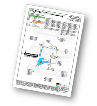
Route Summary:
Horsey Mill - Horsey Mere - Waxham New Cut - Brograve Drainage Mill - Horsey Corner - Horsey church - Horsey - National Trust Permissive Path - Horsey Mill


|
Vital Statistics:
| Length: | 7 miles (11 km) |
| Ascent: | 141ft (43m) |
| Time: | 3 hrs |
| Grade: | |

Route Summary:
Haddiscoe - Thorpe Road - Thorpe Hall - Haddiscoe Marshes - Thorpe Marshes - Thorpe and Haddiscoe Fleet - Haddiscoe Cut Bridge - Willow Farm - Marsh Farm - Lower Thurlton - Haddiscoe

|
Vital Statistics:
| Length: | 9 miles (14.5 km) |
| Ascent: | 125ft (38m) |
| Time: | 3½ hrs |
| Grade: |  |

Route Summary:
Burgh Castle - Burgh Castle Roman Fort - The Angles Way - Breydon Water - Burgh Castle Marshes - Breydon Water Pump House - Fisher's Marshes - Humberstone Marshes - Breydon Bridge - Cobholm Island - Great Yarmouth - Southtown - Ganton Marshes - Bradwell Hall - Burgh Castle

|
Vital Statistics:
| Length: | 7.75 miles (12.5 km) |
| Ascent: | 135ft (41m) |
| Time: | 3 hrs |
| Grade: | |
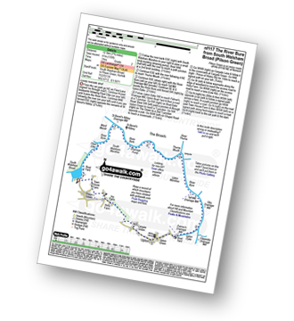
Route Summary:
South Walsham Broad - Fleet Dike - Ward Marsh - St Benet's Abbey - River Bure - South Walsham Marshes - Thurne Mouth - Upton Marshes - Upton Black Drainage Mill - Ashby Oby Drainage & sawmill - Clippesby Mill - Upton Dyke - Palmer's Mill - Upton - Duckboards in Upton Broad and Marshes Nature Reserve - Cargate Green - Pilson Green - South Walsham Broad

|
Vital Statistics:
| Length: | 6 miles (9.5 km) |
| Ascent: | 128ft (39m) |
| Time: | 2½ hrs |
| Grade: | |

Route Summary:
Winterton-on-Sea - Winterton Dunes National Nature Reserve - South Wood - Decay Wood - White House Farm - East Somerton - Winterton-on-Sea

|
Vital Statistics:
| Length: | 4.25 miles (6.5 km) |
| Ascent: | 157ft (2,348m) |
| Time: | 1.75hrs |
| Grade: | |

Route Summary:
Worstead - Worstead Belt - Worstead Hall Farm - Chestnut Belt - Gothic Wood - Upper Street - Carman's Lane - Mucklefield Plantation - Dairyhouse Barn - Green Lane - Berard's Road - Worstead

|
Vital Statistics:
| Length: | 9.25 miles (14.5 km) |
| Ascent: | 229ft (70m) |
| Time: | 3½ hrs |
| Grade: | |
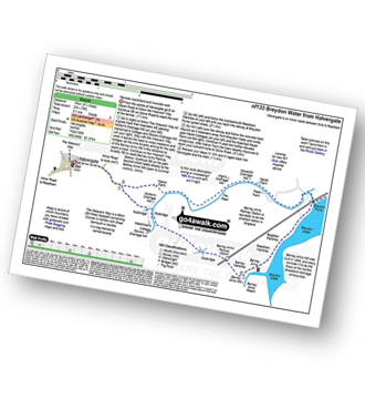
Route Summary:
Halvergate - The Weavers Way - Wickhampton Marshes - Berney Arms Railway Station - Berney Arms Mill - Berney Arms Reach - Breydon Water - Reedham Marshes - Beighton Marshes - Breydon Pump - The Fleet - Halvergate

|
Vital Statistics:
| Length: | 9 miles (14.5 km) |
| Ascent: | 151ft (46m) |
| Time: | 3½ hrs |
| Grade: |  |

Route Summary:
Winterton-on-Sea - Winterton Dunes National Nature Reserve - South Wood - Bramble Hill - Crinkle Hill - Horsey - Horsey Mill - Hundred Stream - Martham Broad National Nature Reserve - Martham Broad - West Somerton Mill - West Somerton - East Somerton - Winterton-on-Sea

|
Vital Statistics:
| Length: | 12.5 miles (20 km) |
| Ascent: | 347ft (106m) |
| Time: | 4.75hrs |
| Grade: | |

Route Summary:
Reedham - Reedham Chain Ferry - Wherryman's Way - Reedham Drainage Mill - River Yare - Reedham Marshes - Seven Mile House - Polkey's Drainage Mill - Cadge's Drainage Mill - Berney Arms Reach - Berney Arms Mill - The Weavers Way - Berney Marshes - Berney Arms Railway Station - Stone's Drainage Mill - Wickhampton Marshes - Wickhampton - Halvergate Road - Reedham Parish Church - Damgate - Holly Farm Road - Reedham

|
Vital Statistics:
| Length: | 5.25 miles (8.5 km) |
| Ascent: | 43ft (13m) |
| Time: | 2 hrs |
| Grade: | |
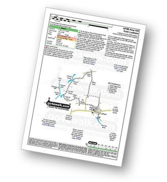
Route Summary:
Ludham - Lovers Lane - Whitegates - How Hill National Nature Reserve - River Ant - Turf Fen Drainage Mill - Boardman's Drainage Mill - Clayrack Drainage Mill - The Mill House - Crome's Farm - Crome's Broad - Grove Farm - Waterpiece Lane - Catfield Road - Ludham

|
Vital Statistics:
| Length: | 7.25 miles (11.5 km) |
| Ascent: | 197ft (60m) |
| Time: | 3 hrs |
| Grade: | |

Route Summary:
Somerleyton - The Angles Way - Somerleyton Park - Lound - Green Lane - Waddling Lane - The Angles Way - Wicker Well - Waddling Wood - Somerleyton Railway Station - Somerleyton
See this list of walks, routes & maps in:
Grade Order | Length Order | Time Order | Walk Number or Start Location Order
NB. To reverse (toggle) this order, click Grade Order again