Ryburn Reservoir in
Easy-to-follow, hand crafted, route maps for walks that start, or go through, Ryburn Reservoir in
Details of refreshments, pubs & parking are included on each Ryburn Reservoir walk description.

   |
Vital Statistics:
| Length: | 3.75 miles (6 km) |
| Ascent: | 562 ft (171 m) |
| Time: | 2 hrs |
| Grade: |  |
Walk route map pdf

Detailed walk route map PDF
complete with GPS Waypoints
Route Summary:
Ryburn Reservoir - River Ryburn - Baitings Reservoir - Back O'the Height - Hutch Brook - Ryburn Reservoir


|
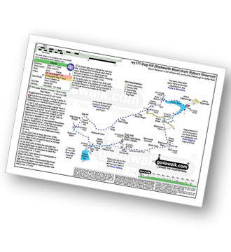
Vital Statistics:
| Length: | 7.5 miles (12 km) |
| Ascent: | 1,241 ft (378 m) |
| Time: | 4 hrs |
| Grade: |  |
Walk route map pdf
Detailed walk route map PDF
complete with GPS Waypoints
Route Summary:
Ryburn Reservoir - River Ryburn - Higher Wormaid - Grey Stone Height - Cat Moss - Rishworth Moor - Warm Withens Hill - Rishworth Drain - Sam Hill - Green Withens Reservoir - Green Withens Moss - Dog Hill (Rishworth Moor) - Blackwood Edge - Blackwood Farm - Hutch Brook - Ryburn Reservoir

|
Vital Statistics:
| Length: | 11.25 miles (18 km) |
| Ascent: | 1,631 ft (497 m) |
| Time: | 5.75 hrs |
| Grade: |  |
Walk route map pdf

Detailed walk route map PDF
complete with GPS Waypoints
Route Summary:
Ryburn Reservoir - River Ryburn - Higher Wormaid - Grey Stone Height - Cat Moss - Rishworth Moor - Warm Withens Hill - Rishworth Drain - Rag Sapling Clough - Blackstone Edge Moor - Old Packhorse Road - Dick Slack - The Aiggin Stone - The Pennine Way - Blackstone Edge - Robin Hoods Bed - Sun End - Redmires - White Isles - Lads Grave - M62 - Green Withens Reservoir - Green Withens Edge - Dog Hill (Rishworth Moor) - Blackwood Edge - Blackwood Farm - Hutch Brook - Ryburn Reservoir
See more easy-to-follow circular walks in The South Pennines and The Forest of Bowland
See more easy-to-follow circular walks in West Yorkshire