Walk ad104 The Devil's Point and Cairn Toul from Corrour Bothy, Lairig Ghru
This highly detailed, easy-to-follow, hand-crafted walk with GPS starts at Corrour Bothy, is 11½ miles long and will take about 8½hrs. It is graded 8 (Hard).
NB. Corrour Bothy is located the middle of Lairig Ghru and inaccessible by car. The nearest car park (by foot/mountain bike) is at Linn of Dee, W of Braemar - see walks ad125 and ad126 for route details.
   |
Vital Statistics:
| Length: | 11½mls (18.5km) |
| Ascent: | 4,260ft (1,298m) |
| Time: | 8½hrs |
| Grade: |  |

Route outline for walk ad104:
Corrour Bothy - Lairig Ghru - Allt a' Coire Odhar - Coire Odhar - The Devil's Point - Stob Coire an t-Saighdeir (Cairn Toul) - Cairn Toul (Carn an t-Sabhail) - Coire An an t-Sabhail - Sgor An Lochain Uaine (The Angel's Peak) - Garbh Core Mor - Carn na Criche (Braeriach) - Clais Luinneag - Loch Nan Stuirteng - Allt Clais an t-Sabhail - Allt a' Core Cath Nam Fionn - Glen Geusachan - Geusachan Burn - River Dee - Corrour Bothy - Lairig Ghru.
Points of Interest/Notes on this walk:
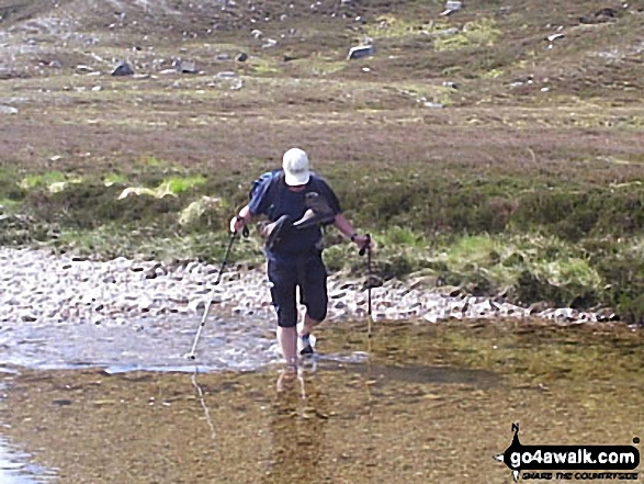
The single roomed Corrour Bothy gets pretty busy, particularly in the summer months. Either get there early to secure a place on the concrete floor or bring a tent and camp outside (as I did).
Peaks, Summits and Tops reached on this walk:
 3 Munros |
 0 Corbetts |
 0 Grahams |
 5 Murdos |
 0 Donalds |
 1 Scottish Marilyn |
 0 Bridgets |
Peak Bagging Statistics for this walk:
The highest point of this walk is Cairn Toul (Carn an t-Sabhail) at 1291m (4237ft). Cairn Toul (Carn an t-Sabhail) is classified as a Munro (No. 4) and a Scottish Marilyn (4th highest in Scotland, 4th highest in the UK). Cairn Toul (Carn an t-Sabhail) is also known as a Murdo (4th highest in Scotland). Cairn Toul (Carn an t-Sabhail) means 'Hill of the Barn' .
Completing this walk will also take you to the top of Carn na Criche (Braeriach) at 1265m (4152ft). Carn na Criche (Braeriach) is known as a Murdo (5th highest in Scotland).
You will also reach the summit of Sgor an Lochain Uaine (The Angel's Peak) at 1258m (4129ft). Sgor an Lochain Uaine (The Angel's Peak) is classified as a Munro (No. 5) Sgor an Lochain Uaine (The Angel's Peak) is also known as a Murdo (6th highest in Scotland).
Along the way you will also bag:
- Stob Coire an t-Saighdeir (Cairn Toul) at 1213m (3981ft). Stob Coire an t-Saighdeir (Cairn Toul) is known as a Murdo (14th highest in Scotland).
- The Devil's Point at 1004m (3295ft). The Devil's Point is classified as a Munro (No. 131) and a Murdo (184th highest in Scotland).
You can find this walk and other nearby walks on these unique free-to-access Interactive Walk Planning Maps:
1:25,000 scale OS Explorer Map (orange/yellow covers):
1:50,000 scale OS Landranger Map (pink/magenta covers):
Some Photos and Pictures from Walk ad104 The Devil's Point and Cairn Toul from Corrour Bothy, Lairig Ghru
In no particular order . . .
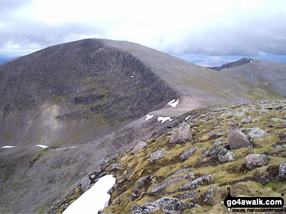
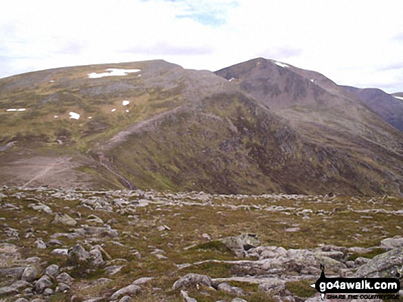
Cairn Toul (Carn an t-Sabhail) from Sgor an Lochain Uaine (The Angel's Peak)


Sgor an Lochain Uaine (The Angel's Peak) from Cairn Toul (Carn an t-Sabhail)
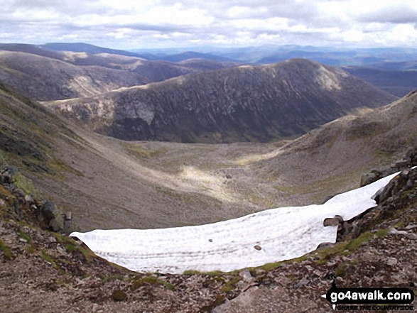
The Falls on Dee, Braeriach (Braigh Riabhach) from Sgor an Lochain Uaine (The Angel's Peak)

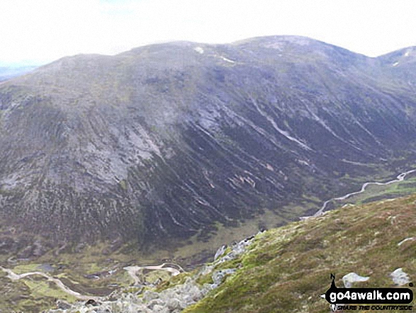
*Carn a' Mhaim, Glen Dee, Beinn Bhrotain, Monadh Mor and Glen Geusachan from The Devil's Point

Beinn Bhrotain (left) and Monadh Mor (right) above Glen Geusachan from The Devil's Point

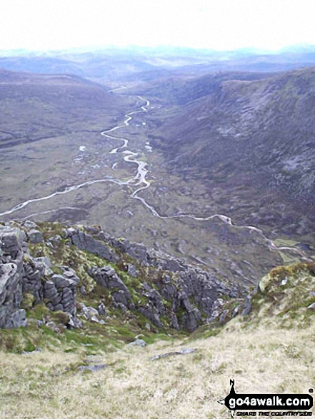
Ben Macdui (Beinn MacDuibh), Corrour Bothy and Lairig Ghru from The Devil's Point


Stob Coire an t-Saighdeir (with Cairn Toul (Carn an t-Sabhail)) beyond) from The Devil's Point
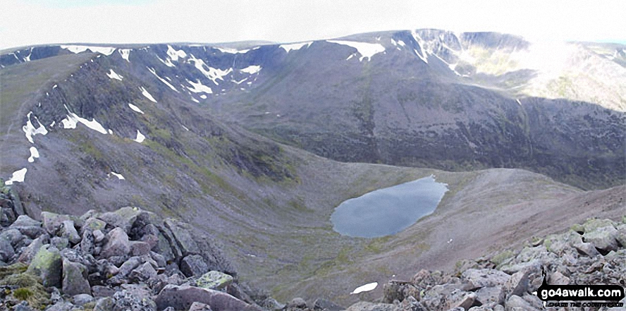
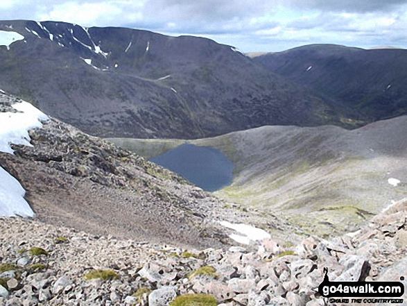
*Sgor an Lochain Uaine (The Angel's Peak), Lochain Uaine and Braeriach (Braigh Riabhach) from Cairn Toul (Carn an t-Sabhail)


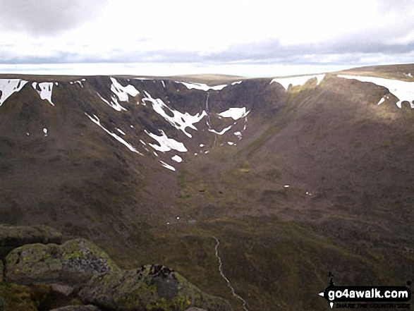
*Carn a' Mhaim, Lairig Ghru, The Devil's Point and Stob Coire an t-Saighdeir from Cairn Toul (Carn an t-Sabhail)
Send us your photographs and pictures from your walks and hikes
We would love to see your photographs and pictures from walk ad104 The Devil's Point and Cairn Toul from Corrour Bothy, Lairig Ghru. Send them in to us as email attachments (configured for any computer) along with your name and where the picture was taken to:
and we shall do our best to publish them.
(Guide Resolution = 300dpi. At least = 660 pixels (wide) x 440 pixels (high).)

You can also submit photos from walk ad104 The Devil's Point and Cairn Toul from Corrour Bothy, Lairig Ghru via our Facebook Page.
NB. Please indicate where each photo was taken.