   |
Vital Statistics:
| Length: | 11mls (17km) |
| Ascent: | 4,001ft (1,219m) |
| Time: | 8hrs |
| Grade: |  |

Route outline for walk c343:
Wasdale Head - Mosedale Beck - Black Sail Pass - High Level Route - Robinson's Cairn - Pillar - Wind Gap - Black Crag (Pillar) - Scoat Fell (Little Scoat Fell) - Red Pike (Wasdale) - Dore Head - Over Beck - Wasdale Head - Wast Water.
Points of Interest/Notes on this walk:
Wasdale Head is a tiny hamlet of agricultural fields and dwellings that claims to be home of the highest mountain in England (Scafell Pike), the deepest lake (Wast Water), the smallest church (Church of St Olaf) and the biggest liar (Will Ritson). There is an excellent National Trust Campsite and a fine pub - the Wasdale Inn - which claims to be the birthplace of British rock climbing. There is also a large free parking area for visitors.
Peak Bagging Statistics for this walk:
The highest point of this walk is Pillar at 892m (2928ft). Pillar is classified as an English Mountain (Hewitt) (11th highest in England, 29th highest in England & Wales) and a Wainwright (No. 8).
Pillar is also known as an English Nuttall (13th highest in England, 33rd highest in England & Wales) and an English Marilyn (6th highest in England, 249th highest in the UK).
The summit of Pillar is marked by an Ordnance Survey Trig Point.
Completing this walk will also take you to the top of Scoat Fell (Little Scoat Fell) at 841m (2759ft). Scoat Fell (Little Scoat Fell) is classified as an English Mountain (Hewitt) (28th highest in England, 54th highest in England & Wales) and a Wainwright (No. 23).
Scoat Fell (Little Scoat Fell) is also known as an English Nuttall (34th highest in England, 62nd highest in England & Wales).
You will also reach the summit of Black Crag (Pillar) at 828m (2717ft). Black Crag (Pillar) is classified as an English Mountain (Hewitt) (31st highest in England, 60th highest in England & Wales)
Black Crag (Pillar) is also known as an English Nuttall (37th highest in England, 69th highest in England & Wales).
Along the way you will also bag:
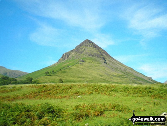
- Red Pike (Wasdale) at 826m (2711ft). Red Pike (Wasdale) is classified as an English Mountain (Hewitt) (33rd highest in England, 63rd highest in England & Wales), a Wainwright (No. 26) and an English Nuttall (39th highest in England, 73rd highest in England & Wales).
You can find this walk and other nearby walks on these unique free-to-access Interactive Walk Planning Maps:
1:25,000 scale OS Explorer Maps (orange/yellow covers):
1:50,000 scale OS Landranger Map (pink/magenta covers):
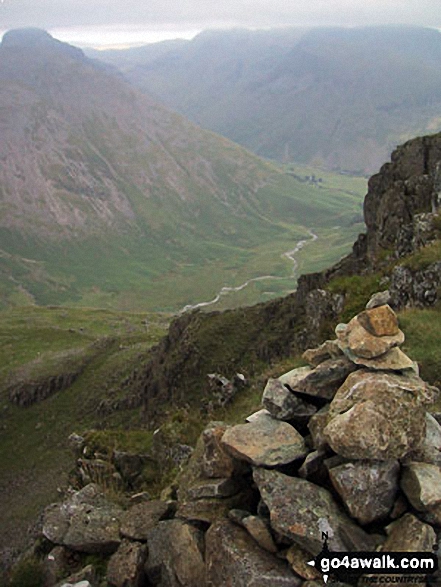
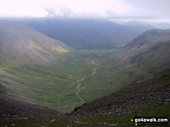
Some Photos and Pictures from Walk c343 Pillar and Red Pike from Wasdale Head, Wast Water
In no particular order . . .

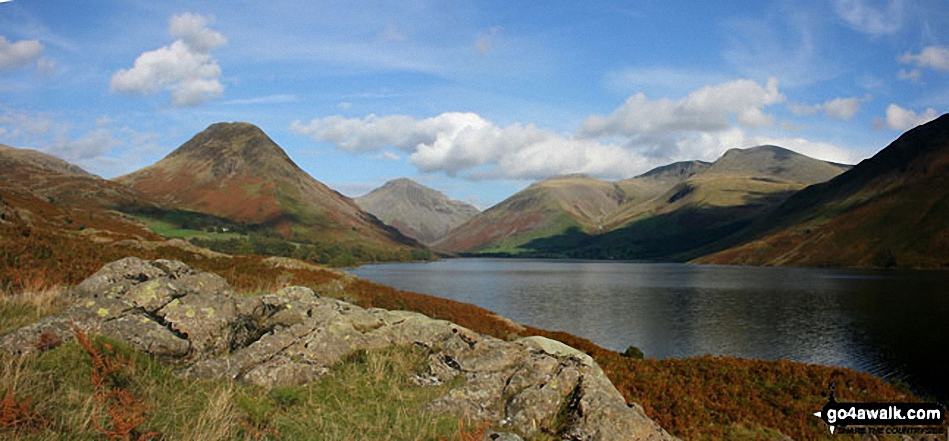
Britain's Favourite View - Yewbarrow, Great Gable, Lingmell, Great End, Sca Fell and the shoulder of Illgill Head (far right) from Wast Water

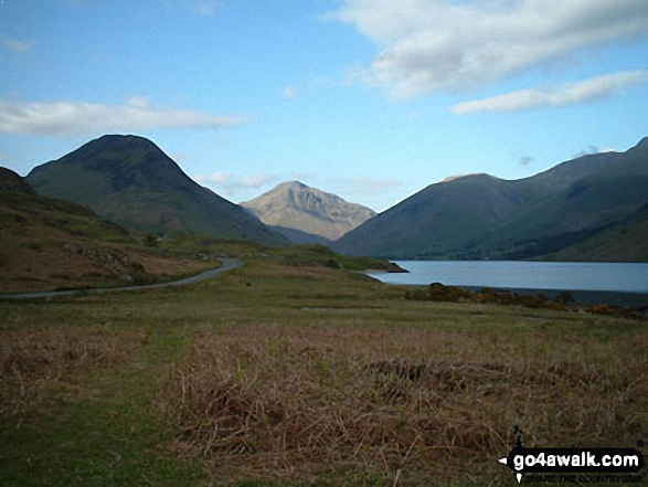
Yewbarrow (left) Great Gable (centre) and Lingmell (right) from across Wast Water in Wasdale
The summit shelter, Mellbreak, Rannerdale Knotts, Buttermere, Grasmoor, Whiteless Pike, Wandope, Crag Hill (Eel Crag), Sail and Knott Rigg from the summit of Robinson


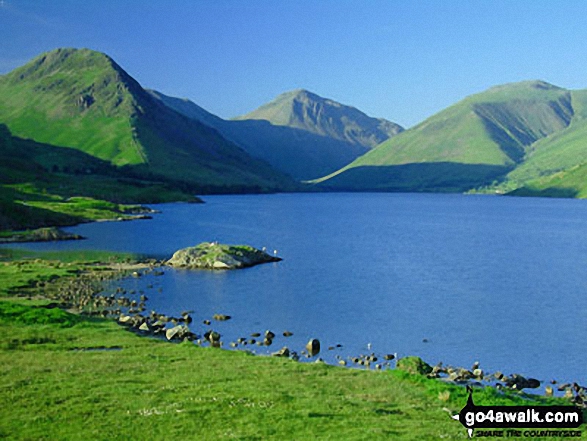
Wasdale Head featuring Yewbarrow (left), Great Gable (centre) and Lingmell (right) from across Wast Water


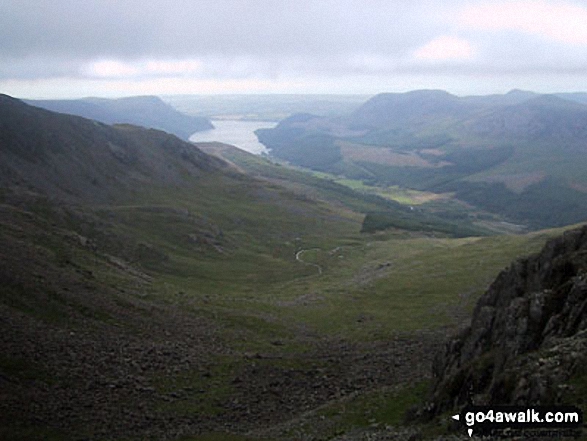
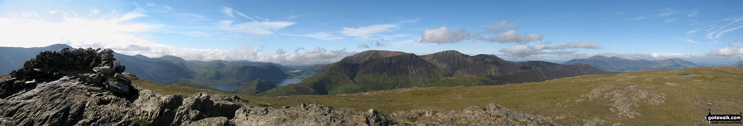
Steeple and Long Crag with Crag Fell (sunlit in the distance), Ennerdale Water and Great Borne from Pillar
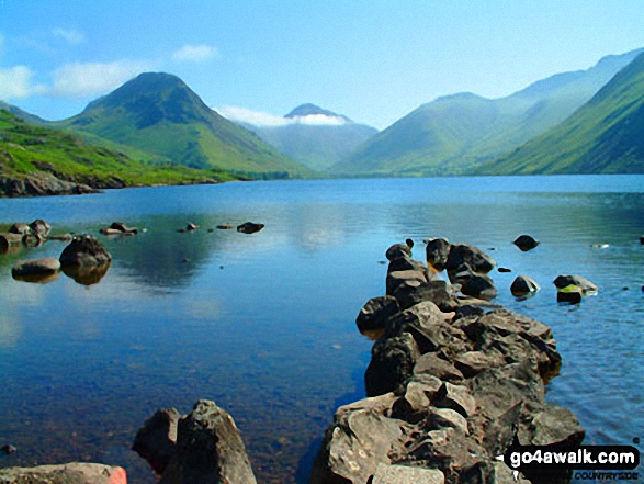
Wasdale Head featuring Yewbarrow (left), Great Gable (centre), Lingmell (right) and the lower slopes of Scafell Pike (right) from across Wast Water

. . . load all 99 walk photos from Walk c343 Pillar and Red Pike from Wasdale Head, Wast Water
Send us your photographs and pictures from your walks and hikes
We would love to see your photographs and pictures from walk c343 Pillar and Red Pike from Wasdale Head, Wast Water. Send them in to us as email attachments (configured for any computer) along with your name and where the picture was taken to:
and we shall do our best to publish them.
(Guide Resolution = 300dpi. At least = 660 pixels (wide) x 440 pixels (high).)

You can also submit photos from walk c343 Pillar and Red Pike from Wasdale Head, Wast Water via our Facebook Page.
NB. Please indicate where each photo was taken.


