The Mountains, Peaks, Tops and Hills in The Northern Fells area of The Lake District, Cumbria with all the tops you have already bagged in first & then the ones you are yet to climb second.
The Northern Fells area of The Lake District National Park, Cumbria is enclosed by:
- Keswick and Threlkeld to the South
- The River Derwent and Bassenthwaite Lake to the South West
- The boundary of The Lake District National Park to the North and East
If you count only the Wainwrights there are 24 tops to climb, bag & conquer and the highest point is Skiddaw at 930m (3,052ft).
To see these Mountains, Peaks, Tops and Hills displayed in different ways - see the options in the left-hand column and towards the bottom of this page.
![]() Your Personal Bagging Record for The Northern Fells area of The Lake District
Your Personal Bagging Record for The Northern Fells area of The Lake District
LOG ON and RELOAD this page to show which Mountains, Peaks, Tops and Hills you have already climbed, bagged & conquered [. . . more details]
Scroll down this list of mountains, peaks, tops & hills below and tap/click on each name (in blue) to locate it on the map above.
See this list in: Alphabetical Order‡ | Height Order
To reverse the order select the link again.
Mountain, Peak, Top or Hill already bagged:
Bagged
Top yet to be climbed, bagged & conquered:
Bagged

![]()
1. Bakestall
673m (2209ft)
Wainwright
See more details, photos, trip reports and easy-to-follow walks up Bakestall
![]()
2. Bannerdale Crags
683m (2242ft)
Wainwright
See more details, photos, trip reports and easy-to-follow walks up Bannerdale Crags
![]()
3. Binsey
447m (1467ft)
Wainwright
See more details, photos, trip reports and easy-to-follow walks up Binsey
![]()
4. Blencathra or Saddleback (Hallsfell Top)
868m (2849ft)
Wainwright
![]()
5. Bowscale Fell
702m (2304ft)
Wainwright
See more details, photos, trip reports and easy-to-follow walks up Bowscale Fell
![]()
6. Brae Fell
586m (1923ft)
Wainwright
See more details, photos, trip reports and easy-to-follow walks up Brae Fell
![]()
7. Carl Side
746m (2448ft)
Wainwright
See more details, photos, trip reports and easy-to-follow walks up Carl Side
![]()
8. Carrock Fell
662m (2173ft)
Wainwright
See more details, photos, trip reports and easy-to-follow walks up Carrock Fell
![]()
9. Dodd (Skiddaw)
502m (1647ft)
Wainwright
See more details, photos, trip reports and easy-to-follow walks up Dodd (Skiddaw)
![]()
10. Great Calva
690m (2264ft)
Wainwright
See more details, photos, trip reports and easy-to-follow walks up Great Calva
![]()
11. Great Cockup
526m (1726ft)
Wainwright
See more details, photos, trip reports and easy-to-follow walks up Great Cockup
![]()
12. Great Sca Fell
651m (2137ft)
Wainwright
See more details, photos, trip reports and easy-to-follow walks up Great Sca Fell
![]()
13. High Pike (Caldbeck)
658m (2160ft)
Wainwright
See more details, photos, trip reports and easy-to-follow walks up High Pike (Caldbeck)
![]()
14. Knott (Uldale Fells)
710m (2330ft)
Wainwright
See more details, photos, trip reports and easy-to-follow walks up Knott (Uldale Fells)
![]()
15. Latrigg
367m (1204ft)
Wainwright
See more details, photos, trip reports and easy-to-follow walks up Latrigg
![]()
16. Little Man (Skiddaw)
865m (2839ft)
Wainwright
See more details, photos, trip reports and easy-to-follow walks up Little Man (Skiddaw)
![]()
17. Long Side
734m (2409ft)
Wainwright
See more details, photos, trip reports and easy-to-follow walks up Long Side
![]()
18. Longlands Fell
483m (1585ft)
Wainwright
See more details, photos, trip reports and easy-to-follow walks up Longlands Fell
![]()
19. Lonscale Fell
715m (2346ft)
Wainwright
See more details, photos, trip reports and easy-to-follow walks up Lonscale Fell
![]()
20. Meal Fell
550m (1805ft)
Wainwright
See more details, photos, trip reports and easy-to-follow walks up Meal Fell
![]()
21. Mungrisdale Common
633m (2078ft)
Wainwright
See more details, photos, trip reports and easy-to-follow walks up Mungrisdale Common
![]()
22. Skiddaw
930m (3052ft)
Wainwright
See more details, photos, trip reports and easy-to-follow walks up Skiddaw
![]()
23. Souther Fell
522m (1713ft)
Wainwright
See more details, photos, trip reports and easy-to-follow walks up Souther Fell
![]()
24. Ullock Pike
690m (2265ft)
Wainwright
See more details, photos, trip reports and easy-to-follow walks up Ullock Pike
![]() Your Personal Bagging Record for The Northern Fells area of The Lake District
Your Personal Bagging Record for The Northern Fells area of The Lake District
LOG ON and RELOAD this page to show which Mountains, Peaks, Tops and Hills you have already climbed, bagged & conquered [. . . more details]
View these 24 Mountains, Peaks, Tops and Hills:
- On a Downloadable PDF you can Print or Save to your Phone#
- On an Interactive Google Map with a list of tops below it.
(makes it easier to locate a particular top) - On a Detailed List in:
Alphabetical Order | Height Order - On one page with 'yet-to-be-bagged' listed 1st
& then 'already-bagged' tops listed 2nd in:
Alphabetical Order | Height Order - On one page with 'already-bagged' tops listed 1st
& then 'yet-to-be-bagged' tops listed 2nd in:
Alphabetical Order | Height Order
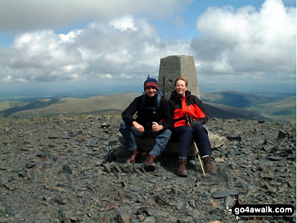 The summit of Skiddaw in The Northern Fells area of The Lake District
Photo: Richard Nicholls
# Whether you print a copy or download it to your phone, this Peak Baggers' Map will prove incredibly useful if you want to know what's what when you are up in the mountains and cannot get a phone signal.
Is there a Mountain, Peak, Top or Hill missing from the above google map or list?