Scotland - a fully detailed list of all the Mountains, Peaks, Tops and Hills (Page 6 of 8)
If you count only the Corbetts there are 222 tops to climb, bag & conquer and the highest point is Beinn a' Chlaidheimh at 914m (2,999ft).
To see these Mountains, Peaks, Tops and Hills displayed in different ways - see the options in the left-hand column and towards the bottom of this page.
![]() Your Personal Bagging Record for Scotland
Your Personal Bagging Record for Scotland
LOG ON and RELOAD this page to show which Mountains, Peaks, Tops and Hills you have already climbed, bagged & conquered [. . . more details]
See this list in: Alphabetical Order
| Height Order‡
To reverse the order select the link again.
Mountain, Peak, Top or Hill:
Bagged

![]()
151. Meall nan Subh
806m (2,645ft)
Meall nan Subh is on interactive maps:
A downloadable go4awalk.com PDF Peak Bagging Map featuring Meall nan Subh will be available soon. |
![]()
152. Beinn na h-Eaglaise (Loch Hourn)
805m (2,642ft)
Send it in and we'll publish it here.
Beinn na h-Eaglaise (Loch Hourn) is on interactive maps:
A downloadable go4awalk.com PDF Peak Bagging Map featuring Beinn na h-Eaglaise (Loch Hourn) will be available soon. |
![]()
153. Beinn Iaruinn
805m (2,641ft)
Beinn Iaruinn is on interactive maps:
A downloadable go4awalk.com PDF Peak Bagging Map featuring Beinn Iaruinn will be available soon. |
![]()
154. Carn Mor (Ladder Hills)
804m (2,639ft)
Send it in and we'll publish it here.
Carn Mor (Ladder Hills) is on interactive maps:
A downloadable go4awalk.com PDF Peak Bagging Map featuring Carn Mor (Ladder Hills) will be available soon. |
![]()
155. Geal Charn (Loch Arkaig)
804m (2,639ft)
Send it in and we'll publish it here.
Geal Charn (Loch Arkaig) is on interactive maps:
A downloadable go4awalk.com PDF Peak Bagging Map featuring Geal Charn (Loch Arkaig) will be available soon. |
![]()
156. The Sow of Atholl
803m (2,635ft)
The Sow of Atholl is on interactive maps:
A downloadable go4awalk.com PDF Peak Bagging Map featuring The Sow of Atholl will be available soon. |
![]()
157. Beinn Bhreac-liath
802m (2,632ft)
Beinn Bhreac-liath is on interactive maps:
A downloadable go4awalk.com PDF Peak Bagging Map featuring Beinn Bhreac-liath will be available soon. |
![]()
158. Meallan Liath Coire Mhic Dhughaill
801m (2,629ft)
Send it in and we'll publish it here.
Meallan Liath Coire Mhic Dhughaill is on interactive maps:
A downloadable go4awalk.com PDF Peak Bagging Map featuring Meallan Liath Coire Mhic Dhughaill will be available soon. |
![]()
159. Cranstackie
801m (2,628ft)
Cranstackie is on interactive maps:
A downloadable go4awalk.com PDF Peak Bagging Map featuring Cranstackie will be available soon. |
![]()
160. An Cliseam
799m (2,622ft)
An Cliseam is on interactive maps:
A downloadable go4awalk.com PDF Peak Bagging Map featuring An Cliseam will be available soon. |
![]()
161. Am Bathach
798m (2,618ft)
Am Bathach is on interactive maps:
A downloadable go4awalk.com PDF Peak Bagging Map featuring Am Bathach will be available soon. |
![]()
162. Cir Mhor
798m (2,618ft)
Cir Mhor is on interactive maps:
A downloadable go4awalk.com PDF Peak Bagging Map featuring Cir Mhor will be available soon. |
![]()
163. Beinn Dronaig
797m (2,616ft)
Beinn Dronaig is on interactive maps:
A downloadable go4awalk.com PDF Peak Bagging Map featuring Beinn Dronaig will be available soon. |
![]()
164. Cairnsmore of Carsphairn
797m (2,615ft)
Send it in and we'll publish it here.
Cairnsmore of Carsphairn is on interactive maps:
A downloadable go4awalk.com PDF Peak Bagging Map featuring Cairnsmore of Carsphairn will be available soon. |
![]()
165. Beinn Bhan (Loch Arkaig)
796m (2,612ft)
Send it in and we'll publish it here.
Beinn Bhan (Loch Arkaig) is on interactive maps:
A downloadable go4awalk.com PDF Peak Bagging Map featuring Beinn Bhan (Loch Arkaig) will be available soon. |
![]()
166. Beinn Mhic-Mhonaidh
796m (2,612ft)
Send it in and we'll publish it here.
Beinn Mhic-Mhonaidh is on interactive maps:
A downloadable go4awalk.com PDF Peak Bagging Map featuring Beinn Mhic-Mhonaidh will be available soon. |
![]()
167. Mam na Gualainn
796m (2,612ft)
Mam na Gualainn is on interactive maps:
A downloadable go4awalk.com PDF Peak Bagging Map featuring Mam na Gualainn will be available soon. |
![]()
168. Sgurr an Utha
796m (2,612ft)
Sgurr an Utha is on interactive maps:
A downloadable go4awalk.com PDF Peak Bagging Map featuring Sgurr an Utha will be available soon. |
![]()
169. Sgurr Coire Choinnichean
796m (2,612ft)
Send it in and we'll publish it here.
Sgurr Coire Choinnichean is on interactive maps:
A downloadable go4awalk.com PDF Peak Bagging Map featuring Sgurr Coire Choinnichean will be available soon. |
![]()
170. Beinn Leoid
792m (2,599ft)
Beinn Leoid is on interactive maps:
A downloadable go4awalk.com PDF Peak Bagging Map featuring Beinn Leoid will be available soon. |
![]()
171. Carn Ealasaid
792m (2,599ft)
Carn Ealasaid is on interactive maps:
A downloadable go4awalk.com PDF Peak Bagging Map featuring Carn Ealasaid will be available soon. |
![]()
172. Glas Bheinn (Mamores)
792m (2,599ft)
Send it in and we'll publish it here.
Glas Bheinn (Mamores) is on interactive maps:
A downloadable go4awalk.com PDF Peak Bagging Map featuring Glas Bheinn (Mamores) will be available soon. |
![]()
173. Sgurr a' Chaorachain (Loch Kishorn)
792m (2,599ft)
Send it in and we'll publish it here.
Sgurr a' Chaorachain (Loch Kishorn) is on interactive maps:
A downloadable go4awalk.com PDF Peak Bagging Map featuring Sgurr a' Chaorachain (Loch Kishorn) will be available soon. |
![]()
174. Beinn Airigh Charr
792m (2,598ft)
Beinn Airigh Charr is on interactive maps:
A downloadable go4awalk.com PDF Peak Bagging Map featuring Beinn Airigh Charr will be available soon. |
![]()
175. Auchnafree Hill
789m (2,589ft)
Auchnafree Hill is on interactive maps:
A downloadable go4awalk.com PDF Peak Bagging Map featuring Auchnafree Hill will be available soon. |
![]()
176. Beinn Loinne (Druim nan Cnamh)
789m (2,589ft)
Send it in and we'll publish it here.
Beinn Loinne (Druim nan Cnamh) is on interactive maps:
A downloadable go4awalk.com PDF Peak Bagging Map featuring Beinn Loinne (Druim nan Cnamh) will be available soon. |
![]()
177. Meall Dubh (Beinneun Forest)
789m (2,589ft)
Send it in and we'll publish it here.
Meall Dubh (Beinneun Forest) is on interactive maps:
A downloadable go4awalk.com PDF Peak Bagging Map featuring Meall Dubh (Beinneun Forest) will be available soon. |
![]()
178. The Brack
787m (2,584ft)
The Brack is on interactive maps:
A downloadable go4awalk.com PDF Peak Bagging Map featuring The Brack will be available soon. |
![]()
179. Arkle (Sutherland)
787m (2,583ft)
Arkle (Sutherland) is on interactive maps:
A downloadable go4awalk.com PDF Peak Bagging Map featuring Arkle (Sutherland) will be available soon. |
![]()
180. Beinn a' Chaisteil (Loch Vaich)
787m (2,583ft)
Send it in and we'll publish it here.
Beinn a' Chaisteil (Loch Vaich) is on interactive maps:
A downloadable go4awalk.com PDF Peak Bagging Map featuring Beinn a' Chaisteil (Loch Vaich) will be available soon. |
View these 222 Mountains, Peaks, Tops and Hills:
- On an Interactive Google Map with a list of tops below it.
(makes it easier to locate a particular top) - On a Detailed List in:
Alphabetical Order | Height Order - On one page with 'yet-to-be-bagged' listed 1st
& then 'already-bagged' tops listed 2nd in:
Alphabetical Order | Height Order - On one page with 'already-bagged' tops listed 1st
& then 'yet-to-be-bagged' tops listed 2nd in:
Alphabetical Order | Height Order
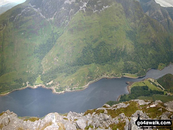
 The summit of Ben Nevis in Ullapool to The Moray FirthScotland
Photo: John Reed
Is there a Mountain, Peak, Top or Hill missing from the above google map or list?
Let us know an we will add it to our database.

To contribute to go4awalk.com or to contact us about anything at all - see Talk To Us.
For help see Help.
go4awalk.com and go4awalk.co.uk are registered trademarks of TMDH Limited.
Copyright © 2000-2026 TMDH Limited. All rights reserved.
Copyright Terms & Conditions Privacy Statement
A - Z Walks Home Log On/Accounts Photo Gallery Walk Ideas and Collections Fell Facts Hill Skills Walking Questions and Answers Your Stories News Competitions Product Reviews/Gear Tests Walking Gear Guides Peaks and Mountains Peak Bagging Find New Walking Friends Camping GPS Waypoints for Walking Contents Walk Search Talk To Us go4awalk.com Help Free Example Walks Newsletter