Scotland - a fully detailed list of all the Mountains, Peaks, Tops and Hills (Page 1 of 8)
If you count only the Corbetts there are 222 tops to climb, bag & conquer and the highest point is Beinn a' Chlaidheimh at 914m (2,999ft).
To see these Mountains, Peaks, Tops and Hills displayed in different ways - see the options in the left-hand column and towards the bottom of this page.
LOG ON and RELOAD this page to show which Mountains, Peaks, Tops and Hills you have already climbed, bagged & conquered [. . . more details]
See this list in: Alphabetical Order
| Height Order‡
To reverse the order select the link again.
Mountain, Peak, Top or Hill:
Bagged
1. Beinn na h-Uamha (Ardgour)
762m (2,501ft)
Beinn na h-Uamha (Ardgour) is on interactive maps:
A downloadable go4awalk.com PDF Peak Bagging Map featuring Beinn na h-Uamha (Ardgour) will be available soon. |
2. Little Wyvis
763m (2,504ft)
See the location of Little Wyvis and walks up it on a google Map Little Wyvis is on interactive maps:
A downloadable go4awalk.com PDF Peak Bagging Map featuring Little Wyvis will be available soon. |
3. Cnoc Coinnich
764m (2,505ft)
Cnoc Coinnich is on interactive maps:
A downloadable go4awalk.com PDF Peak Bagging Map featuring Cnoc Coinnich will be available soon. |
4. An Caisteal (Ben Loyal)
764m (2,507ft)
An Caisteal (Ben Loyal) is on interactive maps:
A downloadable go4awalk.com PDF Peak Bagging Map featuring An Caisteal (Ben Loyal) will be available soon. |
5. Meall an Fhudair
764m (2,507ft)
Meall an Fhudair is on interactive maps:
A downloadable go4awalk.com PDF Peak Bagging Map featuring Meall an Fhudair will be available soon. |
6. Spidean Coinich (Quinag)
764m (2,507ft)
See the location of Spidean Coinich (Quinag) and walks up it on a google Map Spidean Coinich (Quinag) is on interactive maps:
A downloadable go4awalk.com PDF Peak Bagging Map featuring Spidean Coinich (Quinag) will be available soon. |
7. Braigh nan Uamhachan
765m (2,511ft)
Send it in and we'll publish it here.
Braigh nan Uamhachan is on interactive maps:
A downloadable go4awalk.com PDF Peak Bagging Map featuring Braigh nan Uamhachan will be available soon. |
8. Beinn Liath Mhor a' Ghiubhais Li
766m (2,514ft)
Send it in and we'll publish it here.
Beinn Liath Mhor a' Ghiubhais Li is on interactive maps:
A downloadable go4awalk.com PDF Peak Bagging Map featuring Beinn Liath Mhor a' Ghiubhais Li will be available soon. |
9. Dun da Ghaoithe
766m (2,514ft)
Dun da Ghaoithe is on interactive maps:
A downloadable go4awalk.com PDF Peak Bagging Map featuring Dun da Ghaoithe will be available soon. |
10. Fuar Bheinn
766m (2,514ft)
Fuar Bheinn is on interactive maps:
A downloadable go4awalk.com PDF Peak Bagging Map featuring Fuar Bheinn will be available soon. |
11. Sail Mhor (Little Loch Broom)
767m (2,517ft)
Send it in and we'll publish it here.
Sail Mhor (Little Loch Broom) is on interactive maps:
A downloadable go4awalk.com PDF Peak Bagging Map featuring Sail Mhor (Little Loch Broom) will be available soon. |
12. Carn Dearg (Aberchalder Forest)
768m (2,521ft)
Send it in and we'll publish it here.
Carn Dearg (Aberchalder Forest) is on interactive maps:
A downloadable go4awalk.com PDF Peak Bagging Map featuring Carn Dearg (Aberchalder Forest) will be available soon. |
13. Beinn a' Choin
769m (2,522ft)
Beinn a' Choin is on interactive maps:
A downloadable go4awalk.com PDF Peak Bagging Map featuring Beinn a' Choin will be available soon. |
14. Cul Beag
769m (2,524ft)
Cul Beag is on interactive maps:
A downloadable go4awalk.com PDF Peak Bagging Map featuring Cul Beag will be available soon. |
15. Meallach Mhor
769m (2,524ft)
Meallach Mhor is on interactive maps:
A downloadable go4awalk.com PDF Peak Bagging Map featuring Meallach Mhor will be available soon. |
16. Stob a' Bhealach an Sgriodain (Druim Tarsuin
770m (2,527ft)
Send it in and we'll publish it here.
Stob a' Bhealach an Sgriodain (Druim Tarsuin is on interactive maps:
A downloadable go4awalk.com PDF Peak Bagging Map featuring Stob a' Bhealach an Sgriodain (Druim Tarsuin will be available soon. |
17. Stob Coire a' Chearcaill
771m (2,530ft)
Send it in and we'll publish it here.
Stob Coire a' Chearcaill is on interactive maps:
A downloadable go4awalk.com PDF Peak Bagging Map featuring Stob Coire a' Chearcaill will be available soon. |
18. Meall Lighiche
772m (2,534ft)
Meall Lighiche is on interactive maps:
A downloadable go4awalk.com PDF Peak Bagging Map featuring Meall Lighiche will be available soon. |
19. Stob Fear-tomhais (Ceann na Baintighearna)
772m (2,534ft)
Stob Fear-tomhais (Ceann na Baintighearna) is on interactive maps:
A downloadable go4awalk.com PDF Peak Bagging Map featuring Stob Fear-tomhais (Ceann na Baintighearna) will be available soon. |
20. Meall a' Phubuill
773m (2,535ft)
Meall a' Phubuill is on interactive maps:
A downloadable go4awalk.com PDF Peak Bagging Map featuring Meall a' Phubuill will be available soon. |
21. Beinn Spionnaidh
773m (2,537ft)
Beinn Spionnaidh is on interactive maps:
A downloadable go4awalk.com PDF Peak Bagging Map featuring Beinn Spionnaidh will be available soon. |
22. Beinn nan Caorach
774m (2,540ft)
Beinn nan Caorach is on interactive maps:
A downloadable go4awalk.com PDF Peak Bagging Map featuring Beinn nan Caorach will be available soon. |
23. Sgorr Craobh a' Chaorainn
775m (2,544ft)
Send it in and we'll publish it here.
Sgorr Craobh a' Chaorainn is on interactive maps:
A downloadable go4awalk.com PDF Peak Bagging Map featuring Sgorr Craobh a' Chaorainn will be available soon. |
24. Sgurr Mhairi (Glamaig)
775m (2,544ft)
Send it in and we'll publish it here.
Sgurr Mhairi (Glamaig) is on interactive maps:
A downloadable go4awalk.com PDF Peak Bagging Map featuring Sgurr Mhairi (Glamaig) will be available soon. |
25. Shalloch on Minnoch
775m (2,544ft)
Send it in and we'll publish it here.
Shalloch on Minnoch is on interactive maps:
A downloadable go4awalk.com PDF Peak Bagging Map featuring Shalloch on Minnoch will be available soon. |
26. Glas Bheinn (Ben More Assynt)
776m (2,547ft)
Glas Bheinn (Ben More Assynt) is on interactive maps:
A downloadable go4awalk.com PDF Peak Bagging Map featuring Glas Bheinn (Ben More Assynt) will be available soon. |
27. Sail Ghorm (Quinag)
776m (2,547ft)
Send it in and we'll publish it here.
See the location of Sail Ghorm (Quinag) and walks up it on a google Map Sail Ghorm (Quinag) is on interactive maps:
A downloadable go4awalk.com PDF Peak Bagging Map featuring Sail Ghorm (Quinag) will be available soon. |
28. Meall Horn
777m (2,550ft)
Meall Horn is on interactive maps:
A downloadable go4awalk.com PDF Peak Bagging Map featuring Meall Horn will be available soon. |
29. Meall na Leitreach (Glen Garry)
777m (2,550ft)
Send it in and we'll publish it here.
Meall na Leitreach (Glen Garry) is on interactive maps:
A downloadable go4awalk.com PDF Peak Bagging Map featuring Meall na Leitreach (Glen Garry) will be available soon. |
30. Mount Battock
778m (2,553ft)
Mount Battock is on interactive maps:
A downloadable go4awalk.com PDF Peak Bagging Map featuring Mount Battock will be available soon. |
View these 222 Mountains, Peaks, Tops and Hills:
- On an Interactive Google Map with a list of tops below it.
(makes it easier to locate a particular top) - On a Detailed List in:
Alphabetical Order | Height Order - On one page with 'yet-to-be-bagged' listed 1st
& then 'already-bagged' tops listed 2nd in:
Alphabetical Order | Height Order - On one page with 'already-bagged' tops listed 1st
& then 'yet-to-be-bagged' tops listed 2nd in:
Alphabetical Order | Height Order
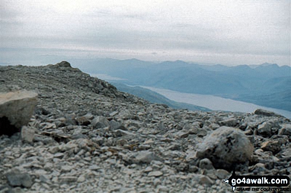 The summit of Ben Nevis in The East Mounth - Glen Shee and Mount Keen to MontroseScotland
Photo: John Reed
Is there a Mountain, Peak, Top or Hill missing from the above google map or list?
Let us know an we will add it to our database.

