Scotland - a fully detailed list of all the Mountains, Peaks, Tops and Hills (Page 1 of 8)
If you count only the Corbetts there are 222 tops to climb, bag & conquer and the highest point is Beinn a' Chlaidheimh at 914m (2,999ft).
To see these Mountains, Peaks, Tops and Hills displayed in different ways - see the options in the left-hand column and towards the bottom of this page.
![]() Your Personal Bagging Record for Scotland
Your Personal Bagging Record for Scotland
LOG ON and RELOAD this page to show which Mountains, Peaks, Tops and Hills you have already climbed, bagged & conquered [. . . more details]
See this list in: Alphabetical Order‡
| Height Order
To reverse the order select the link again.
Mountain, Peak, Top or Hill:
Bagged

![]()
1. A' Chaoirnich (Creag an Loch)
875m (2,872ft)
Send it in and we'll publish it here.
A' Chaoirnich (Creag an Loch) is on interactive maps:
A downloadable go4awalk.com PDF Peak Bagging Map featuring A' Chaoirnich (Creag an Loch) will be available soon. |
![]()
2. Ainshval
781m (2,563ft)
Ainshval is on interactive maps:
A downloadable go4awalk.com PDF Peak Bagging Map featuring Ainshval will be available soon. |
![]()
3. Am Bathach
798m (2,618ft)
Am Bathach is on interactive maps:
A downloadable go4awalk.com PDF Peak Bagging Map featuring Am Bathach will be available soon. |
![]()
4. An Caisteal (Ben Loyal)
764m (2,507ft)
An Caisteal (Ben Loyal) is on interactive maps:
A downloadable go4awalk.com PDF Peak Bagging Map featuring An Caisteal (Ben Loyal) will be available soon. |
![]()
5. An Cliseam
799m (2,622ft)
An Cliseam is on interactive maps:
A downloadable go4awalk.com PDF Peak Bagging Map featuring An Cliseam will be available soon. |
![]()
6. An Dun
827m (2,714ft)
An Dun is on interactive maps:
A downloadable go4awalk.com PDF Peak Bagging Map featuring An Dun will be available soon. |
![]()
7. An Ruadh-stac
890m (2,921ft)
An Ruadh-stac is on interactive maps:
A downloadable go4awalk.com PDF Peak Bagging Map featuring An Ruadh-stac will be available soon. |
![]()
8. An Sidhean
814m (2,672ft)
An Sidhean is on interactive maps:
A downloadable go4awalk.com PDF Peak Bagging Map featuring An Sidhean will be available soon. |
![]()
9. An Stac (Rhos-Beinn)
814m (2,672ft)
An Stac (Rhos-Beinn) is on interactive maps:
A downloadable go4awalk.com PDF Peak Bagging Map featuring An Stac (Rhos-Beinn) will be available soon. |
![]()
10. Aonach Buidhe
899m (2,951ft)
Aonach Buidhe is on interactive maps:
A downloadable go4awalk.com PDF Peak Bagging Map featuring Aonach Buidhe will be available soon. |
![]()
11. Aonach Shasuinn
888m (2,914ft)
Aonach Shasuinn is on interactive maps:
A downloadable go4awalk.com PDF Peak Bagging Map featuring Aonach Shasuinn will be available soon. |
![]()
12. Arkle (Sutherland)
787m (2,583ft)
Arkle (Sutherland) is on interactive maps:
A downloadable go4awalk.com PDF Peak Bagging Map featuring Arkle (Sutherland) will be available soon. |
![]()
13. Askival
812m (2,665ft)
Askival is on interactive maps:
A downloadable go4awalk.com PDF Peak Bagging Map featuring Askival will be available soon. |
![]()
14. Auchnafree Hill
789m (2,589ft)
Auchnafree Hill is on interactive maps:
A downloadable go4awalk.com PDF Peak Bagging Map featuring Auchnafree Hill will be available soon. |
![]()
15. Bac an Eich
849m (2,786ft)
Bac an Eich is on interactive maps:
A downloadable go4awalk.com PDF Peak Bagging Map featuring Bac an Eich will be available soon. |
![]()
16. Baosbheinn
875m (2,872ft)
Baosbheinn is on interactive maps:
A downloadable go4awalk.com PDF Peak Bagging Map featuring Baosbheinn will be available soon. |
![]()
17. Beinn a' Bha' ach Ard
862m (2,829ft)
Send it in and we'll publish it here.
Beinn a' Bha' ach Ard is on interactive maps:
A downloadable go4awalk.com PDF Peak Bagging Map featuring Beinn a' Bha' ach Ard will be available soon. |
![]()
18. Beinn a' Bhuiridh
897m (2,944ft)
Beinn a' Bhuiridh is on interactive maps:
A downloadable go4awalk.com PDF Peak Bagging Map featuring Beinn a' Bhuiridh will be available soon. |
![]()
19. Beinn a' Chaisgein Mor
856m (2,809ft)
Send it in and we'll publish it here.
Beinn a' Chaisgein Mor is on interactive maps:
A downloadable go4awalk.com PDF Peak Bagging Map featuring Beinn a' Chaisgein Mor will be available soon. |
![]()
20. Beinn a' Chaisteil (Loch Lyon)
886m (2,908ft)
Send it in and we'll publish it here.
Beinn a' Chaisteil (Loch Lyon) is on interactive maps:
A downloadable go4awalk.com PDF Peak Bagging Map featuring Beinn a' Chaisteil (Loch Lyon) will be available soon. |
![]()
21. Beinn a' Chaisteil (Loch Vaich)
787m (2,583ft)
Send it in and we'll publish it here.
Beinn a' Chaisteil (Loch Vaich) is on interactive maps:
A downloadable go4awalk.com PDF Peak Bagging Map featuring Beinn a' Chaisteil (Loch Vaich) will be available soon. |
![]()
22. Beinn a' Chlaidheimh
914m (2,999ft)
Send it in and we'll publish it here.
Beinn a' Chlaidheimh is on interactive maps:
A downloadable go4awalk.com PDF Peak Bagging Map featuring Beinn a' Chlaidheimh will be available soon. |
![]()
23. Beinn a' Choin
769m (2,522ft)
Beinn a' Choin is on interactive maps:
A downloadable go4awalk.com PDF Peak Bagging Map featuring Beinn a' Choin will be available soon. |
![]()
24. Beinn a' Chrulaiste
857m (2,813ft)
Beinn a' Chrulaiste is on interactive maps:
A downloadable go4awalk.com PDF Peak Bagging Map featuring Beinn a' Chrulaiste will be available soon. |
![]()
25. Beinn a' Chuallaich
892m (2,927ft)
Beinn a' Chuallaich is on interactive maps:
A downloadable go4awalk.com PDF Peak Bagging Map featuring Beinn a' Chuallaich will be available soon. |
![]()
26. Beinn Airigh Charr
792m (2,598ft)
Beinn Airigh Charr is on interactive maps:
A downloadable go4awalk.com PDF Peak Bagging Map featuring Beinn Airigh Charr will be available soon. |
![]()
27. Beinn an Eoin (Flowerdale Forest)
855m (2,806ft)
Beinn an Eoin (Flowerdale Forest) is on interactive maps:
A downloadable go4awalk.com PDF Peak Bagging Map featuring Beinn an Eoin (Flowerdale Forest) will be available soon. |
![]()
28. Beinn an Lochain
902m (2,958ft)
Beinn an Lochain is on interactive maps:
A downloadable go4awalk.com PDF Peak Bagging Map featuring Beinn an Lochain will be available soon. |
![]()
29. Beinn an Oir
785m (2,576ft)
Beinn an Oir is on interactive maps:
A downloadable go4awalk.com PDF Peak Bagging Map featuring Beinn an Oir will be available soon. |
![]()
30. Beinn Bhan (Loch Arkaig)
796m (2,612ft)
Send it in and we'll publish it here.
Beinn Bhan (Loch Arkaig) is on interactive maps:
A downloadable go4awalk.com PDF Peak Bagging Map featuring Beinn Bhan (Loch Arkaig) will be available soon. |
View these 222 Mountains, Peaks, Tops and Hills:
- On an Interactive Google Map with a list of tops below it.
(makes it easier to locate a particular top) - On a Detailed List in:
Alphabetical Order | Height Order - On one page with 'yet-to-be-bagged' listed 1st
& then 'already-bagged' tops listed 2nd in:
Alphabetical Order | Height Order - On one page with 'already-bagged' tops listed 1st
& then 'yet-to-be-bagged' tops listed 2nd in:
Alphabetical Order | Height Order
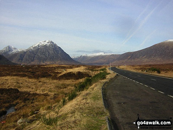
 The summit of Ben Nevis in Glen Shiel to Glenfinnan and Loch EilScotland
Photo: John Reed
Is there a Mountain, Peak, Top or Hill missing from the above google map or list?
Let us know an we will add it to our database.
To contribute to go4awalk.com or to contact us about anything at all - see Talk To Us.
For help see Help.
go4awalk.com and go4awalk.co.uk are registered trademarks of TMDH Limited.
Copyright © 2000-2026 TMDH Limited. All rights reserved.
Copyright Terms & Conditions Privacy Statement
A - Z Walks Home Log On/Accounts Photo Gallery Walk Ideas and Collections Fell Facts Hill Skills Walking Questions and Answers Your Stories News Competitions Product Reviews/Gear Tests Walking Gear Guides Peaks and Mountains Peak Bagging Find New Walking Friends Camping GPS Waypoints for Walking Contents Walk Search Talk To Us go4awalk.com Help Free Example Walks Newsletter