Scotland - a fully detailed list of all the Mountains, Peaks, Tops and Hills (Page 5 of 8)
If you count only the Corbetts there are 222 tops to climb, bag & conquer and the highest point is Beinn a' Chlaidheimh at 914m (2,999ft).
To see these Mountains, Peaks, Tops and Hills displayed in different ways - see the options in the left-hand column and towards the bottom of this page.
![]() Your Personal Bagging Record for Scotland
Your Personal Bagging Record for Scotland
LOG ON and RELOAD this page to show which Mountains, Peaks, Tops and Hills you have already climbed, bagged & conquered [. . . more details]
See this list in: Alphabetical Order
| Height Order‡
To reverse the order select the link again.
Mountain, Peak, Top or Hill:
Bagged

![]()
121. Benvane
821m (2,695ft)
Benvane is on interactive maps:
A downloadable go4awalk.com PDF Peak Bagging Map featuring Benvane will be available soon. |
![]()
122. Geal Charn (Eastern Cairngorms)
821m (2,695ft)
Send it in and we'll publish it here.
Geal Charn (Eastern Cairngorms) is on interactive maps:
A downloadable go4awalk.com PDF Peak Bagging Map featuring Geal Charn (Eastern Cairngorms) will be available soon. |
![]()
123. White Coomb
821m (2,695ft)
White Coomb is on interactive maps:
A downloadable go4awalk.com PDF Peak Bagging Map featuring White Coomb will be available soon. |
![]()
124. Beinn Dearg Bheag
820m (2,691ft)
Beinn Dearg Bheag is on interactive maps:
A downloadable go4awalk.com PDF Peak Bagging Map featuring Beinn Dearg Bheag will be available soon. |
![]()
125. Carn na Drochaide
818m (2,685ft)
Carn na Drochaide is on interactive maps:
A downloadable go4awalk.com PDF Peak Bagging Map featuring Carn na Drochaide will be available soon. |
![]()
126. Sgorr na Diollaid
818m (2,685ft)
Sgorr na Diollaid is on interactive maps:
A downloadable go4awalk.com PDF Peak Bagging Map featuring Sgorr na Diollaid will be available soon. |
![]()
127. Beinn Chaorach (Strath Fillan)
818m (2,684ft)
Send it in and we'll publish it here.
Beinn Chaorach (Strath Fillan) is on interactive maps:
A downloadable go4awalk.com PDF Peak Bagging Map featuring Beinn Chaorach (Strath Fillan) will be available soon. |
![]()
128. Carn a' Chuilinn
817m (2,681ft)
Carn a' Chuilinn is on interactive maps:
A downloadable go4awalk.com PDF Peak Bagging Map featuring Carn a' Chuilinn will be available soon. |
![]()
129. Carn Dearg (Braeroy Forest)
817m (2,681ft)
Send it in and we'll publish it here.
Carn Dearg (Braeroy Forest) is on interactive maps:
A downloadable go4awalk.com PDF Peak Bagging Map featuring Carn Dearg (Braeroy Forest) will be available soon. |
![]()
130. Stob Coire Creagach (Binnein an Fhidhleir)
817m (2,681ft)
Send it in and we'll publish it here.
Stob Coire Creagach (Binnein an Fhidhleir) is on interactive maps:
A downloadable go4awalk.com PDF Peak Bagging Map featuring Stob Coire Creagach (Binnein an Fhidhleir) will be available soon. |
![]()
131. Breabag
815m (2,675ft)
Breabag is on interactive maps:
A downloadable go4awalk.com PDF Peak Bagging Map featuring Breabag will be available soon. |
![]()
132. An Sidhean
814m (2,672ft)
An Sidhean is on interactive maps:
A downloadable go4awalk.com PDF Peak Bagging Map featuring An Sidhean will be available soon. |
![]()
133. An Stac (Rhos-Beinn)
814m (2,672ft)
An Stac (Rhos-Beinn) is on interactive maps:
A downloadable go4awalk.com PDF Peak Bagging Map featuring An Stac (Rhos-Beinn) will be available soon. |
![]()
134. Corserine
814m (2,672ft)
Corserine is on interactive maps:
A downloadable go4awalk.com PDF Peak Bagging Map featuring Corserine will be available soon. |
![]()
135. Beinn Each
813m (2,668ft)
Beinn Each is on interactive maps:
A downloadable go4awalk.com PDF Peak Bagging Map featuring Beinn Each will be available soon. |
![]()
136. Sgor Mor (Forest of Mar)
813m (2,668ft)
Sgor Mor (Forest of Mar) is on interactive maps:
A downloadable go4awalk.com PDF Peak Bagging Map featuring Sgor Mor (Forest of Mar) will be available soon. |
![]()
137. Askival
812m (2,665ft)
Askival is on interactive maps:
A downloadable go4awalk.com PDF Peak Bagging Map featuring Askival will be available soon. |
![]()
138. Carn na Saobhaidhe
811m (2,662ft)
Carn na Saobhaidhe is on interactive maps:
A downloadable go4awalk.com PDF Peak Bagging Map featuring Carn na Saobhaidhe will be available soon. |
![]()
139. Creach Bheinn (Dunaneach)
810m (2,658ft)
Send it in and we'll publish it here.
Creach Bheinn (Dunaneach) is on interactive maps:
A downloadable go4awalk.com PDF Peak Bagging Map featuring Creach Bheinn (Dunaneach) will be available soon. |
![]()
140. Meall a' Bhuachaille
810m (2,658ft)
Meall a' Bhuachaille is on interactive maps:
A downloadable go4awalk.com PDF Peak Bagging Map featuring Meall a' Bhuachaille will be available soon. |
![]()
141. Creag Mac Ranaich
809m (2,655ft)
Creag Mac Ranaich is on interactive maps:
A downloadable go4awalk.com PDF Peak Bagging Map featuring Creag Mac Ranaich will be available soon. |
![]()
142. Meall na Fearna
809m (2,655ft)
Meall na Fearna is on interactive maps:
A downloadable go4awalk.com PDF Peak Bagging Map featuring Meall na Fearna will be available soon. |
![]()
143. Sail Gharbh (Quinag)
809m (2,654ft)
Send it in and we'll publish it here.
Sail Gharbh (Quinag) is on interactive maps:
A downloadable go4awalk.com PDF Peak Bagging Map featuring Sail Gharbh (Quinag) will be available soon. |
![]()
144. Sgurr Innse
809m (2,654ft)
Sgurr Innse is on interactive maps:
A downloadable go4awalk.com PDF Peak Bagging Map featuring Sgurr Innse will be available soon. |
![]()
145. Garbh-bheinn (Skye)
808m (2,652ft)
Garbh-bheinn (Skye) is on interactive maps:
A downloadable go4awalk.com PDF Peak Bagging Map featuring Garbh-bheinn (Skye) will be available soon. |
![]()
146. Hart Fell (Moffat)
808m (2,652ft)
Hart Fell (Moffat) is on interactive maps:
A downloadable go4awalk.com PDF Peak Bagging Map featuring Hart Fell (Moffat) will be available soon. |
![]()
147. Creag Rainich
807m (2,649ft)
Creag Rainich is on interactive maps:
A downloadable go4awalk.com PDF Peak Bagging Map featuring Creag Rainich will be available soon. |
![]()
148. Monamenach
807m (2,649ft)
Monamenach is on interactive maps:
A downloadable go4awalk.com PDF Peak Bagging Map featuring Monamenach will be available soon. |
![]()
149. Beinn nam Fuaran
806m (2,645ft)
Beinn nam Fuaran is on interactive maps:
A downloadable go4awalk.com PDF Peak Bagging Map featuring Beinn nam Fuaran will be available soon. |
![]()
150. Ben Gulabin
806m (2,645ft)
Ben Gulabin is on interactive maps:
A downloadable go4awalk.com PDF Peak Bagging Map featuring Ben Gulabin will be available soon. |
View these 222 Mountains, Peaks, Tops and Hills:
- On an Interactive Google Map with a list of tops below it.
(makes it easier to locate a particular top) - On a Detailed List in:
Alphabetical Order | Height Order - On one page with 'yet-to-be-bagged' listed 1st
& then 'already-bagged' tops listed 2nd in:
Alphabetical Order | Height Order - On one page with 'already-bagged' tops listed 1st
& then 'yet-to-be-bagged' tops listed 2nd in:
Alphabetical Order | Height Order
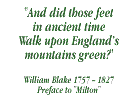
 The summit of Ben Nevis in The West Mounth - Blair Atholl to Braemar and BlairgowrieScotland
Photo: John Reed
Is there a Mountain, Peak, Top or Hill missing from the above google map or list?
Let us know an we will add it to our database.

To contribute to go4awalk.com or to contact us about anything at all - see Talk To Us.
For help see Help.
go4awalk.com and go4awalk.co.uk are registered trademarks of TMDH Limited.
Copyright © 2000-2026 TMDH Limited. All rights reserved.
Copyright Terms & Conditions Privacy Statement
A - Z Walks Home Log On/Accounts Photo Gallery Walk Ideas and Collections Fell Facts Hill Skills Walking Questions and Answers Your Stories News Competitions Product Reviews/Gear Tests Walking Gear Guides Peaks and Mountains Peak Bagging Find New Walking Friends Camping GPS Waypoints for Walking Contents Walk Search Talk To Us go4awalk.com Help Free Example Walks Newsletter