The Mountains, Peaks, Tops and Hills in Scotland as a detailed list

If you count only the Corbetts there are 222 tops to climb, bag & conquer and the highest point is Beinn a' Chlaidheimh at 914m (2,999ft).


munro
282/0
Munros
corbett
222/0
Corbetts
graham
219/0
Grahams
donald
89/0
Donalds
murdo
442/0
Murdos
marilyn
1218/0
Scottish
Marilyns
Bridget
159/0
Scottish
Bridgets
Trig Point
659/0
Trig
Points


To see all Mountains, Peaks, Tops and Hills displayed in different ways - see the options in the left-hand column and towards the bottom of this page.


LOG ON and RELOAD this page to show which Mountains, Peaks, Tops and Hills you have already climbed, bagged & conquered [. . . more]


Page 3 of 8    Go to page: 1 2 3 4 5 6 7 8


See this list in: Alphabetical Order | Height Order
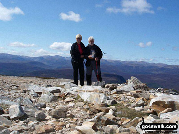
To reverse the order select the link again.


Mountain, Peak, Top or Hill:

Bagged


61. Morven (Cairngorms)

871m (2,859ft)


Got a good photo of
Morven (Cairngorms)?

Send it in and we'll publish it here.

Photo
Submission
Details

  • Corbett (61st)
  • Marilyn (264th in Scotland, 282nd in GB)
  • OS Trig Point

  • We hope to have walks that climb & bag Morven (Cairngorms) very soon

    Google Maps Icon
    See the location of Morven (Cairngorms) and walks up it on a google Map

    Morven (Cairngorms) is on interactive maps:

  • OS Explorer (Orange Covers): OL58
  • OS Landranger (Pink Covers): 37

  • A go4awalk.com Peak Bagging Map and Hill Tick List featuring Morven (Cairngorms) will be available soon.


    62. Sgorr nan Lochan Uaine

    871m (2,859ft)


    Got a good photo of
    Sgorr nan Lochan Uaine?

    Send it in and we'll publish it here.

    Photo
    Submission
    Details

  • Corbett (62nd)
  • Marilyn (265th in Scotland, 283rd in GB)

  • We hope to have walks that climb & bag Sgorr nan Lochan Uaine very soon

    Google Maps Icon
    See the location of Sgorr nan Lochan Uaine and walks up it on a google Map

    Sgorr nan Lochan Uaine is on interactive maps:

  • OS Explorer (Orange Covers): 429
  • OS Landranger (Pink Covers): 25

  • A go4awalk.com Peak Bagging Map and Hill Tick List featuring Sgorr nan Lochan Uaine will be available soon.


    63. Stob a' Choin

    869m (2,852ft)

  • Corbett (63rd)
  • Marilyn (266th in Scotland, 284th in GB)

  • We hope to have walks that climb & bag Stob a' Choin very soon

    Google Maps Icon
    See the location of Stob a' Choin and walks up it on a google Map

    Stob a' Choin is on interactive maps:

  • OS Explorer (Orange Covers): OL46
  • OS Landranger (Pink Covers): 56

  • A go4awalk.com Peak Bagging Map and Hill Tick List featuring Stob a' Choin will be available soon.


    64. Faochaig

    868m (2,849ft)


    Got a good photo of
    Faochaig?

    Send it in and we'll publish it here.

    Photo
    Submission
    Details

  • Corbett (64th)
  • Marilyn (267th in Scotland, 286th in GB)

  • We hope to have walks that climb & bag Faochaig very soon

    Google Maps Icon
    See the location of Faochaig and walks up it on a google Map

    Faochaig is on interactive maps:

  • OS Explorer (Orange Covers): 414 and 429
  • OS Landranger (Pink Covers): 25

  • A go4awalk.com Peak Bagging Map and Hill Tick List featuring Faochaig will be available soon.


    65. Meall na Meoig (Beinn Pharlagain)

    868m (2,849ft)


    Got a good photo of
    Meall na Meoig (Beinn Pharlagain)?

    Send it in and we'll publish it here.

    Photo
    Submission
    Details

  • Corbett (65th)
  • Marilyn (268th in Scotland, 287th in GB)

  • We hope to have walks that climb & bag Meall na Meoig (Beinn Pharlagain) very soon

    Google Maps Icon
    See the location of Meall na Meoig (Beinn Pharlagain) and walks up it on a google Map

    Meall na Meoig (Beinn Pharlagain) is on interactive maps:

  • OS Explorer (Orange Covers): 385
  • OS Landranger (Pink Covers): 42

  • A go4awalk.com Peak Bagging Map and Hill Tick List featuring Meall na Meoig (Beinn Pharlagain) will be available soon.


    66. Bidein a' Chabair

    867m (2,845ft)


    Got a good photo of
    Bidein a' Chabair?

    Send it in and we'll publish it here.

    Photo
    Submission
    Details

  • Corbett (67th)
  • Marilyn (269th in Scotland, 288th in GB)

  • We hope to have walks that climb & bag Bidein a' Chabair very soon

    Google Maps Icon
    See the location of Bidein a' Chabair and walks up it on a google Map

    Bidein a' Chabair is on interactive maps:

  • OS Explorer (Orange Covers): 398
  • OS Landranger (Pink Covers): 33 and 40

  • A go4awalk.com Peak Bagging Map and Hill Tick List featuring Bidein a' Chabair will be available soon.


    67. Garbh Bheinn (Loch Leven)

    867m (2,845ft)


    Got a good photo of
    Garbh Bheinn (Loch Leven)?

    Send it in and we'll publish it here.

    Photo
    Submission
    Details

  • Corbett (66th)
  • Marilyn (270th in Scotland, 289th in GB)

  • We hope to have walks that climb & bag Garbh Bheinn (Loch Leven) very soon

    Google Maps Icon
    See the location of Garbh Bheinn (Loch Leven) and walks up it on a google Map

    Garbh Bheinn (Loch Leven) is on interactive maps:

  • OS Explorer (Orange Covers): 384
  • OS Landranger (Pink Covers): 41

  • A go4awalk.com Peak Bagging Map and Hill Tick List featuring Garbh Bheinn (Loch Leven) will be available soon.


    68. Carn a' Choire Ghairbh

    865m (2,839ft)


    Got a good photo of
    Carn a' Choire Ghairbh?

    Send it in and we'll publish it here.

    Photo
    Submission
    Details

  • Corbett (69th)
  • Marilyn (271st in Scotland, 290th in GB)

  • We hope to have walks that climb & bag Carn a' Choire Ghairbh very soon

    Google Maps Icon
    See the location of Carn a' Choire Ghairbh and walks up it on a google Map

    Carn a' Choire Ghairbh is on interactive maps:

  • OS Explorer (Orange Covers): 414
  • OS Landranger (Pink Covers): 34

  • A go4awalk.com Peak Bagging Map and Hill Tick List featuring Carn a' Choire Ghairbh will be available soon.


    69. Conachcraig

    865m (2,839ft)


    Got a good photo of
    Conachcraig?

    Send it in and we'll publish it here.

    Photo
    Submission
    Details

  • Corbett (68th)
  • Marilyn (272nd in Scotland, 291st in GB)

  • We hope to have walks that climb & bag Conachcraig very soon

    Google Maps Icon
    See the location of Conachcraig and walks up it on a google Map

    Conachcraig is on interactive maps:

  • OS Explorer (Orange Covers): OL53
  • OS Landranger (Pink Covers): 44

  • A go4awalk.com Peak Bagging Map and Hill Tick List featuring Conachcraig will be available soon.


    70. Beinn Mhic Chasgaig

    864m (2,836ft)


    Got a good photo of
    Beinn Mhic Chasgaig?

    Send it in and we'll publish it here.

    Photo
    Submission
    Details

  • Corbett (70th)
  • Marilyn (273rd in Scotland, 292nd in GB)

  • We hope to have walks that climb & bag Beinn Mhic Chasgaig very soon

    Google Maps Icon
    See the location of Beinn Mhic Chasgaig and walks up it on a google Map

    Beinn Mhic Chasgaig is on interactive maps:

  • OS Explorer (Orange Covers): 384
  • OS Landranger (Pink Covers): 41

  • A go4awalk.com Peak Bagging Map and Hill Tick List featuring Beinn Mhic Chasgaig will be available soon.


    71. Beinn Tharsuinn (West Monar Forest)

    863m (2,832ft)


    Got a good photo of
    Beinn Tharsuinn (West Monar Forest)?

    Send it in and we'll publish it here.

    Photo
    Submission
    Details

  • Corbett (71st)
  • Marilyn (274th in Scotland, 293rd in GB)

  • We hope to have walks that climb & bag Beinn Tharsuinn (West Monar Forest) very soon

    Google Maps Icon
    See the location of Beinn Tharsuinn (West Monar Forest) and walks up it on a google Map

    Beinn Tharsuinn (West Monar Forest) is on interactive maps:

  • OS Explorer (Orange Covers): 429
  • OS Landranger (Pink Covers): 25

  • A go4awalk.com Peak Bagging Map and Hill Tick List featuring Beinn Tharsuinn (West Monar Forest) will be available soon.


    72. Creag an Dail Bheag (Cairngorms)

    863m (2,831ft)


    Got a good photo of
    Creag an Dail Bheag (Cairngorms)?

    Send it in and we'll publish it here.

    Photo
    Submission
    Details

  • Corbett (72nd)
  • Marilyn (275th in Scotland, 294th in GB)

  • We hope to have walks that climb & bag Creag an Dail Bheag (Cairngorms) very soon

    Google Maps Icon
    See the location of Creag an Dail Bheag (Cairngorms) and walks up it on a google Map

    Creag an Dail Bheag (Cairngorms) is on interactive maps:

  • OS Explorer (Orange Covers): OL58
  • OS Landranger (Pink Covers): 36 and 43

  • A go4awalk.com Peak Bagging Map and Hill Tick List featuring Creag an Dail Bheag (Cairngorms) will be available soon.


    73. Beinn a' Bha' ach Ard

    862m (2,829ft)


    Got a good photo of
    Beinn a' Bha' ach Ard?

    Send it in and we'll publish it here.

    Photo
    Submission
    Details

  • Corbett (74th)
  • Marilyn (276th in Scotland, 295th in GB)
  • OS Trig Point

  • We hope to have walks that climb & bag Beinn a' Bha' ach Ard very soon

    Google Maps Icon
    See the location of Beinn a' Bha' ach Ard and walks up it on a google Map

    Beinn a' Bha' ach Ard is on interactive maps:

  • OS Explorer (Orange Covers): 431
  • OS Landranger (Pink Covers): 26

  • A go4awalk.com Peak Bagging Map and Hill Tick List featuring Beinn a' Bha' ach Ard will be available soon.


    74. Cam Chreag (Glen Lyon)

    862m (2,829ft)


    Got a good photo of
    Cam Chreag (Glen Lyon)?

    Send it in and we'll publish it here.

    Photo
    Submission
    Details

  • Corbett (75th)
  • Marilyn (277th in Scotland, 296th in GB)

  • We hope to have walks that climb & bag Cam Chreag (Glen Lyon) very soon

    Google Maps Icon
    See the location of Cam Chreag (Glen Lyon) and walks up it on a google Map

    Cam Chreag (Glen Lyon) is on interactive maps:

  • OS Explorer (Orange Covers): OL48
  • OS Landranger (Pink Covers): 51

  • A go4awalk.com Peak Bagging Map and Hill Tick List featuring Cam Chreag (Glen Lyon) will be available soon.


    75. Meall na h-Aisre

    862m (2,829ft)


    Got a good photo of
    Meall na h-Aisre?

    Send it in and we'll publish it here.

    Photo
    Submission
    Details

  • Corbett (76th)
  • Marilyn (278th in Scotland, 297th in GB)
  • OS Trig Point

  • We hope to have walks that climb & bag Meall na h-Aisre very soon

    Google Maps Icon
    See the location of Meall na h-Aisre and walks up it on a google Map

    Meall na h-Aisre is on interactive maps:

  • OS Explorer (Orange Covers): OL55
  • OS Landranger (Pink Covers): 35

  • A go4awalk.com Peak Bagging Map and Hill Tick List featuring Meall na h-Aisre will be available soon.


    76. Sgurr na Feartaig

    862m (2,829ft)


    Got a good photo of
    Sgurr na Feartaig?

    Send it in and we'll publish it here.

    Photo
    Submission
    Details

  • Corbett (73rd)
  • Marilyn (279th in Scotland, 298th in GB)

  • We hope to have walks that climb & bag Sgurr na Feartaig very soon

    Google Maps Icon
    See the location of Sgurr na Feartaig and walks up it on a google Map

    Sgurr na Feartaig is on interactive maps:

  • OS Explorer (Orange Covers): 429
  • OS Landranger (Pink Covers): 25

  • A go4awalk.com Peak Bagging Map and Hill Tick List featuring Sgurr na Feartaig will be available soon.


    77. Beinn Luibhean

    890m (2,821ft)


    Got a good photo of
    Beinn Luibhean?

    Send it in and we'll publish it here.

    Photo
    Submission
    Details

  • Corbett (77th)
  • Marilyn (280th in Scotland, 299th in GB)

  • We hope to have walks that climb & bag Beinn Luibhean very soon

    Google Maps Icon
    See the location of Beinn Luibhean and walks up it on a google Map

    Beinn Luibhean is on interactive maps:

  • OS Explorer (Orange Covers): OL39
  • OS Landranger (Pink Covers): 56

  • A go4awalk.com Peak Bagging Map and Hill Tick List featuring Beinn Luibhean will be available soon.


    78. Beinn Lair

    859m (2,819ft)


    Got a good photo of
    Beinn Lair?

    Send it in and we'll publish it here.

    Photo
    Submission
    Details

  • Corbett (78th)
  • Marilyn (281st in Scotland, 300th in GB)

  • We hope to have walks that climb & bag Beinn Lair very soon

    Google Maps Icon
    See the location of Beinn Lair and walks up it on a google Map

    Beinn Lair is on interactive maps:

  • OS Explorer (Orange Covers): 433
  • OS Landranger (Pink Covers): 19

  • A go4awalk.com Peak Bagging Map and Hill Tick List featuring Beinn Lair will be available soon.


    79. Caisteal Abhail

    859m (2,819ft)

  • Corbett (80th)
  • Marilyn (282nd in Scotland, 301st in GB)
  • OS Trig Point

  • We hope to have walks that climb & bag Caisteal Abhail very soon

    Google Maps Icon
    See the location of Caisteal Abhail and walks up it on a google Map

    Caisteal Abhail is on interactive maps:

  • OS Explorer (Orange Covers): 361
  • OS Landranger (Pink Covers): 62 and 69

  • A go4awalk.com Peak Bagging Map and Hill Tick List featuring Caisteal Abhail will be available soon.


    80. Morrone (or Morven)

    859m (2,819ft)

  • Corbett (79th)
  • Marilyn (283rd in Scotland, 302nd in GB)
  • OS Trig Point

  • We hope to have walks that climb & bag Morrone (or Morven) very soon

    Google Maps Icon
    See the location of Morrone (or Morven) and walks up it on a google Map

    Morrone (or Morven) is on interactive maps:

  • OS Explorer (Orange Covers): OL58
  • OS Landranger (Pink Covers): 43

  • A go4awalk.com Peak Bagging Map and Hill Tick List featuring Morrone (or Morven) will be available soon.


    81. Fraoch Bheinn

    858m (2,816ft)


    Got a good photo of
    Fraoch Bheinn?

    Send it in and we'll publish it here.

    Photo
    Submission
    Details

  • Corbett (81st)
  • Marilyn (284th in Scotland, 303rd in GB)

  • We hope to have walks that climb & bag Fraoch Bheinn very soon

    Google Maps Icon
    See the location of Fraoch Bheinn and walks up it on a google Map

    Fraoch Bheinn is on interactive maps:

  • OS Explorer (Orange Covers): 398 and 399
  • OS Landranger (Pink Covers): 33 and 40

  • A go4awalk.com Peak Bagging Map and Hill Tick List featuring Fraoch Bheinn will be available soon.


    82. Beinn a' Chrulaiste

    857m (2,813ft)

  • Corbett (84th)
  • Marilyn (285th in Scotland, 304th in GB)
  • OS Trig Point

  • To walk, climb & bag Beinn a' Chrulaiste use this easy to follow walk:

    Google Maps Icon
    See the location of Beinn a' Chrulaiste and walks up it on a google Map

    Beinn a' Chrulaiste is on interactive maps:

  • OS Explorer (Orange Covers): 384
  • OS Landranger (Pink Covers): 41

  • A go4awalk.com Peak Bagging Map and Hill Tick List featuring Beinn a' Chrulaiste will be available soon.


    83. Carn Dearg Mor (Glen Feshie)

    857m (2,813ft)


    Got a good photo of
    Carn Dearg Mor (Glen Feshie)?

    Send it in and we'll publish it here.

    Photo
    Submission
    Details

  • Corbett (83rd)
  • Marilyn (286th in Scotland, 305th in GB)

  • We hope to have walks that climb & bag Carn Dearg Mor (Glen Feshie) very soon

    Google Maps Icon
    See the location of Carn Dearg Mor (Glen Feshie) and walks up it on a google Map

    Carn Dearg Mor (Glen Feshie) is on interactive maps:

  • OS Explorer (Orange Covers): OL56
  • OS Landranger (Pink Covers): 35 and 43

  • A go4awalk.com Peak Bagging Map and Hill Tick List featuring Carn Dearg Mor (Glen Feshie) will be available soon.


    84. Cruach Innse

    857m (2,813ft)


    Got a good photo of
    Cruach Innse?

    Send it in and we'll publish it here.

    Photo
    Submission
    Details

  • Corbett (82nd)
  • Marilyn (287th in Scotland, 306th in GB)

  • We hope to have walks that climb & bag Cruach Innse very soon

    Google Maps Icon
    See the location of Cruach Innse and walks up it on a google Map

    Cruach Innse is on interactive maps:

  • OS Explorer (Orange Covers): 392
  • OS Landranger (Pink Covers): 41

  • A go4awalk.com Peak Bagging Map and Hill Tick List featuring Cruach Innse will be available soon.


    85. Beinn a' Chaisgein Mor

    856m (2,809ft)


    Got a good photo of
    Beinn a' Chaisgein Mor?

    Send it in and we'll publish it here.

    Photo
    Submission
    Details

  • Corbett (85th)
  • Marilyn (288th in Scotland, 307th in GB)

  • We hope to have walks that climb & bag Beinn a' Chaisgein Mor very soon

    Google Maps Icon
    See the location of Beinn a' Chaisgein Mor and walks up it on a google Map

    Beinn a' Chaisgein Mor is on interactive maps:

  • OS Explorer (Orange Covers): 435
  • OS Landranger (Pink Covers): 19

  • A go4awalk.com Peak Bagging Map and Hill Tick List featuring Beinn a' Chaisgein Mor will be available soon.


    86. Beinn an Eoin (Flowerdale Forest)

    855m (2,806ft)

  • Corbett (88th)
  • Marilyn (289th in Scotland, 308th in GB)
  • OS Trig Point

  • We hope to have walks that climb & bag Beinn an Eoin (Flowerdale Forest) very soon

    Google Maps Icon
    See the location of Beinn an Eoin (Flowerdale Forest) and walks up it on a google Map

    Beinn an Eoin (Flowerdale Forest) is on interactive maps:

  • OS Explorer (Orange Covers): 433
  • OS Landranger (Pink Covers): 19

  • A go4awalk.com Peak Bagging Map and Hill Tick List featuring Beinn an Eoin (Flowerdale Forest) will be available soon.


    87. Beinn Bhuidhe (Knoydart)

    855m (2,806ft)


    Got a good photo of
    Beinn Bhuidhe (Knoydart)?

    Send it in and we'll publish it here.

    Photo
    Submission
    Details

  • Corbett (86th)
  • Marilyn (290th in Scotland, 309th in GB)
  • OS Trig Point

  • We hope to have walks that climb & bag Beinn Bhuidhe (Knoydart) very soon

    Google Maps Icon
    See the location of Beinn Bhuidhe (Knoydart) and walks up it on a google Map

    Beinn Bhuidhe (Knoydart) is on interactive maps:

  • OS Explorer (Orange Covers): 398
  • OS Landranger (Pink Covers): 33 and 40

  • A go4awalk.com Peak Bagging Map and Hill Tick List featuring Beinn Bhuidhe (Knoydart) will be available soon.


    88. Stob an Aonaich Mhoir

    855m (2,806ft)


    Got a good photo of
    Stob an Aonaich Mhoir?

    Send it in and we'll publish it here.

    Photo
    Submission
    Details

  • Corbett (87th)
  • Marilyn (291st in Scotland, 310th in GB)

  • We hope to have walks that climb & bag Stob an Aonaich Mhoir very soon

    Google Maps Icon
    See the location of Stob an Aonaich Mhoir and walks up it on a google Map

    Stob an Aonaich Mhoir is on interactive maps:

  • OS Explorer (Orange Covers): OL50 and 385
  • OS Landranger (Pink Covers): 42

  • A go4awalk.com Peak Bagging Map and Hill Tick List featuring Stob an Aonaich Mhoir will be available soon.


    89. Creach Bheinn (Glen Tarbert)

    853m (2,800ft)


    Got a good photo of
    Creach Bheinn (Glen Tarbert)?

    Send it in and we'll publish it here.

    Photo
    Submission
    Details

  • Corbett (89th)
  • Marilyn (292nd in Scotland, 312th in GB)
  • OS Trig Point

  • We hope to have walks that climb & bag Creach Bheinn (Glen Tarbert) very soon

    Google Maps Icon
    See the location of Creach Bheinn (Glen Tarbert) and walks up it on a google Map

    Creach Bheinn (Glen Tarbert) is on interactive maps:

  • OS Explorer (Orange Covers): 376 and 383
  • OS Landranger (Pink Covers): 49

  • A go4awalk.com Peak Bagging Map and Hill Tick List featuring Creach Bheinn (Glen Tarbert) will be available soon.


    90. Meall an t-Seallaidh

    852m (2,796ft)


    Got a good photo of
    Meall an t-Seallaidh?

    Send it in and we'll publish it here.

    Photo
    Submission
    Details

  • Corbett (90th)
  • Marilyn (293rd in Scotland, 314th in GB)
  • OS Trig Point

  • We hope to have walks that climb & bag Meall an t-Seallaidh very soon

    Google Maps Icon
    See the location of Meall an t-Seallaidh and walks up it on a google Map

    Meall an t-Seallaidh is on interactive maps:

  • OS Explorer (Orange Covers): OL46
  • OS Landranger (Pink Covers): 51

  • A go4awalk.com Peak Bagging Map and Hill Tick List featuring Meall an t-Seallaidh will be available soon.


    Page 3 of 8    Go to page: 1 2 3 4 5 6 7 8


    View all 1674 Mountains, Peaks, Tops and Hills in Glen Coe Scottish Region : Loch Lomond and The Trossachs to Loch Tay:


    Is there a Mountain, Peak, Top or Hill missing from the above google map or list?

    Let us know an we will add it to our database.


    Do not miss our pick of the Best Walks in Britain


    Follow go4awalk.com on Twitter Follow go4awalk.com on Facebook


    Home


    Find new Friends to go walking with

    Walk all 214 Wainwrights in just 59 Walks. Download GPS Waypoints - Great Walks you must not miss!

    Walk The Yorkshire Three Peaks Challenge Walk - All the Latest Route Information, GPS Waypoints and Split Times to keep you on Schedule

    Walk The British Three Peaks Challenge Walk - All the Latest Route Information and GPS Waypoints

    See our pick of The Best Walks in The Lake District - Great Walks you must not miss!

    Walk our pick of the Best Lake District Ridge Walks - Great Walks you must not miss!

    Walk our pick of the Best Lake District Walks to do in the rain - Great Walks you must not miss!

    Walk our pick of The Best Walks in Snowdonia - Great Walks you must not miss!

    Walk our pick of The Best Ridge Walks in Wales - Walks you must not miss!

    Walk our pick of The Best Walks in The Brecon Beacons - Great Walks you must not miss!

    Walk our pick of The Best Walks in The Yorkshire Dales - Walks you must not miss!

    Walk our pick of The Best Walks in The Peak District - Walks you must not miss!

    Walk our pick of The Best Walks in The Forest of Bowland - Walks you must not miss!

    Walk our pick of The Best Walks in Shropshire - Walks you must not miss!

    Walk our pick of The Best Walks in Cheshire - Walks you must not miss!

    Walk our pick of The Best Walks in Lancashire - Walks you must not miss!

    Not sure where to walk next? Try Peak Bagging - Great Walks you must not miss!

    Not sure where to walk next? Walk part of a National Trail - Great Walks you must not miss!

    Walks with Downloadable and Uploadable GPS Waypoint Data

    Walking Kit and Gear Tested by Walkers

    Full Site Search