The Mountains, Peaks, Tops and Hills in Scotland as a detailed list

If you count only the Corbetts there are 222 tops to climb, bag & conquer and the highest point is Beinn a' Chlaidheimh at 914m (2,999ft).


munro
282/0
Munros
corbett
222/0
Corbetts
graham
219/0
Grahams
donald
89/0
Donalds
murdo
442/0
Murdos
marilyn
1218/0
Scottish
Marilyns
Bridget
159/0
Scottish
Bridgets
Trig Point
659/0
Trig
Points


To see all Mountains, Peaks, Tops and Hills displayed in different ways - see the options in the left-hand column and towards the bottom of this page.


LOG ON and RELOAD this page to show which Mountains, Peaks, Tops and Hills you have already climbed, bagged & conquered [. . . more]


Page 2 of 8    Go to page: 1 2 3 4 5 6 7 8


See this list in: Alphabetical Order | Height Order
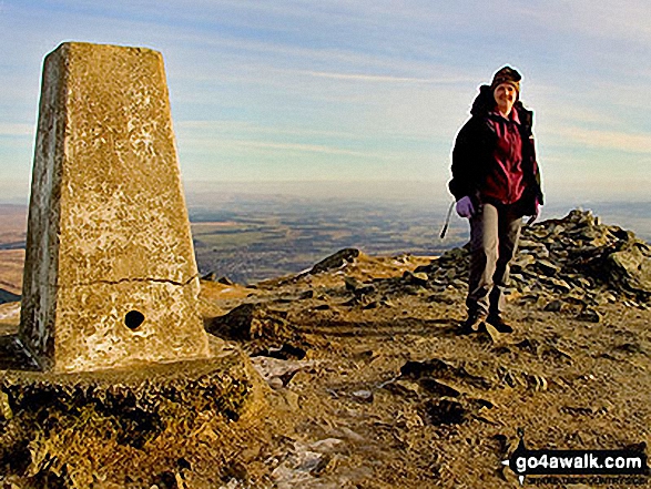
To reverse the order select the link again.


Mountain, Peak, Top or Hill:

Bagged


31. Creag Mhor (Glen Avon)

895m (2,937ft)


Got a good photo of
Creag Mhor (Glen Avon)?

Send it in and we'll publish it here.

Photo
Submission
Details

  • Corbett (31st)
  • Marilyn (234th in Scotland, 246th in GB)

  • We hope to have walks that climb & bag Creag Mhor (Glen Avon) very soon

    Google Maps Icon
    See the location of Creag Mhor (Glen Avon) and walks up it on a google Map

    Creag Mhor (Glen Avon) is on interactive maps:

  • OS Explorer (Orange Covers): OL57 and OL58
  • OS Landranger (Pink Covers): 36

  • A go4awalk.com Peak Bagging Map and Hill Tick List featuring Creag Mhor (Glen Avon) will be available soon.


    32. Beinn a' Chuallaich

    892m (2,927ft)

  • Corbett (32nd)
  • Marilyn (235th in Scotland, 250th in GB)
  • OS Trig Point

  • We hope to have walks that climb & bag Beinn a' Chuallaich very soon

    Google Maps Icon
    See the location of Beinn a' Chuallaich and walks up it on a google Map

    Beinn a' Chuallaich is on interactive maps:

  • OS Explorer (Orange Covers): OL49
  • OS Landranger (Pink Covers): 42

  • A go4awalk.com Peak Bagging Map and Hill Tick List featuring Beinn a' Chuallaich will be available soon.


    33. An Ruadh-stac

    890m (2,921ft)


    Got a good photo of
    An Ruadh-stac?

    Send it in and we'll publish it here.

    Photo
    Submission
    Details

  • Corbett (33rd)
  • Marilyn (236th in Scotland, 251st in GB)

  • We hope to have walks that climb & bag An Ruadh-stac very soon

    Google Maps Icon
    See the location of An Ruadh-stac and walks up it on a google Map

    An Ruadh-stac is on interactive maps:

  • OS Explorer (Orange Covers): 429
  • OS Landranger (Pink Covers): 25

  • A go4awalk.com Peak Bagging Map and Hill Tick List featuring An Ruadh-stac will be available soon.


    34. Beinn Enaiglair

    890m (2,921ft)


    Got a good photo of
    Beinn Enaiglair?

    Send it in and we'll publish it here.

    Photo
    Submission
    Details

  • Corbett (34th)
  • Marilyn (237th in Scotland, 252nd in GB)

  • We hope to have walks that climb & bag Beinn Enaiglair very soon

    Google Maps Icon
    See the location of Beinn Enaiglair and walks up it on a google Map

    Beinn Enaiglair is on interactive maps:

  • OS Explorer (Orange Covers): 436
  • OS Landranger (Pink Covers): 20

  • A go4awalk.com Peak Bagging Map and Hill Tick List featuring Beinn Enaiglair will be available soon.


    35. Aonach Shasuinn

    888m (2,914ft)


    Got a good photo of
    Aonach Shasuinn?

    Send it in and we'll publish it here.

    Photo
    Submission
    Details

  • Corbett (35th)
  • Marilyn (238th in Scotland, 253rd in GB)

  • We hope to have walks that climb & bag Aonach Shasuinn very soon

    Google Maps Icon
    See the location of Aonach Shasuinn and walks up it on a google Map

    Aonach Shasuinn is on interactive maps:

  • OS Explorer (Orange Covers): 415
  • OS Landranger (Pink Covers): 34

  • A go4awalk.com Peak Bagging Map and Hill Tick List featuring Aonach Shasuinn will be available soon.


    36. Creagan na Beinne

    888m (2,914ft)

  • Corbett (36th)
  • Marilyn (239th in Scotland, 254th in GB)

  • We hope to have walks that climb & bag Creagan na Beinne very soon

    Google Maps Icon
    See the location of Creagan na Beinne and walks up it on a google Map

    Creagan na Beinne is on interactive maps:

  • OS Explorer (Orange Covers): OL48
  • OS Landranger (Pink Covers): 51 and 52

  • A go4awalk.com Peak Bagging Map and Hill Tick List featuring Creagan na Beinne will be available soon.


    37. Sgurr Dhomhnuill

    888m (2,914ft)

  • Corbett (37th)
  • Marilyn (240th in Scotland, 255th in GB)
  • OS Trig Point

  • We hope to have walks that climb & bag Sgurr Dhomhnuill very soon

    Google Maps Icon
    See the location of Sgurr Dhomhnuill and walks up it on a google Map

    Sgurr Dhomhnuill is on interactive maps:

  • OS Explorer (Orange Covers): 391
  • OS Landranger (Pink Covers): 40

  • A go4awalk.com Peak Bagging Map and Hill Tick List featuring Sgurr Dhomhnuill will be available soon.


    38. Ben Aden

    887m (2,911ft)


    Got a good photo of
    Ben Aden?

    Send it in and we'll publish it here.

    Photo
    Submission
    Details

  • Corbett (38th)
  • Marilyn (241st in Scotland, 256th in GB)

  • We hope to have walks that climb & bag Ben Aden very soon

    Google Maps Icon
    See the location of Ben Aden and walks up it on a google Map

    Ben Aden is on interactive maps:

  • OS Explorer (Orange Covers): 413 and 398
  • OS Landranger (Pink Covers): 33 and 40

  • A go4awalk.com Peak Bagging Map and Hill Tick List featuring Ben Aden will be available soon.


    39. Meall a' Ghiubhais

    887m (2,911ft)


    Got a good photo of
    Meall a' Ghiubhais?

    Send it in and we'll publish it here.

    Photo
    Submission
    Details

  • Corbett (39th)
  • Marilyn (242nd in Scotland, 257th in GB)

  • We hope to have walks that climb & bag Meall a' Ghiubhais very soon

    Google Maps Icon
    See the location of Meall a' Ghiubhais and walks up it on a google Map

    Meall a' Ghiubhais is on interactive maps:

  • OS Explorer (Orange Covers): 433
  • OS Landranger (Pink Covers): 19

  • A go4awalk.com Peak Bagging Map and Hill Tick List featuring Meall a' Ghiubhais will be available soon.


    40. Beinn a' Chaisteil (Loch Lyon)

    886m (2,908ft)


    Got a good photo of
    Beinn a' Chaisteil (Loch Lyon)?

    Send it in and we'll publish it here.

    Photo
    Submission
    Details

  • Corbett (40th)
  • Marilyn (243rd in Scotland, 258th in GB)

  • We hope to have walks that climb & bag Beinn a' Chaisteil (Loch Lyon) very soon

    Google Maps Icon
    See the location of Beinn a' Chaisteil (Loch Lyon) and walks up it on a google Map

    Beinn a' Chaisteil (Loch Lyon) is on interactive maps:

  • OS Explorer (Orange Covers): 377
  • OS Landranger (Pink Covers): 50

  • A go4awalk.com Peak Bagging Map and Hill Tick List featuring Beinn a' Chaisteil (Loch Lyon) will be available soon.


    41. Buidhe Bheinn

    885m (2,905ft)


    Got a good photo of
    Buidhe Bheinn?

    Send it in and we'll publish it here.

    Photo
    Submission
    Details

  • Corbett (41st)
  • Marilyn (244th in Scotland, 260th in GB)
  • Until recently Buidhe Bheinn was thought to have an identical height to its neighbour Sgurr a' Bhac Chaolais. With only 400ft or so of reascent separating the two they were classified as twin Corbetts (meaning you had to climb both to get one tick!). In 2012 they were surveyed in more detail and it was determined that at 885.50m (2096.2ft) Buidhe Bheinn was the higher peak and therefore the Corbett. Sgurr a' Bhac Chaolais at 885.21m (2095.2ft) is now unclassified - but still a mighty fine mountain to climb.


    We hope to have walks that climb & bag Buidhe Bheinn very soon

    Google Maps Icon
    See the location of Buidhe Bheinn and walks up it on a google Map

    Buidhe Bheinn is on interactive maps:

  • OS Explorer (Orange Covers): 414
  • OS Landranger (Pink Covers): 33

  • A go4awalk.com Peak Bagging Map and Hill Tick List featuring Buidhe Bheinn will be available soon.


    42. Garbh Bheinn (Glen Tarbert)

    885m (2,904ft)


    Got a good photo of
    Garbh Bheinn (Glen Tarbert)?

    Send it in and we'll publish it here.

    Photo
    Submission
    Details

  • Corbett (42nd)
  • Marilyn (245th in Scotland, 261st in GB)

  • We hope to have walks that climb & bag Garbh Bheinn (Glen Tarbert) very soon

    Google Maps Icon
    See the location of Garbh Bheinn (Glen Tarbert) and walks up it on a google Map

    Garbh Bheinn (Glen Tarbert) is on interactive maps:

  • OS Explorer (Orange Covers): 391
  • OS Landranger (Pink Covers): 40

  • A go4awalk.com Peak Bagging Map and Hill Tick List featuring Garbh Bheinn (Glen Tarbert) will be available soon.


    43. Cam Chreag (Glen Lochay)

    884m (2,901ft)


    Got a good photo of
    Cam Chreag (Glen Lochay)?

    Send it in and we'll publish it here.

    Photo
    Submission
    Details

  • Corbett (43rd)
  • Marilyn (246th in Scotland, 262nd in GB)

  • We hope to have walks that climb & bag Cam Chreag (Glen Lochay) very soon

    Google Maps Icon
    See the location of Cam Chreag (Glen Lochay) and walks up it on a google Map

    Cam Chreag (Glen Lochay) is on interactive maps:

  • OS Explorer (Orange Covers): 377
  • OS Landranger (Pink Covers): 50

  • A go4awalk.com Peak Bagging Map and Hill Tick List featuring Cam Chreag (Glen Lochay) will be available soon.


    44. The Cobbler (Ben Arthur)

    884m (2,901ft)

  • Corbett (44th)
  • Marilyn (247th in Scotland, 263rd in GB)

  • To walk, climb & bag The Cobbler (Ben Arthur) use this easy to follow walk:

    Google Maps Icon
    See the location of The Cobbler (Ben Arthur) and walks up it on a google Map

    The Cobbler (Ben Arthur) is on interactive maps:

  • OS Explorer (Orange Covers): OL39
  • OS Landranger (Pink Covers): 56

  • A go4awalk.com Peak Bagging Map and Hill Tick List featuring The Cobbler (Ben Arthur) will be available soon.


    45. Stob Dubh (Glen Etive)

    883m (2,898ft)

  • Corbett (45th)
  • Marilyn (248th in Scotland, 264th in GB)

  • We hope to have walks that climb & bag Stob Dubh (Glen Etive) very soon

    Google Maps Icon
    See the location of Stob Dubh (Glen Etive) and walks up it on a google Map

    Stob Dubh (Glen Etive) is on interactive maps:

  • OS Explorer (Orange Covers): 384
  • OS Landranger (Pink Covers): 50

  • A go4awalk.com Peak Bagging Map and Hill Tick List featuring Stob Dubh (Glen Etive) will be available soon.


    46. Beinn Odhar Bheag

    882m (2,894ft)


    Got a good photo of
    Beinn Odhar Bheag?

    Send it in and we'll publish it here.

    Photo
    Submission
    Details

  • Corbett (47th)
  • Marilyn (249th in Scotland, 265th in GB)

  • We hope to have walks that climb & bag Beinn Odhar Bheag very soon

    Google Maps Icon
    See the location of Beinn Odhar Bheag and walks up it on a google Map

    Beinn Odhar Bheag is on interactive maps:

  • OS Explorer (Orange Covers): 391
  • OS Landranger (Pink Covers): 40

  • A go4awalk.com Peak Bagging Map and Hill Tick List featuring Beinn Odhar Bheag will be available soon.


    47. Rois-Bheinn

    882m (2,894ft)


    Got a good photo of
    Rois-Bheinn?

    Send it in and we'll publish it here.

    Photo
    Submission
    Details

  • Corbett (46th)
  • Marilyn (250th in Scotland, 266th in GB)
  • OS Trig Point

  • We hope to have walks that climb & bag Rois-Bheinn very soon

    Google Maps Icon
    See the location of Rois-Bheinn and walks up it on a google Map

    Rois-Bheinn is on interactive maps:

  • OS Explorer (Orange Covers): 390
  • OS Landranger (Pink Covers): 40

  • A go4awalk.com Peak Bagging Map and Hill Tick List featuring Rois-Bheinn will be available soon.


    48. Beinn Chuirn

    880m (2,888ft)


    Got a good photo of
    Beinn Chuirn?

    Send it in and we'll publish it here.

    Photo
    Submission
    Details

  • Corbett (48th)
  • Marilyn (251st in Scotland, 267th in GB)

  • We hope to have walks that climb & bag Beinn Chuirn very soon

    Google Maps Icon
    See the location of Beinn Chuirn and walks up it on a google Map

    Beinn Chuirn is on interactive maps:

  • OS Explorer (Orange Covers): OL39 and 377
  • OS Landranger (Pink Covers): 50

  • A go4awalk.com Peak Bagging Map and Hill Tick List featuring Beinn Chuirn will be available soon.


    49. Sgurr Mhurlagain

    880m (2,888ft)


    Got a good photo of
    Sgurr Mhurlagain?

    Send it in and we'll publish it here.

    Photo
    Submission
    Details

  • Corbett (49th)
  • Marilyn (252nd in Scotland, 268th in GB)

  • We hope to have walks that climb & bag Sgurr Mhurlagain very soon

    Google Maps Icon
    See the location of Sgurr Mhurlagain and walks up it on a google Map

    Sgurr Mhurlagain is on interactive maps:

  • OS Explorer (Orange Covers): 399
  • OS Landranger (Pink Covers): 33

  • A go4awalk.com Peak Bagging Map and Hill Tick List featuring Sgurr Mhurlagain will be available soon.


    50. Fraochaidh

    879m (2,885ft)


    Got a good photo of
    Fraochaidh?

    Send it in and we'll publish it here.

    Photo
    Submission
    Details

  • Corbett (51st)
  • Marilyn (253rd in Scotland, 269th in GB)

  • We hope to have walks that climb & bag Fraochaidh very soon

    Google Maps Icon
    See the location of Fraochaidh and walks up it on a google Map

    Fraochaidh is on interactive maps:

  • OS Explorer (Orange Covers): 384
  • OS Landranger (Pink Covers): 41

  • A go4awalk.com Peak Bagging Map and Hill Tick List featuring Fraochaidh will be available soon.


    51. Sguman Coinntich

    879m (2,885ft)


    Got a good photo of
    Sguman Coinntich?

    Send it in and we'll publish it here.

    Photo
    Submission
    Details

  • Corbett (50th)
  • Marilyn (254th in Scotland, 270th in GB)
  • OS Trig Point

  • We hope to have walks that climb & bag Sguman Coinntich very soon

    Google Maps Icon
    See the location of Sguman Coinntich and walks up it on a google Map

    Sguman Coinntich is on interactive maps:

  • OS Explorer (Orange Covers): 414 and 429
  • OS Landranger (Pink Covers): 25

  • A go4awalk.com Peak Bagging Map and Hill Tick List featuring Sguman Coinntich will be available soon.


    52. Ben Ledi

    879m (2,884ft)

  • Corbett (53rd)
  • Marilyn (255th in Scotland, 271st in GB)
  • OS Trig Point

  • To walk, climb & bag Ben Ledi use this easy to follow walk:

    Google Maps Icon
    See the location of Ben Ledi and walks up it on a google Map

    Ben Ledi is on interactive maps:

  • OS Explorer (Orange Covers): OL46
  • OS Landranger (Pink Covers): 57

  • A go4awalk.com Peak Bagging Map and Hill Tick List featuring Ben Ledi will be available soon.


    53. Creag Uchdag

    879m (2,884ft)


    Got a good photo of
    Creag Uchdag?

    Send it in and we'll publish it here.

    Photo
    Submission
    Details

  • Corbett (54th)
  • Marilyn (256th in Scotland, 272nd in GB)
  • OS Trig Point

  • We hope to have walks that climb & bag Creag Uchdag very soon

    Google Maps Icon
    See the location of Creag Uchdag and walks up it on a google Map

    Creag Uchdag is on interactive maps:

  • OS Explorer (Orange Covers): OL48
  • OS Landranger (Pink Covers): 51 and 52

  • A go4awalk.com Peak Bagging Map and Hill Tick List featuring Creag Uchdag will be available soon.


    54. Sgurr a' Mhuilinn

    879m (2,884ft)


    Got a good photo of
    Sgurr a' Mhuilinn?

    Send it in and we'll publish it here.

    Photo
    Submission
    Details

  • Corbett (52nd)
  • Marilyn (257th in Scotland, 273rd in GB)
  • OS Trig Point

  • We hope to have walks that climb & bag Sgurr a' Mhuilinn very soon

    Google Maps Icon
    See the location of Sgurr a' Mhuilinn and walks up it on a google Map

    Sgurr a' Mhuilinn is on interactive maps:

  • OS Explorer (Orange Covers): 430
  • OS Landranger (Pink Covers): 25

  • A go4awalk.com Peak Bagging Map and Hill Tick List featuring Sgurr a' Mhuilinn will be available soon.


    55. Carn an Fhreiceadain

    878m (2,882ft)


    Got a good photo of
    Carn an Fhreiceadain?

    Send it in and we'll publish it here.

    Photo
    Submission
    Details

  • Corbett (55th)
  • Marilyn (258th in Scotland, 274th in GB)
  • OS Trig Point

  • We hope to have walks that climb & bag Carn an Fhreiceadain very soon

    Google Maps Icon
    See the location of Carn an Fhreiceadain and walks up it on a google Map

    Carn an Fhreiceadain is on interactive maps:

  • OS Explorer (Orange Covers): OL56
  • OS Landranger (Pink Covers): 35

  • A go4awalk.com Peak Bagging Map and Hill Tick List featuring Carn an Fhreiceadain will be available soon.


    56. A' Chaoirnich (Creag an Loch)

    875m (2,872ft)


    Got a good photo of
    A' Chaoirnich (Creag an Loch)?

    Send it in and we'll publish it here.

    Photo
    Submission
    Details

  • Corbett (56th)
  • Marilyn (259th in Scotland, 275th in GB)

  • We hope to have walks that climb & bag A' Chaoirnich (Creag an Loch) very soon

    Google Maps Icon
    See the location of A' Chaoirnich (Creag an Loch) and walks up it on a google Map

    A' Chaoirnich (Creag an Loch) is on interactive maps:

  • OS Explorer (Orange Covers): OL51
  • OS Landranger (Pink Covers): 42

  • A go4awalk.com Peak Bagging Map and Hill Tick List featuring A' Chaoirnich (Creag an Loch) will be available soon.


    57. Baosbheinn

    875m (2,872ft)


    Got a good photo of
    Baosbheinn?

    Send it in and we'll publish it here.

    Photo
    Submission
    Details

  • Corbett (57th)
  • Marilyn (260th in Scotland, 276th in GB)

  • We hope to have walks that climb & bag Baosbheinn very soon

    Google Maps Icon
    See the location of Baosbheinn and walks up it on a google Map

    Baosbheinn is on interactive maps:

  • OS Explorer (Orange Covers): 433
  • OS Landranger (Pink Covers): 19 and 24

  • A go4awalk.com Peak Bagging Map and Hill Tick List featuring Baosbheinn will be available soon.


    58. Goatfell (Goat Fell)

    874m (2,868ft)

  • Corbett (58th)
  • Marilyn (261st in Scotland, 277th in GB)
  • OS Trig Point

  • We hope to have walks that climb & bag Goatfell (Goat Fell) very soon

    Google Maps Icon
    See the location of Goatfell (Goat Fell) and walks up it on a google Map

    Goatfell (Goat Fell) is on interactive maps:

  • OS Explorer (Orange Covers): 361
  • OS Landranger (Pink Covers): 62 and 69

  • A go4awalk.com Peak Bagging Map and Hill Tick List featuring Goatfell (Goat Fell) will be available soon.


    59. Sgurr na Ba Glaise

    874m (2,868ft)


    Got a good photo of
    Sgurr na Ba Glaise?

    Send it in and we'll publish it here.

    Photo
    Submission
    Details

  • Corbett (59th)
  • Marilyn (262nd in Scotland, 278th in GB)

  • We hope to have walks that climb & bag Sgurr na Ba Glaise very soon

    Google Maps Icon
    See the location of Sgurr na Ba Glaise and walks up it on a google Map

    Sgurr na Ba Glaise is on interactive maps:

  • OS Explorer (Orange Covers): 390
  • OS Landranger (Pink Covers): 40

  • A go4awalk.com Peak Bagging Map and Hill Tick List featuring Sgurr na Ba Glaise will be available soon.


    60. Ben Hee (Sutherland)

    873m (2,865ft)


    Got a good photo of
    Ben Hee (Sutherland)?

    Send it in and we'll publish it here.

    Photo
    Submission
    Details

  • Corbett (60th)
  • Marilyn (263rd in Scotland, 279th in GB)
  • OS Trig Point

  • We hope to have walks that climb & bag Ben Hee (Sutherland) very soon

    Google Maps Icon
    See the location of Ben Hee (Sutherland) and walks up it on a google Map

    Ben Hee (Sutherland) is on interactive maps:

  • OS Explorer (Orange Covers): 440 and 447
  • OS Landranger (Pink Covers): 16

  • A go4awalk.com Peak Bagging Map and Hill Tick List featuring Ben Hee (Sutherland) will be available soon.


    Page 2 of 8    Go to page: 1 2 3 4 5 6 7 8


    View all 1674 Mountains, Peaks, Tops and Hills in Scottish Region : Assynt and The Far North:


    Is there a Mountain, Peak, Top or Hill missing from the above google map or list?

    Let us know an we will add it to our database.


    Follow go4awalk.com on Twitter Follow go4awalk.com on Facebook


    Home


    Find new Friends to go walking with

    Walk all 214 Wainwrights in just 59 Walks. Download GPS Waypoints - Great Walks you must not miss!

    Walk The Yorkshire Three Peaks Challenge Walk - All the Latest Route Information, GPS Waypoints and Split Times to keep you on Schedule

    Walk The British Three Peaks Challenge Walk - All the Latest Route Information and GPS Waypoints

    See our pick of The Best Walks in The Lake District - Great Walks you must not miss!

    Walk our pick of the Best Lake District Ridge Walks - Great Walks you must not miss!

    Walk our pick of the Best Lake District Walks to do in the rain - Great Walks you must not miss!

    Walk our pick of The Best Walks in Snowdonia - Great Walks you must not miss!

    Walk our pick of The Best Ridge Walks in Wales - Walks you must not miss!

    Walk our pick of The Best Walks in The Brecon Beacons - Great Walks you must not miss!

    Walk our pick of The Best Walks in The Yorkshire Dales - Walks you must not miss!

    Walk our pick of The Best Walks in The Peak District - Walks you must not miss!

    Walk our pick of The Best Walks in The Forest of Bowland - Walks you must not miss!

    Walk our pick of The Best Walks in Shropshire - Walks you must not miss!

    Walk our pick of The Best Walks in Cheshire - Walks you must not miss!

    Walk our pick of The Best Walks in Lancashire - Walks you must not miss!

    Not sure where to walk next? Try Peak Bagging - Great Walks you must not miss!

    Not sure where to walk next? Walk part of a National Trail - Great Walks you must not miss!

    Walks with Downloadable and Uploadable GPS Waypoint Data

    Walking Kit and Gear Tested by Walkers

    Full Site Search
    Do not miss our pick of the Best Walks in Britain