Scotland - a fully detailed list of all the Mountains, Peaks, Tops and Hills (Page 1 of 8)
If you count only the Corbetts there are 222 tops to climb, bag & conquer and the highest point is Beinn a' Chlaidheimh at 914m (2,999ft).
To see these Mountains, Peaks, Tops and Hills displayed in different ways - see the options in the left-hand column and towards the bottom of this page.
![]() Your Personal Bagging Record for Scotland
Your Personal Bagging Record for Scotland
LOG ON and RELOAD this page to show which Mountains, Peaks, Tops and Hills you have already climbed, bagged & conquered [. . . more details]
See this list in: Alphabetical Order‡
| Height Order
To reverse the order select the link again.
Mountain, Peak, Top or Hill:
Bagged

![]()
1. White Coomb
821m (2,695ft)
White Coomb is on interactive maps:
A downloadable go4awalk.com PDF Peak Bagging Map featuring White Coomb will be available soon. |
![]()
2. The Sow of Atholl
803m (2,635ft)
The Sow of Atholl is on interactive maps:
A downloadable go4awalk.com PDF Peak Bagging Map featuring The Sow of Atholl will be available soon. |
![]()
3. The Goet (Ben Tirran)
896m (2,941ft)
Send it in and we'll publish it here.
The Goet (Ben Tirran) is on interactive maps:
A downloadable go4awalk.com PDF Peak Bagging Map featuring The Goet (Ben Tirran) will be available soon. |
![]()
4. The Fara
911m (2,990ft)
The Fara is on interactive maps:
A downloadable go4awalk.com PDF Peak Bagging Map featuring The Fara will be available soon. |
![]()
5. The Cobbler (Ben Arthur)
884m (2,901ft)
The Cobbler (Ben Arthur) is on interactive maps:
A downloadable go4awalk.com PDF Peak Bagging Map featuring The Cobbler (Ben Arthur) will be available soon. |
![]()
6. The Brack
787m (2,584ft)
The Brack is on interactive maps:
A downloadable go4awalk.com PDF Peak Bagging Map featuring The Brack will be available soon. |
![]()
7. Streap
909m (2,980ft)
Streap is on interactive maps:
A downloadable go4awalk.com PDF Peak Bagging Map featuring Streap will be available soon. |
![]()
8. Stob Fear-tomhais (Ceann na Baintighearna)
772m (2,534ft)
Stob Fear-tomhais (Ceann na Baintighearna) is on interactive maps:
A downloadable go4awalk.com PDF Peak Bagging Map featuring Stob Fear-tomhais (Ceann na Baintighearna) will be available soon. |
![]()
9. Stob Dubh (Glen Etive)
883m (2,898ft)
Stob Dubh (Glen Etive) is on interactive maps:
A downloadable go4awalk.com PDF Peak Bagging Map featuring Stob Dubh (Glen Etive) will be available soon. |
![]()
10. Stob Coire Creagach (Binnein an Fhidhleir)
817m (2,681ft)
Send it in and we'll publish it here.
Stob Coire Creagach (Binnein an Fhidhleir) is on interactive maps:
A downloadable go4awalk.com PDF Peak Bagging Map featuring Stob Coire Creagach (Binnein an Fhidhleir) will be available soon. |
![]()
11. Stob Coire a' Chearcaill
771m (2,530ft)
Send it in and we'll publish it here.
Stob Coire a' Chearcaill is on interactive maps:
A downloadable go4awalk.com PDF Peak Bagging Map featuring Stob Coire a' Chearcaill will be available soon. |
![]()
12. Stob an Aonaich Mhoir
855m (2,806ft)
Send it in and we'll publish it here.
Stob an Aonaich Mhoir is on interactive maps:
A downloadable go4awalk.com PDF Peak Bagging Map featuring Stob an Aonaich Mhoir will be available soon. |
![]()
13. Stob a' Choin
869m (2,852ft)
Stob a' Choin is on interactive maps:
A downloadable go4awalk.com PDF Peak Bagging Map featuring Stob a' Choin will be available soon. |
![]()
14. Stob a' Bhealach an Sgriodain (Druim Tarsuin
770m (2,527ft)
Send it in and we'll publish it here.
Stob a' Bhealach an Sgriodain (Druim Tarsuin is on interactive maps:
A downloadable go4awalk.com PDF Peak Bagging Map featuring Stob a' Bhealach an Sgriodain (Druim Tarsuin will be available soon. |
![]()
15. Sron a' Choire Chnapanich
837m (2,747ft)
Send it in and we'll publish it here.
Sron a' Choire Chnapanich is on interactive maps:
A downloadable go4awalk.com PDF Peak Bagging Map featuring Sron a' Choire Chnapanich will be available soon. |
![]()
16. Spidean Coinich (Quinag)
764m (2,507ft)
Spidean Coinich (Quinag) is on interactive maps:
A downloadable go4awalk.com PDF Peak Bagging Map featuring Spidean Coinich (Quinag) will be available soon. |
![]()
17. Shalloch on Minnoch
775m (2,544ft)
Send it in and we'll publish it here.
Shalloch on Minnoch is on interactive maps:
A downloadable go4awalk.com PDF Peak Bagging Map featuring Shalloch on Minnoch will be available soon. |
![]()
18. Sgurr nan Eugallt
898m (2,947ft)
Sgurr nan Eugallt is on interactive maps:
A downloadable go4awalk.com PDF Peak Bagging Map featuring Sgurr nan Eugallt will be available soon. |
![]()
19. Sgurr nan Ceannaichean
913m (2,997ft)
Send it in and we'll publish it here.
Sgurr nan Ceannaichean is on interactive maps:
A downloadable go4awalk.com PDF Peak Bagging Map featuring Sgurr nan Ceannaichean will be available soon. |
![]()
20. Sgurr na Feartaig
862m (2,829ft)
Sgurr na Feartaig is on interactive maps:
A downloadable go4awalk.com PDF Peak Bagging Map featuring Sgurr na Feartaig will be available soon. |
![]()
21. Sgurr na Ba Glaise
874m (2,868ft)
Sgurr na Ba Glaise is on interactive maps:
A downloadable go4awalk.com PDF Peak Bagging Map featuring Sgurr na Ba Glaise will be available soon. |
![]()
22. Sgurr Mhurlagain
880m (2,888ft)
Sgurr Mhurlagain is on interactive maps:
A downloadable go4awalk.com PDF Peak Bagging Map featuring Sgurr Mhurlagain will be available soon. |
![]()
23. Sgurr Mhic Bharraich
779m (2,557ft)
Send it in and we'll publish it here.
Sgurr Mhic Bharraich is on interactive maps:
A downloadable go4awalk.com PDF Peak Bagging Map featuring Sgurr Mhic Bharraich will be available soon. |
![]()
24. Sgurr Mhairi (Glamaig)
775m (2,544ft)
Send it in and we'll publish it here.
Sgurr Mhairi (Glamaig) is on interactive maps:
A downloadable go4awalk.com PDF Peak Bagging Map featuring Sgurr Mhairi (Glamaig) will be available soon. |
![]()
25. Sgurr Innse
809m (2,654ft)
Sgurr Innse is on interactive maps:
A downloadable go4awalk.com PDF Peak Bagging Map featuring Sgurr Innse will be available soon. |
![]()
26. Sgurr Ghiubhsachain
849m (2,786ft)
Sgurr Ghiubhsachain is on interactive maps:
A downloadable go4awalk.com PDF Peak Bagging Map featuring Sgurr Ghiubhsachain will be available soon. |
![]()
27. Sgurr Gaorsaic
839m (2,754ft)
Sgurr Gaorsaic is on interactive maps:
A downloadable go4awalk.com PDF Peak Bagging Map featuring Sgurr Gaorsaic will be available soon. |
![]()
28. Sgurr Dubh (Coulin Forest)
782m (2,567ft)
Send it in and we'll publish it here.
Sgurr Dubh (Coulin Forest) is on interactive maps:
A downloadable go4awalk.com PDF Peak Bagging Map featuring Sgurr Dubh (Coulin Forest) will be available soon. |
![]()
29. Sgurr Dhomhnuill
888m (2,914ft)
Sgurr Dhomhnuill is on interactive maps:
A downloadable go4awalk.com PDF Peak Bagging Map featuring Sgurr Dhomhnuill will be available soon. |
![]()
30. Sgurr Cos na Breachd-laoidh
835m (2,740ft)
Send it in and we'll publish it here.
Sgurr Cos na Breachd-laoidh is on interactive maps:
A downloadable go4awalk.com PDF Peak Bagging Map featuring Sgurr Cos na Breachd-laoidh will be available soon. |
View these 222 Mountains, Peaks, Tops and Hills:
- On an Interactive Google Map with a list of tops below it.
(makes it easier to locate a particular top) - On a Detailed List in:
Alphabetical Order | Height Order - On one page with 'yet-to-be-bagged' listed 1st
& then 'already-bagged' tops listed 2nd in:
Alphabetical Order | Height Order - On one page with 'already-bagged' tops listed 1st
& then 'yet-to-be-bagged' tops listed 2nd in:
Alphabetical Order | Height Order
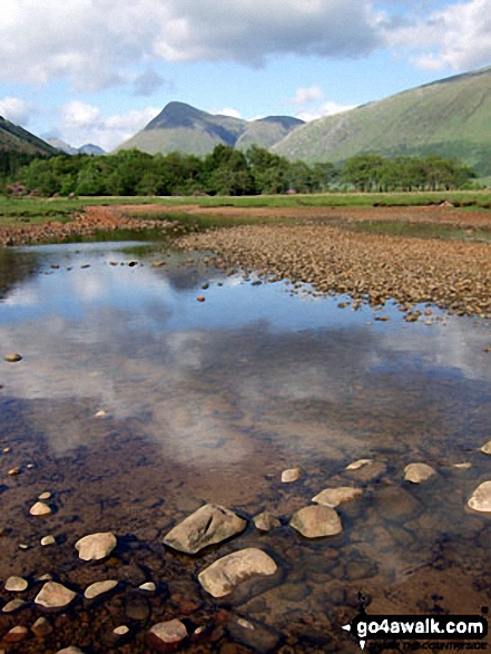
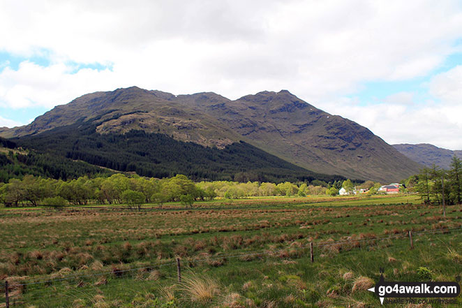
 The summit of Ben Nevis in Glen Shiel to Glenfinnan and Loch EilScotland
Photo: John Reed
Is there a Mountain, Peak, Top or Hill missing from the above google map or list?
Let us know an we will add it to our database.

To contribute to go4awalk.com or to contact us about anything at all - see Talk To Us.
For help see Help.
go4awalk.com and go4awalk.co.uk are registered trademarks of TMDH Limited.
Copyright © 2000-2026 TMDH Limited. All rights reserved.
Copyright Terms & Conditions Privacy Statement
A - Z Walks Home Log On/Accounts Photo Gallery Walk Ideas and Collections Fell Facts Hill Skills Walking Questions and Answers Your Stories News Competitions Product Reviews/Gear Tests Walking Gear Guides Peaks and Mountains Peak Bagging Find New Walking Friends Camping GPS Waypoints for Walking Contents Walk Search Talk To Us go4awalk.com Help Free Example Walks Newsletter