   |
Vital Statistics:
| Length: | 4½mls (7km) |
| Ascent: | 236ft (72m) |
| Time: | 2hrs |
| Grade: |  |
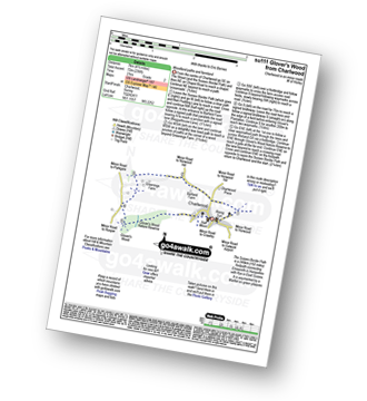
Route outline for walk su111:
Charlwood - The Sussex Border Path - Barfield Farm - Greenings Farm - Glover's Wood Nature Reserve - Charlwood
National Trails & Long Paths included on this walk:
Part of this walk follows a section of The Sussex Border Path, a 245km (152 miles) linear footpath connecting Emsworth in Hampshire, England with Rye in East Sussex, England. The Sussex Border Path is waymarked by a Martlet on green plaques. For more walks that include a section of this trail see The Sussex Border Path.
You can find this walk and other nearby walks on these unique free-to-access Interactive Walk Planning Maps:
1:25,000 scale OS Explorer Map (orange/yellow covers):
1:50,000 scale OS Landranger Map (pink/magenta covers):
Send us your photographs and pictures from your walks and hikes
We would love to see your photographs and pictures from walk su111 Glover's Wood from Charlwood. Send them in to us as email attachments (configured for any computer) along with your name and where the picture was taken to:
and we shall do our best to publish them.
(Guide Resolution = 300dpi. At least = 660 pixels (wide) x 440 pixels (high).)

You can also submit photos from walk su111 Glover's Wood from Charlwood via our Facebook Page.
NB. Please indicate where each photo was taken.


