Walk l145 Weets Hill from Salterforth

This 10 mile, Grade 5 (Moderate), easy-to-follow, hand-crafted walk, complete with GPS Waypoints, starts at Salterforth Marina & will take about 5 hrs to complete.

Download Walk PDF Icon
Download GPX Track Icon
Download GPS Waypoints Icon

Vital Statistics:

Length:10mls (16km)
Ascent:1,267ft (386m)
Time:5hrs
Grade:Walk Grade 5_23_with_text.png Icon

Route outline for walk l145:

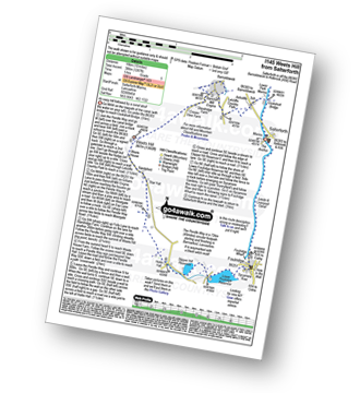
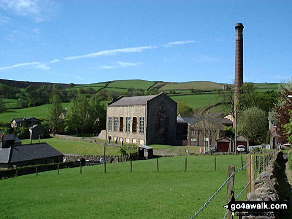
Salterforth Marina  -  The Leeds and Liverpool Canal  -  The Leeds and Liverpool Canal Walk  -  The Pendle Way  -  Letcliffe Country Park  -  Bancroft Mill Engine  -  Barnoldswick  -  Weets Hill  -  Weets House  -  Hollin Hall  -  Slipper Hill Reservoir  -  Lower Foulridge Reservoir  -  Foulridge  -  Foulridge Wharf  -  The Leeds and Liverpool Canal  -  Salterforth.

Peaks, Summits and Tops reached on this walk:

Hewitt Icon
0
English
Mountains
Wainwright Icon
0
Wainwrights
English Nuttall Icon
0
English
Nuttalls
Dewey Icon
0
English
Deweys
Wainwright Outlying Fell Icon
0
Wainwright
Outlying Fells
Marilyn Icon
0
Marilyns
Bridget Icon
1
Bridget

Peak Bagging Statistics for this walk:

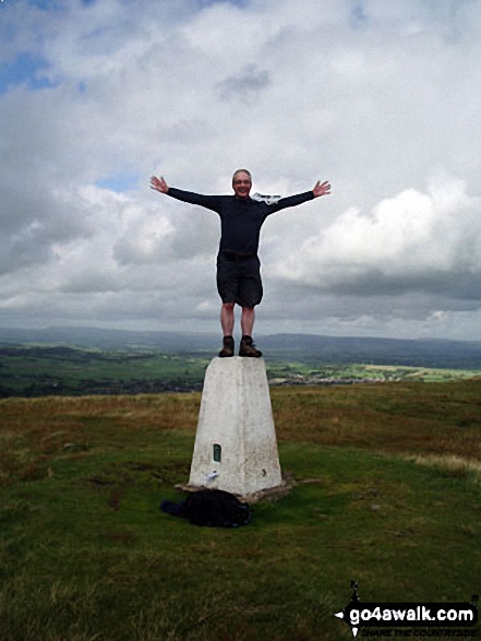
The highest point of this walk is Weets Hill at 397m (1303ft). Weets Hill is known as an English Bridget. The summit of Weets Hill is marked by an Ordnance Survey Trig Point.

National Trails & Long Paths included on this walk:

Part of this walk follows a section of The Leeds and Liverpool Canal Walk, a 203km (126 miles) linear footpath connecting Leeds in West Yorkshire, with Liverpool in Merseyside, England. The Leeds and Liverpool Canal Walk is waymarked by the canal. For more walks that include a section of this trail see The Leeds and Liverpool Canal Walk.

Part of this walk also follows a section of The Pendle Way, a 72km (45 miles) circular footpath starting and finishing in Barrowford in Lancashire, England. The Pendle Way is waymarked by a black witch motif. For more walks that include a section of this trail see The Pendle Way.


You can find this walk and other nearby walks on these unique Interactive Walk Planning Maps:

(worth a look if you're new to go4awalk.com & have never seen one of these before.)


1:25,000 scale OS Explorer Maps (orange/yellow covers):

OS Explorer OL21 South Pennines

OS Explorer OL41 Forest of Bowland & Ribblesdale


1:50,000 scale OS Landranger Map (pink/magenta covers):

OS Landranger 103 Blackburn & Burnley, Clitheroe & Skipton


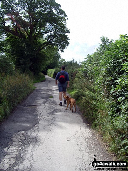
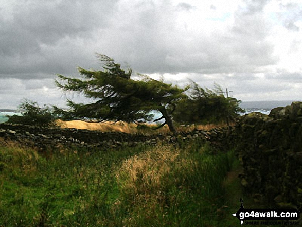
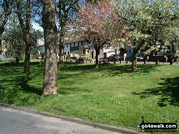
Some Photos and Pictures from Walk l145 Weets Hill from Salterforth

In no particular order . . .

Barnoldswick from Weets Hill

Barnoldswick from Weets Hill

Photo: Stuart Richardson (19)

Foulridge Village Green

Foulridge Village Green

Photo: Howard Bradley (3)

On the summit of Weets Hill

On the summit of Weets Hill

Photo: Stuart Richardson (18)

En-route to Weets Hill from Barnoldswick

En-route to Weets Hill from Barnoldswick

Photo: Stuart Richardson (21)

Walking along Esp Lane, Barnoldswick

Walking along Esp Lane, Barnoldswick

Photo: Stuart Richardson (20)

Weets Hill Summit

Weets Hill Summit

Photo: Howard Bradley (2)

Bancroft Mill

Bancroft Mill

Photo: Howard Bradley (1)


Send us your photographs and pictures from your walks and hikes

Send them in to us as email attachments (configured for any computer) along with your name/username and where the picture was taken to:

and we shall do our best to publish them.

(Guide Resolution = 300dpi. At least = 660 pixels (wide) x 440 pixels (high).)

Facebook Logo

You can also submit photos via our Facebook Page.

NB. Please indicate where each photo was taken so we can match it to a walk route.


Be on and up, where Nature's heart beats strong amid the hills - Richard Houghton: 1809-1885
Follow go4awalk.com on Twitter Follow go4awalk.com on Facebook


Find new Friends to go walking with

Walk all 214 Wainwrights in just 59 Walks. Download GPS Waypoints - Great Walks you must not miss!

Walk The Yorkshire Three Peaks Challenge Walk - All the Latest Route Information, GPS Waypoints and Split Times to keep you on Schedule

Walk The British Three Peaks Challenge Walk - All the Latest Route Information and GPS Waypoints

See our pick of The Best Walks in The Lake District - Great Walks you must not miss!

Walk our pick of the Best Lake District Ridge Walks - Great Walks you must not miss!

Walk our pick of the Best Lake District Walks to do in the rain - Great Walks you must not miss!

Walk our pick of The Best Walks in Snowdonia - Great Walks you must not miss!

Walk our pick of The Best Ridge Walks in Wales - Walks you must not miss!

Walk our pick of The Best Walks in The Brecon Beacons - Great Walks you must not miss!

Walk our pick of The Best Walks in The Yorkshire Dales - Walks you must not miss!

Walk our pick of The Best Walks in The Peak District - Walks you must not miss!

Walk our pick of The Best Walks in The Forest of Bowland - Walks you must not miss!

Walk our pick of The Best Walks in Shropshire - Walks you must not miss!

Walk our pick of The Best Walks in Cheshire - Walks you must not miss!

Walk our pick of The Best Walks in Lancashire - Walks you must not miss!

Not sure where to walk next? Try Peak Bagging - Great Walks you must not miss!

Not sure where to walk next? Walk part of a National Trail - Great Walks you must not miss!

Walks with Downloadable and Uploadable GPS Waypoint Data

Walking Kit and Gear Tested by Walkers

Full Site Search