   |
Vital Statistics:
| Length: | 8¼mls (13km) |
| Ascent: | 1,532ft (467m) |
| Time: | 4½hrs |
| Grade: |  |
Route outline for walk d224:
Edale - Small Clough - Hardenclough Farm - Greenlands - Hollins Cross - Back Tor (Hollins Cross) - Lose Hill (Ward's Piece) - Hope - The River Noe - Normans Farm - Edale End - Carr House - Nether Booth - Ollerbrook Booth - The Vale of Edale - Edale
Points of Interest/Notes on this walk:
It costs £6.00 to park a car for the day in the main car park in Edale. The ticket machine only takes coins and you cannot pay with notes or credit cards. There is precious little alternative parking. Best make sure you bring enough change. Sept 2021.
Peaks, Summits and Tops reached on this walk:
 0 English Mountains |
 0 Wainwrights |
 0 English Nuttalls |
 0 English Deweys |
 0 Wainwright Outlying Fells |
 0 Marilyns |
 2 Bridgets |
Peak Bagging Statistics for this walk:
The highest point of this walk is Lose Hill (Ward's Piece) at 476m (1562ft). Lose Hill (Ward's Piece) is known as an English Bridget.
Completing this walk will also take you to the top of Back Tor (Hollins Cross) at 438m (1438ft). Back Tor (Hollins Cross) is known as an English Bridget.
You can find this walk and other nearby walks on these unique free-to-access Interactive Walk Planning Maps:
1:25,000 scale OS Explorer Map (orange/yellow covers):
1:50,000 scale OS Landranger Map (pink/magenta covers):
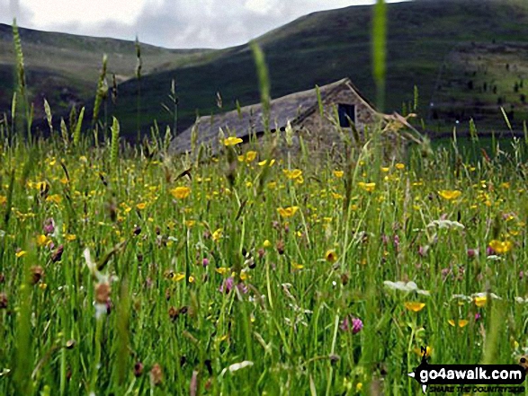
Some Photos and Pictures from Walk d224 Lose Hill from Edale
In no particular order . . .
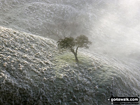
Frozen tree on the slopes of Back Tor (Hollins Cross) viewed from Hollins Cross


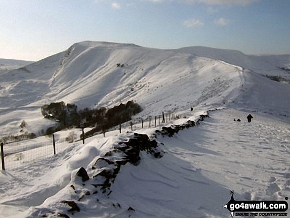
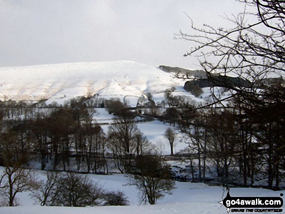
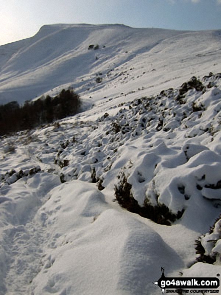
Mam Tor, Hollins Cross, Back Tor (Hollins Cross) in deep snow on the Lose Hill (Ward's Piece) ridge
Winhill Pike (Win Hill) from The River Noe Valley north of Hope in heavy snow

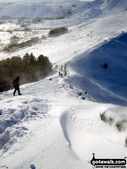
The steep descent to Hollins Cross in deep snow from the summit of Back Tor (Hollins Cross)

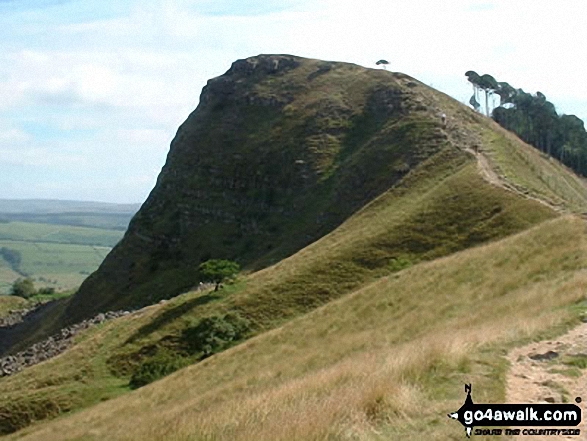
Hollins Cross, Mam Tor and Lord's Seat (Rushup Edge) from Back Tor (Hollins Cross)

Walking the ridge towards Mam Tor in deep snow between Back Tor (Hollins Cross) and Hollins Cross
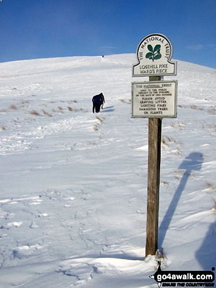
Climbing towards the summit of Lose Hill (Ward's Piece) in arctic snow conditions
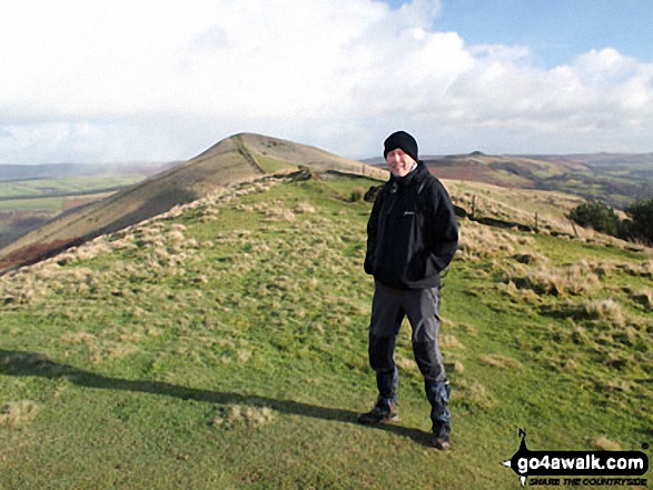
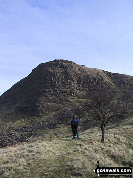
Mozzer on Back Tor (Hollins Cross) with Lose Hill (Ward's Piece) in the background
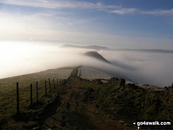
Mam Tor, and Back Tor (Hollins Cross) from Lose Hill (Ward's Piece) Tree on Back Tor (Hollins Cross) from Hollins Cross during a winter temperature inversion

. . . load all 86 walk photos from Walk d224 Lose Hill from Edale
Send us your photographs and pictures from your walks and hikes
We would love to see your photographs and pictures from walk d224 Lose Hill from Edale. Send them in to us as email attachments (configured for any computer) along with your name and where the picture was taken to:
and we shall do our best to publish them.
(Guide Resolution = 300dpi. At least = 660 pixels (wide) x 440 pixels (high).)

You can also submit photos from walk d224 Lose Hill from Edale via our Facebook Page.
NB. Please indicate where each photo was taken.


