Walk cw108 Carnedd Moel Siabod from Plas y Brenin, Capel Curig

This 6¾ mile, Grade 6 (Moderate), easy-to-follow, hand-crafted walk, complete with GPS Waypoints, starts at Plas y Brenin & will take about 5½ hrs to complete.

Download Walk PDF Icon
Download GPX Track Icon
Download GPS Waypoints Icon

Vital Statistics:

Length:6¾mls (11km)
Ascent:2,819ft (859m)
Time:5½hrs
Grade:Walk Grade 6_23_with_text.png Icon

Route outline for walk cw108:

Plas y Brenin  -  Capel Curig  -  Llynnau Mymbyr  -  Plas y Brenin Path  -  Coed Bryn-engan  -  Carnedd Moel Siabod  -  Rhos Farm  -  Pont Cyfyng  -  Afon Llugwy  -  Coed Bryn-engan  -  Plas y Brenin  -  Capel Curig

Peaks, Summits and Tops reached on this walk:

Hewitt Icon
1
Welsh
Mountain
Wainwright Icon
0
Wainwrights
Welsh Nuttall Icon
1
Welsh
Nuttall
Dewey Icon
0
Welsh
Deweys
Wainwright Outlying Fell Icon
0
Wainwright
Outlying Fells
Marilyn Icon
1
Welsh
Marilyn
Bridget Icon
0
Bridgets

Peak Bagging Statistics for this walk:

The highest point of this walk is Carnedd Moel Siabod at 872m (2861ft). Carnedd Moel Siabod is classified as a Welsh Mountain (Hewitt) (21st highest in Wales, 36th highest in England & Wales)

Carnedd Moel Siabod is also known as a Welsh Nuttall (23rd highest in Wales, 41st highest in England & Wales) and a Welsh Marilyn (11th highest in Wales, 281st highest in the UK).

Carnedd Moel Siabod means 'Cairn on Siabod Bare Hill' in Welsh and is pronounced 'kan-neth moy-el shee-bodd'.

The summit of Carnedd Moel Siabod is marked by an Ordnance Survey Trig Point & a large circular stone wind break.


You can find this walk and other nearby walks on these unique Interactive Walk Planning Maps:

(worth a look if you're new to go4awalk.com & have never seen one of these before.)

Snowdonia National Park


1:25,000 scale OS Explorer Maps (orange/yellow covers):

OS Explorer OL17 Snowdon/Yr Wyddfa and Conwy Valley/Dyffryn Conwy

OS Explorer OL18 Harlech, Porthmadog & Bala/Y Bala


1:50,000 scale OS Landranger Map (pink/magenta covers):

OS Landranger 115 Snowdon & Caernarfon


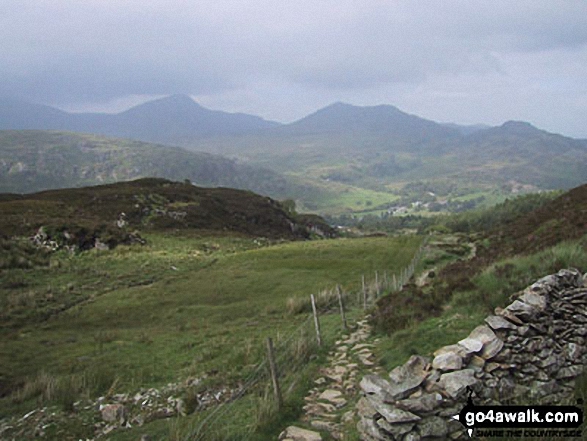
Some Photos and Pictures from Walk cw108 Carnedd Moel Siabod from Plas y Brenin, Capel Curig

In no particular order . . .
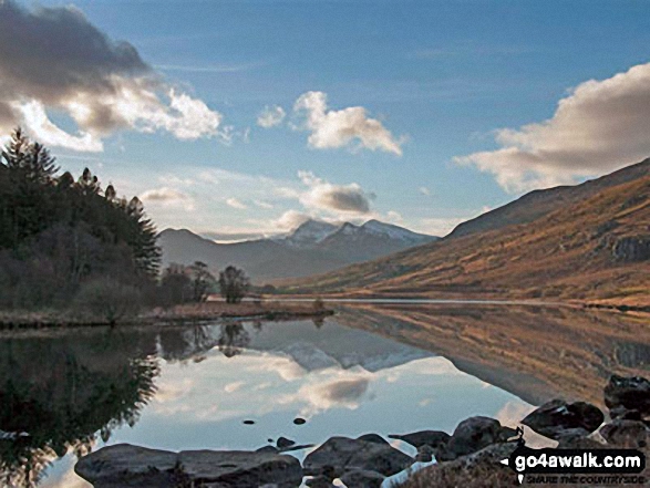
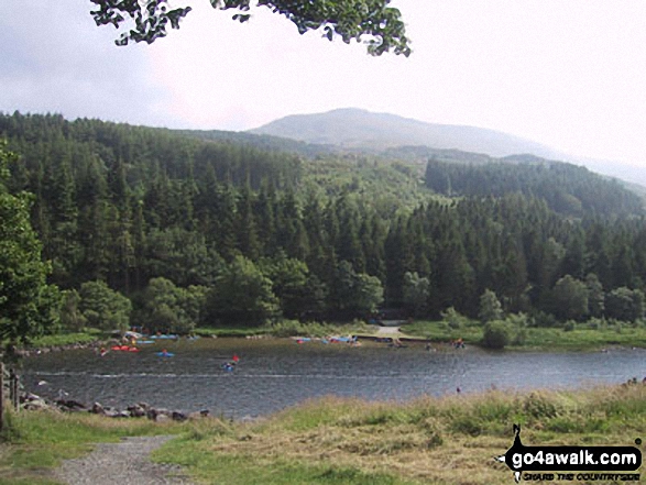
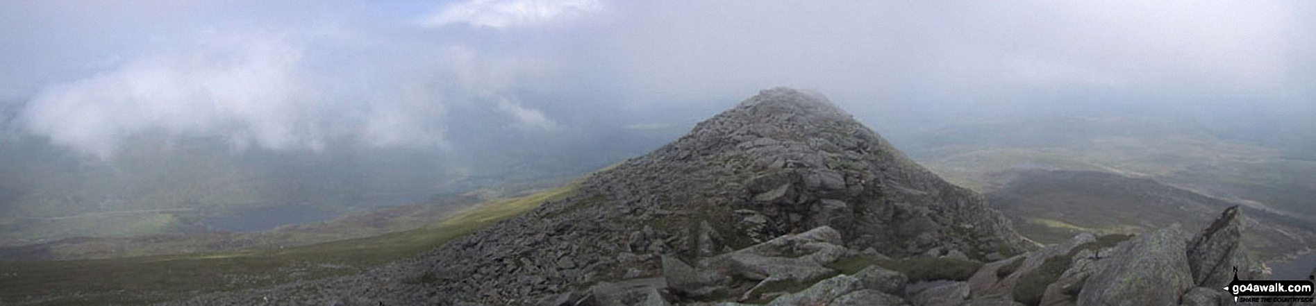
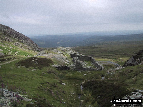
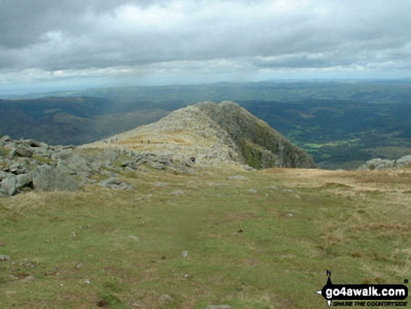
*The Carneddau, Llynnau Mymbyr, Plas Y Brenin, Capel Curig, The Moel Siabod Ridge and Betws-y-Coed from Carnedd Moel Siabod

Photo: Davie Naylor (5)

William Golder on Carnedd Moel Siabod

William Golder on Carnedd Moel Siabod

Photo: Sean Golder (1)

The summit ridge on Carnedd Moel Siabod

The summit ridge on Carnedd Moel Siabod

Photo: Mike Griffiths (14)

Me at the top of Carnedd Moel Siabod

Me at the top of Carnedd Moel Siabod

Photo: Dave Slack (2)

Snowdon from Llynnau Mymbyr, Capel Curig

Snowdon from Llynnau Mymbyr, Capel Curig

Photo: Clive Brown (1)

Cyfyng Falls, Pont Cyfyng

Cyfyng Falls, Pont Cyfyng

Photo: Davie Naylor (2)

On the summit of Carnedd Moel Siabod in the January snow

On the summit of Carnedd Moel Siabod in the January snow

Photo: Dave Slack (4)

Y Lliwedd (centre left), Snowdon and Crib Goch (right) across Llynnau Mymbyr from Plas y Brenin near Capel Curig

Y Lliwedd (centre left), Snowdon and Crib Goch (right) across Llynnau Mymbyr from Plas y Brenin near Capel Curig

Photo: Robert Rowe (1)

Climbing the North West ridge of Carnedd Moel Siabod

Climbing the North West ridge of Carnedd Moel Siabod

Photo: Mike Knipe (116)


. . . load all 36 walk photos from Walk cw108 Carnedd Moel Siabod from Plas y Brenin, Capel Curig


Send us your photographs and pictures from your walks and hikes

Send them in to us as email attachments (configured for any computer) along with your name/username and where the picture was taken to:

and we shall do our best to publish them.

(Guide Resolution = 300dpi. At least = 660 pixels (wide) x 440 pixels (high).)

Facebook Logo

You can also submit photos via our Facebook Page.

NB. Please indicate where each photo was taken so we can match it to a walk route.


Do not miss our pick of the Best Walks in Britain


To steep and difficult descent, trusting ourselves, we wound from crag to crag, where passage could be won - William Wordsworth: 1770-1850
Follow go4awalk.com on Twitter Follow go4awalk.com on Facebook


Find new Friends to go walking with

Walk all 214 Wainwrights in just 59 Walks. Download GPS Waypoints - Great Walks you must not miss!

Walk The Yorkshire Three Peaks Challenge Walk - All the Latest Route Information, GPS Waypoints and Split Times to keep you on Schedule

Walk The British Three Peaks Challenge Walk - All the Latest Route Information and GPS Waypoints

See our pick of The Best Walks in The Lake District - Great Walks you must not miss!

Walk our pick of the Best Lake District Ridge Walks - Great Walks you must not miss!

Walk our pick of the Best Lake District Walks to do in the rain - Great Walks you must not miss!

Walk our pick of The Best Walks in Snowdonia - Great Walks you must not miss!

Walk our pick of The Best Ridge Walks in Wales - Walks you must not miss!

Walk our pick of The Best Walks in The Brecon Beacons - Great Walks you must not miss!

Walk our pick of The Best Walks in The Yorkshire Dales - Walks you must not miss!

Walk our pick of The Best Walks in The Peak District - Walks you must not miss!

Walk our pick of The Best Walks in The Forest of Bowland - Walks you must not miss!

Walk our pick of The Best Walks in Shropshire - Walks you must not miss!

Walk our pick of The Best Walks in Cheshire - Walks you must not miss!

Walk our pick of The Best Walks in Lancashire - Walks you must not miss!

Not sure where to walk next? Try Peak Bagging - Great Walks you must not miss!

Not sure where to walk next? Walk part of a National Trail - Great Walks you must not miss!

Walks with Downloadable and Uploadable GPS Waypoint Data

Walking Kit and Gear Tested by Walkers

Full Site Search
Do not miss our pick of the Best Walks in Britain