UK Postcode DG14 - The 30 nearest easy-to-follow, circular walk route maps to you
The thirty nearest easy-to-follow, circular walk route maps to you in UK Postcode DG14 in Walk Grade Order
The UK cities, towns and villages in Dumfries and Galloway, Scotland that have DG14 in their UK Postcode include:
• Auchenrivock • Canonbie • Cauldside • Chapelknowe • Evertown • Milltown • Rowanburn •
Not familiar with the area around DG14?
See these 30 nearest walks to UK Postcode DG14 on a google map
   |
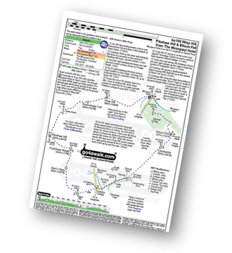
Vital Statistics:
| Length: | 4 miles (6.5 km) |
| Ascent: | 958ft (292m) |
| Time: | 2½ hrs |
| Grade: |  |
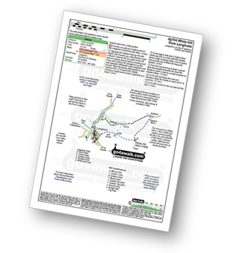
Route Summary:
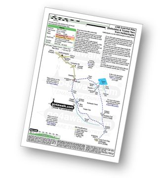
Langholm - Ewes Water - River Esk - Whita Hill - Sir John Malcolm Monument Obelsik - Charlie's Moss - Hugh MacDiarmid Memorial - Hillhead - Ewes Water - Langholm
|
Vital Statistics:
| Length: | 10.25 miles (16.5 km) |
| Ascent: | 1,917ft (584m) |
| Time: | 5.75hrs |
| Grade: |  |
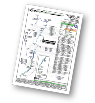
Route Summary:
Tarras Lodge - Tarras Water - Coomsfell End - Arkleton Cottage - Greenlea Knowe - Cooms Farm - White Brae - White Cove - Black Cove - Arkleton Hill - Linns Knowe - Pike Fell - Ludsgill Sware - Hawknest Rig - Byrecleuch Burn - Lodgegill Farm - Cooms Farm - Greenlea Knowe - Arkleton Cottage - Coomsfell End - Tarras Lodge
|
Vital Statistics:
| Length: | 14.75 miles (23.5 km) |
| Ascent: | 2,609ft (795m) |
| Time: | 8 hrs |
| Grade: |  |
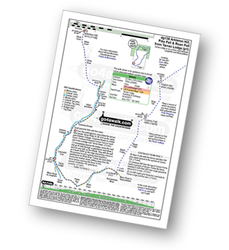
Route Summary:
Tarras Lodge - Tarras Water - Arkleton Cottage - Greenlea Knowe - Cooms Farm - White Brae - White Cove - Black Cove - Arkleton Hill - Linns Knowe - Pike Fell - Ludsgill Sware - Watch Knowe - Scawd Bank - The Pikes - Hartsgarth Fell - Roan Fell - Millstone Edge (Roan Fell) - Watch Hill - Strait Hill - Cooms Fell - Black Edge - Watch Crags - Loch Knowe - Burrowstown Moss - Perter Rig - Tarras Lodge
|
Vital Statistics:
| Length: | 13.75 miles (22 km) |
| Ascent: | 1,861ft (567m) |
| Time: | 6.75hrs |
| Grade: | |

Route Summary:
Tarras Lodge - Tarras Water - Coomsfell End - Arkleton Cottage - Greenlea Knowe - Cooms Farm - Lodgegill Farm - Byrecleuch Burn - Hawknest Rig - Ludsgill Sware - Watch Knowe - Scawd Bank - The Pikes - Hartsgarth Fell - Roan Fell - Millstone Edge (Roan Fell) - Watch Hill - Strait Hill - Cooms Fell - Black Edge - Watch Crags - Loch Knowe - Burrowstown Moss - Perter Rig - Tarras Lodge
|
Vital Statistics:
| Length: | 6.25 miles (10 km) |
| Ascent: | 758ft (231m) |
| Time: | 3 hrs |
| Grade: | |
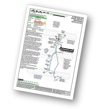
Route Summary:
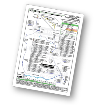
Newcastleton - Liddesdale - Liddel Water - Tweeden Burn - Mangerton Tower - Sorbietrees Farm - Carby Hill (Caerba Hill) - Newcastleton or Copshaw Holme.
|
Vital Statistics:
| Length: | 14.5 miles (23 km) |
| Ascent: | 2,018ft (615m) |
| Time: | 7.25hrs |
| Grade: | |

Route Summary:
Newcastleton or Copshaw Holm - Bedda Cleuch - Blackburn Farm - Kiln Knowe - Black Burn - Hog Gill - Rigging Sike - Millstone Edge (Roan Fell) - Roan Fell - Watch Hill - Strait Hill - Cooms Fell - Black Edge - Watch Crags - Loch Knowe - Tinnis Bridge - Hazelyside Hill - Bedda Hill - Newcastleton
|
Vital Statistics:
| Length: | 8.75 miles (14 km) |
| Ascent: | 3,482ft (1,061m) |
| Time: | 7 hrs |
| Grade: | |
Route Summary:
Mosspaul Hotel - Wisp Hill (Teviothead) - Ewenshope Fell - Ewes Doors - Pikethaw Hill - Frodaw Height - Dan's Hags - Upper Hill (Fiddleton Cottage) - Fiddleton Cottage - Glenrief Cottage - Castlewink - Ellson Fell - Glenrief Rig - Mosspaul Burn - Mosspaul Hotel
|
Vital Statistics:
| Length: | 8.5 miles (13.5 km) |
| Ascent: | 2,832ft (863m) |
| Time: | 5.75hrs |
| Grade: | |

Route Summary:
Mosspaul Hotel - Wisp Hill (Teviothead) - Ewenshope Fell - Ewes Doors - Pikethaw Hill - Frodaw Height - Dan's Hags - Upper Hill (Fiddleton Cottage) - Fiddleton Cottage - Bught Knowe - Glenrief Rig - Mosspaul Burn - Mosspaul Hotel
|
Vital Statistics:
| Length: | 7.5 miles (12 km) |
| Ascent: | 2,018ft (615m) |
| Time: | 4.75hrs |
| Grade: |  |

Route Summary:
Mosspaul Hotel - Wisp Hill (Teviothead) - Ewenshope Fell - Ewes Doors - Ewelees Farm - Fiddleton Cottage - Bught Knowe - Glenrief Rig - Mosspaul Burn - Mosspaul Hotel
|
Vital Statistics:
| Length: | 5.75 miles (9 km) |
| Ascent: | 1,877ft (572m) |
| Time: | 4 hrs |
| Grade: | |
Route Summary:
Mosspaul Hotel - Mosspaul Burn - Glenrief Rig - Ellson Fell - Castlewink - Glenrief Cottage - Bught Knowe - Glenrief Rig - Mosspaul Burn - Mosspaul Hotel
|
Vital Statistics:
| Length: | 7.25 miles (11.5 km) |
| Ascent: | 2,009ft (612m) |
| Time: | 4.75hrs |
| Grade: | |
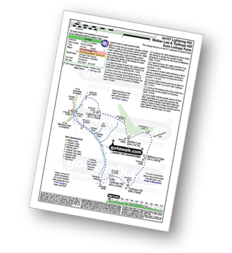
Route Summary:
Linhope Farm - Lightning Hill - Wether Law (Teviothead) - Crummiecleuch Rig - Millstone Edge (Tudhope Hill) - Tudhope Hill - Little Tudhope Hill - Sunhope Hass - Elygrain Farm - Linhope Burn - Linhope Farm
|
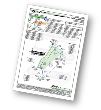
Vital Statistics:
| Length: | 8.75 miles (14 km) |
| Ascent: | 2,793ft (851m) |
| Time: | 6 hrs |
| Grade: | |
Route Summary:
Linhope Farm - Lightning Hill - Wether Law (Teviothead) - Crummiecleuch Rig - Millstone Edge (Tudhope Hill) - Tudhope Hill - Little Tudhope Hill - Sunhope Hass - Carlin Tooth (Teviothead) - Bye Hill - Dod Hill (Teviothead) - Linhope Burn - Linhope Farm
|
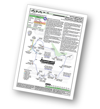
Vital Statistics:
| Length: | 4.5 miles (7 km) |
| Ascent: | 1,503ft (458m) |
| Time: | 3.25hrs |
| Grade: |  |

Route Summary:
Linhope Farm - Linhope Burn - Dod Hill (Teviothead) - Bye Hill - Carlin Tooth (Teviothead) - Sunhope Hass - Linhope Burn - Elygrain Farm - Linhope Farm
|
Vital Statistics:
| Length: | 5.75 miles (9 km) |
| Ascent: | 1,480ft (451m) |
| Time: | 3.75hrs |
| Grade: | |
Route Summary:
Clesketts - Tortie Farm - Howgill Cottages - Tindale Fells - Howgill Beck - Cold Fell Pike (Geltsdale) - Tindale Fell - Tindale Tarn - Thron Farm - Clesketts
|
Vital Statistics:
| Length: | 11.75 miles (19 km) |
| Ascent: | 1,943ft (592m) |
| Time: | 6.25hrs |
| Grade: | |
Route Summary:
Clesketts - Tortie Farm - Howgill Cottages - Tindale Fells - Howgill Beck - Tindale Fell - Cold Fell Pike (Geltsdale) - Great Blacklaw Hill - Old Water - Old Water Bridge - Gairs Farm - Howgill Cottages - Clesketts
Not familiar with the area around DG14?
See these 30 nearest walks to UK Postcode DG14 on a google map
|
Vital Statistics:
| Length: | 8.25 miles (13 km) |
| Ascent: | 1,520ft (463m) |
| Time: | 4½ hrs |
| Grade: | |
Route Summary:
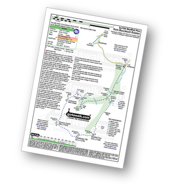
Buccleuch Estates (Teviothead - Teviotdale) - Fouledge Syke - Alderybar Cottage - Harwood Rigg - Grey Pen - Skelfhill Pen - Greatmoor Hill - Knowes Head - Coltercleugh Shiel Cottage - Goat Hill - Buccleuch Estates (Teviothead).
|
Vital Statistics:
| Length: | 8.5 miles (13.5 km) |
| Ascent: | 945ft (288m) |
| Time: | 4 hrs |
| Grade: | |

Route Summary:
Hawkhope Car Park - Starsley Burn - Falstone Mine - Flastone Forest - Belling Burn - Goodwell Syke - Soney Gap - Plashetts Incline Jetty - Kielder Water - Benny Shanks Jetty - Pot Burn - Cock Soor - Whinny Hill - Belling Burn - The Belling - Bastle - Kielder Water Dam - Hawkhope Car Park
|
Vital Statistics:
| Length: | 5.5 miles (9 km) |
| Ascent: | 1,138ft (347m) |
| Time: | 3½ hrs |
| Grade: | |
Route Summary:
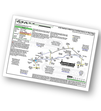
Cawfield Quarry Car Park - Hadrian's Wall - The Pennine Way - The Hadrian's Wall Path - Cawfield Crags - Thorny Doors - Caw Gap - Bogle Hole - Lodhams Slack - Winshields (Winshield Crags) - Green Slack - Steel Rigg - Hound Hill - Melkridge Common - East Cawfields - Cawfields - Cawfield Quarry Car Park
|
Vital Statistics:
| Length: | 8.5 miles (13.5 km) |
| Ascent: | 804ft (245m) |
| Time: | 4 hrs |
| Grade: | |

Route Summary:
Haltwhistle - Wydon Farm - Wydon Eals Farm - River South Tyne - Featherstone Castle - Lambley Viaduct Nature Trail - Thorneyhole Wood - Featherstone Rowfoot - Park Village - Broomhouse Farm - Haltwhistle
|
Vital Statistics:
| Length: | 4.5 miles (7 km) |
| Ascent: | 584ft (178m) |
| Time: | 2.25hrs |
| Grade: | |
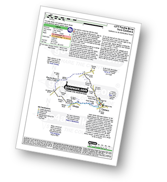
Route Summary:
Caldbeck - Caldbeck Duck Pond - Ratten Row - Grange View - Knocker House - Faulds Brow - Whelpo - Whelpo Bridge - Whelpo Beck - Howk Bobbin Mill - Caldbeck
|
Vital Statistics:
| Length: | 13.25 miles (21 km) |
| Ascent: | 2,586ft (788m) |
| Time: | 7.25hrs |
| Grade: | |

Route Summary:
Ettrick Water,Longhope Burn - Bught Hill - Bodesbeck Law - Nowtrig Head - Mid Rig (Bell Craig) - Salmongill Craig - Bald Craig - Bell Craig - Mirk Side - Andrewhinney Hill - Brockhope Head - Trowgrain Middle - Herman Law - Fala Grain - Back Beck - Brockhoperig - Ettrick Water
|
Vital Statistics:
| Length: | 12.25 miles (19.5 km) |
| Ascent: | 2,750ft (838m) |
| Time: | 7½ hrs |
| Grade: | |

Route Summary:
Parking Area A708 NE of Moffat - Moffat Water - Moffat Dale - The Southern Upland Way - Cornal Burn - Craigbeck Hope - Coomb Cairn - Scaw'd Fell - Eskdalemuir - Wamphrey Burn - Sheepfold - Slecoth Burn - Croft Head - Corfthead Burn - Craiglochan Gardens - Parking Area.
|
Vital Statistics:
| Length: | 14.5 miles (23 km) |
| Ascent: | 3,781ft (1,152m) |
| Time: | 9 hrs |
| Grade: |  |

Route Summary:
Parking Area A708 NE of Moffat - Moffat Water - Moffat Dale - The Southern Upland Way - Cornal Burn - Craigbeck Hope - Coomb Cairn - Scaw'd Fell - Eskdalemuir - Wamphrey Burn - Sheepfold - Slecoth Burn - Loch Fell - Croft Head - Corfthead Burn - Craiglochan Gardens - Parking Area.
|
Vital Statistics:
| Length: | 9.75 miles (15.5 km) |
| Ascent: | 2,206ft (672m) |
| Time: | 5.75hrs |
| Grade: | |

Route Summary:
Parking Area A708 NE of Moffat - Moffat Water - Moffat Dale - The Southern Upland Way - Cornal Burn - Craigbeck Hope - Eskdalemuir - Wamphrey Burn - Sheepfold - Slecoth Burn - Croft Head - Corfthead Burn - Craiglochan Gardens - Parking Area.
|
Vital Statistics:
| Length: | 4 miles (6.5 km) |
| Ascent: | 1,293ft (394m) |
| Time: | 2.75hrs |
| Grade: | |
|
Vital Statistics:
| Length: | 10.25 miles (16.5 km) |
| Ascent: | 2,002ft (610m) |
| Time: | 5.75hrs |
| Grade: | |
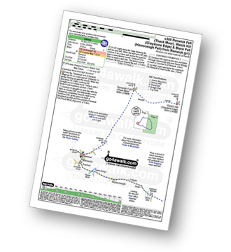
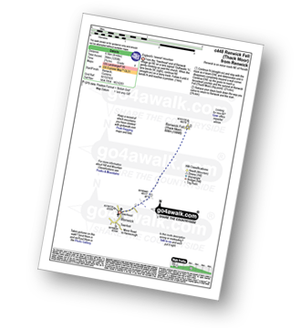
Route Summary:
Renwick - Townend - Renwick Fell (Thack Moor) - Watch Hill (Graystone Edge) - Black Fell (Haresceugh Fell) - Little Daffenside - Hartside Height - Hartside Top Cafe (A686) - Ricker Gill - Seavy Sike - Haresceugh - Raven Bridge - Townfoot - Renwick
|
Vital Statistics:
| Length: | 7.75 miles (12.5 km) |
| Ascent: | 2,198ft (670m) |
| Time: | 5 hrs |
| Grade: | |
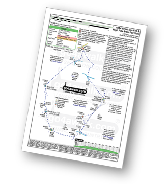
Route Summary:
Fell Side - Dale Beck - Brae Fell - Little Sca Fell - Great Sca Fell - Knott (Uldale Fells) - Grainsgill Beck - The Cumbria Way - Lingy Hut - Miller Moss - Great Lingy Hill - Hare Stones - High Pike (Caldbeck) - Long Grain Beck - Fell Side
|
Vital Statistics:
| Length: | 8.75 miles (14 km) |
| Ascent: | 3,236ft (986m) |
| Time: | 6½ hrs |
| Grade: | |
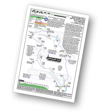
Route Summary:
Capplegill - Blackhope Burn - Saddle Yoke - Under Saddle Yoke - Whirly Gill - Saddle Craigs - Harfell Rig - Hart Fell (Moffat) - Hartfell Craig - Falcon Craig - Upper Comb Craig - Swatte Fell - Nether Comb Craig - Black Craig - Hang Burn - Hang Gill - Capplegill
|
Vital Statistics:
| Length: | 8.25 miles (13 km) |
| Ascent: | 1,460ft (445m) |
| Time: | 4½ hrs |
| Grade: | |

Route Summary:
Housteads Visitor Centre - Chapel Hill - Housesteads - Vercovicium Fort - The Hadrian's Wall Path - Housesteads Crags - Cuddy's Crag - The Pennine Way - Hotbank Crags - Hotbank - Crag Lough - Highshield Crags - Steel Rigg - Peel Crags - Peel - Once Brewed - Brackies Burn - Smith's Shield - Causeway House - Vindolanda Roman Fort - Chesterholm - Barcombe - East Crindledykes Farm - Green Brae - Little Shield - Deafley Rigg - Housteads Visitor Centre
|
Vital Statistics:
| Length: | 10.5 miles (17 km) |
| Ascent: | 2,903ft (885m) |
| Time: | 6.75hrs |
| Grade: | |

Route Summary:
Over Water Reservoir - Orthwaite - Orthwaite Bank - Uldale Fells - Great Cockup - Frozenfell Gill - Trusmadoor - Meal Fell - Little Sca Fell - Great Sca Fell - Knott (Uldale Fells) - Little Calva - Great Calva - Hause Gill - Burn Tod - Burntod Gill - Brockle Crags - Orthwaite - Over Water
Not familiar with the area around DG14?
See these 30 nearest walks to UK Postcode DG14 on a google map


