Nine easy to follow walks from Rukin's Park Lodge Campsite, Keld, The Yorkshire Dales, North Yorkshire, England
To reach Rukin's Park Lodge Campsite, Keld, in-car SatNav users should select the Latitude/Longitude (Lat Lon) screen and enter:
Lat = N54.40637 and Lon = W2.16736 or postcode: DL11 6LJ
Not familiar with this campsite?
Nine easy to follow walks from Rukin's Park Lodge Campsite, Keld, The Yorkshire Dales, North Yorkshire, England
Scroll down the list of walks below & click on each walk title (in blue) to locate it on the map above.

   |
Vital Statistics:
| Length: | 3.75 miles (6 km) |
| Ascent: | 295ft (90m) |
| Time: | 1.75hrs |
| Grade: |  |
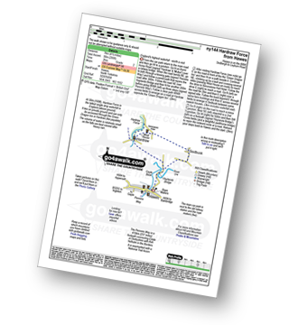
Route Summary:
Hawes - The Pennine Way - The Herriot Way - Haylands Bridge - The River Ure - Hardraw - Hardraw Force - West House - Simonstone Hotel - Sedbusk - Hawes


|
Vital Statistics:
| Length: | 6 miles (9.5 km) |
| Ascent: | 853ft (260m) |
| Time: | 3 hrs |
| Grade: |  |

Route Summary:
Tom Gill - Tom Gill Waterfall - Tarn Hows - Rose Castle Plantation - Torver Intake - The Cumbria Way - Tom Heights - Iron Keld - Low Arnside - The Cumbria Way - Oxen Fell High Cross - Man Crag - Yew Tree Tarn - Harry Guards Wood - Yew Tree Farm - Glen Mary Bridge - Tom Gill

|
Vital Statistics:
| Length: | 8.5 miles (13.5 km) |
| Ascent: | 1,030ft (314m) |
| Time: | 4 hrs |
| Grade: |  |
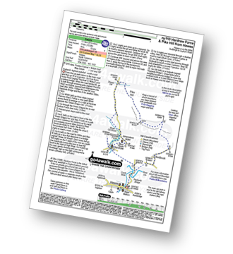
Route Summary:
Hawes - The Pennine Way - The Herriot Way - Haylands Bridge - The River Ure - Hardraw - Hardraw Force - Shaw Gill Wood - Simonstone Hotel - High Shaw - Shivery Gill - Pike Hill - Abbotside Common - Low Clint - High Pasture Gate - Shutt Lane - Sedbusk - Hawes

|
Vital Statistics:
| Length: | 7 miles (11 km) |
| Ascent: | 1,345ft (410m) |
| Time: | 3.75hrs |
| Grade: |  |

Route Summary:
Muker - Kisdon - Hooker Mill Scar - Swallow Hole Farm - Keld - The Herriot Way - The Pennine Way - The River Swale - Wainwright's Coast to Coast Walk - Kisdon Force - East Gill Force - Crackpot Hall - Swinner Gill - Arngill Wood - Swaledale - Ramps Holme Bridge - Muker

|
Vital Statistics:
| Length: | 8.25 miles (13 km) |
| Ascent: | 1,995ft (608m) |
| Time: | 5 hrs |
| Grade: |  |

Route Summary:
Tom Gill Car Park - Glen Mary Bridge - Yew Tree Farm - Yew Tree Farm - Harry Guards Wood - Uskdale Gap - Holme Fell - Holme Hill Wood - Low Tilberthwaite - Hodge Close Quarry - High Tilberthwaite - Wythebank - High Oxenfell Farm - Low Arnside - Black Fell (Black Crag) - Iron Keld - Tarn Hows - Tom Gill Waterfalls - Tom Gill Car Park.

|
Vital Statistics:
| Length: | 12 miles (19 km) |
| Ascent: | 1,956ft (596m) |
| Time: | 6.25hrs |
| Grade: | |
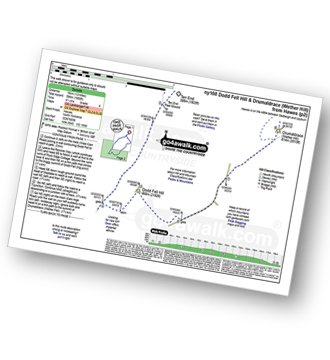
Route Summary:
Hawes - The Pennine Way - The Herriot Way - Gayle - Gaudy Lane - Rottonstone Hill - Ten End Peat Ground - West Cam Road - Dodd Fell Hill - North Gate - West Duerley Pasture - Cam High Road - Howgate Head - Drumaldrace (Wether Fell) - Wether Fell - Gayle - Hawes

|
Vital Statistics:
| Length: | 11.25 miles (18 km) |
| Ascent: | 2,091ft (637m) |
| Time: | 6.25hrs |
| Grade: | |

Route Summary:
Keld - The Pennine Way - The Herriot Way - Kisdon Force - Black Moor - Stonesdale Moor - The Tan Hill Inn - Tan Gill - Stonesdale Beck - Thomas Gill - Robert's Seat - Pryclose Gutter - Ravenseat - Wainwright's Coast to Coast Walk - Whitsundale Beck - How Edge Scars - Oven Mouth - Cotterby Scar - East Stonesdale Farm - The River Swale - Keld

|
Vital Statistics:
| Length: | 11 miles (17.5 km) |
| Ascent: | 2,681ft (817m) |
| Time: | 6.75hrs |
| Grade: |  |

Route Summary:
Keld - The Pennine Way - The Herriot Way - The River Swale - Swaledale - Wainwright's Coast to Coast Walk - Kisdon Force - Crackpot Hall - Swinner Gill - Hind Hole Beck - Swinner Gill Lead Mines - East Grain - High Stone Man - Rogan's Seat - Moor Hen Nest - Water Crag (Arkengarthdale) - Blakethwaite Gill - Blakethwaite Meres - Blakethwaite Dams - Gunnerside Gill - Eweleap Scar - Bling Gill - Lownathwaite Mea - High Whim - Swinner Gill - Kisdon Force - Crackpot Hall - Keld

|
Vital Statistics:
| Length: | 13.75 miles (22 km) |
| Ascent: | 2,330ft (710m) |
| Time: | 7.25hrs |
| Grade: | |

Route Summary:
Hawes - The Pennine Way - The Herriot Way - Haylands Bridge - The River Ure - Hardraw - Hardraw Force - Hearne Coal Road - Hollin Hill - Bluebell Hill - Blea Pot Plain - Hearn Top - Bleak Haw - Hearne Head - Great Shunner Fell - Little Shunner Fell - Pickersett Mea - Fossdale Moss - Grimy Gutter - Lovely Seat - Coal Gill Hags - Abbotside Common - High Clint - High Pasture Gate - Shutt Lane - Sedbusk - Hawes