Thirteen easy to follow walks from Park Coppice Campsite, Park Coppice (nr Coniston), The Lake District, Cumbria, England
To reach Park Coppice Campsite, Park Coppice (nr Coniston), in-car SatNav users should select the Latitude/Longitude (Lat Lon) screen and enter:
Lat = N54.35301 and Lon = W3.08385 or postcode: LA21 8LA
Not familiar with this campsite?
Thirteen easy to follow walks from Park Coppice Campsite, Park Coppice (nr Coniston), The Lake District, Cumbria, England
Scroll down the list of walks below & click on each walk title (in blue) to locate it on the map above.

   |
Vital Statistics:
| Length: | 6 miles (9.5 km) |
| Ascent: | 853ft (260m) |
| Time: | 3 hrs |
| Grade: |  |

Route Summary:
Tom Gill - Tom Gill Waterfall - Tarn Hows - Rose Castle Plantation - Torver Intake - The Cumbria Way - Tom Heights - Iron Keld - Low Arnside - The Cumbria Way - Oxen Fell High Cross - Man Crag - Yew Tree Tarn - Harry Guards Wood - Yew Tree Farm - Glen Mary Bridge - Tom Gill


|
Vital Statistics:
| Length: | 5.75 miles (9 km) |
| Ascent: | 909ft (277m) |
| Time: | 3 hrs |
| Grade: | |
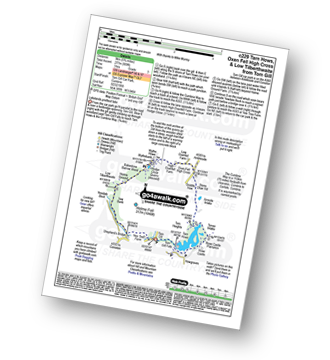
Route Summary:
Tom Gill - Tom Gill Waterfall - Tarn Hows - Rose Castle Plantation - Torver Intake - The Cumbria Way - Tom Heights - Arnside Intake - Stone Chair Hill - Griddle How - Oxen Fell High Cross - High Oxenfell Farm - Wythe Howe - Wythebank - Hodge Close Quarry - Bakestone Barrow Wood - Holme Ground - Low Tilberthwaite - Yew Bank - Shepherd's Bridge - Yew Tree Farm - Glen Mary Bridge - Tom Gill

|
Vital Statistics:
| Length: | 7.75 miles (12.5 km) |
| Ascent: | 1,758ft (536m) |
| Time: | 4.75hrs |
| Grade: |  |
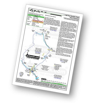
Route Summary:
Coniston - The Cumbria Way - Low Yewdale - Yewdale Beck - High Yewdale - Yew Band - Low Tilberthwaite - High Tilberthwaite - Low Coppice - Tilberthwaite Gill - Crook Beck - Hole Rake - Miners Bridge - Church Beck - Coniston

|
Vital Statistics:
| Length: | 10 miles (16 km) |
| Ascent: | 1,364ft (416m) |
| Time: | 5 hrs |
| Grade: | |
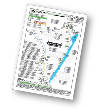
Route Summary:
Coniston - Walna Scar Road - Banishead - Torver Beck - Torver - Beckstones - The Cumbria Way - Coniston Water - Coniston Sailing Club - Coniston Hall - Coniston

|
Vital Statistics:
| Length: | 5 miles (8 km) |
| Ascent: | 1,935ft (590m) |
| Time: | 4 hrs |
| Grade: | |

Route Summary:
Coniston - Walna Scar Road - Goat's Water - The Old Man of Coniston - Low Water - Walna Scar Road - Coniston

|
Vital Statistics:
| Length: | 8.25 miles (13 km) |
| Ascent: | 2,778ft (847m) |
| Time: | 5.75hrs |
| Grade: |  |

Route Summary:
Coniston - Walna Scar Road - Goat's Water - The Old Man of Coniston - Brim Fell - Levers Hawse - Swirl Band - Swirl How - Prison Band - Levers Water - Walna Scar Road - Coniston

|
Vital Statistics:
| Length: | 7.5 miles (12 km) |
| Ascent: | 2,762ft (842m) |
| Time: | 5.25hrs |
| Grade: | |

Route Summary:
Coniston - Walna Scar Road - Boo Tarn - The Old Man of Coniston - Brim Fell - Levers Water - Boulder Valley - Crowberry Haws - Miners Bridge - Coniston

|
Vital Statistics:
| Length: | 8.25 miles (13 km) |
| Ascent: | 1,995ft (608m) |
| Time: | 5 hrs |
| Grade: | |

Route Summary:
Tom Gill Car Park - Glen Mary Bridge - Yew Tree Farm - Yew Tree Farm - Harry Guards Wood - Uskdale Gap - Holme Fell - Holme Hill Wood - Low Tilberthwaite - Hodge Close Quarry - High Tilberthwaite - Wythebank - High Oxenfell Farm - Low Arnside - Black Fell (Black Crag) - Iron Keld - Tarn Hows - Tom Gill Waterfalls - Tom Gill Car Park.

|
Vital Statistics:
| Length: | 7 miles (11 km) |
| Ascent: | 2,422ft (738m) |
| Time: | 5 hrs |
| Grade: | |
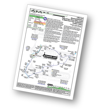
Route Summary:
Seathwaite (Duddon Valley) - Newfield Wood - Dobby Shaw - New Close - How Scale Haw - Old Park Beck - Broadslack - Caw (Dunnerdale Fells) - Pikes (Caw) - Green Pikes (Caw) - Dawson Pike - White Pike - White Maiden - Walna Scar - Walna Scar Road - Broad Haws - Hollin House Haw - Tarn Beck - Seathwaite (Duddon Valley)

|
Vital Statistics:
| Length: | 9.5 miles (15 km) |
| Ascent: | 3,523ft (1,074m) |
| Time: | 7 hrs |
| Grade: |  |

Route Summary:
Walna Scar Road (nr Seathwaite (Duddon Valley) - Long Houses - Brown Pike - Dow Crag - Goat's Hawse - The Old Man of Coniston - Brim Fell - Levers Hawse - Swirl Band - Swirl How - Great Carrs - Grey Friar - Seathwaite Tarn - Walna Scar Road.

|
Vital Statistics:
| Length: | 10 miles (16 km) |
| Ascent: | 3,584ft (1,092m) |
| Time: | 7 hrs |
| Grade: | |

Route Summary:
Coniston - Church Beck - Levers Water Beck - Crowberry Haws - Low Water - Brim Fell - Levers Hawse - Swirl Band - Swirl How - Prison Band - Swirl Hawse - Keld Gill Head - Black Sails - Red Dell Head Moss - Wetherlam - Furness Fells - Coniston

|
Vital Statistics:
| Length: | 9.75 miles (15.5 km) |
| Ascent: | 3,664ft (1,117m) |
| Time: | 7.25hrs |
| Grade: | |

Route Summary:
Coniston - Church Beck - Levers Water Beck - Crowberry Haws - Low Water - The Old Man of Coniston - Brim Fell - Levers Hawse - Swirl Band - Swirl How - Prison Band - Swirl Hawse - Keld Gill Head - Black Sails - Red Dell Head Moss - Wetherlam - Furness Fells - Coniston

|
Vital Statistics:
| Length: | 12.75 miles (20.5 km) |
| Ascent: | 4,191ft (1,277m) |
| Time: | 8.75hrs |
| Grade: |  |

Route Summary:
Coniston - Walna Scar Road - Boo Tarn - Torver Beck - Cove Bridge - Goat's Water - Goat's Hawse - Dow Crag - Goat's Hawse - The Old Man of Coniston - Brim Fell - Levers Hawse - Grey Friar - Great Carrs - Swirl How - Prison Band - Keld Gill Head - Black Sails - Wetherlam - Swirl Hawse - Levers Water - Crowberry Haws - Walna Scar Road - Coniston