
![]()
Plover Hill
680m (2231ft)
The Southern Dales Area, The Yorkshire Dales, North Yorkshire, England
Not familiar with this top?
You can walk/hike to the top of Plover Hill by using either of these 2 easy‑to‑follow route maps:
Walk ny158 Pen-y-ghent and Plover Hill from Horton in Ribblesdale
One of the classic 'Yorkshire Three Peaks'
   |
|---|
Vital Statistics:
| Length: | 8.75ml (14km) |
|---|---|
| Ascent: | 1,827ft (557m) |
| Time: | 5 hrs |
| Grade: |  (Moderate) (Moderate) |

Route Summary:
Horton In Ribblesdale - Brackenbottom - Gavel Rigg - The Pennine Way - Pen-y-ghent - Plover Hill - Foxup Moor - Swarth Gill Gate - Black Banks - Turpen - Horton Moor - Hull Pot - The Pennine Way - Horton Scar Lane - Horton In Ribblesdale
Walk ny112 Pen-y-ghent and Plover Hill from Dale Head
Majestic Pen-y-ghent and stunning Littondale
|
|---|
Vital Statistics:
| Length: | 10ml (16km) |
|---|---|
| Ascent: | 1,663ft (506m) |
| Time: | 5 hrs |
| Grade: | (Moderate) |
Route Summary:
Dale Head - The Pennine Way - Gavel Rigg - Pen-y-ghent - Plover Hill - Foxup Moor - Foxup Road - Low Bergh - Littondale - Pen-y-ghent Gill - Dale Head
See Plover Hill and the surrounding tops on our free-to-access 'Google Style' Peak Bagging Maps:
The Southern Dales Area of The Yorkshire Dales National Park
Less data - quicker to download
The Whole of The Yorkshire Dales National Park
More data - might take a little longer to download
See Plover Hill and the surrounding tops on our unique, downloadable, PDF Peak Bagging Map:

NB: Whether you print off a copy or download it to your phone, this PDF Peak Baggers' Map might prove incredibly useful when your are up there on the tops and you cannot get a phone signal.
You can find Plover Hill & all the walks that climb it on these unique free-to-access Interactive Walk Planning Maps:
1:25,000 scale OS Explorer Maps (orange/yellow covers):
1:50,000 scale OS Landranger Map (pink/magenta covers):
 Fellow go4awalkers who have already walked, climbed, scaled, summited, hiked & bagged Plover Hill
Tony Halliday walked up Plover Hill on August 10th, 2021 [from/via/route] Parked Horton in ribblesdale climbed pen y Ghent first then dropped down & climbed plover hill the looped back to Horton 9 mile circular [with] Only went with Jimmy my boarder terrier [weather] Cloudy start but cleared up pen y Ghent really good clear views from plover hill with hardly any other walkers on this toute - Great views great weather had the hill to ourself
Mark Davidson climbed it on March 4th, 2004 [from/via/route] Walk ny158 Pen-y-ghent & Plover Hill from Horton in Ribblesdale [with] Theresa [weather] Dry but very cold. Quite a lot of ice on the summit.
Gill Bates bagged it on May 6th, 2019 [from/via/route] from Horton In Ribblesdale
Eric Wilson hiked Plover Hill on November 22nd, 2019 [from/via/route] Pen-y-gent [weather] Low cloud
Alan Smith summited on May 16th, 2019 [from/via/route] Horton on ribblesdale [with] Keith and kevin [weather] Sunny
To add (or remove) your name and experiences on this page - Log On and edit your Personal Mountain Bagging Record
. . . [see more walk reports]
More Photographs & Pictures of views from, on, or of, Plover Hill
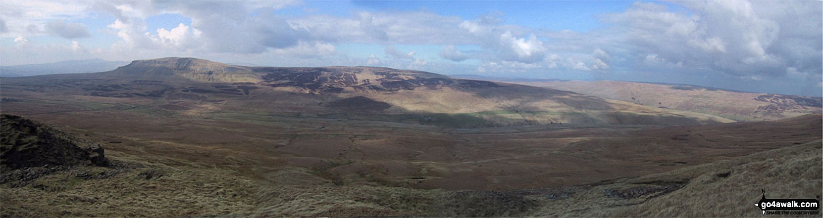

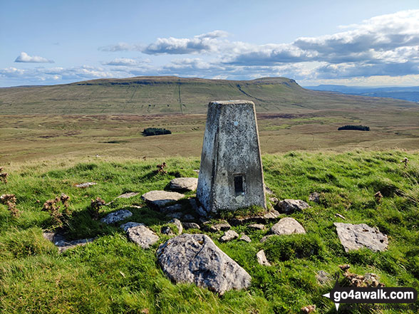
Trig Point on High Green Field Knott with Plover Hill and Pen-y-ghent in the background


Send us your photographs and pictures on, of, or from Plover Hill
If you would like to add your walk photographs and pictures to this page, please send them as email attachments (configured for any computer) along with your name to:
and we shall do our best to publish them.
(Guide Resolution = 300dpi. At least = 660pixels (wide) x 440 pixels (high).)

You can also submit photos via our Facebook Page.
NB. Please indicate where each photo was taken and whether you wish us to credit your photos with a Username or your First Name/Last Name.


