Knoutberry Haw
675m (2217ft)
The Northern Dales Area, The Yorkshire Dales, Cumbria, England
The summit of Knoutberry Haw is marked by an Ordnance Survey Trig Point.
Not familiar with this top?
You can walk/hike to the top of Knoutberry Haw by using this easy‑to‑follow route map:
See Knoutberry Haw and the surrounding tops on our free-to-access 'Google Style' Peak Bagging Maps:
The Northern Dales Area of The Yorkshire Dales National Park
Less data - quicker to download
The Whole of The Yorkshire Dales National Park
More data - might take a little longer to download
See Knoutberry Haw and the surrounding tops on our unique, downloadable, PDF Peak Bagging Map:
NB: Whether you print off a copy or download it to your phone, this PDF Peak Baggers' Map might prove incredibly useful when your are up there on the tops and you cannot get a phone signal.
You can find Knoutberry Haw & all the walks that climb it on these unique free-to-access Interactive Walk Planning Maps:
1:25,000 scale OS Explorer Map (orange/yellow covers):
1:50,000 scale OS Landranger Map (pink/magenta covers):
 Fellow go4awalkers who have already walked, climbed, scaled, summited, hiked & bagged Knoutberry Haw
Ruth Nolan walked up Knoutberry Haw on June 27th, 2022 [from/via/route] Dent, Dales High Way, tarns [with] Solo [weather] Some clouds, light breeze, mostly bright with occasional shower
Angela Moroney climbed it on March 31st, 2021 [from/via/route] uldale house [with] Jane ludders [weather] sunny
Andy Jakob bagged it on April 21st, 2018 [from/via/route] Pennine Way north to south [with] colin and roger AFWC [weather] Fab sun shine
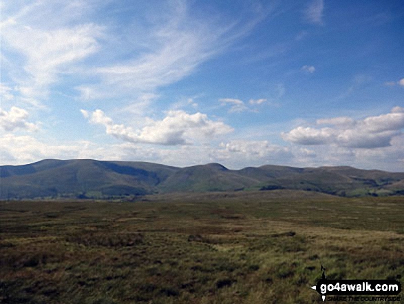
Kevin Foster hiked Knoutberry Haw on August 24th, 2017 [from/via/route] Baugh Fell (Tarn Rigg Hill) [with] Henry [weather] Cloudy - Following the ridge wall westwards & after more bog trotting the trig point on Knoutberry Haw was soon reached with fine views towards the Howgill fells. As time was against me I didn't hang around & headed in a northerly direction towards West Baugh Fell Tarn. A brief stop for photos was followed by a very long descent over grassy slopes which became boggier the nearer I got to the plantation of trees at Uldale House. Eventually I reached the riverside path & followed it to the footbridge over the river. The falls along this section of the river were very impressive. A long & tiring walk & 4 'peaks' bagged but was it that enjoyable? in parts Yes but then only briefly.
Mark Davidson summited on February 23rd, 2003 [with] Alone [weather] High light cloud - not bad for February!
Tony Rogerson conquered it on June 18th, 2016 [from/via/route] Rawthey Bridge Tarn Rigg Hill Knoutberry Haw Bluecaster [with] Caz Floss [weather] Dry Sunny at first Cloudy later - Bit of a slog
Elaine Grayson scaled it on September 3rd, 2015 [from/via/route] go 4 a walk route c382 [with] Robin [weather] cloudy light rain
Christine Shepherd walked up Knoutberry Haw on July 17th, 2014 [from/via/route] Walked from Rawthey Bridge using walk c382 [with] On my own [weather] Very hot & sunny - The walk from Rawthey Gill to this summit seemed a lot further than I expected. This was my second attempt at this fell as I started the walk on 12.7.14 but had to give up when I lost my camera & spent too long looking for it to carry on. Imagine my surprise when I stopped for a drink today & looked down to find my camera hanging from a thistle!! Made the return trip worth while.
Ray O'hara climbed it on March 1st, 2014 [from/via/route] Garsdale, Knoutberry Haw, Baugh Fell & back [weather] mist above about 1800' & rain - Very boggy between the two summits
Patrick Rogozinski, Matthew Thomas and Paul Booth have all walked, climbed & bagged Knoutberry Haw.
To add (or remove) your name and experiences on this page - Log On and edit your Personal Mountain Bagging Record
More Photographs & Pictures of views from, on, or of, Knoutberry Haw
Send us your photographs and pictures on, of, or from Knoutberry Haw
If you would like to add your walk photographs and pictures to this page, please send them as email attachments (configured for any computer) along with your name to:
and we shall do our best to publish them.
(Guide Resolution = 300dpi. At least = 660pixels (wide) x 440 pixels (high).)
You can also submit photos via our Facebook Page.
NB. Please indicate where each photo was taken and whether you wish us to credit your photos with a Username or your First Name/Last Name.

 (Hard)


