
![]()
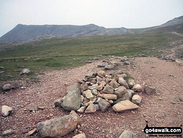
Great End
910m (2987ft)
The Southern Fells, The Lake District, Cumbria, England

Not familiar with this top?
You can walk/hike to the top of Great End by using any of these 8 easy‑to‑follow route maps:
Walk c197 Lingmell and Scafell Pike from Wasdale Head, Wast Water
England's highest mountain
   |
|---|
Vital Statistics:
| Length: | 9ml (14.5km) |
|---|---|
| Ascent: | 3,696ft (1,126m) |
| Time: | 7 hrs |
| Grade: |  (Hard) (Hard) |

Route Summary:
Wasdale Head - Wast Water - Lingmell - Lingmell Col - Scafell Pike - Broad Crag - Ill Crag - Great End - Esk Hause - Sty Head - Lingmell Beck - Gable Beck Bridge - Wasdale Head - Wast Water.
Walk c215 Scafell Pike from Seathwaite (Borrowdale)
England's highest mountain
|
|---|
Vital Statistics:
| Length: | 9.5ml (15km) |
|---|---|
| Ascent: | 3,477ft (1,060m) |
| Time: | 7 hrs |
| Grade: | (Hard) |

Route Summary:
Seathwaite (Borrowdale) - Grains Gill - Styhead Gill - Styhead Tarn - Corridor Route - Scafell Pike - Broad Crag - Ill Crag - Great End - Esk Hause - Grains Gill - Seathwaite (Borrowdale)
Walk c271 The Scafell Massif from Wasdale Head, Wast Water
England's highest & 2nd highest mountains
|
|---|
Vital Statistics:
| Length: | 9.75ml (15.5km) |
|---|---|
| Ascent: | 5,140ft (1,567m) |
| Time: | 8.75hrs |
| Grade: |  (Hard) (Hard) |

Route Summary:
Wasdale Head - (National Trust Campsite) - Wast Water - Lingmell - Middleboot Knotts - Round How (Scafell) - Great End - Ill Crag - Broad Crag - Scafell Pike - Mickledore - Foxes Tarn - Symonds Knott - Sca Fell - Wast Water.
Walk c453 The Scafell Mountains from Wasdale Head, Wast Water
Testing route up England's highest mountains
|
|---|
Vital Statistics:
| Length: | 11ml (17.5km) |
|---|---|
| Ascent: | 5,409ft (1,648m) |
| Time: | 9½ hrs |
| Grade: | (Hard) |

Route Summary:
Wasdale Head - (National Trust Campsite) - Wast Water - Lingmell - Corridor Route - Great End - Ill Crag - Broad Crag - Scafell Pike - Mickledore - Foxes Tarn - Symonds Knott - Sca Fell - Slight Side - Broad Tongue - Hardrigg Gill - Wasdale Head - Wast Water.
Walk c416 Scafell Pike from The Old Dungeon Ghyll, Great Langdale
The 'easiest' way up England's highest from Great Langdale
|
|---|
Vital Statistics:
| Length: | 11.25ml (18km) |
|---|---|
| Ascent: | 3,883ft (1,183m) |
| Time: | 8 hrs |
| Grade: | (Hard) |

Route Summary:
Great Langdale - The Old Dungeon Ghyll - The Cumbria Way - Mickleden Beck - Rossett Gill - Rossett Pike - Angle Tarn (Langdale) - Esk Hause - Scafell Pike - Ill Crag - Broad Crag - Great End - Esk Hause - Angle Tarn - Rossett Gill - Mickleden - Mickleden Beck - The Cumbria Way - The Old Dungeon Ghyll - Great Langdale
Walk c194 Scafell Pike from The Old Dungeon Ghyll, Great Langdale
England's Highest Mountain
|
|---|
Vital Statistics:
| Length: | 12.5ml (20km) |
|---|---|
| Ascent: | 4,684ft (1,428m) |
| Time: | 9.25hrs |
| Grade: | (Hard) |

Route Summary:
Great Langdale - The Old Dungeon Ghyll - The Cumbria Way - Mickleden Beck - Mickleden - Rossett Beck - Rossett Pike - Angle Tarn (Langdale) - Esk Hause - Great End - Ill Crag - Broad Crag - Scafell Pike - Esk Hause - Esk Pike - Ore Gap - Bow Fell (Bowfell) (North Top) - Bow Fell (Bowfell) - Bowfell Buttress - Cambridge Crag - Flat Crag - Climbers' Traverse (optional) - Three Tarns - The Band - Oxendale - Stool End Farm - The Old Dungeon Ghyll - Great Langdale
Walk c166 The Scafell Masiff from Wha House Farm, Eskdale
England's highest mountains
|
|---|
Vital Statistics:
| Length: | 13.75ml (22km) |
|---|---|
| Ascent: | 4,982ft (1,519m) |
| Time: | 10 hrs |
| Grade: |  (Very Hard) (Very Hard) |

Route Summary:
Eskdale - Wha House Farm - Hare Crag - Quagrigg Moss - Slight Side - Sca Fell - Symonds Knott - Scafell Pike - Broad Crag - Ill Crag - Great End - Esk Hause - Lingcove Bridge - Great Moss - Eskdale
Walk c110 The Eskdale Skyline from Wha House Farm, Eskdale
Stenuous high level route across England's highest mountains
|
|---|
Vital Statistics:
| Length: | 14ml (22.5km) |
|---|---|
| Ascent: | 6,009ft (1,832m) |
| Time: | 9 hrs |
| Grade: | (Very Hard) |

Route Summary:
Eskdale - Wha House Farm - Hare Crag - Quagrigg Moss - Slight Side - Sca Fell - Symonds Knott - Mickledore - Scafell Pike - Broad Crag - Ill Crag - Great End - Esk Hause - Esk Pike - Ore Gap - Bow Fell (Bowfell) (North Top) - Bow Fell (Bowfell) - Bowfell Buttress - Cambridge Crag - Flat Crag - Climbers' Traverse (optional) - Three Tarns - Great Moss - Brotherikeld - Eskdale
See Great End and the surrounding tops on our free-to-access 'Google Style' Peak Bagging Maps:
The Southern Fells of The Lake District National Park
Less data - quicker to download
The Whole of The Lake District National Park
More data - might take a little longer to download
See Great End and the surrounding tops on our unique, downloadable, PDF Peak Bagging Maps:

NB: Whether you print off a copy or download it to your phone, these PDF Peak Baggers' Maps might prove incredibly useful when your are up there on the tops and you cannot get a phone signal.
*This version is marked with the walk routes you need to follow to Walk all 214 Wainwrights in just 59 walks.
You can find Great End & all the walks that climb it on these unique free-to-access Interactive Walk Planning Maps:
1:25,000 scale OS Explorer Map (orange/yellow covers):
1:50,000 scale OS Landranger Maps (pink/magenta covers):
 Fellow go4awalkers who have already walked, climbed, scaled, summited, hiked & bagged Great End
Pete George walked up Great End on October 13th, 2025 [from/via/route] Wasdale Head [with] Roco [weather] Beautiful cloud inversion on Lingmell, cloud rising on Scafell Pike, rest of day in fog
Hazel Gilbert climbed it on June 24th, 2008 [with] Lawrence
Christina Lander bagged it on June 28th, 2019 [from/via/route] Wasdale Head - Styhead Pass - The Band - Great End - Broad Crag - Lingmell - Wasdale Head. [with] Dick & Meg [weather] Hot & sunny. - Missed the turning up the Band, so headed up from Sprinkling Tarn to join the Band further up.
John Ramsbottom hiked Great End on January 7th, 2024 [from/via/route] Started at Wasdale Head car park [with] Lola [weather] sunshine cold & frosty, nice day - No pub this time . Being good
James Hughes summited on June 15th, 2023 [from/via/route] Lingmell, Scafell Pike, Broad Crag, Ill Crag, Great End [with] Solo [weather] Beautiful day, clear, warm. blue skies & no wind. - Pearler of a day...
To add (or remove) your name and experiences on this page - Log On and edit your Personal Mountain Bagging Record
. . . [see more walk reports]
More Photographs & Pictures of views from, on, or of, Great End

Haycock, Little Scoat Fell, Red Pike (Wasdale), Pillar, Top of Stirrup Crag, Kirk Fell, Great Gable, Great End, Lingmell, Scafell Pike, Sca Fell, Slightside, Harter Fell (Eskdale) and Burnmoor Tarn from the summit of Yewbarrow
Kirk Fell, Great Gable, Great End and Lingmell from the summit of Yewbarrow


The Scafell Massif - Slight Side, Sca Fell, Symonds Knott, Mickledore, Scafell Pike, Ill Crag and Great End - from the summit cairn on Crinkle Crags (South Top)
The Scafell Massif - Slight Side, Sca Fell, Symonds Knott, Mickledore, Scafell Pike, Ill Crag and Great End from Crinkle Crags (Long Top)

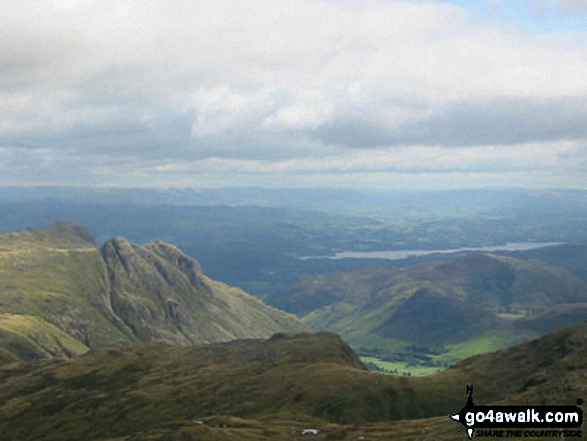
The Scafell Massif - Slight Side, Sca Fell, Symonds Knott, Mickledore, Scafell Pike, Ill Crag and Great End - from the summit of Little Stand

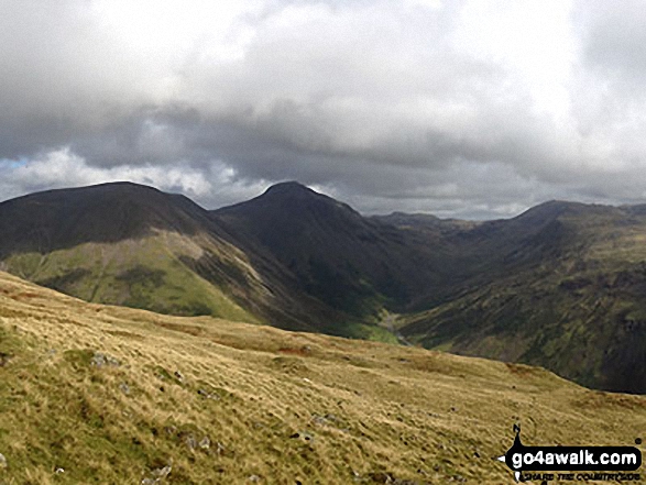
Looking south from the summit of Dale Head (Newlands) with (left to right) Great End, Broad Crag, Ill Crag and Scafell Pike on the horizon and Great Gable (far right - mid distance)

Great End, Lingmell, Scafell Pike, Sca Fell and Slightside from the summit of Yewbarrow

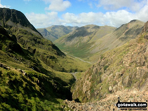
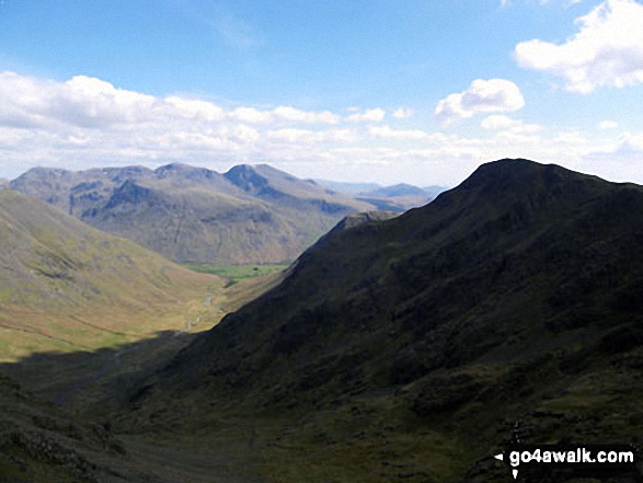
Looking down Greta Gill to Wasdale from Great End with Red Pike (Wasdale), Little Scoat Fell, Kirk Fell and Great Gable beyond
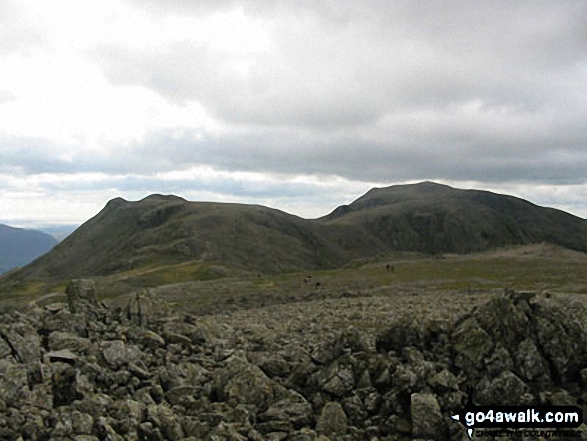
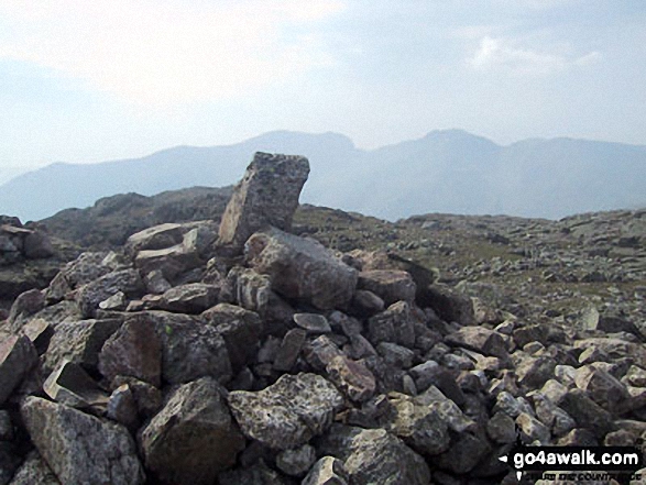
Ill Crag (left) Broad Crag (centre) and Scafell Pike (right) from Great End (Scafell Massif)

From left to right: Slight Side and Sca Fell, Mickledore, Scafell Pike, Ill Crag and Great End, Esk Hause, Esk Pike, Bow Fell (Bowfell), Crinkle Crags (Long Top), Cold Pike, Little Stand and finally the shoulder of Grey Friar from the summit of Hard Knott

The Scafell Massif - Sca Fell, Symonds Knott, Mickledore, Scafell Pike, Ill Crag & Great End - with Bow Fell (Bowfell) in the right foreground from the summit of Bow Fell (Bowfell) (North Top)

Wast Water with the Scafel Massive (far left- featuring Ling Mell, Great End, Broad Crag, Ill Crag, Scafell Pike, Symonds Knott and Sca Fell) and Illgill Head (centre) and Whin Rigg (centre right) above the Wast Water screes from Buckbarrow

Looking down Mosedale to Wasdale Head from Little Scoat Fell with Red Pike (Wasdale) on the right in shadow and the Scafell Massif (featuring Great End, Broad Crag, Lingmell, Scafell Pike, Symonds Knott and Sca Fell) across the valley
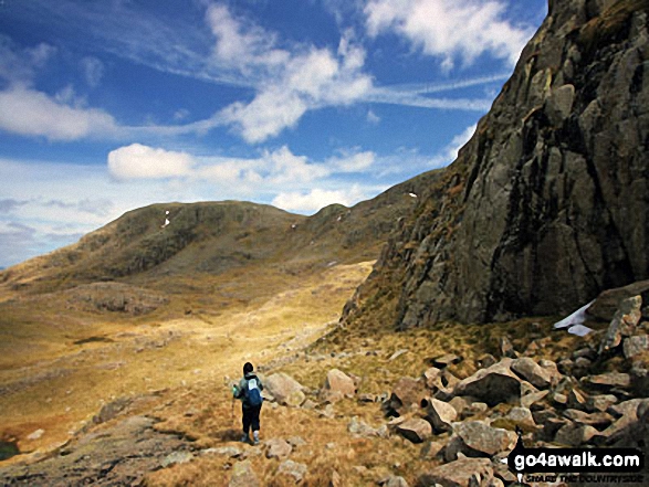
Great End from Broad Crag buttress, just off the corridor route to Scafell Pike
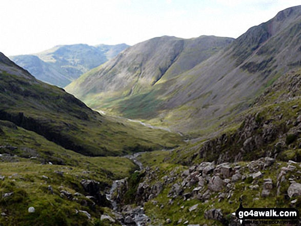
Kirk Fell and the shoulder of Great Gable (right) with the lower slopes of Great End (left) and Red Pike (Wasdale) in the distance from Sty Head
Slight Side and Sca Fell, Mickledore, Scafell Pike, Ill Crag, Great End and Esk Hause from Lingcove Bridge

The Scafel Massive featuring Ling Mell, Great End, Broad Crag, Ill Crag, Scafell Pike, Symonds Knott and Sca Fell above Wast Water from Buckbarrow
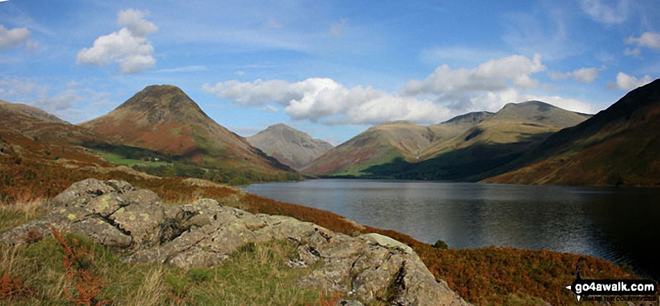
Britain's Favourite View - Yewbarrow, Great Gable, Lingmell, Great End, Sca Fell and the shoulder of Illgill Head (far right) from Wast Water

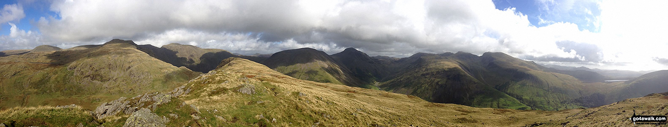
360 degree panorama featuring Great Gable, Green Gable, Little Scoat Fell & Pillar (distance), Brandreth, Dale Head (Newlands), High Spy, Glaramara, Esk Pike, Great End and Scafell Pike from Base Brown
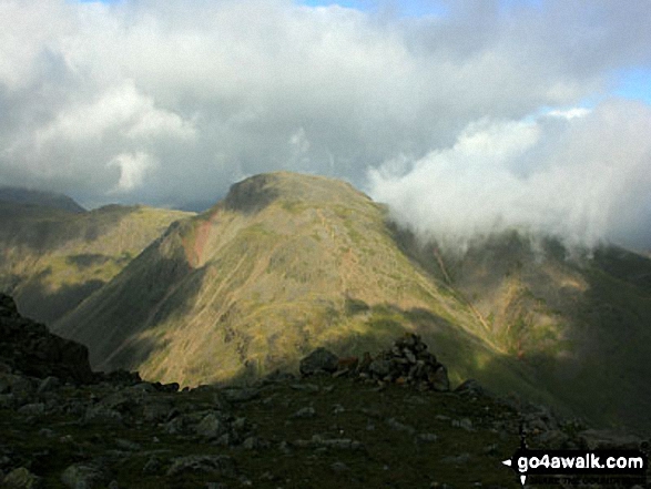
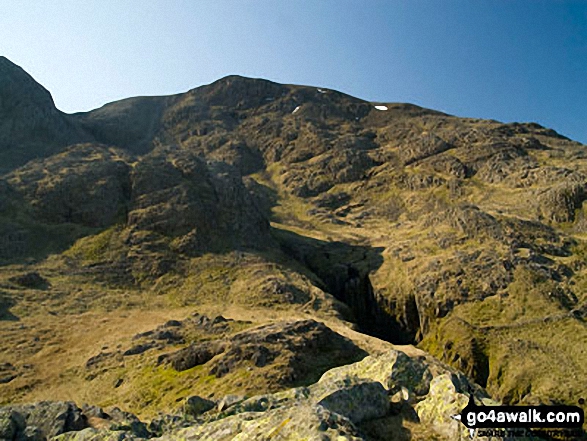
A moody looking Great Gable from Great End's north ridge close to Custs Gully


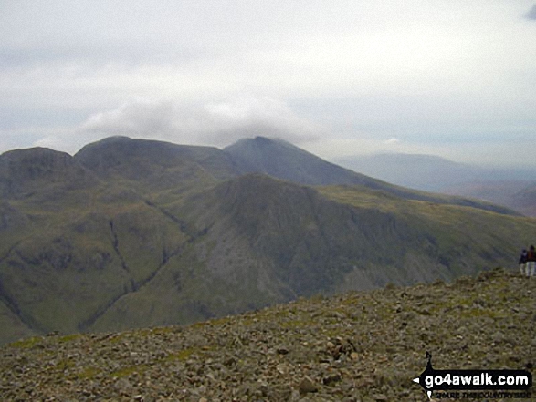


Great End, Scafell Pike and Sca Fell from near the summit of Red Pike (Buttermere)
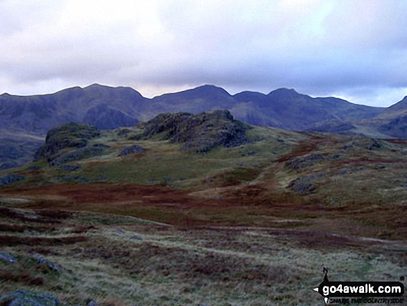
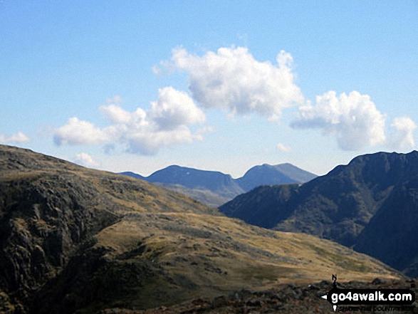
Scafell Pike (far left), Ill Crag and the shoulder of Great End (far right) from Esk Hause
. . . see just 10 walk photographs & pictures of views from, on, or of, Great End
Send us your photographs and pictures on, of, or from Great End
If you would like to add your walk photographs and pictures to this page, please send them as email attachments (configured for any computer) along with your name to:
and we shall do our best to publish them.
(Guide Resolution = 300dpi. At least = 660pixels (wide) x 440 pixels (high).)

You can also submit photos via our Facebook Page.
NB. Please indicate where each photo was taken and whether you wish us to credit your photos with a Username or your First Name/Last Name.


