Fountains Fell (South Top)
663m (2176ft)
The Southern Dales Area, The Yorkshire Dales, North Yorkshire, England
Not familiar with this top?
You can walk/hike to the top of Fountains Fell (South Top) by using this easy‑to‑follow route map:
See Fountains Fell (South Top) and the surrounding tops on our free-to-access 'Google Style' Peak Bagging Maps:
The Southern Dales Area of The Yorkshire Dales National Park
Less data - quicker to download
The Whole of The Yorkshire Dales National Park
More data - might take a little longer to download
See Fountains Fell (South Top) and the surrounding tops on our unique, downloadable, PDF Peak Bagging Map:
NB: Whether you print off a copy or download it to your phone, this PDF Peak Baggers' Map might prove incredibly useful when your are up there on the tops and you cannot get a phone signal.
You can find Fountains Fell (South Top) & all the walks that climb it on these unique free-to-access Interactive Walk Planning Maps:
1:25,000 scale OS Explorer Map (orange/yellow covers):
1:50,000 scale OS Landranger Map (pink/magenta covers):
 Fellow go4awalkers who have already walked, climbed, scaled, summited, hiked & bagged Fountains Fell (South Top)
Mark Davidson walked up Fountains Fell (South Top) on March 29th, 2004 [from/via/route] Walk ny135 Fountains Fell & Darnbrook Fell from Dale Head [with] Alone [weather] Dry but quite cold. Brightened up later.
Angela Moroney climbed it during 2020 [with] JL
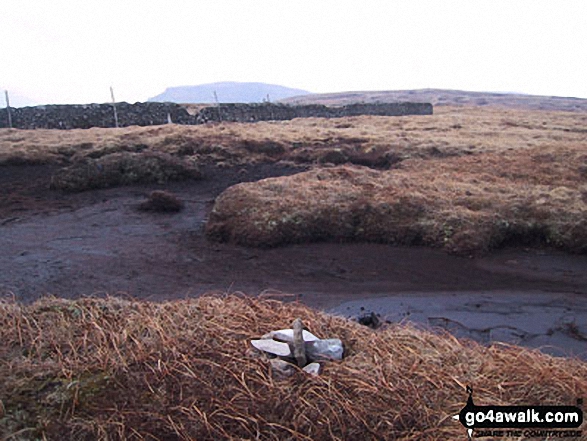
Kevin Foster bagged it on August 17th, 2017 [from/via/route] Silverdale road [with] Henry [weather] Sunny. - A bit of a mopping up exercise this one as I'd missed out Fountain's Fell South Top the last time around. Today was a straight up & down from the relatively high starting point of the Silverdale Road. I walked up the Miner's track until it levelled off then followed the Pennine Way to the main summit cairn. Then an out & back to the South Top. A tiny cairn on an island surrounded by water near the wall marked the summit but it could have been anywhere on this flattish grassy summit. I couldn't locate the disused weather station marked on the map but heading East for a little way I did find two well built wind shelters & an impressive view South towards Malham Tarn. Retracing my steps to the main summit of Fountains Fell I took the original PW route off the fell which now seems to have fallen out of use in favour of the miner's track. The descent was very steep, which probably explains why it has fallen out of favour, but the view across to Pen-Y-Ghent was excellent.
Chris Faulkner hiked Fountains Fell (South Top) on April 30th, 2017 [from/via/route] Dale Head [with] Michelle chandler [weather] Dry / blowy
Tony Rogerson summited on May 10th, 2015 [from/via/route] Dale Head Darnbrook Fell Fountains Fell South Top & Gingling Hole [with] Darren Floss Robbie & Ruby [weather] High cloud
Caroline Winter conquered it on May 2nd, 2015 [from/via/route] Start LittonDale & add on from Fountain Fell Peak [with] Solo [weather] Wet, driving rain & sleet - Headed off to the south top as some dispute about actual FF Summit from Yorkshire gentleman at PW junction before FF Peak, so just in case I took detour to South top before heading back to even more rain in the valley
Ray O'hara scaled it on September 26th, 2013 [from/via/route] Walked straight up from Dale Head, via Fountains Fell [weather] Fine - I overlooked this one the first time I visited Fountains Fell, so I came back again to bag it.
Christine Shepherd walked up Fountains Fell (South Top) on July 8th, 2013 [from/via/route] Walked from Dale Head using walk ny135 [with] On my own [weather] Very hot & sunny
Matthew Thomas, Patrick Rogozinski, Wendy Sockett, Daniel Wynn and Trevor Williams have all walked, climbed & bagged Fountains Fell (South Top).
To add (or remove) your name and experiences on this page - Log On and edit your Personal Mountain Bagging Record
More Photographs & Pictures of views from, on, or of, Fountains Fell (South Top)
Send us your photographs and pictures on, of, or from Fountains Fell (South Top)
If you would like to add your walk photographs and pictures to this page, please send them as email attachments (configured for any computer) along with your name to:
and we shall do our best to publish them.
(Guide Resolution = 300dpi. At least = 660pixels (wide) x 440 pixels (high).)
You can also submit photos via our Facebook Page.
NB. Please indicate where each photo was taken and whether you wish us to credit your photos with a Username or your First Name/Last Name.

 (Moderate)


