![]()
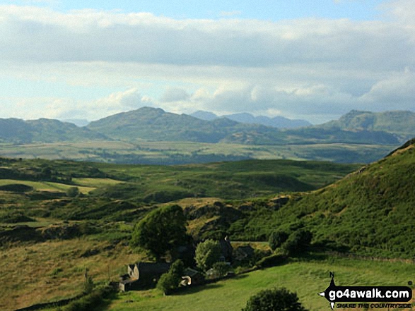
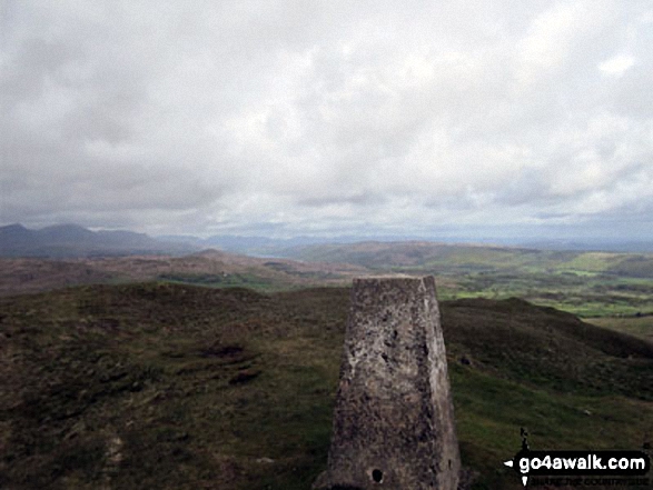
Burney (Great Burney)
298m (978ft)
The Southern Marches, The Lake District, Cumbria, England
Burney (Great Burney) is called 'Burney' in Alfred Wainwright's 1974 Book 'The Outlying Fells of Lakeland'.
Tap/mouse over a coloured circle (1-3 easy walks, 4-6 moderate walks, 7-9 hard walks) and click to select.
The summit of Burney (Great Burney) is marked by an Ordnance Survey Trig Point.
Not familiar with this top?
See Burney (Great Burney) and the surrounding tops on our free-to-access 'Google Style' Peak Bagging Maps:
The Southern Marches area of The Lake District National Park
Less data - quicker to download
The Whole of The Lake District National Park
More data - might take a little longer to download
A go4awalk.com downloadable Peak Bagging Map in PDF format featuring Burney (Great Burney) should be available soon.
You can find Burney (Great Burney) & all the walks that climb it on these unique free-to-access Interactive Walk Planning Maps:
1:25,000 scale OS Explorer Map (orange/yellow covers):
1:50,000 scale OS Landranger Maps (pink/magenta covers):
 Fellow go4awalkers who have already walked, climbed, summited & bagged Burney (Great Burney)
Adrian Howard walked up it on May 6th, 2016 [from/via/route] From Kirkby Moor.
Christine Shepherd climbed it on May 28th, 2015 [from/via/route] Walked from the lay by near the tarn at the bottom on the Woodland Road & just went straight up & down. [with] On my own [weather] Cold & windy but clear
Trevor Williams bagged it on March 9th, 2017 [with] Bob mitchell, paul booth and Barry Salmon [weather] Great
Dave Gay hiked it on June 10th, 2016 [from/via/route] Route as in Wainwrights Outlying Fells book [with] Solo
Andy Pearce summited on May 30th, 2015 [from/via/route] Woodland Road, South of Great Burney [with] Anita & Stan [weather] Sunny, cool
Mark Davidson conquered it on April 23rd, 2015 [with] Alone [weather] Warm & sunny & warm - glorious - Lost my map en-route & had to do the walk via GPS & my memory of the planned route - only got lost once!
David Lord scaled it on May 11th, 2013 [from/via/route] Started from the car park of the Greyhound pub at Grizebeck, just off the A595. [with] My wife Debbie. [weather] Bright but blustery. - The first real fell that we have walked together. A scenic walk taking in Ashlack Hall.
Peter Thwaites, Louise Sandwith, David Preston, Paul Booth and Paul Woodburn have all walked, climbed & bagged Burney (Great Burney).
To add (or remove) your name and experiences on this page - Log On and edit your Personal Mountain Bagging Record
More Photographs & Pictures of views from, on or of Burney (Great Burney)
Send us your photographs and pictures on, of, or from Burney (Great Burney)
If you would like to add your walk photographs and pictures to this page, please send them as email attachments (configured for any computer) along with your name to:
and we shall do our best to publish them.
(Guide Resolution = 300dpi. At least = 660pixels (wide) x 440 pixels (high).)

You can also submit photos via our Facebook Page.
NB. Please indicate where each photo was taken and whether you wish us to credit your photos with a Username or your First Name/Last Name.
Not familiar with this top?