Bullman Hills
610m (2000ft)
The North Pennines, Cumbria, England
Tap/mouse over a coloured circle (1-3 easy walks, 4-6 moderate walks, 7-9 hard walks) and click to select.
Not familiar with this top?
See Bullman Hills and the surrounding tops on our free-to-access 'Google Style' Peak Bagging Map:
The North Pennines
Less data - quicker to download
See Bullman Hills and the surrounding tops on our downloadable Peak Bagging Map in PDF format:
NB: Whether you print off a copy or download it to your phone, this PDF Peak Baggers' Map might prove incredibly useful when your are up there on the tops and you cannot get a phone signal.
You can find Bullman Hills & all the walks that climb it on these unique free-to-access Interactive Walk Planning Maps:
1:25,000 scale OS Explorer Map (orange/yellow covers):
1:50,000 scale OS Landranger Map (pink/magenta covers):
 Fellow go4awalkers who have already walked, climbed, summited & bagged Bullman Hills
Mark Davidson walked up Bullman Hills on October 25th, 2012 [from/via/route] Extension to Walk c443 Round Hill & Bellbeaver Rigg from Garrigill when I went across Crossgill Pants. Very, very boggy & not recommended. Certainly not in late October! [with] Alone [weather] Wet & miserable - loved (most of) it!
Angela Moroney climbed Bullman Hills on May 18th, 2021 [from/via/route] kirkstone [with] Jane ludders [weather] sun wind
Kevin Foster bagged Bullman Hills on August 20th, 2018 [from/via/route] Cross Fell [with] Henry. [weather] cloudy with rain. - The descent off Cross Fell in a just west of north direction was straightforward enough if a little soggy underfoot. I then reached a good track which I followed past Geg's hut & on to Backstone Edge. Here I went off piste in a northerly direction descending down rough grass & then through bog. A line of grouse butts led me to the foot of a short but very steep climb to the first of two tops collectively known as the Bulman Hills. The second northerly top (although slightly lower than the other one) is the actual Nuttall as it rises by nearly 60 feet. The higher southerly top doesn't rise far enough above the col with Cross Fell so isn't a separate summit. I bagged both just to make sure! The descent off the ridge to join up with the old mine track belonging to the Cashwell mine workings was pleasant enough even though by now the weather had really closed in & the waterproofs were back on. The mine track soon rejoined the Pennine Way close to the turn off I'd taken earlier that day for Long Man Hill. From here it was a long descent in the rain & gathering gloom back to my starting point at Garrigill. I finally finished the walk at about 8.30pm thoroughly exhausted but happy with my lot.
Christine Shepherd hiked Bullman Hills on April 18th, 2017 [from/via/route] Walked from Garrigill on The Pennine Way then took detours to bag this & Long Man Hill. [with] On my own [weather] Bright & clear - Look out for beautiful purple fluospar on the way back to the Pennine Way alongside Cash Burn.
Ray O'hara summited Bullman Hills on February 7th, 2013 [from/via/route] Garrigill [weather] Cold, snow underfoot
To add (or remove) your name and experiences on this page - Log On and edit your Personal Mountain Bagging Record
More Photographs & Pictures of views from, on or of Bullman Hills
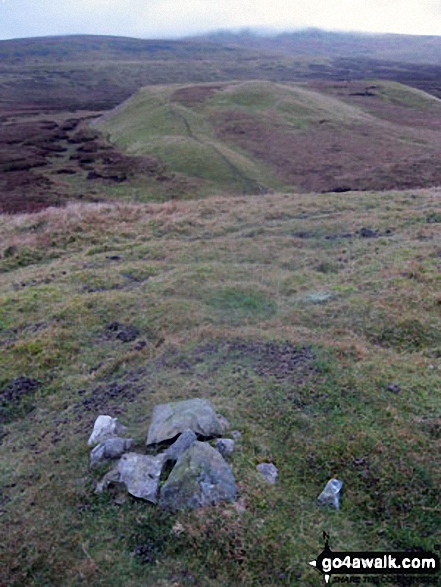
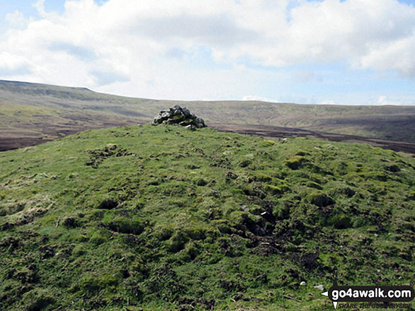
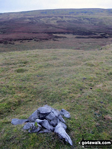
The cairn on Bullman Hills (South Top) summit with Bullman Hills and Cross Fell beyond
Send us your photographs and pictures on, of, or from Bullman Hills
If you would like to add your walk photographs and pictures featuring views from, on or of Bullman Hills to this page, please send them as email attachments (configured for any computer) along with your name to:
and we shall do our best to publish them.
(Guide Resolution = 300dpi. At least = 660pixels (wide) x 440 pixels (high).)
You can also submit photos via our Facebook Page.
NB. Please indicate where each photo was taken and whether you wish us to credit your photos with a Username or your First Name/Last Name.
Not familiar with this top?
 (Hard)