Wainwright Icon

Blea Rigg
541m (1776ft)

The Central Fells, The Lake District, Cumbria, England


Tap/mouse over a coloured circle (1-3 easy walks, 4-6 moderate walks, 7-9 hard walks) and click to select.


Record Blea Rigg as Bagged, Climbed & Conquered


Wainwright Icon

Wainwright
(No. 152)

Walk Blea Rigg walking UK Mountains in The Central Fells The Lake District National Park Cumbria, England

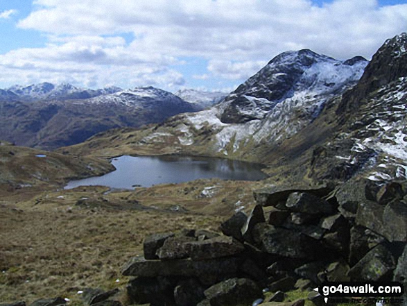
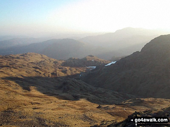
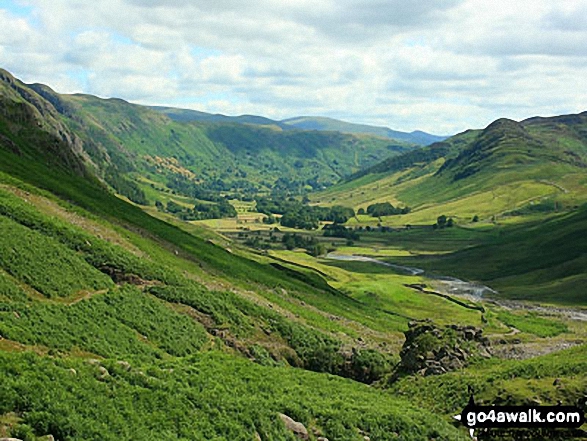
The view from the summit of Blea Rigg

Photo: Andy Malcolm

You can find Blea Rigg & all the walks that climb it on these unique free-to-access Interactive Walk Planning Maps: (click/TAP to select)

The Lake District National Park


1:25,000 scale OS Explorer Maps (the ones with orange/yellow covers):

OL6 The English Lakes - South Western area


OL7 The English Lakes - South Eastern area


1:50,000 scale OS Landranger Map (the ones with pink/magenta covers):

90 Penrith & Keswick, Ambleside


See Blea Rigg and the surrounding tops on our free-to-access 'Google Style' Peak Bagging Maps:

See Blea Rigg and the surrounding tops on our downloadable PDF Peak Bagging Maps:

NB: Whether you print off a copy on to paper or download it to your phone, these PDF Peak Baggers Maps will prove incredibly useful when your are up there on the tops and you cannot get a phone signal!


You can walk to the top of Blea Rigg by using any of these 4 easy‑to‑follow route maps:
Walking Boot Print Icon

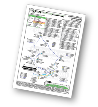
Walk c208 Harrison Stickle and High Raise from The New Dungeon Ghyll, Great Langdale

Steep scramble - strictly for the adventurous

Walk GPS Icon
Walk GPX Icon
Walk PDF Icon

Vital Statistics:

Length: 7.25ml (11.5km)
Ascent:3,046ft (928m)
Time:5.75hrs
Grade:Walk Grade 6 Icon (Moderate)
Walking Boot Print Icon

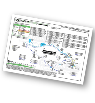
Walk c195 Castle How and Blea Rigg from Grasmere

Good views into Easedale and Langdale

Walk GPS Icon
Walk GPX Icon
Walk PDF Icon

Vital Statistics:

Length: 8.5ml (13.5km)
Ascent:2,402ft (732m)
Time:5½ hrs
Grade:Walk Grade 6 Icon (Moderate)
Walking Boot Print Icon

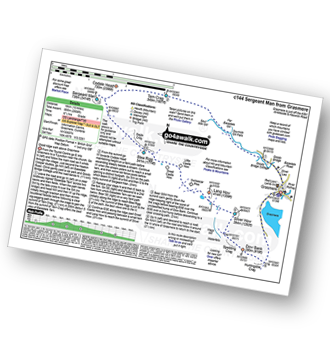
Walk c144 Sergeant Man from Grasmere

Good ridge walk above Grasmere

Walk GPS Icon
Walk GPX Icon
Walk PDF Icon

Vital Statistics:

Length: 10ml (16km)
Ascent:2,936ft (895m)
Time:6½ hrs
Grade:Walk Grade 7 Icon (Hard)
Walking Boot Print Icon

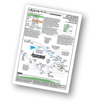
Walk c428 The Langdale Pikes, High Raise and The Easedale Fells from Grasmere

Long high level round

Walk GPS Icon
Walk GPX Icon
Walk PDF Icon

Vital Statistics:

Length: 13.75ml (22km)
Ascent:3,991ft (1,216m)
Time:9 hrs
Grade:Walk Grade 8 Icon (Hard)

Other walkers who hiked, climbed, bagged and summited Blea Rigg Fellow go4awalkers who have already walked, climbed, summited & bagged Blea Rigg

David Higginbottom walked up Blea Rigg on October 3rd, 2024 [from/via/route] C144 [with] Carolyn [weather] Clear - A little boggy miserable walk

Tim Winn climbed Blea Rigg on October 23rd, 2023 [with] Steve, John, Andy, Dave and Darrell [weather] Sunny Day

Christine Shepherd bagged Blea Rigg on October 31st, 2008 [from/via/route] Walked from Grasmere [with] On my own [weather] Sunshine, showers & rainbows. - Bagged this again using walk c144 on 2.9.10 Climbed again with a group from Head 4 the Hills 31.5.21 Climbed again on 9.10.23 with Jenny. Easedale Tarn, Blea Rigg & Silver How- Walk c195 in reverse.This was a walk in glorious Autumn sunshine.

Steve Lucas hiked Blea Rigg on December 22nd, 2020 [with] On my own

Angeline Grieveson summited Blea Rigg on February 26th, 2023 [with] Dotty

Paul Roddam conquered Blea Rigg on February 4th, 2023 [from/via/route] Grasmere [with] Bri and Barber [weather] Cloudy but fairly dry with decent visibility

Richard Fulcher scaled Blea Rigg on October 2nd, 2022 [from/via/route] Parked in the layby on the A591 opposite a footpath down to Grasmere. Set off through Grasmere & the Easedale Road & then followed the bridle path to Stythwaite Steps, turned left up Stenners Crag & then left up Greathead Crag & on to Tarn Crag. From there we followed a stream up to Codale Head. I continued on up to High Raise (because it was there!) & then joined Jen at Sergeant Man. We then descended down & across to Blea Rigg. The descent from Blea Rigg was initially tricky (probably went the wrong way) but became more manageable as we reached Easedale Tarn. The walk from the tarn & back to the car was on well made paths (Lakes style i.e. boulders) & was a slog! [with] Jen [weather] Sunshine & showers, occasional gusts of wind. At times I was hot, freezing cold, battered by wind & then sometimes no wind & just right! - A tiring but rewarding walk.

Martyn Atherton walked up Blea Rigg on March 14th, 2022 [from/via/route] c206 Blea Rigg, Sergeant Man, High Raise, Thunacar Knot, Pavey Ark, Harrison Stickle, Pike of Stickle & Loft Crag [with] Self [weather] Dry & cloudy ath first then sunny & then raining - A really good & varied walk

Ian Ashton climbed Blea Rigg on February 21st, 2022 [with] Solo

Geoff Hand bagged Blea Rigg on January 27th, 2022 [from/via/route] Walk c144 Sergeant Man from Grasmere. [with] Alone with Tess [weather] Broken cloud & sun, showery, getting clearer as day went on. - Unfortunately main thing which will remain in my mind about thid walk was trapping my finger in the car rear door just as I was setting off! Lots of pain, blood & confusion for most of the walk.

To add (or remove) your name and experiences on this page - Log On and edit your Personal Mountain Bagging Record

. . . [see more walk reports]


More Photographs & Pictures of views from, on or of Blea Rigg
Stickle Tarn, Harrison Stickle and Pavey Ark from near Blea Rigg

Stickle Tarn, Harrison Stickle and Pavey Ark from near Blea Rigg

Photo: Andy Malcolm (44)

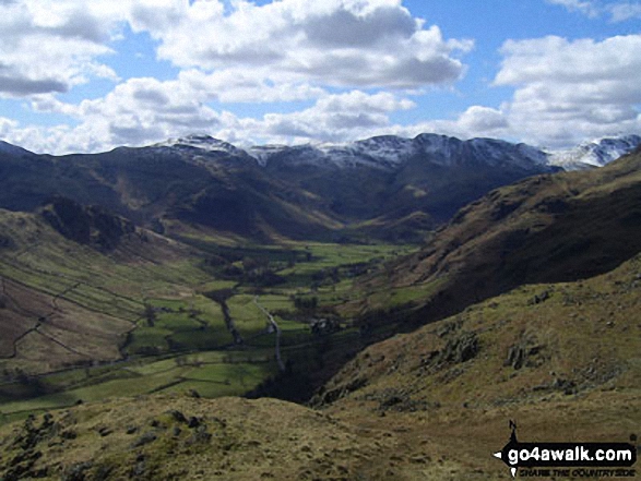
Great Langdale and Blea Rigg with The Helvellyn Massiff in the distance under a deep blanket of snow from the lower slopes of Pike of Blisco (Pike o' Blisco)

Great Langdale and Blea Rigg with The Helvellyn Massiff in the distance under a deep blanket of snow from the lower slopes of Pike of Blisco (Pike o' Blisco)

Photo: Simon Barnett (56)

Blea Rigg, Castle How, Lang How and Silver How (far left) Great Langdale, Windermere and Elter Water (left), Lingmoor Fell and Side Pike (centre left), Blea Tarn and Little Langdale (centre right), Pike of Blisco (Pike o' Blisco) right and Crickle Crags (far right) from the summit of Harrison Stickle, The Langdale Pikes

Blea Rigg, Castle How, Lang How and Silver How (far left) Great Langdale, Windermere and Elter Water (left), Lingmoor Fell and Side Pike (centre left), Blea Tarn and Little Langdale (centre right), Pike of Blisco (Pike o' Blisco) right and Crickle Crags (far right) from the summit of Harrison Stickle, The Langdale Pikes

Photo: Jacques Duijn (1)

*The view from Sergeant Man featuring Blea Rigg (centre left), Lingmoor Fell (centre distance), Stickle Tarn (partially hidden) and Pavey Ark with Harrison Stickle beyond (The Langdale Pikes) (centre right)

*The view from Sergeant Man featuring Blea Rigg (centre left), Lingmoor Fell (centre distance), Stickle Tarn (partially hidden) and Pavey Ark with Harrison Stickle beyond (The Langdale Pikes) (centre right)

Photo: Tim Hope (29)

Grasmere, Silver How, Lang How, Blea Rigg, Easedale Tarn, The LAngdale Pikes, Codale Head, Gibson Knott and Calf Crag from Helm Crag summit cairn

Grasmere, Silver How, Lang How, Blea Rigg, Easedale Tarn, The LAngdale Pikes, Codale Head, Gibson Knott and Calf Crag from Helm Crag summit cairn

Photo: Tim Hope (73)

Grasmere, Easedale Tarn and Blea Rigg from Tarn Crag summit

Grasmere, Easedale Tarn and Blea Rigg from Tarn Crag summit

Photo: Tim Hope (62)

Harrison Stickle and the Langdale Pikes from Blea Rigg in the snow

Harrison Stickle and the Langdale Pikes from Blea Rigg in the snow

Photo: Peter Harrison (17)

Blea Rigg (right) from Coledale Tarn

Blea Rigg (right) from Coledale Tarn

Photo: Alan Wainwright (223)

Great Langdale with Blea Rigg, Lang How and Silver How (left) and Lingmoor Fell (right) from the foot of Oxendale

Great Langdale with Blea Rigg, Lang How and Silver How (left) and Lingmoor Fell (right) from the foot of Oxendale

Photo: Andy Malcolm (224)

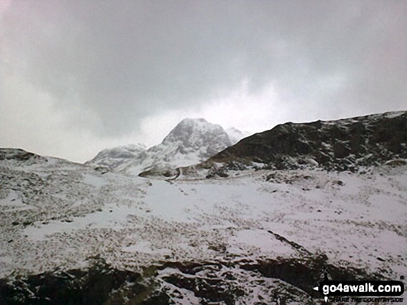
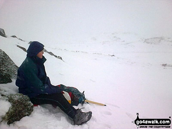
Snow moving in on Blea Rigg

Snow moving in on Blea Rigg

Photo: Peter Harrison (16)

*Stickle Tarn, Harrison Stickle and Pavey Ark from near Blea Rigg

*Stickle Tarn, Harrison Stickle and Pavey Ark from near Blea Rigg

Photo: Andy Malcolm (48)

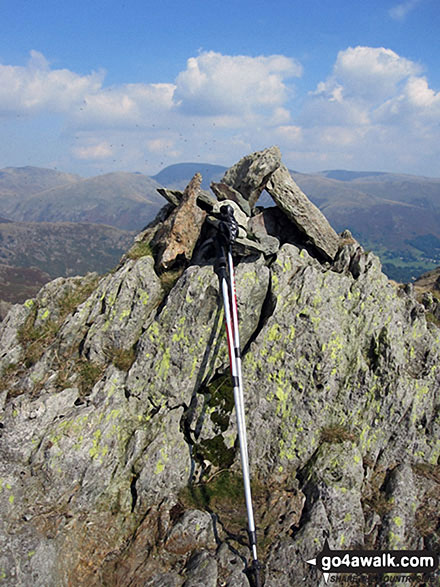
Blea Rigg summit cairn

Blea Rigg summit cairn

Photo: Christine Shepherd (462)

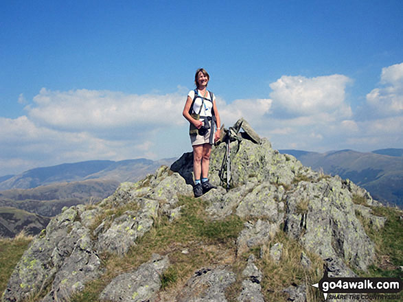
Me on the summit of Blea Rigg

Me on the summit of Blea Rigg

Photo: Christine Shepherd (511)

Towards Blea Rigg from Tarn Crag (Easedale)

Towards Blea Rigg from Tarn Crag (Easedale)

Photo: David Hayter (266)

Pavey Ark, Stickle Tarn & Harrison Stickle from nr Blea Rigg

Pavey Ark, Stickle Tarn & Harrison Stickle from nr Blea Rigg

Photo: Robbie Breadner (1)

*Codale Tarn (left) and Easedale Tarn from the Blea Rigg ridge with Helvellyn (left), Seat Sandal (centre) and Fairfield (right) on the horizon

*Codale Tarn (left) and Easedale Tarn from the Blea Rigg ridge with Helvellyn (left), Seat Sandal (centre) and Fairfield (right) on the horizon

Photo: Tim Hope (26)

The view from Sergeant Man featuring Blea Rigg (centre left),Lingmoor Fell (distance centre), Stickle Tarn (partially hidden) and the shoulder of Pavey Ark (The Langdale Pikes) (right)

The view from Sergeant Man featuring Blea Rigg (centre left),Lingmoor Fell (distance centre), Stickle Tarn (partially hidden) and the shoulder of Pavey Ark (The Langdale Pikes) (right)

Photo: Tim Hope (30)

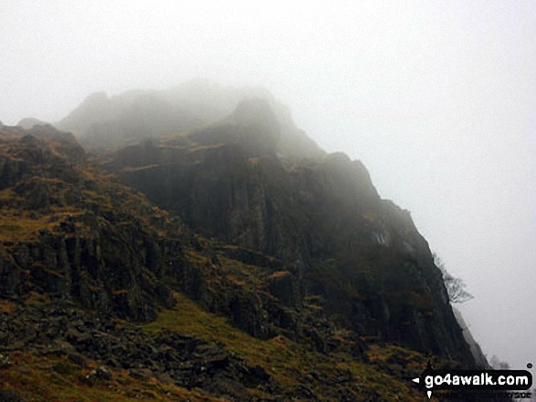
A misty Blea Crag on the descent down from Blea Rigg

A misty Blea Crag on the descent down from Blea Rigg

Photo: Andy Malcolm (118)

Sunburst on Great Langdale from near Blea Rigg

Sunburst on Great Langdale from near Blea Rigg

Photo: Andy Malcolm (46)


Send us your photographs and pictures on, of, or from Blea Rigg

If you would like to add your walk photographs and pictures featuring views from, on or of Blea Rigg to this page, please send them as email attachments (configured for any computer) along with your name to:


and we shall do our best to publish them.

(Guide Resolution = 300dpi. At least = 660pixels (wide) x 440 pixels (high).)

Send us your photographs and pictures on, of, or from Blea Rigg via Facebook

You can also submit photos via our Facebook Page.

NB. Please indicate where each photo was taken.


Follow go4awalk.com on Twitter Follow go4awalk.com on Facebook


Home


Find new Friends to go walking with

Walk all 214 Wainwrights in just 59 Walks. Download GPS Waypoints - Great Walks you must not miss!

Walk The Yorkshire Three Peaks Challenge Walk - All the Latest Route Information, GPS Waypoints and Split Times to keep you on Schedule

Walk The British Three Peaks Challenge Walk - All the Latest Route Information and GPS Waypoints

See our pick of The Best Walks in The Lake District - Great Walks you must not miss!

Walk our pick of the Best Lake District Ridge Walks - Great Walks you must not miss!

Walk our pick of the Best Lake District Walks to do in the rain - Great Walks you must not miss!

Walk our pick of The Best Walks in Snowdonia - Great Walks you must not miss!

Walk our pick of The Best Ridge Walks in Wales - Walks you must not miss!

Walk our pick of The Best Walks in The Brecon Beacons - Great Walks you must not miss!

Walk our pick of The Best Walks in The Yorkshire Dales - Walks you must not miss!

Walk our pick of The Best Walks in The Peak District - Walks you must not miss!

Walk our pick of The Best Walks in The Forest of Bowland - Walks you must not miss!

Walk our pick of The Best Walks in Shropshire - Walks you must not miss!

Walk our pick of The Best Walks in Cheshire - Walks you must not miss!

Walk our pick of The Best Walks in Lancashire - Walks you must not miss!

Not sure where to walk next? Try Peak Bagging - Great Walks you must not miss!

Not sure where to walk next? Walk part of a National Trail - Great Walks you must not miss!

Walks with Downloadable and Uploadable GPS Waypoint Data

Walking Kit and Gear Tested by Walkers

Full Site Search