
![]()
Durham Edge (Abney Moor)
416m (1365ft)
The White Peak Area, The Peak District, Derbyshire, England
The Trig Point on the summit of Durham Edge (Abney Moor) summit is on private land and not accessible to the public.
The summit of Durham Edge (Abney Moor) is marked by an Ordnance Survey Trig Point.

Not familiar with this top?
You can walk/hike to the top of Durham Edge (Abney Moor) by using any of these 3 easy‑to‑follow route maps:
Walk d223 Durham Edge, Great Hucklow and Little Hucklow from Bradwell
Excellent high level route with superb views
   |
|---|
Vital Statistics:
| Length: | 6.5ml (10.5km) |
|---|---|
| Ascent: | 1,241ft (378m) |
| Time: | 3.75hrs |
| Grade: |  (Moderate) (Moderate) |

Route Summary:
Bradwell - Bradwell Hills - Bradwell Edge - Robin Hood's Cross - Bleak Knoll (Abney Moor) - Durham Edge (Abney Moor) - Abney Moor - Abney Grange - Bretton Brook - Great Hucklow - Windmill - Little Hucklow - Coplow Dale - Intake Dale - Bradwell Dale - Bradwell
Walk d117 Burton Bole End and Abney Clough from Bradwell
Excellent high level views with a lovely valley
|
|---|
Vital Statistics:
| Length: | 7.5ml (12km) |
|---|---|
| Ascent: | 1,766ft (538m) |
| Time: | 4½ hrs |
| Grade: |  (Moderate) (Moderate) |
Route Summary:
Bradwell - Bradwell Hills - Bradwell Edge - Robin Hood's Cross - Bleak Knoll (Abney Moor) - Durham Edge (Abney Moor) - Abney Moor - Wolf's Pit - Burton Bole End (Abney Moor) - Smelting Hill - Oaks Farm - Mill Wood - Stoke Ford - Highlow Brook - Abney Clough - Abney - Abney Moor - Bradwell
Walk d155 Great Hucklow, Tideswell Moor and Bradwell Moor from Bradwell
Superb high level route with excellent views
|
|---|
Vital Statistics:
| Length: | 11.25ml (18km) |
|---|---|
| Ascent: | 1,759ft (536m) |
| Time: | 5.75hrs |
| Grade: |  (Moderate) (Moderate) |

Route Summary:
Bradwell - Bradwell Hills - Bradwell Edge - Robin Hood's Cross - Bleak Knoll (Abney Moor) - Durham Edge (Abney Moor) - Abney Moor - Abney Grange - Bretton Brook - Great Hucklow - Windmill - High Rake Mine - High Rake - Tideslow Rake - Tides Low - New Farm - Tideswell Moor - Bradwell Moor - Old Moor - Potter Barn - Smalldale Hall - Bradwell
See Durham Edge (Abney Moor) and the surrounding tops on our free-to-access 'Google Style' Peak Bagging Maps:
The White Peak Area of The Peak District National Park
Less data - quicker to download
See Durham Edge (Abney Moor) and the surrounding tops on our unique, downloadable, PDF Peak Bagging Map:

NB: Whether you print off a copy or download it to your phone, this PDF Peak Baggers' Map might prove incredibly useful when your are up there on the tops and you cannot get a phone signal.
You can find Durham Edge (Abney Moor) & all the walks that climb it on these unique free-to-access Interactive Walk Planning Maps:
1:25,000 scale OS Explorer Map (orange/yellow covers):
1:50,000 scale OS Landranger Map (pink/magenta covers):
There are no walk reports for Durham Edge (Abney Moor) because it is on private land and not accessible to the public
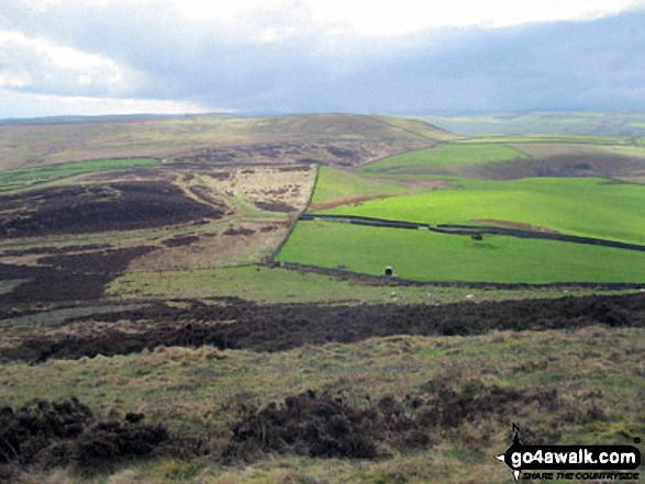
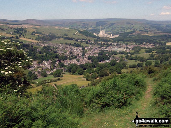
More Photographs & Pictures of views from, on, or of, Durham Edge (Abney Moor)
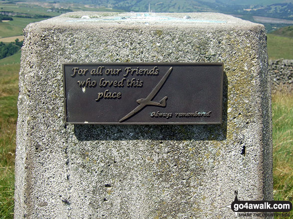
Dedication from the local gliding club in Durham Edge (Abney Moor) summit Trig Point

Send us your photographs and pictures on, of, or from Durham Edge (Abney Moor)
If you would like to add your walk photographs and pictures to this page, please send them as email attachments (configured for any computer) along with your name to:
and we shall do our best to publish them.
(Guide Resolution = 300dpi. At least = 660pixels (wide) x 440 pixels (high).)

You can also submit photos via our Facebook Page.
NB. Please indicate where each photo was taken and whether you wish us to credit your photos with a Username or your First Name/Last Name.


