
![]()
High Neb (Stanage Edge)
458m (1503ft)
The Dark Peak Area, The Peak District, Derbyshire/South Yorkshire, England
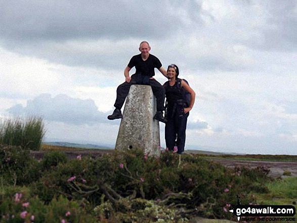
The summit of High Neb (Stanage Edge) is marked by an Ordnance Survey Trig Point.

Not familiar with this top?
   |
|---|
Vital Statistics:
| Length: | 9.5mls (15km) |
|---|---|
| Ascent: | 2,097ft (639m) |
| Time: | 5½ hrs |
| Grade: |  (Moderate) (Moderate) |
Route Summary:
Hathersage - Hathersage Pinfold - Toothill Farm - Hookcar Sitch - Overstones Farm - Cowper Stone - Stanage Edge (Stanage Edge) - Hook's Car - White Path Moss - Robin Hood's Cave - Stanage Plantation - Long Causeway - Stanage Edge - High Neb (Stanage Edge) - Crow Chin - Moscar Moor - Bamford Moor - Upper Hurst Brook - Bole Hill (Bamford) - Bolehill Wood - Upper Hurst Farm - Gatehouse Farm - Hurstclough Lane - Nether Hurst Farm - Coggers Lane - Hathersage
See High Neb (Stanage Edge) and the surrounding tops on our free-to-access 'Google Style' Peak Bagging Maps:
The Dark Peak Area of The Peak District National Park
Less data - quicker to download
See High Neb (Stanage Edge) and the surrounding tops on our downloadable Peak Bagging Map in PDF format:

NB: Whether you print off a copy or download it to your phone, this PDF Peak Baggers' Map might prove incredibly useful when your are up there on the tops and you cannot get a phone signal.
You can find High Neb (Stanage Edge) & all the walks that climb it on these unique free-to-access Interactive Walk Planning Maps:
1:25,000 scale OS Explorer Map (orange/yellow covers):
1:50,000 scale OS Landranger Map (pink/magenta covers):
 Fellow go4awalkers who have already walked, climbed, summited & bagged High Neb (Stanage Edge)
Nick Tippins walked up High Neb (Stanage Edge) on April 28th, 2024 [with] Fran
Nina Adams climbed it on May 28th, 2023 [from/via/route] Hooks Carr Carpark - Stanage Edge - High Neb & back again [with] Craig [weather] 12C Sunny
Angela Haworth bagged it on December 15th, 2020 [from/via/route] From Dennis Knoll [with] alone [weather] Dry
Christine Shepherd hiked High Neb (Stanage Edge) on April 9th, 2019 [from/via/route] Walked from Hathersage using walk d130 [with] On my own [weather] Lovely spring sunshine. Quite a gusty breeze on the summits. - A good walk. The 'boggy moor' wasn't boggy today & there were quite a few narrow but clear paths from High Neb over to Bamford Moor.
Michael Lee summited during 1986 [from/via/route] From various directions places.. [with] Jill and loads of other people [weather] various - Done this many times in all sorts of weathers..
To add (or remove) your name and experiences on this page - Log On and edit your Personal Mountain Bagging Record
. . . [see more walk reports]
More Photographs & Pictures of views from, on or of High Neb (Stanage Edge)

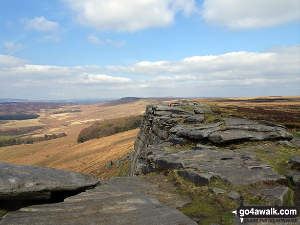
Looking towards High Neb (Stanage Edge) from Stanage Edge (Stanage Edge)

Winhill Pike (Win Hill) across Bamford Moor from High Neb (Stanage Edge)

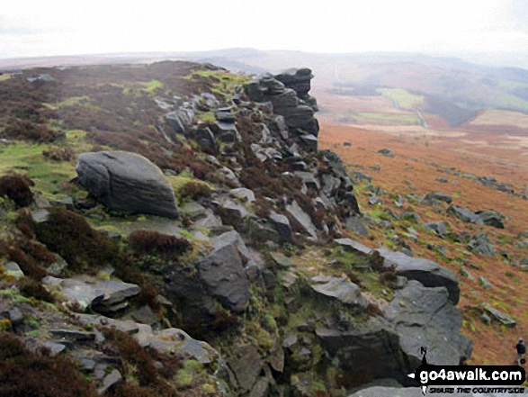
High Neb (Stanage Edge) (left), Stanage Edge and Stanage Edge (Stanage Edge) (right - distance) from Moscar Moor


Send us your photographs and pictures on, of, or from High Neb (Stanage Edge)
If you would like to add your walk photographs and pictures to this page, please send them as email attachments (configured for any computer) along with your name to:
and we shall do our best to publish them.
(Guide Resolution = 300dpi. At least = 660pixels (wide) x 440 pixels (high).)

You can also submit photos via our Facebook Page.
NB. Please indicate where each photo was taken and whether you wish us to credit your photos with a Username or your First Name/Last Name.


