
![]()
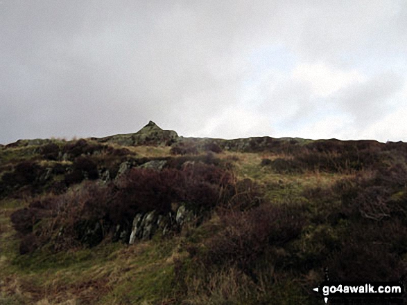
High Light Haw (Top o' Selside)
259m (850ft)
The Southern Marches, The Lake District, Cumbria, England

Not familiar with this top?
We will be adding easy-to-follow route maps up High Light Haw (Top o' Selside) very soon.
See High Light Haw (Top o' Selside) and the surrounding tops on our free-to-access 'Google Style' Peak Bagging Maps:
The Southern Marches area of The Lake District National Park
Less data - quicker to download
The Whole of The Lake District National Park
More data - might take a little longer to download
A go4awalk.com downloadable Peak Bagging Map in PDF format featuring High Light Haw (Top o' Selside) should be available soon.
You can find High Light Haw (Top o' Selside) & all the walks that climb it on these unique free-to-access Interactive Walk Planning Maps:
1:25,000 scale OS Explorer Maps (orange/yellow covers):
1:50,000 scale OS Landranger Maps (pink/magenta covers):
 Fellow go4awalkers who have already walked, climbed, scaled, summited, hiked & bagged High Light Haw (Top o' Selside)
Nick Tippins walked up High Light Haw (Top o' Selside) on September 29th, 2025 [from/via/route] High Light Haw - Top o' Selside Summit Cairn Loop from Oxen Park [with] Fran
Colin Egan climbed it on April 5th, 2018 [from/via/route] Continuation from Top O Selside [with] My wife Faith [weather] Fine. - A pleasant enough amble along the ridge although distinctly squishy underfoot.
Trevor Williams bagged it on May 23rd, 2017 [from/via/route] Water Yeat [with] Recce for HF
Mark Davidson hiked High Light Haw (Top o' Selside) on May 9th, 2016 [with] Alone [weather] Warm & sunny, clear blue skies with hardly a cloud but quite a strong wind
Dave Gay summited on September 13th, 2015 [from/via/route] Parked at Dodgson Wood. Up via Low Parkamoor to Top o'Selside - Amsbarrow Hill - Stang Hill - High light Haw - Low light Haw - Brock Barrow [with] Jessica
Andy Pearce has conquered it [from/via/route] East of Lake [with] Anita & Stan [weather] Sunny & Warm
Christine Shepherd scaled it on February 20th, 2015 [from/via/route] Walked from High Nibthwaite using Wainwright's Outlying Fells [with] On my own [weather] Dull but quite clear. Did get quite cold in the wind.
Adrian Howard, Louise Sandwith, David Preston and Paul Woodburn have all walked, climbed & bagged High Light Haw (Top o' Selside).
To add (or remove) your name and experiences on this page - Log On and edit your Personal Mountain Bagging Record
More Photographs & Pictures of views from, on, or of, High Light Haw (Top o' Selside)
Send us your photographs and pictures on, of, or from High Light Haw (Top o' Selside)
If you would like to add your walk photographs and pictures to this page, please send them as email attachments (configured for any computer) along with your name to:
and we shall do our best to publish them.
(Guide Resolution = 300dpi. At least = 660pixels (wide) x 440 pixels (high).)

You can also submit photos via our Facebook Page.
NB. Please indicate where each photo was taken and whether you wish us to credit your photos with a Username or your First Name/Last Name.


