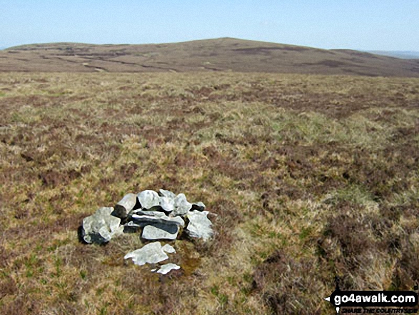
Carnedd Llechwedd-llyfn
643m (2110ft)
The Arenigs Area, Snowdonia, Conwy/Gwynedd, Wales
Not familiar with this top?

   |
|---|
Vital Statistics:
| Length: | 7.5ml (12km) |
|---|---|
| Ascent: | 1,841ft (561m) |
| Time: | 4.75hrs |
| Grade: |  (Moderate) (Moderate) |

Route Summary:
Llyn Celyn - Ffridd Bwlch-gwyhn - Nant y Coed - Brottos - Carnedd y Filiast (Arenigs) - Waun Garnedd-y-filiast - Carnedd Llechwedd-llyfn - Llechwedd-llyfnr - Foel-boeth (Llyn Celyn) - Llyn Celyn


|
|---|
Vital Statistics:
| Length: | 12.75ml (20.5km) |
|---|---|
| Ascent: | 2,939ft (896m) |
| Time: | 7.75hrs |
| Grade: |  (Hard) (Hard) |

Route Summary:
Llyn Celyn - Nant y Coed - Brottos - Carnedd y Filiast (Arenigs) - Waun Garnedd-y-Filiast - Carnedd y Filiast (Arenigs) - Carnedd Llechwedd-llyfn - Afon Celyn - Trinant - Arenig Fach - Capel Celyn - Llyn Celyn
See Carnedd Llechwedd-llyfn and the surrounding tops on our free-to-access 'Google Style' Peak Bagging Maps:

The Arenigs of Snowdonia National Park
Less data - quicker to download
The Whole of Snowdonia National Park
More data - might take a little longer to download
See Carnedd Llechwedd-llyfn and the surrounding tops on our downloadable Peak Bagging Map in PDF format:

NB: Whether you print off a copy or download it to your phone, this PDF Peak Baggers' Map might prove incredibly useful when your are up there on the tops and you cannot get a phone signal.
You can find Carnedd Llechwedd-llyfn & all the walks that climb it on these unique free-to-access Interactive Walk Planning Maps:
1:25,000 scale OS Explorer Map (orange/yellow covers):
1:50,000 scale OS Landranger Maps (pink/magenta covers):
 Fellow go4awalkers who have already walked, climbed, summited & bagged Carnedd Llechwedd-llyfn
Christina Lander walked up Carnedd Llechwedd-llyfn on May 24th, 2023 [from/via/route] Ysbyty Ifan - Carnedd Llechwedd Llyfn - Carnedd y Filiast - Waun Carnedd y Filiast - Ysbyty Ifan [with] Dick [weather] Sunny day - Almost pathless!
Mark Davidson climbed it on May 11th, 2009 [with] Alone [weather] Lovely & sunny & warm - Fantastic Views
Stephanie Doyle, Paul Booth and Trevor Williams have all walked, climbed & bagged Carnedd Llechwedd-llyfn.
To add (or remove) your name and experiences on this page - Log On and edit your Personal Mountain Bagging Record
More Photographs & Pictures of views from, on or of Carnedd Llechwedd-llyfn


Send us your photographs and pictures on, of, or from Carnedd Llechwedd-llyfn
If you would like to add your walk photographs and pictures to this page, please send them as email attachments (configured for any computer) along with your name to:
and we shall do our best to publish them.
(Guide Resolution = 300dpi. At least = 660pixels (wide) x 440 pixels (high).)

You can also submit photos via our Facebook Page.
NB. Please indicate where each photo was taken and whether you wish us to credit your photos with a Username or your First Name/Last Name.