
![]()
Scar Crags
672m (2205ft)
The North Western Fells, The Lake District, Cumbria, England
You can find Scar Crags & all the walks that climb it on these unique free-to-access Interactive Walk Planning Maps: (click/TAP to select)
1:25,000 scale OS Explorer Map (the ones with orange/yellow covers):
1:50,000 scale OS Landranger Maps (the ones with pink/magenta covers):
See Scar Crags and the surrounding tops on our free-to-access 'Google Style' Peak Bagging Maps:
See Scar Crags and the surrounding tops on our downloadable PDF Peak Bagging Maps:
*Walk & bag all 29 Wainwrights in The North Western Fells area of The Lake District in just 7 easy-to-follow circular walks.
*This version is marked with the walk routes you need to follow to Walk all 214 Wainwrights in just 59 walks. Click here for more information.
NB: Whether you print off a copy on to paper or download it to your phone, these PDF Peak Baggers Maps will prove incredibly useful when your are up there on the tops and you cannot get a phone signal!
   |
|---|
Vital Statistics:
| Length: | 7.25ml (11.5km) |
|---|---|
| Ascent: | 3,013ft (918m) |
| Time: | 5.75hrs |
| Grade: |  (Moderate) (Moderate) |
Route Summary:
Braithwaite - Barrow (Newlands) - Stile End - Low Moss - Outerside - High Moss - Scar Crags - Causey Pike - Sleet Hause - Rowling End - Stoneycroft - Braithwaite
|
|---|
Vital Statistics:
| Length: | 10ml (16km) |
|---|---|
| Ascent: | 4,641ft (1,414m) |
| Time: | 8½ hrs |
| Grade: |  (Hard) (Hard) |
Route Summary:
Braithwaite - Sleet How - Grisedale Pike - Hobcarton Crag - Hopegill Head - Sand Hill - Coledale Hause - Crag Hill (Eel Crag) - Sail (Derwent Fells) - Scar Crags - Causey Pike - Outerside - Stile End - Barrow (Newlands) - Braithwaite
|
|---|
Vital Statistics:
| Length: | 12ml (19km) |
|---|---|
| Ascent: | 5,261ft (1,603m) |
| Time: | 9.75hrs |
| Grade: |  (Very Hard) (Very Hard) |
Route Summary:
Braithwaite - Sleet How - Grisedale Pike - Hobcarton Crag - Hopegill Head - Sand Hill - Coledale Hause - Grasmoor - Wandope - Crag Hill (Eel Crag) - Sail (Derwent Fells) - Scar Crags - Causey Pike - Outerside - Stile End - Barrow (Newlands) - Braithwaite
 Fellow go4awalkers who have already walked, climbed, summited & bagged Scar Crags
Ian Ashton walked up Scar Crags on June 30th, 2024 [with] Solo - Ì
Geoff Hand climbed Scar Crags on June 18th, 2024 [from/via/route] Walk C408 Grisedale Pike, Crag Hill, Sail, Scar Craggs & Outerside [with] Tess the Jack Russell [weather] Misty & claggy at first then clearing into a pleasant sunny day. - Left a couple of peaks out as I had already completed them. Went upto Stile end on the way back. It was a tough, fun climb up Eel crag from Coledale Hause
Claire Kirk bagged Scar Crags on August 6th, 2023 [from/via/route] Braithwaite - Coledale Horseshoe [with] Leigh
Dan Milman hiked Scar Crags on April 11th, 2024 [with] Milly [weather] Warm & clear
Sarah Gunn summited Scar Crags on March 30th, 2024 [from/via/route] Grisedale Pike & Causey Pike from Braithwaite [with] Martin Gunn
David Higginbottom conquered Scar Crags on July 3rd, 2023 [from/via/route] Route 408 [with] Carolyn [weather] Good
Michael Austin scaled Scar Crags on August 21st, 2022 [from/via/route] C112
Paul Macey walked up Scar Crags on June 15th, 2023 [from/via/route] Using walk c408 [with] Luke [weather] Sunny & warm 23 degrees at start 25 at end cloud built later in day - Missed out Hopegill Head & Sand Hill as had climbed yesterday new path not on map to bypass these after Hobcarton Crag
Kate Peacock climbed Scar Crags on August 28th, 2022 [with] Me & Sheila
Tim Winn bagged Scar Crags on May 15th, 2023 [from/via/route] Uzzicar farm [with] Myself [weather] Sunny & dry
To add (or remove) your name and experiences on this page - Log On and edit your Personal Mountain Bagging Record
. . . [see more walk reports]
More Photographs & Pictures of views from, on or of Scar Crags
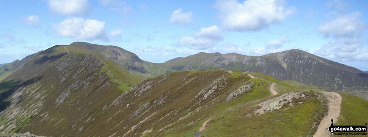
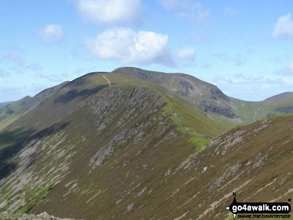
*Looking back along Scar Crags to Sail (Derwent Fells) and Crag Hill (Eel Crag) from Causey Pike
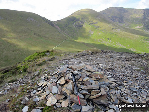
Scar Crags (left), Sail and Crag Hill (Eel Crag) from the summit cairn on Outerside
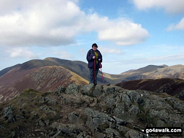
On top of Causey Pike with Scar Crags, Sail (Derwent Fells) and Crag Hill (Eel Crag) behind
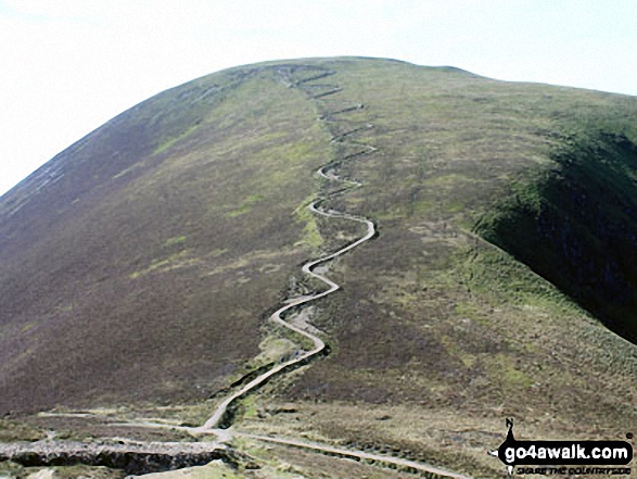
Looking back to the zig zags from Scar Crags at the route down from Sail (Derwent Fells)

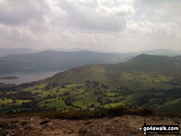
Cat Bells (Catbells), Derwent Water with Bleaberry Fell & High Seat (Ashness Fell) from Scar Crags
Send us your photographs and pictures on, of, or from Scar Crags
If you would like to add your walk photographs and pictures featuring views from, on or of Scar Crags to this page, please send them as email attachments (configured for any computer) along with your name to:
and we shall do our best to publish them.
(Guide Resolution = 300dpi. At least = 660pixels (wide) x 440 pixels (high).)

You can also submit photos via our Facebook Page.
NB. Please indicate where each photo was taken.


