A Google Peak Bagging Map of Scottish Region 8: The Cairngorm Mountains a fully detailed list (Page 2 of 2)
Scottish Region 8: The Cairngorm Mountains region is the area enclosed by an imaginary line connecting:
- Kincraig to Grantown-on-Spey via the A9 through Aviemore to Boat of Garten & then the River Spey to the North West
- Grantown-on-Spey to Ballater via the A939 to the East
- Ballater to Glen Feshie via the A93 to Braemar & then the the River Dee via Linn of Dee, Geldie Burn and Glen Geldie to the South
- Glen Feshie to Kincraig via Glen Feshie to the West
If you include all the Munros, the Corbetts, the Grahams, the Donalds, the Murdos, the Marilyns, the Bridgets (Hills), and all the Mountains, Tops, Peaks and Hills with a Trig Point on them there are 56 tops to climb, bag & conquer and the highest point is Ben Macdui (Beinn MacDuibh) at 1,309m (4,296ft).
To see these Mountains, Peaks, Tops and Hills displayed in different ways - see the options in the left-hand column and towards the bottom of this page.
LOG ON and RELOAD this page to show which Mountains, Peaks, Tops and Hills you have already climbed, bagged & conquered [. . . more details]
Page 2 of 2 Go to page: 1 2 |
See this list in: Alphabetical Order
| Height Order‡
To reverse the order select the link again.
Mountain, Peak, Top or Hill:
Bagged
31. The Devil's Point
1,004m (3,295ft)
See the location of The Devil's Point and walks up it on a google Map The Devil's Point is on interactive maps:
A downloadable go4awalk.com PDF Peak Bagging Map featuring The Devil's Point will be available soon. |
32. Meall Dubhag (Sgor Gaoith)
998m (3,275ft)
Send it in and we'll publish it here.
Meall Dubhag (Sgor Gaoith) is on interactive maps:
A downloadable go4awalk.com PDF Peak Bagging Map featuring Meall Dubhag (Sgor Gaoith) will be available soon. |
33. Sgurr an Lochan Uaine (Derry Cairngorm)
983m (3,226ft)
Send it in and we'll publish it here.
Sgurr an Lochan Uaine (Derry Cairngorm) is on interactive maps:
A downloadable go4awalk.com PDF Peak Bagging Map featuring Sgurr an Lochan Uaine (Derry Cairngorm) will be available soon. |
34. Meall Buidhe (Sgor Gaoith)
976m (3,203ft)
Send it in and we'll publish it here.
Meall Buidhe (Sgor Gaoith) is on interactive maps:
A downloadable go4awalk.com PDF Peak Bagging Map featuring Meall Buidhe (Sgor Gaoith) will be available soon. |
35. Creag an Dail Mhor (Ben Avon)
972m (3,190ft)
Send it in and we'll publish it here.
Creag an Dail Mhor (Ben Avon) is on interactive maps:
A downloadable go4awalk.com PDF Peak Bagging Map featuring Creag an Dail Mhor (Ben Avon) will be available soon. |
36. Carn Cloich-mhuilinn (Beinn Bhrotain)
942m (3,092ft)
Send it in and we'll publish it here.
Carn Cloich-mhuilinn (Beinn Bhrotain) is on interactive maps:
A downloadable go4awalk.com PDF Peak Bagging Map featuring Carn Cloich-mhuilinn (Beinn Bhrotain) will be available soon. |
37. Beinn Bhreac (Glen Derry)
931m (3,056ft)
Send it in and we'll publish it here.
Beinn Bhreac (Glen Derry) is on interactive maps:
A downloadable go4awalk.com PDF Peak Bagging Map featuring Beinn Bhreac (Glen Derry) will be available soon. |
38. Geal-charn (Western Cairngorms)
920m (3,019ft)
Send it in and we'll publish it here.
Geal-charn (Western Cairngorms) is on interactive maps:
A downloadable go4awalk.com PDF Peak Bagging Map featuring Geal-charn (Western Cairngorms) will be available soon. |
39. Tom Dubh (Monadh Mor)
918m (3,013ft)
Send it in and we'll publish it here.
Tom Dubh (Monadh Mor) is on interactive maps:
A downloadable go4awalk.com PDF Peak Bagging Map featuring Tom Dubh (Monadh Mor) will be available soon. |
40. Culardoch
900m (2,954ft)
Culardoch is on interactive maps:
A downloadable go4awalk.com PDF Peak Bagging Map featuring Culardoch will be available soon. |
41. Creag Mhor (Glen Avon)
895m (2,937ft)
Send it in and we'll publish it here.
Creag Mhor (Glen Avon) is on interactive maps:
A downloadable go4awalk.com PDF Peak Bagging Map featuring Creag Mhor (Glen Avon) will be available soon. |
42. Creag an Dail Bheag (Cairngorms)
863m (2,831ft)
Send it in and we'll publish it here.
Creag an Dail Bheag (Cairngorms) is on interactive maps:
A downloadable go4awalk.com PDF Peak Bagging Map featuring Creag an Dail Bheag (Cairngorms) will be available soon. |
43. Brown Cow Hill
829m (2,721ft)
Brown Cow Hill is on interactive maps:
A downloadable go4awalk.com PDF Peak Bagging Map featuring Brown Cow Hill will be available soon. |
44. Geal Charn (Eastern Cairngorms)
821m (2,695ft)
Send it in and we'll publish it here.
Geal Charn (Eastern Cairngorms) is on interactive maps:
A downloadable go4awalk.com PDF Peak Bagging Map featuring Geal Charn (Eastern Cairngorms) will be available soon. |
45. Carn na Drochaide
818m (2,685ft)
Carn na Drochaide is on interactive maps:
A downloadable go4awalk.com PDF Peak Bagging Map featuring Carn na Drochaide will be available soon. |
46. Sgor Mor (Forest of Mar)
813m (2,668ft)
Sgor Mor (Forest of Mar) is on interactive maps:
A downloadable go4awalk.com PDF Peak Bagging Map featuring Sgor Mor (Forest of Mar) will be available soon. |
47. Meall a' Bhuachaille
810m (2,658ft)
See the location of Meall a' Bhuachaille and walks up it on a google Map Meall a' Bhuachaille is on interactive maps:
A downloadable go4awalk.com PDF Peak Bagging Map featuring Meall a' Bhuachaille will be available soon. |
48. Carn Ealasaid
792m (2,599ft)
Carn Ealasaid is on interactive maps:
A downloadable go4awalk.com PDF Peak Bagging Map featuring Carn Ealasaid will be available soon. |
49. Geallaig Hill
743m (2,439ft)
Geallaig Hill is on interactive maps:
A downloadable go4awalk.com PDF Peak Bagging Map featuring Geallaig Hill will be available soon. |
50. Sgor Dubh
741m (2,431ft)
Sgor Dubh is on interactive maps:
|
51. Cnap Chaochan Aitinn
715m (2,347ft)
Send it in and we'll publish it here.
Cnap Chaochan Aitinn is on interactive maps:
A downloadable go4awalk.com PDF Peak Bagging Map featuring Cnap Chaochan Aitinn will be available soon. |
52. Craig Veann
711m (2,333ft)
Craig Veann is on interactive maps:
|
53. Carn Leac Saighdeir (The Laird's Bed)
699m (2,294ft)
Send it in and we'll publish it here.
Carn Leac Saighdeir (The Laird's Bed) is on interactive maps:
|
54. Creag Bhalg
668m (2,192ft)
Creag Bhalg is on interactive maps:
A downloadable go4awalk.com PDF Peak Bagging Map featuring Creag Bhalg will be available soon. |
55. Meall Alvie
560m (1,838ft)
Meall Alvie is on interactive maps:
A downloadable go4awalk.com PDF Peak Bagging Map featuring Meall Alvie will be available soon. |
56. Ord Ban
428m (1,404ft)
Ord Ban is on interactive maps:
A downloadable go4awalk.com PDF Peak Bagging Map featuring Ord Ban will be available soon. |
Page 2 of 2 Go to page: 1 2 |
View these 56 Mountains, Peaks, Tops and Hills:
- On an Interactive Google Map with a list of tops below it.
(makes it easier to locate a particular top) - On a Detailed List in:
Alphabetical Order | Height Order - On one page with 'yet-to-be-bagged' listed 1st
& then 'already-bagged' tops listed 2nd in:
Alphabetical Order | Height Order - On one page with 'already-bagged' tops listed 1st
& then 'yet-to-be-bagged' tops listed 2nd in:
Alphabetical Order | Height Order
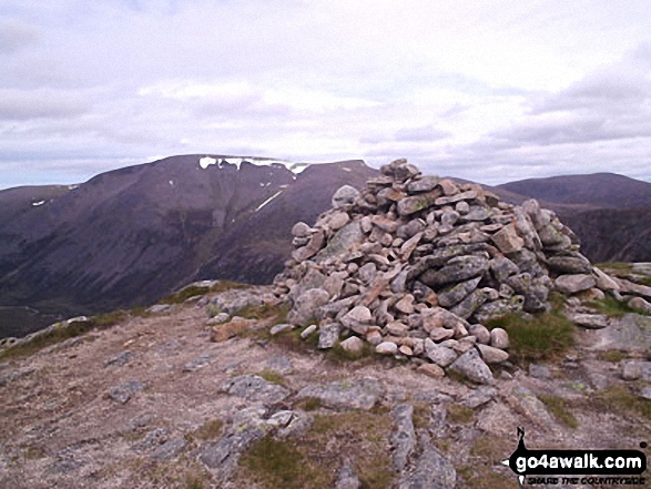
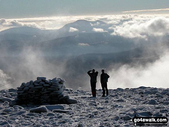 Ben Macdui (Beinn MacDuibh) in The Cairngorm Mountains
Photo: John Gell
Is there a Mountain, Peak, Top or Hill missing from the above google map or list?
Let us know an we will add it to our database.

